I'd been thinking about driving through the Southwest, stopping at all sorts of beautiful national parks, for a while. But I never had the time—such a trip requires at least two, preferably three weeks, and where would I find that time? And the kids might not enjoy the long drive. Finally, it all came together: the kids had grown up and moved away, I had more vacation time, working remotely allows me to work from anywhere, and my new car was just waiting to prove itself on a long road trip. So off we went.
Some statistics:
Miles/Kilometers Traveled: 5500 / 8800
Days: 22
States visited: 12 (of which one, Utah, was only visited for a few minutes, in a place called "«Four corners«)
This trip began, oddly enough, with a hike on Isle Royale last summer. Denis had bought an annual pass to all of America's national parks, and to justify the cost, we decided to go somewhere else. We'd actually been thinking of going to Machu Picchu in the spring, but unrest broke out there, and that's when the idea of a trip to the southwest came about. Denis, as always, spent a long time meticulously planning our route. He managed to put together a route that included skiing, visits to seven national parks, and, as the icing on the cake (not counting the return trip), a vacation/work trip near the ocean in Texas.
My proposals were chaotic.
- Let's go to Antelope Canyon, the Ch-ovs went there, the photos they showed were completely out of this world!
- Oh, my kid gave me a report about the pueblo at school, I need to check it out!
- Well, skiing is sacred, of course, let's start with Colorado!
— I've been wanting to see the bat flight in Carlsbad Caverns for a long time. Maybe we should go there?
And so, early on a clear morning on April 1st, we set off. Michigan and Illinois flew by quickly. Then the Great Plains stretched out. Driving across the plains was boring: steppe and steppe all around. Fields, fields, and pig farms. Even the Mississippi, which we crossed somewhere on the Iowa border, seemed like a mediocre river. Only in Nebraska, at sunset, did flocks of migratory birds, large and small, suddenly appear. Against the crimson sun, hundreds of flocks and flocks flew from somewhere in the south. Denis and I exchanged glances: "Look, good people, they're heading home. And where are you and I going?"»
We spent the night in Nebraska, arrived in Colorado by midday, and met up with friends. It was warm and windy, like spring. We met at the Wild Animal Sanctuary, looked at the animals, and then headed off to the next part of the cultural program. As always, there was little time to spend with friends. We vowed that next time we would definitely stay for a few days.
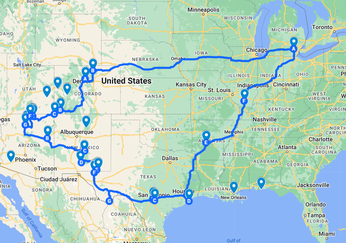
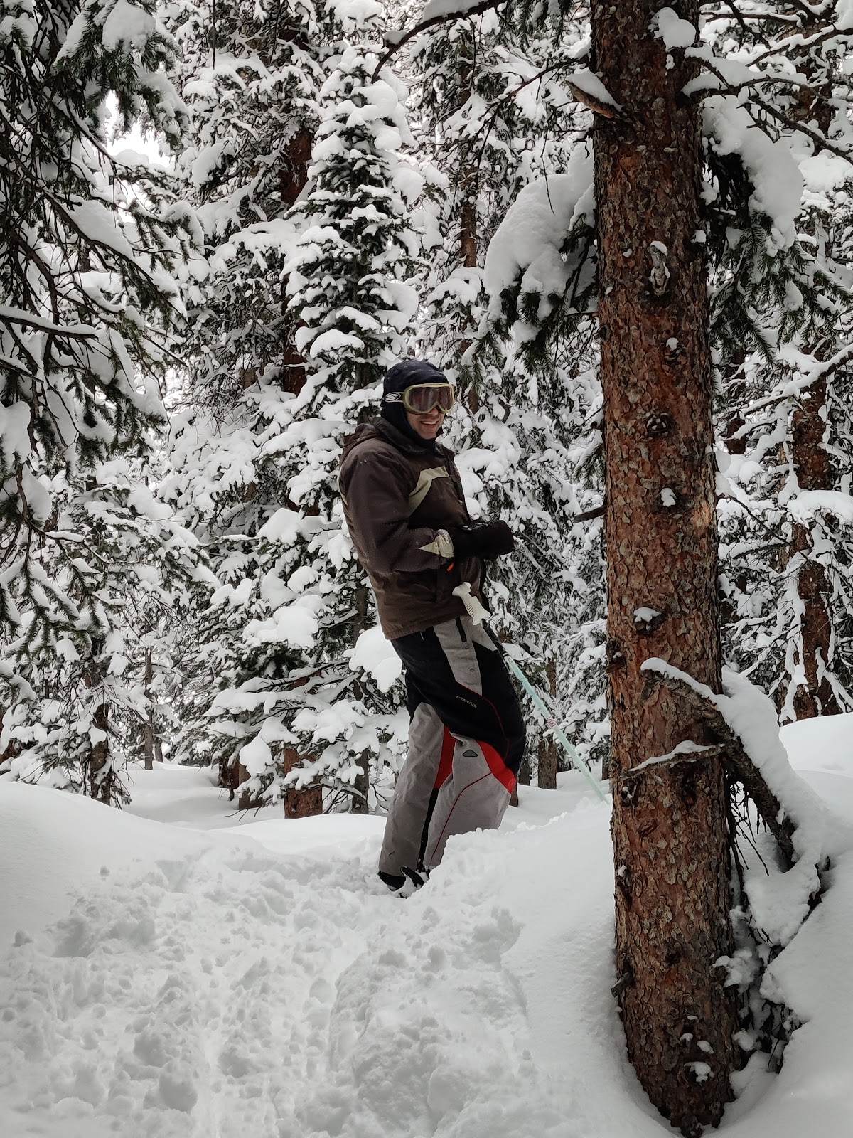
By ten o'clock the next morning we found ourselves in the ski town of Winter Park.
Alpine skiing. Winter Park
Alpine skiing is my great love. I love watching the motley crowd of skiers and snowboarders. They simply emanate freshness, joy, and a desire to move. I see them as brothers. They, too, aren't afraid of the cold. They, too, enjoy the speed, the wind in their faces, and the slight sensation of danger.
This time we had the opportunity to ride in both spring and winter mode.
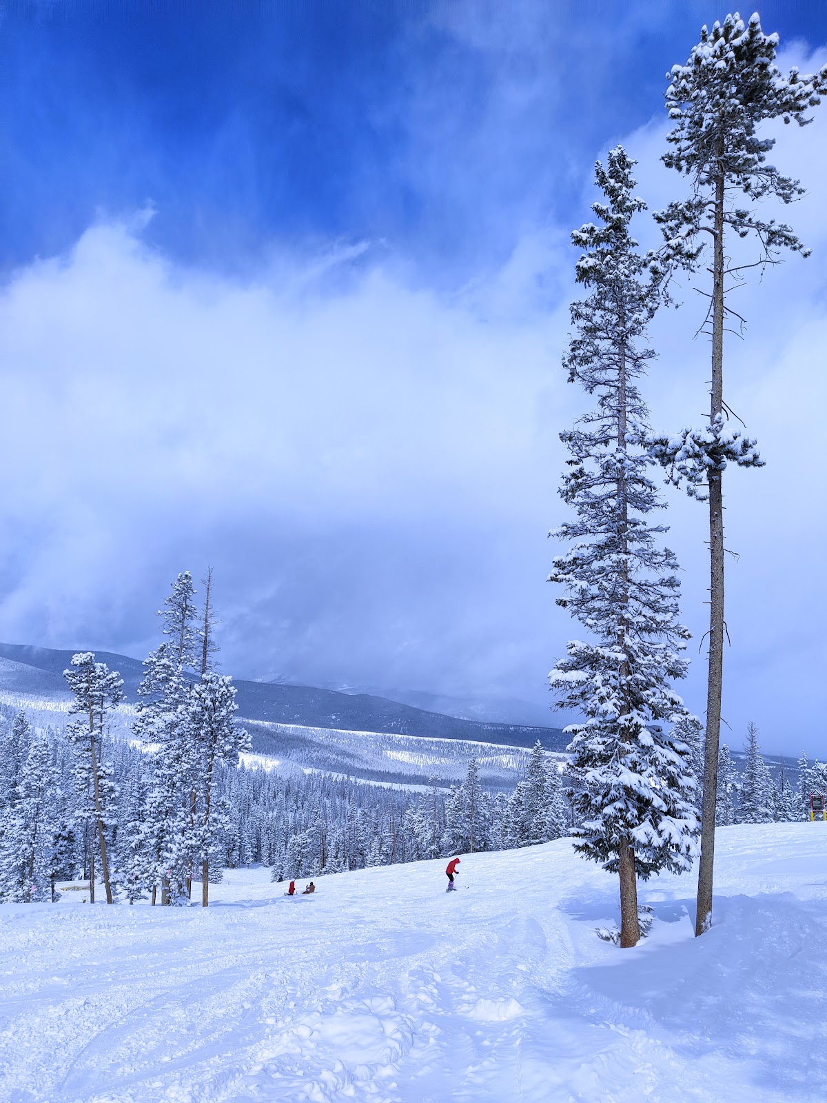
Skiing in April can even lead to sunburn from the harsh mountain UV rays; there have been cases before. Luckily, we had brought three sunscreens this time. One of them came in handy right away because the day was clear. But there's still plenty of snow in these parts, even in April. The only sign of spring is the warm sun. On the first day of skiing, unless you're a native mountaineer, your body always acclimatizes in the high mountains: shortness of breath, headache, mild nausea. This can usually be alleviated with painkillers. And the generally cheerful atmosphere of the ski resort encourages you to ignore such trifles. By the second day, everything usually passes. This day of our skiing was truly wintry. The temperature dropped, and it started snowing. It's good that we had warm mittens and sweaters. On a snowy day, the contours of the slope aren't very visible. Since the eyes can't see, the body doesn't always understand the best way to ski. You have to go at random.
With this kind of skiing, your leg muscles tire quickly. But we rested, warming ourselves with hot tea, and then, a couple of hours later, with hot soup—and the snowfall was nothing to us.
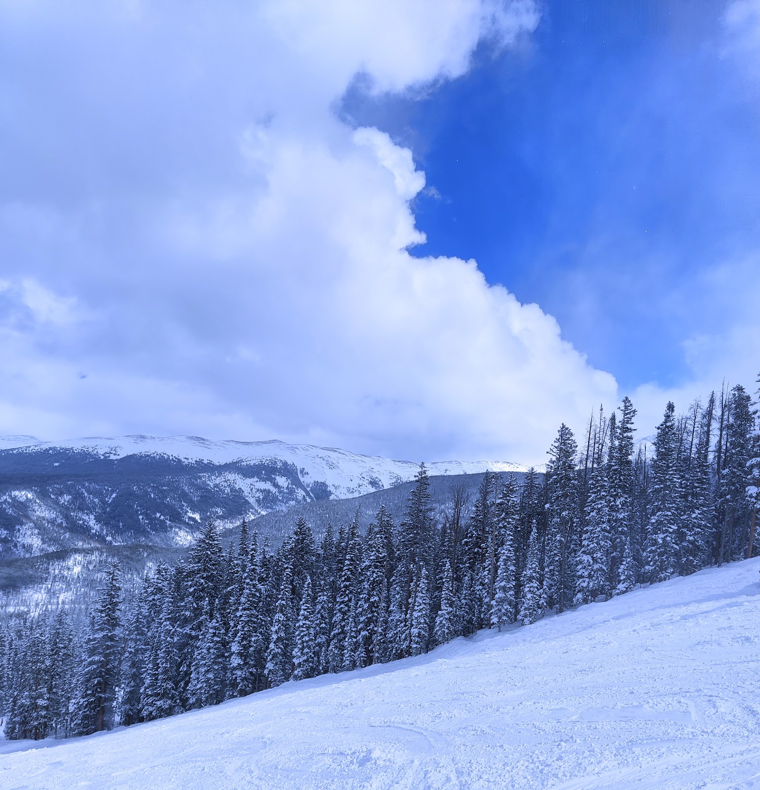
By the morning of the third day, the slopes were covered in fluffy snow, and the sky had turned blue. A bearded man on the lift loudly and joyfully admired the snow conditions, telling us that these parts offered the best tree skiing. That's when you ski through fresh snow and between fir trees, preferably at speed. We decided we had to give it a try.
Fine, dry, fresh snow is like powder. There's even a term for it: "powder." Skiers and snowboarders especially love it. It's a different kind of skiing technique. You glide along the soft snow, sinking slightly into the featherbed, pulling a light white cloud behind you. Your feet feel like they're stuck in the fresh snow, and you have to steer them more carefully. And we need to be especially careful, because we'll need our feet for the rest of the journey, and everything else.
Even though we skied carefully, we really enjoyed tree skiing. If our legs are still healthy by next ski season, we'll give it another try.
Well, we'd just gotten the hang of it—and it was time to leave. But the next morning, warm jackets, hats, mittens, and ski boots were tucked under the seats, and the skis were stowed in their bags. They'd served their purpose. Where we were going, it had to be warmer.
Mesa Verde
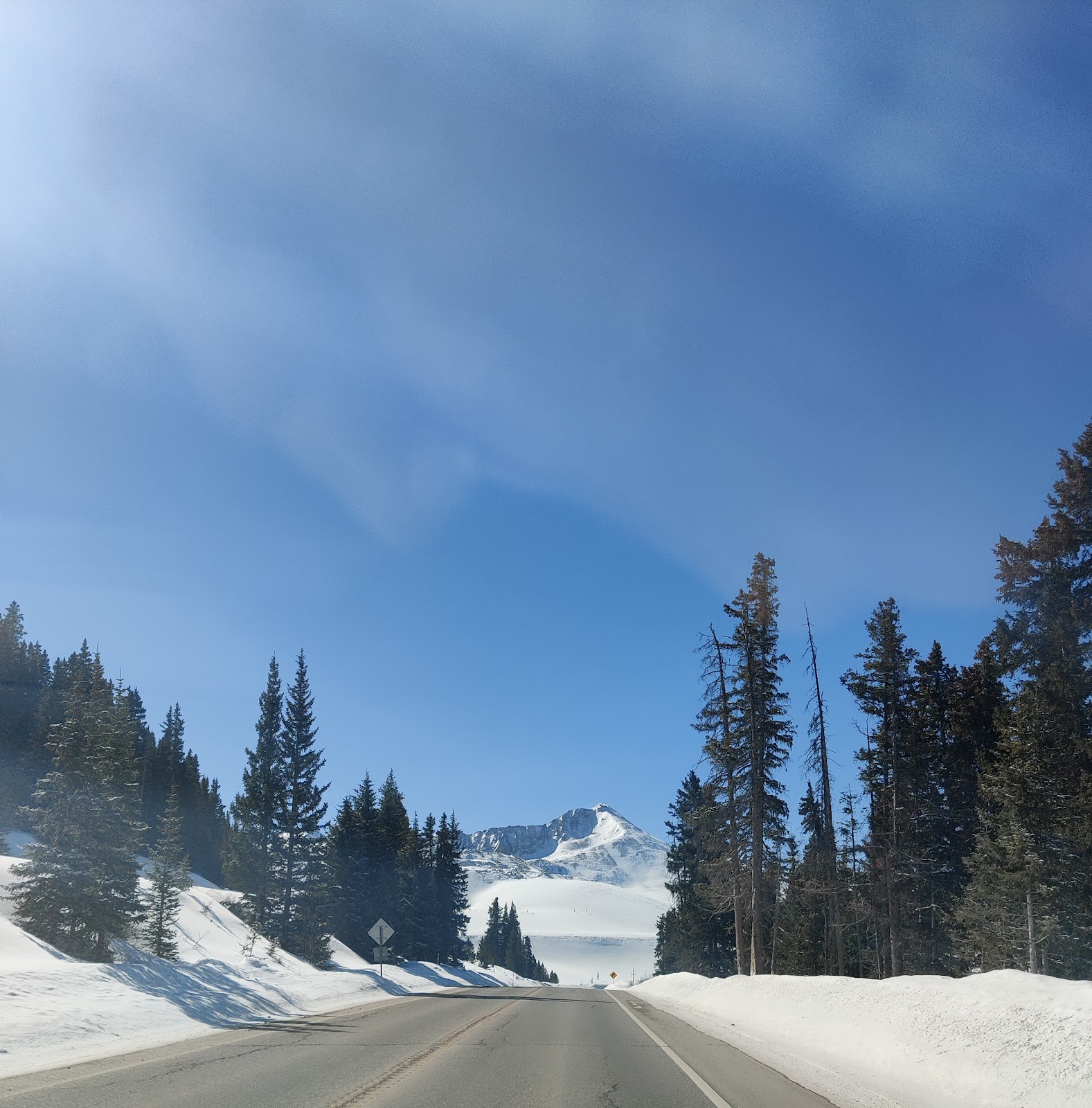
We drove through Colorado all day.
Two passes and snow-covered gorges still made us doubt whether spring ever really happened here. Then we entered a valley that grew wider and wider. Finally, the mountains parted enough for us to admire them while driving along the arrow-straight road. Down in the valley, there was almost no snow left, but it shone white on the mountains to the right and left.
We arrived at the campsite late in the afternoon, with plenty of time left to begin exploring the Mesa.
Mesa is a Spanish borrowing meaning "table mountain." Park Mesa Verde marked the beginning of a series of national parks we planned to visit. Here, or even a little earlier, begins the land of canyons. In these lands, the ancient Indians built their strange dwellings. The Pueblo people would first find a large natural cave and then begin adding one structure after another to it, creating something resembling multi-level swallows' nests. The exit was located on the roof. And to move up and down the settlement, they used a system of ladders and ropes. They lived like this for several centuries, and then suddenly abandoned everything and migrated south. An analogy with the Arkaim settlement suggests itself. Why did they leave? What was missing for them to be happy? Did they use up all the natural resources they had been exploiting for so long? There is much incomprehensible in this story.
Mesa Verde It can also be translated as "green table" or "green upland." This is understandable, because there should be much more greenery in the northern part of the Mesa. But when we arrived at the park, the northern slopes were still covered in deep snow, while the southern ones were already clear, ready for the arrival of spring. Meltwater drags rocks and landslides. We had the opportunity to see one such landslide, slowly rolling toward the road. In dangerous areas, there are warning signs: "Do not stop here!" and "Do not park!" It's difficult not to stop because the slanting rays of the setting sun make every turn in the road picturesque, and there are many. I'm driving, and Denis is armed with a camera, capturing the moments.
The next morning, we went back to the park to see what we hadn't seen the day before. To warm up, we ran down a canyon, up and down a trail. Then we drove along a road leading to the park's points of interest. Pueblos were built not only on cliffs but also on flat ground. At first, the dwellings were very primitive, like dugouts. Later, they began using stone, but the shape remained circular, with high earthen benches around the diameter. The hearth was located in the center, and they used a smoke stove. A ventilated storage room, attached to the living space, was a must. A common element in both cave and plains pueblos is an overhead exit. Thus, each house resembled a small fortress. Most often, even on the plains, dwellings were attached to each other, creating a kind of fortified settlement. This is how people lived for many centuries. By that time, Greek and Roman civilizations had flourished and declined in Europe, the Middle Ages had arrived, and the Pueblos lived without much change: they cultivated cornfields, hunted, and built their simple homes. I wonder if they would still be living in this pastoral world if it hadn't been for the conquest? But what kind of pastoral world could it be, with so many hostile tribes all around? They built fortified houses for a reason. The path of civilization is one of continuous enslavement, and if one civilization ends with another, so too. And the conquistadors did bring progress. True, they didn't ask whether the Indians needed this progress. Might is right. And might is the more civilized. Have you noticed that in our civilized society, this principle still applies today?
I've wanted to reach the very bottom of the Grand Canyon for a long time. But the problem is that the campsites at the bottom of the canyon are very limited, and reserving them is very difficult. But there is another way: to descend and ascend in one day, without spending the night. People have written that it's difficult, but possible.
Almost ten years ago, when we first visited this park, we even walked a short distance down the trail. And I decided I absolutely had to make it to the very end.
So, when Natasha and I were planning our grand trip to the Southwest, we added the Canyon to it. I read the descriptions of the descent and picked a route.
This route has two very important advantages:
We descend one route and ascend another, so we see the canyon from slightly different angles.
On the way up, you can collect water at a point called Havasupai Gardens—about halfway up the trail and a third of the way up. This is important because it allows you to carry less water.
Everyone advised getting on the trail as early as possible to get back before dark. There's no parking at the trailhead, so the best option is to leave your car at the information center and take the free shuttle. The shuttles start running at 6:00 AM, so we decided to arrive around then.
So, we got up at five in the morning, made coffee, and headed out. It's about an hour to the canyon, the road is empty, and the entrance to the park is still free. The only people greeting us are deer.
Once in the park, we had a quick breakfast, found our bus (it runs every half hour at this time), and at about 7:40, we were at the trailhead. There were about fifteen people with us who had arrived on the same bus. But not everyone makes it all the way to the bottom—many turn around at one of the waypoints.
Along the trail, there are several signs with warnings in four languages: they suggest you reconsider whether you can make it up and down in one day. Thanks for the warning, we'll continue on.
The descent was fairly easy. At one point, we had to stop and stuff extra clothes into our backpack: it had been +1°C when we set out, but now the sun was rising, and the lower we got, the warmer it would be. We stopped for a rest at one of the waypoints, drank some water, and then continued on.
About halfway down
The road winds steeply. In the lower third of the way, I start to feel my calf muscles tighten up (they'll be aching for the next two or three days), but for now, I can walk.
Here on this serpentine road - lower and lower...
Finally, the Colorado River came into view. Here it was a dirty brown (upstream it was green). A bridge spanned the river—we were headed that way. As we walked, I wondered how the necessary structures and materials for the bridge were delivered here. I decided it was by helicopter. Turns out that wasn't the case—there's a sign below explaining that the bridge is called "“Black Bridge” (“Black Bridge”), it was built in 1928, and everything necessary was delivered from above on mules and on the shoulders of the Indians of the local tribe Havasupai.
Finally, we reached the bridge. Hooray! We took a selfie on the bridge. Now it's just minutes to the camp. There's civilization there (which we don't really need), but the most important thing is water—we need to refill our canteens.
A few minutes' rest, and then we're back on our way. We make a small detour to pass by a campsite—a cozy spot on the banks of a creek that flows into the Colorado. We cross the river again, this time a different way., Silver, the bridge, and we walk along a pleasant, gentle trail along the stream. But if we hadn't crossed, we would have climbed to the northern edge of the Canyon—and from there to our car. four hours drive, and it’s still unclear on what...
The road gradually becomes steeper and steeper, and here we come out into a small oasis called “Havasupai Gardens” (until November 2022, this place was called “Indian Gardens”, until it was renamed (At the request of the Havasupai tribe). It's nice there—a stream flows, lots of trees, and there's drinking water. It's about halfway up the canyon (about 4.5 miles from the bottom) and a third of the way up. There's another campsite there, and you also need to get a permit in advance for that. Logistically, I liked this campsite much better—you don't have to lug a backpack all the way down and, most importantly, up, and running from here to the bottom of the canyon isn't that difficult. Plus, the views up there are much better than at the bottom.
Havasupai Gardens - there's plenty of water and greenery here, but a steep climb awaits us.
We rest here and refill our water supplies—there won't be any further. Almost immediately, the steepest climb begins here—three miles of switchbacks. We move slowly—about a mile and a half an hour. Every hour we stop for about 10 minutes and drink half a liter of water between us. Within a minute, our mouths are dry again—the air here is very dry. We have a half-liter canteen and a soft plastic five-liter jerrycan. I poured about two liters into it so as not to lug around extra. We drink water from the canteen and refill it from the jerrycan. There's still water, but we need to conserve a little. Besides, there's snow on the slopes above, so if it gets really tight, we can stuff it into the canteen and melt it.
The climb is quite challenging, but manageable. It's far from the hardest hike I've done in the last few years—it's third or fourth on my list. The hardest was a six-mile section in the Adirondack Park two years ago, where we trudged up for three miles and then down—with no trail at all, along a stream bed and over huge rocks, and in the rain, to boot. Compared to that hike, this trail is a real treat…
At the top, the trail is covered in a layer of slightly melted ice and mud. It's a good thing we brought our poles; they came in very handy here. Earlier this morning, as we were leaving, I saw some people lugging crampons along. I shrugged in confusion at the time, but now I realize it makes sense. However, the poles are quite sufficient; the walking is fine.
We started seeing sightseers descending from the top—they're easily identified by their casual clothing and footwear. It must be tough for them on this ice…
Finally, the steep switchbacks end, and now there's a relatively gentle climb for about half a mile. The end of the route is in sight…
The path we climbed is visible on the right side of the photo.
Here we are at the top! We take a photo at the sign indicating the start/end of the trail and pour the last of our water into our flasks. There's just one flask left—our timing was spot on. 🙂
Now we just need to catch the bus we need and get to the car. The route is complete!
Yesterday, Natasha and I walked from the South Rim of the Grand Canyon down to the Colorado River and back, all in one day. About 27 km, 44,000 steps, and a mile and a half of elevation gain. The entire journey took nine hours.
It wasn't easy, but we've been on more difficult routes recently.