The day before, Kevin and Kasha, our new acquaintances, had run to the high-mountain lake "Amphitheater" and inspired us. We certainly didn't try to replicate their feat of running the entire route. But the trail turned out to be easy, with gentle switchbacks and observation platforms. Another thing is that the climb takes much longer on foot. Most people travel lightly, with small backpacks for day trips. There were runners, like Kevin and Kasha. And then there were those heading to the high-altitude campsite with heavy backpacks and special canisters for storing food from bears. Denis even regretted not planning a hike into the wilderness. But it was still good, especially once we got higher. The high-mountain meadows are ablaze with flowers. Every bend in the trail opens up to a stunning panorama. Everything is in full view. And somewhere higher up, there are more lakes, and that's where we're heading. First, a small lake called Surprise appeared, then another, larger one. It's surrounded by mountains on all sides, like an amphitheater. That's what they called it. We're sitting on the rocks, taking in all this beauty. There are about seven other people here. We weren't even that tired, and when a turnoff to another trail appeared, we decided to go and see what was there, just a short distance away, about 600 meters up. We weren't even stopped by the warning sign saying, "Are you ready for what comes next?" We thought, what could possibly be there? Well, a ravine. No big deal. It turned out to be not just a ravine, but also loose scree, which requires a fairly steep climb, and then the trail, which is even steeper. Moreover, there were no visible markings or signs to indicate the direction, which was confusing. And, surprisingly, there were quite a few people on such a difficult section. Mostly young people. There was even a reckless mother with a baby in a backpack, who was jumping defiantly over the boulders.
Denis was clearly not happy with this addition to the planned route. He suggested turning back. But I decided that since I had the time and energy, I should go for it. I don't know what Denis thought when we reached the end of the trail, near Delta Lake, but I didn't regret it.
A very picturesque place.
The return journey seemed easier. At first, the walking poles were a great help. But after an hour, fatigue suddenly set in. Even the invigorating water of the mountain streams only provided a brief refreshment. I longed to get to the campsite and get some proper rest.
We walked a lot that day.
Some people wash off the road dust in a civilized shower, while others "take" a dip in the lake. A spicy Japanese soup helps us replenish our strength. This is enough for me to sit with a book and write travel notes, and for Denis to take a Spanish lesson and answer client emails. It's still light, but I'm already very sleepy. Tomorrow we'll continue on to Yellowstone.
I'm lying in the tent, listening to what's going on around me. I can hear a violent wind rising in the treetops, howling and howling. The thin fabric of our temporary shelter flutters timidly in anticipation of a downpour. In the distance, I can hear rumbles of thunder and a growing roar—a storm is approaching. I say out loud, "A storm is coming..." Denis snores, confirms through his sleep—aha...—turns over onto his other side and goes back to sleeping, as if nothing had happened. A man's lucky! He falls asleep in half a minute and knows no worries. And here I am, imagining all sorts of misfortunes. Judging by the approaching thunderstorm, it's going to be a serious one. Now the first handfuls of drops are splashing forcefully onto the roof. And off it goes! The rain has begun to pound with terrible force. It pours down, gurgling, flowing around the tent from all sides. The air was filled with moisture and the smell of ozone.
I'm not afraid of a thunderstorm, but the tent site is too packed down, the water won't soak in, and it's slightly sloped—it'll probably seep under the floor. Oh, I should have tightened the guy lines on the sides better! But it doesn't seem to be dripping inside... Denis's sleeping pad is too short—part of his sleeping bag will definitely get wet... Stuff?! It's stowed in the car. Good. I feel the top corners of the tent—sure enough, they're already damp. Oh, damn, it's going to get worse if the storm doesn't stop. The phone! Put it on the mesh shelf under the ceiling, quick! It's crazy, it's already almost two in the morning... Sleep, sleep!
The storm ebbed and flowed, pouring down all night. My thoughts swirled and haunted me. Just as I closed my eyes, another source of worry emerged. It spoke in Denis's voice:
Well, shall we get up?
What?! It's already... How long?
Well, yes, we wanted to stay on Michigan time.
In a light rain, we awkwardly stuffed the tent into a waterproof bag and the sleeping pads into a backpack. We quickly gathered our other belongings—thankfully, we'd packed almost everything away the night before—and drove away from this rainforest. More thunder rumbled from the sky after us, but fortunately, we and the cloud were heading in different directions. Outside the car, it was damp, gray, and gloomy, just like my sleep-deprived body. Oh, if only I could use some coffee right now! But the forest around us was still wet, and the gas station coffee was lousy. Besides, it was still very early. I glanced at Denis. He was as alert and fresh as a daisy. At least he'd gotten enough sleep; let him drive, and I'll take a nap, I suppose… And to the drone of the audiobook, I drifted off to sleep.
Devil's Tower
When I open my eyes, everything around me looks different. The forest has given way to gently rolling hills, and the clear morning sun shines above them. The road is easy and dry. And right ahead, a giant rock rises like a monolith. It stands out so strangely in the overall landscape. Why alone? After all, if there are mountains, there are many of them, but here, all alone, there's nothing special, as a friend of mine says. But that's precisely what's so interesting.
There are many legends and theories surrounding Devil's Tower's origins. One is that it's a "reverse volcano." That is, whatever was in the crater, likely lava, fossilized and remained, while the volcano itself eroded over millions of years. It's unclear, however, why this is an isolated incident.
Ah, my zest for life has awakened, which means I managed to get some sleep. We pull over to the side of the road and photograph the cliff from afar. The morning light makes for some excellent shots. Against the blue sky, Devil's Tower looks fantastic!
Another ten minutes later we arrive at the foot of the monolith, where there is a recreation area.
In the center of the clearing, a large black man in bright red robes sits in the lotus position, offering prayers, facing the rock. "We must have stumbled into another place of power," I think. "I wonder what gods he's praying to. Or maybe the devil? His clothes are red..." But we don't bother him.
Denis gets out the camp stove and breakfast supplies, and I hang the wet tent, mats, and sleeping bags on the fence. The sun is already hot, so everything should dry quickly. And indeed, while we're cooking buckwheat porridge and coffee and eating a leisurely breakfast, the thin nylon tarp dries in an instant—you just have to unfold the folds. Meanwhile, another car pulls up with other unfortunate souls like us. They're unloading a multitude of wet things to dry. Seeing our tent on the fence, these people also start hanging their pillows, mattresses, sleeping bags, towels, and wet T-shirts and socks there. We exchange a few words and realize we're from the same places. Fellow sufferers! Everything around looks like a gypsy camp has set up camp. The ranger doesn't chase us away, but smiles understandingly from the window of his car.
We throw our still-dry sleeping bags on the roof of the car and head off along the trail that leads around Devil's Tower. We see quite a few people, and it's clear this is a popular spot. Interestingly, the trail isn't always visible from here. Occasionally, you'll glimpse it sideways between the trees. It's a good thing we photographed it from afar. But the trail is also beautiful—it smells of sun-warmed pine resin and wet pine needles. About twenty minutes later, we unexpectedly found ourselves near the tourist center. Elderly Japanese people fluttered effortlessly from a tour bus in the parking lot and, chattering excitedly, set off along the trail to photograph Devil's Tower. They're the kind of people who take pictures and marvel at everything, like children. But we were heading in the other direction. In one place, a storm had knocked down several trees. Perhaps the devil, the tower's owner, was angry and uprooted everything in his path. Then we encountered some Martian landscapes with red soil. The trail beneath our feet also turned red. From the other side of the cliff, a beautiful view of the distant distances suddenly opened up: green hills and blue forests, the blue ribbon of the river and the yellow ribbon of the road. They encountered climbers, young men with backpacks, ropes, and carabiners.
"Will you climb the Devil's Tower?" I asked.
They nodded affirmatively, and I wished them luck. Not everyone would dare to venture into the depths of hell.
Well, that's it. Devil's Tower isn't a national park where you can wander for ages—you couldn't see it all in a year. It's a national monument. We walked quickly, just two and a half hours, and then we moved on. Our sleeping bags were dry. And even that wet group that arrived after us was gone. We had to move on.
On the side of the road
The bikers, a glittering, noisy swarm, stopped for a moment by the side of the road, imprinted the Devil's Tower on their hearts, and sped on. And it's time for us to go.
Shaking off the last vestiges of sleep deprivation on the trail, I got behind the wheel. And the prairies and deserted roads stretched out. In fact, the almost complete absence of civilization often accompanied us on the journey. It was very useful to know where the next gas station was. In these parts, they could be hundreds of miles apart. Occasionally, there were cattle ranches, and there were no rest areas at all. Feeling hungry, we couldn't find a suitable place to have lunch. Finally, we pulled over on the side of the road, in the blazing sun, stuffed ourselves with food, and quickly drove on. We washed down our lunch with mineral water as we drove.
Without an audiobook, it would have been difficult to navigate such vast spaces. By evening, the greenery had thickened. The river appeared, along with willows and poplars lining its banks. Mountains appeared on the horizon. We also began to see settlements. Near one of them, in the town of Dubois (or Dubois?), was our hotel. It smelled pleasantly of wood and turned out to be quite cozy. Such roadside inns are a stopover for car tourists heading to popular national parks. There's nothing to see in the surrounding area, but the location of the temporary shelter was strategically placed. It used to be like this: you'd drive and drive, get tired, spot a caravan by the side of the road, spend the night, and then continue on. Now you have to book everything in advance. Or go in the off-season. By evening, our hotel was filled with cars and car tourists like us. We washed off the road dust in the shower and decided we didn't want to drive into the town center. We were tired. We simply cooked some pasta in the microwave and went to have dinner on the riverbank near the hotel. There was a canopy, soft chairs, and a small table. What more could a weary traveler need? Well, maybe a glass of wine.
There weren't enough of us left for the campfire, even though it was included in the cultural program. Why? Because we'd moved to a different time zone. While it's still nine o'clock in Wyoming, it's already eleven o'clock in Michigan. We want to live on our own time, so we went to bed before dark.
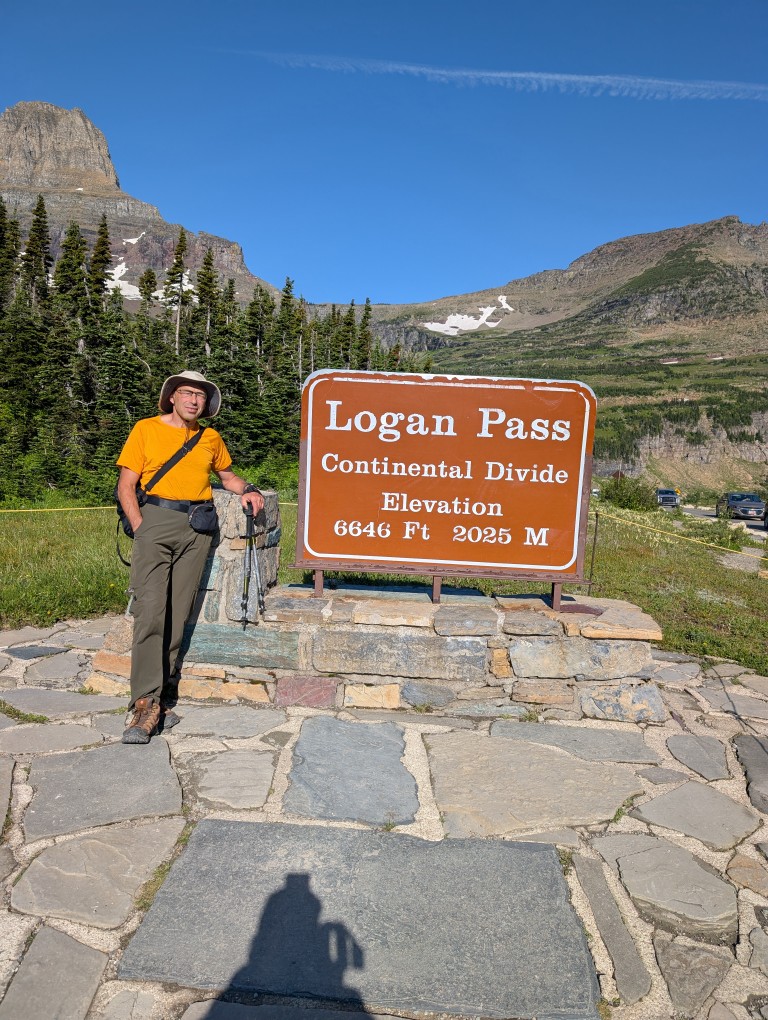
When I was planning my trip to Glacier NP, I almost accidentally came across a piece of news that made me a little nervous: the park, for the second year in a row, is allowing access to the road with the poetic name “Road to the Sun”"Only with special passes. Passes must be purchased, and although the price is purely symbolic ($1 per day), their supply is limited. This is how the park addresses the problem of overtourism. The problem with this road is that it's the only way to get around the park: trails to almost all the lakes, waterfalls, and other trails start from here.
There was still a month and a half left before the trip, but, as expected, all the passes had long since been purchased. I signed up for the pass availability notification mailing list (sometimes people cancel their purchased passes, and they become available again) and even received several notifications about vacancies. But every time I tried to buy one, it turned out someone else had already gotten it faster…
But later, I read the road information more carefully and calmed down: the road was closed after 7 a.m., and before that, entry was free. Considering I rented a place 10 minutes' drive from the park, and we planned to stay on Michigan time (two hours ahead of the park's time zone), there shouldn't have been any problems. And so it turned out.
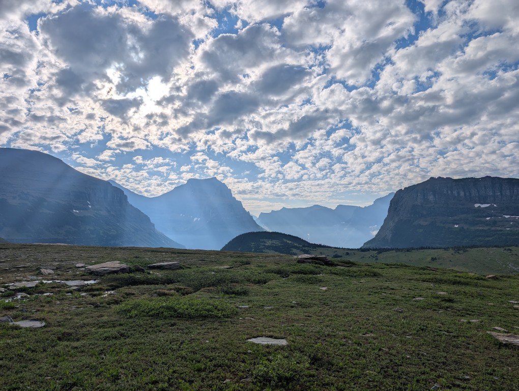
The plan was to get up early and leave the hotel around 5:30 a.m., and we followed it. We quickly crossed the empty road to the park entrance and then drove more slowly along that very same Going to the Sun Road—the speed limit was 40 miles per hour.
Deep down, I hoped we'd keep going until the very end, because who in their right mind would wake up at 5:30 a.m.? However, the park sees over 3 million visitors a year, with around 800,000 of those in July. That's nearly 27,000 people a day—the population of a small town. And among that many, there are enough crazy people to cause a traffic jam on the park's only road, even at 6 a.m.
So soon we found ourselves at the tail end of a stream that was slowly rolling along the road. Slowly because the climb had just begun with a steep switchback, which even on an empty road wouldn't let you go very fast. It didn't bother us, though, because after the most picturesque serpentine in the world, The road we drove on last year in Greece doesn't scare us like that (though I'm a little apprehensive about the Peru trip—there will be plenty of switchbacks there). But we still have to keep the speed down…
At one point, we pull over to the side of the road and take a few photos—the view is so beautiful in the rays of the rising sun. Perhaps those five minutes would come back to haunt us later…
A few minutes later, we arrived at the visitor center parking lot, and I couldn't believe my eyes—the rather large parking lot was full. And mind you, it was 6:50 a.m.—normal people are still asleep at that hour. We had to keep driving. Several small parking lots on the side of the road were full, but finally, about a kilometer from where we were going, I saw a single empty spot where we could park. Perhaps if we hadn't stopped for those five minutes to take photos, we would have managed to park a little closer to the center. But the photos were worth it.
The view from our parking lot, however, was wonderful. Shivering slightly from the cold (the temperature this morning was just above freezing, with snow in places), we cooked breakfast on the stove, drank a traditional cup of cappuccino, and briskly headed back along the road to the trailhead.
We made our way back to the visitor center, the first route for today is trail to Hidden Lake. When I walk along trails like these, the first thing that comes to mind is "May Day demonstration." The trail is beautiful, short, and easy, so all those crowds that occupied our parking space are heading that way. And so are we, because what else could we do? 🙂 We didn't make it all the way to the lake—about halfway there, the trail was closed due to increased bear activity in the area. Considering I'd forgotten my bear spray in the car again, we decided not to risk crawling under the fence like some others… So we admired the scenery and turned back to the parking lot.
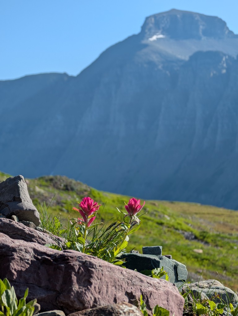
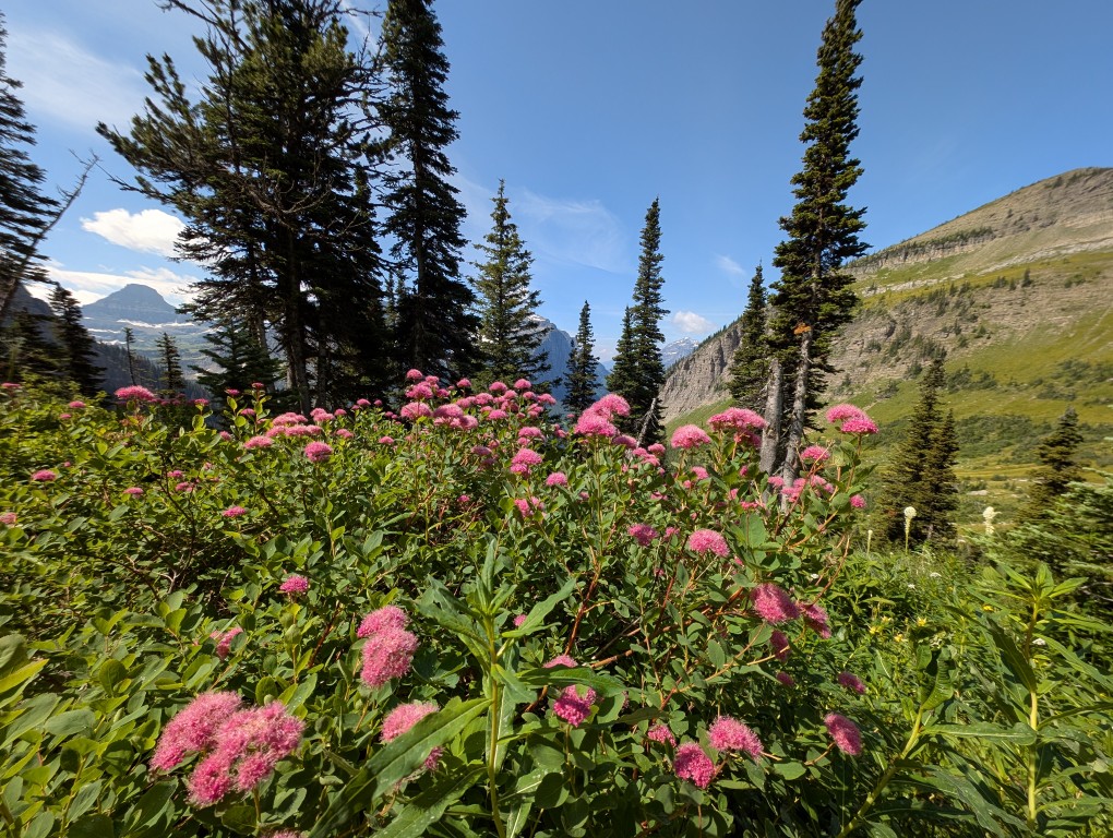
The main trail for today awaited us - Highline Trail (the high trail). It's long—40 miles—and people hike it for days, with tents. But we weren't tourists today, we were just out for a stroll, so we decided to walk it for a few hours (to a small pass near the summit).“Haystack”), and turn back.
I must say, the trail turned out to be the most spectacular of these three very busy days. It's not difficult because it runs parallel to the slope, without significant changes in elevation, but it's very picturesque.
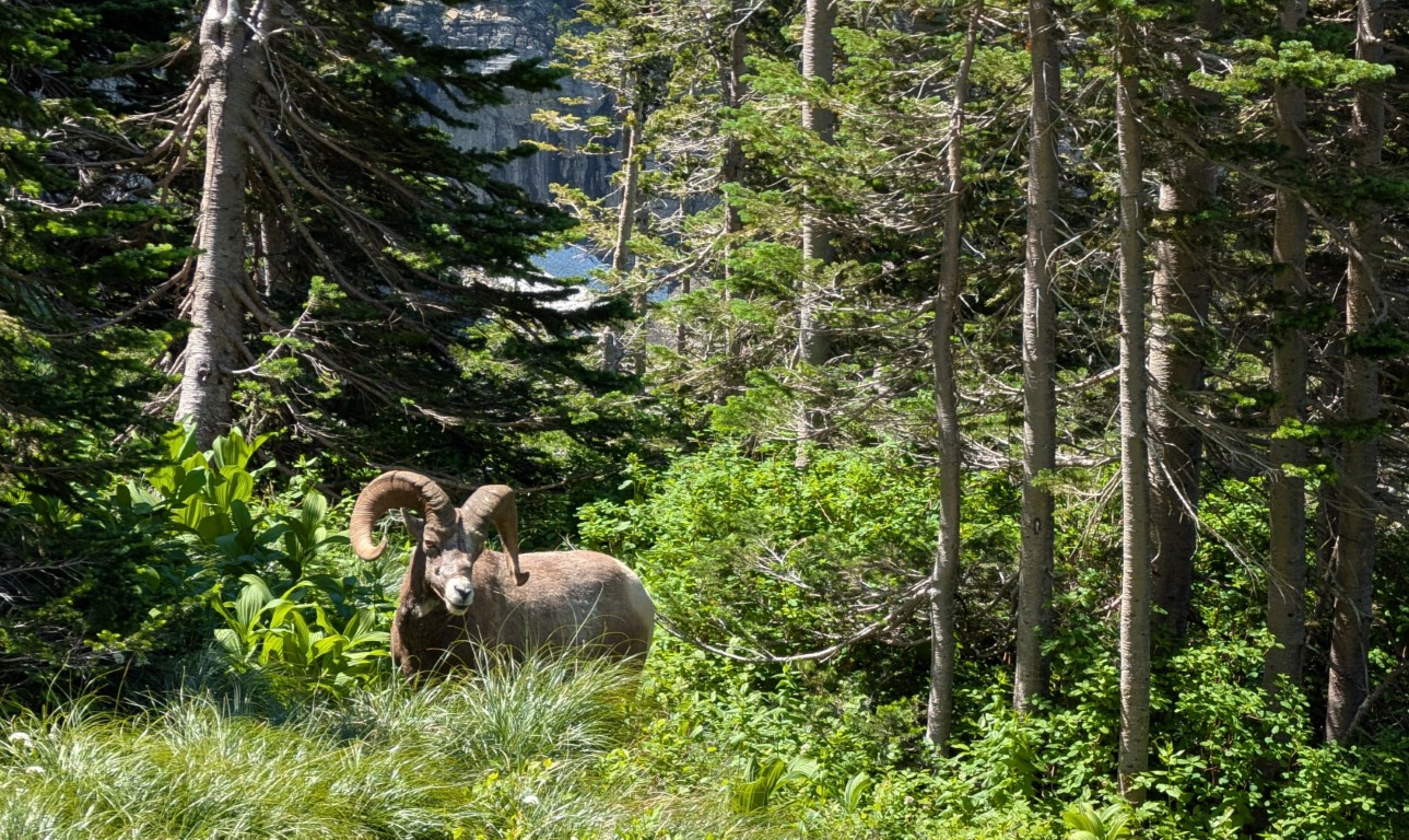
Moreover, since this is the only convenient trail running along the slope, local animals have taken a liking to it. So we encountered a deer (very close, we could reach it with our hand), a marmot (marmot "—it's not a swear word, but the Latin and English word for marmot," and "mountain sheep" (a bit off the trail, but that's for the best). We didn't encounter a bear, though—maybe next time.
Well, the landscapes there themselves are wonderful - I probably took at least a hundred photographs, so it was a real shame to clean them.
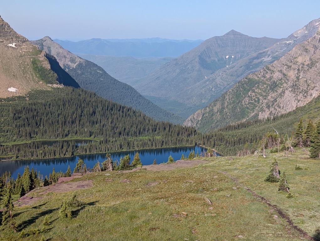
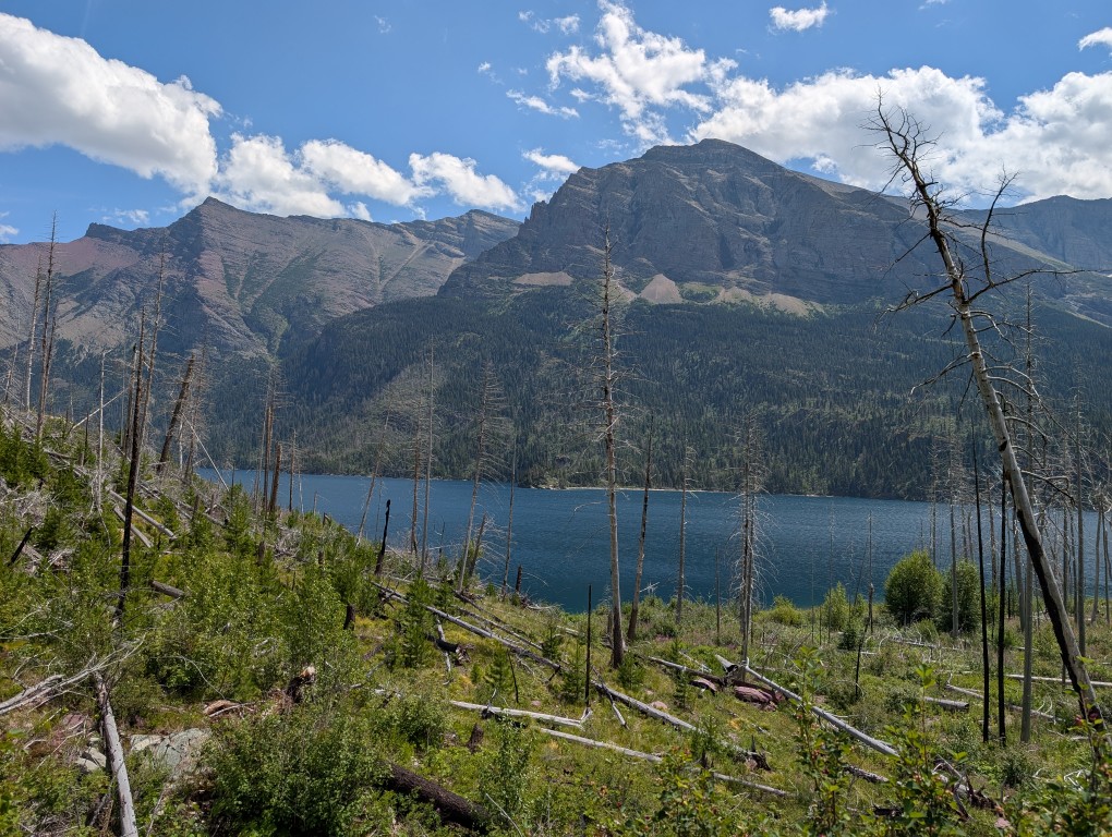
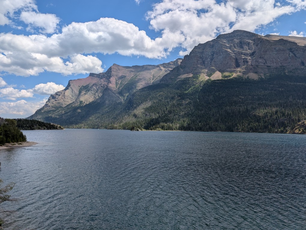
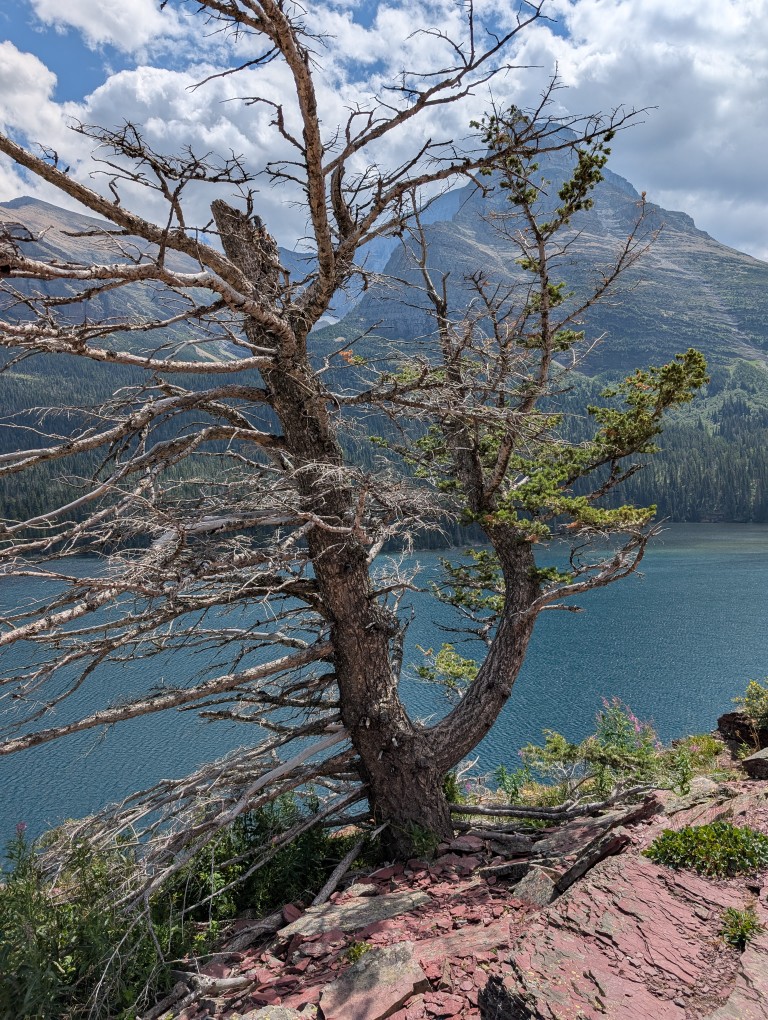
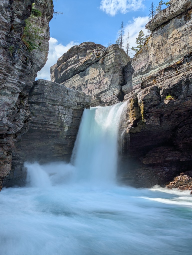
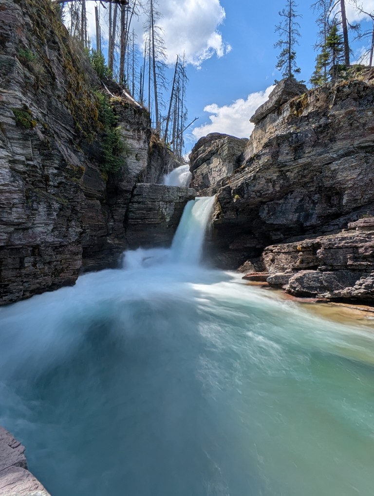
Returning back to the car, we had lunch and, since the sun was still high, we drove on to Lake St. Mary (Saint Mary Lake). This is a typical mountain lake, long and narrow, located in a small valley. Many streams flow into the lake, along which there are beautiful waterfalls - they were our target.
The trail to the waterfalls is very scenic, but, like many places in this park, it's a bit gloomy due to the large number of dead trees—apparently, a major fire raged here about 15 years ago. New growth is now growing, and the charred remains of the former trees stand as a reminder of the past cataclysm.
However, the overall impression is very bright and positive. The trail is easy and well-trodden.
The waterfalls themselves are beautiful (there is a cascade of three waterfalls).
More:
Some desperate girls jumped off the bridge into the water. We didn't.
After returning along the same trail, we took a long, leisurely ride back. Nearing the park's exit, we spotted a deer with classic antlers, just like a postcard, on the side of the road.
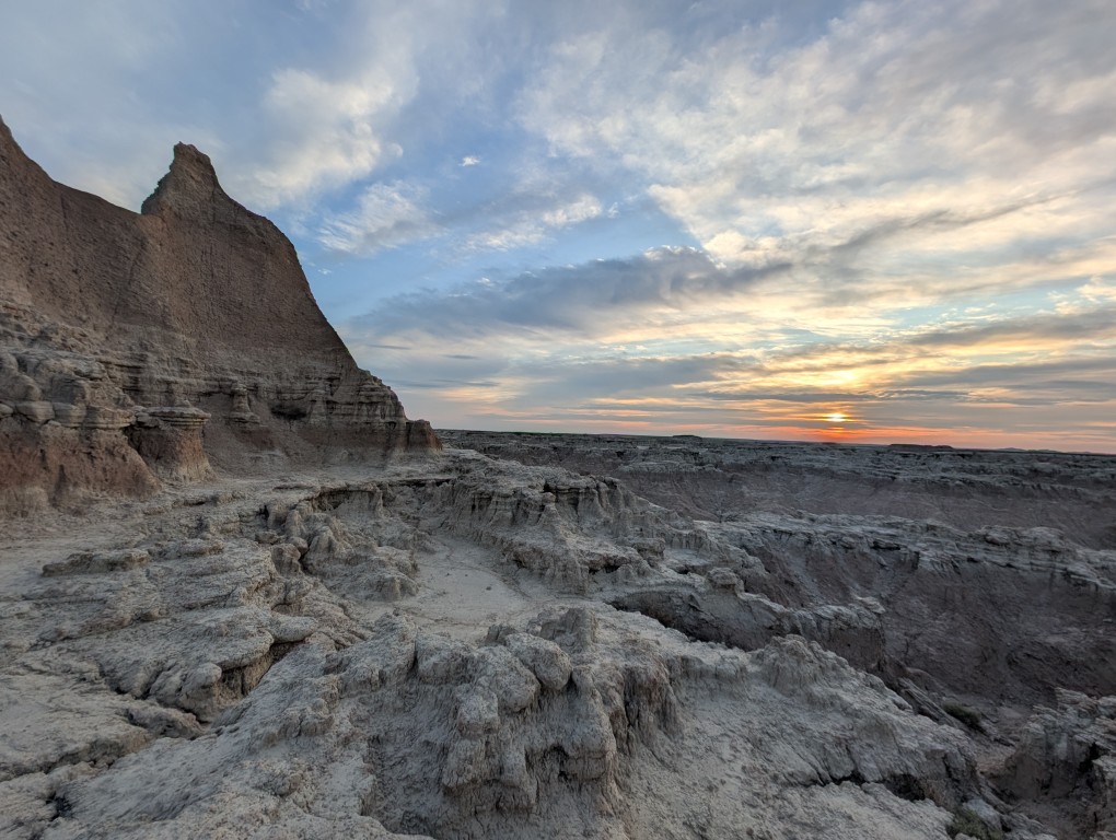
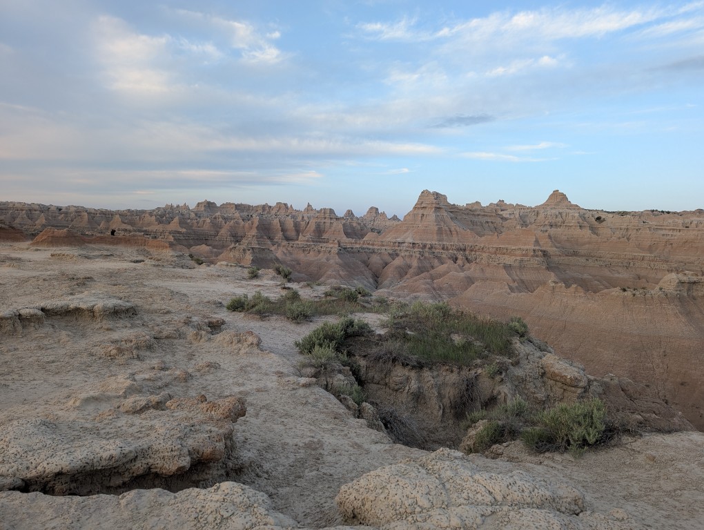
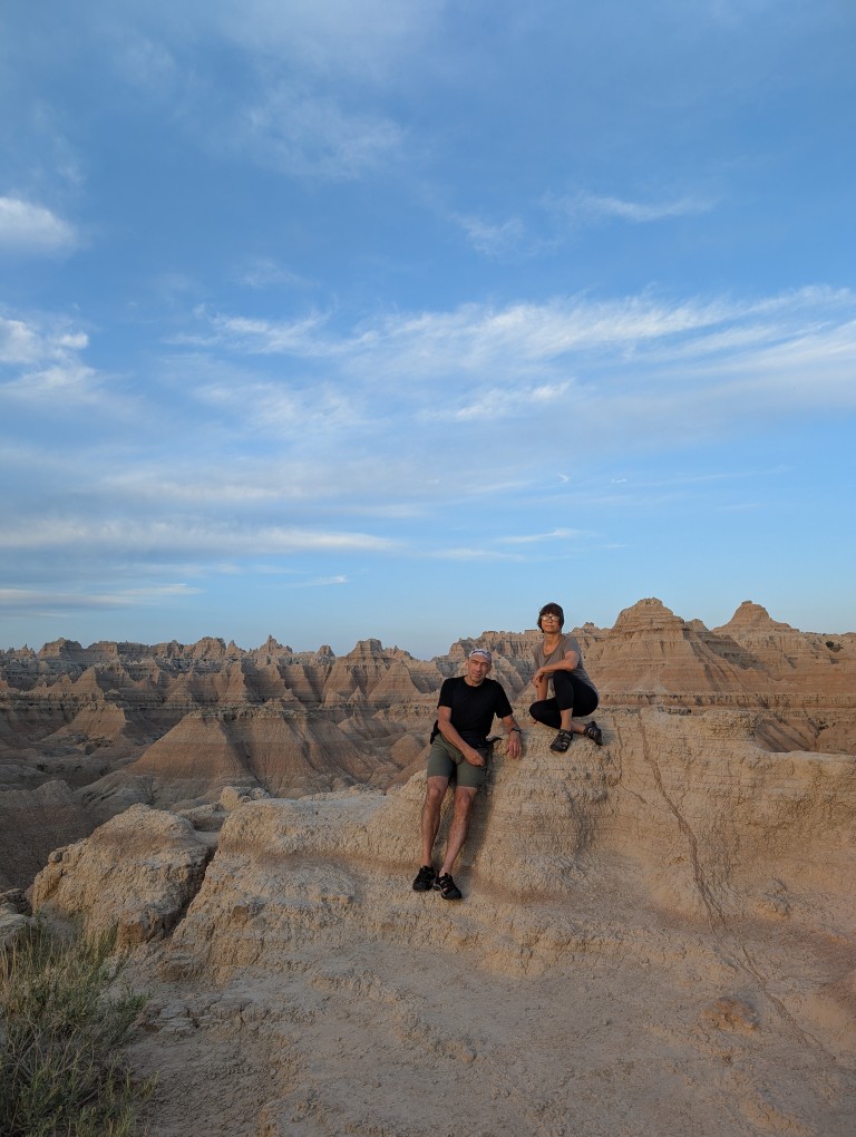
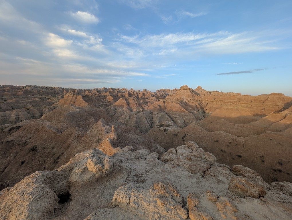
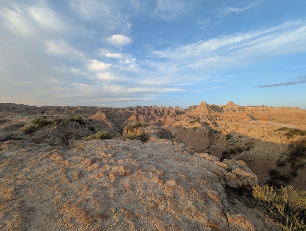
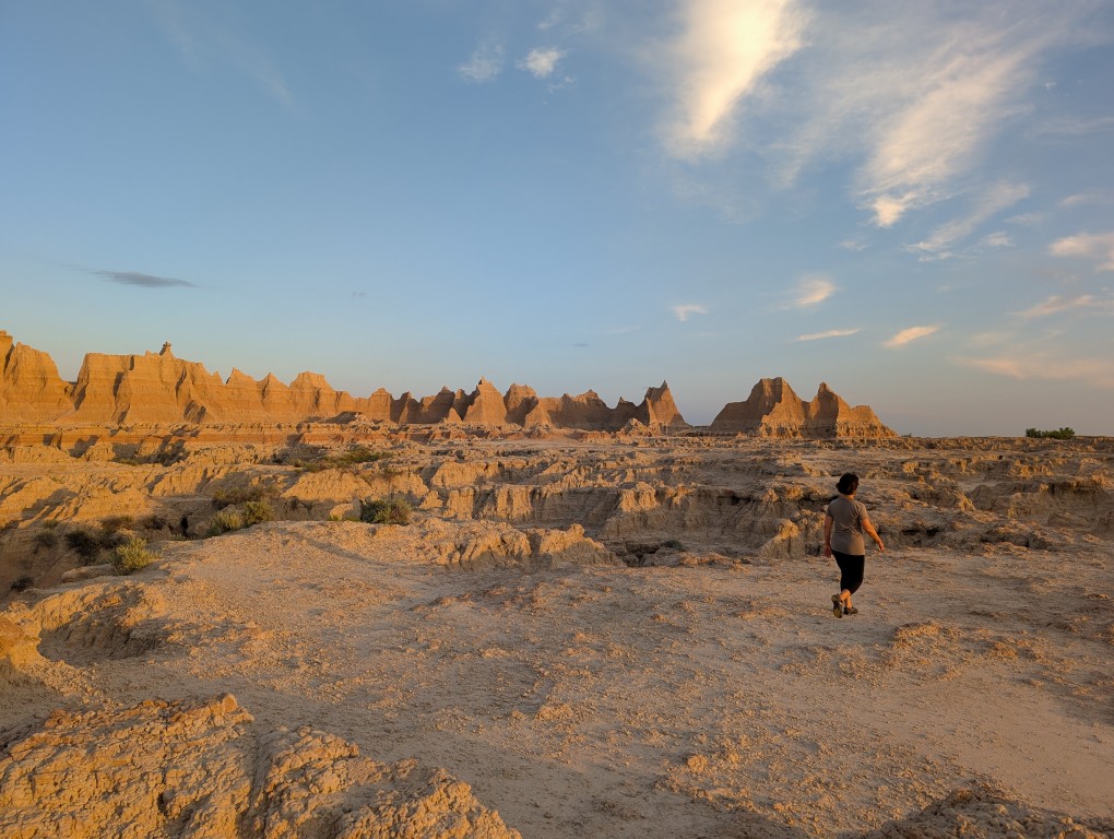
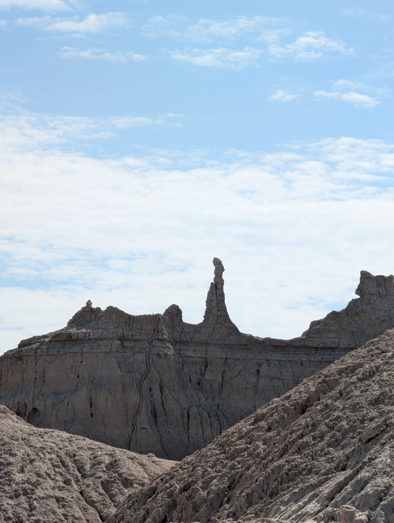
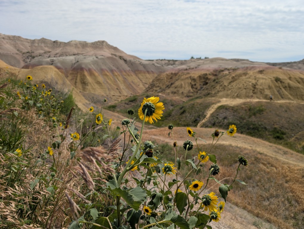
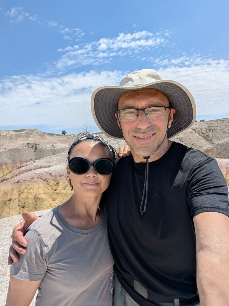
We woke up early this morning and headed to a nearby trail to see the cliffs in the morning light. When traveling west, it's very helpful to stick to our east coast schedule: go to bed early and wake up early. This allows us to easily get to the right spot before the crowds arrive. However, this didn't work everywhere: in Glacier Park, we left the cabin at 5:30 AM and arrived at the parking lot at our destination by 6:40 AM (yes, we drove for over an hour—the park is big), and the parking lot was already full. But Badlands isn't that popular, so there was only one other car there.
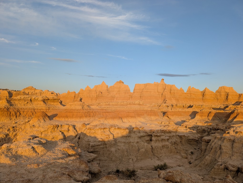
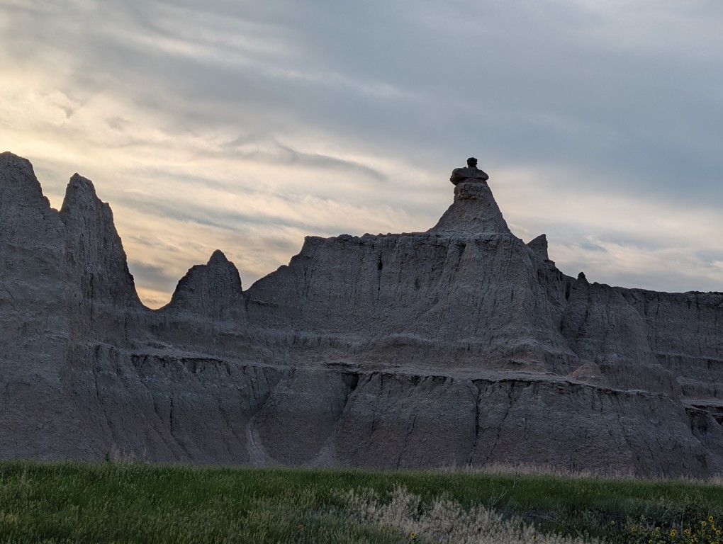
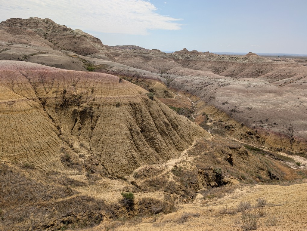
The sight of these cliffs, especially in the right light, is mesmerizing. But you immediately understand why the settlers heading west gave these places their name: they were more interested in growing grain and grazing livestock than in beauty. Agriculture in the local barren lands is very poor. Although there were a few settlements in these parts, especially after the railroad was built, they have not survived.
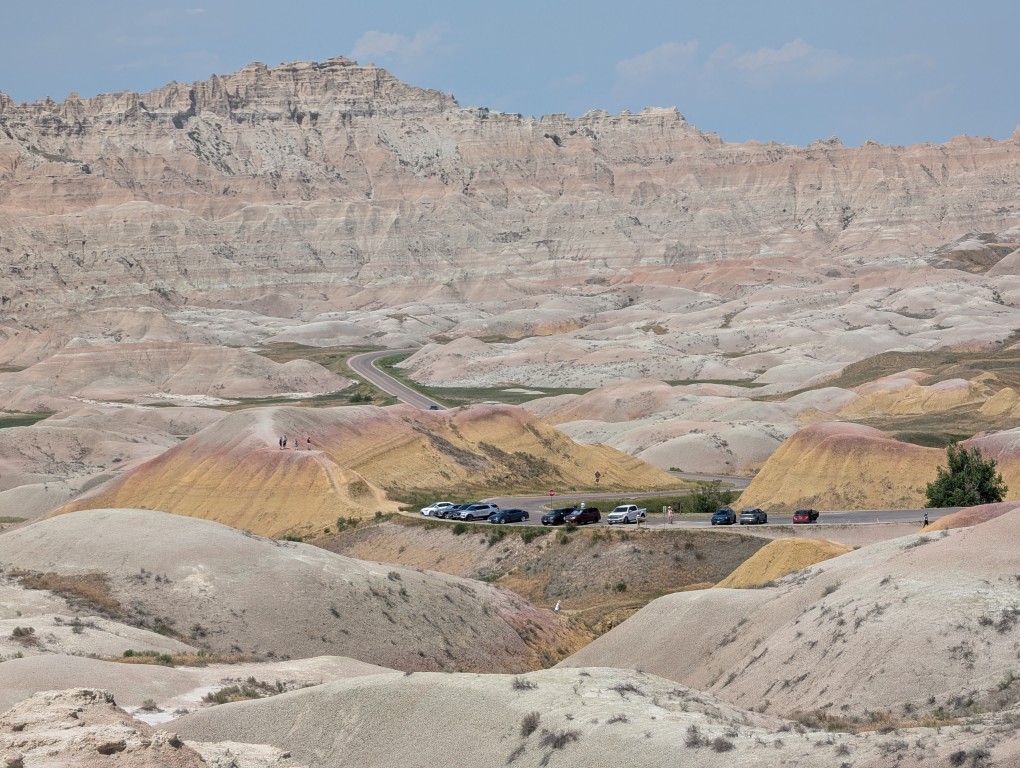
After walking along the trail, we had breakfast and drove along the road No. 240 (aka “Ring Road”"). The road itself isn't long—we covered less than 40 miles, and that was almost it. But there are numerous stops along the way where you can take in all sorts of beauty, walk a few miles along the trail, and then hop in the car, drive to the next stop, and repeat the whole thing. We stopped at almost every stop and soon began to recognize people doing the same, and even began to practically say goodbye to some of them. In total, the drive from the first stop along the road took about 7 hours. There were a couple more stops left, but we decided against it because the main attraction there were the prairie dogs, which we'd already seen (and rightly so, as it turns out—in other parks, they're completely unafraid of people and let you get much closer). So I later deleted all the photos of the dogs from that day.
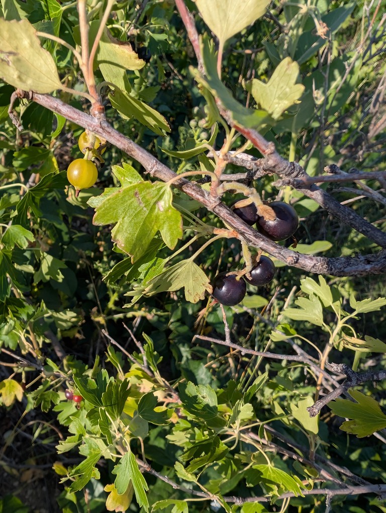
It's called "golden currant." The flavor is somewhere between currant and gooseberry.
So somewhere around one o'clock we finished and went to the nearest town called Wall, to the town pharmacy, to have lunch.
Walla City Pharmacy.
This drugstore is not just any drugstore—it has been there for about a hundred years, and, to some extent, it is one of the symbols of the American Dream.
If you go to pharmacy website, you can read its story there. In 1931, Ted and Dorothy Husted bought a struggling drugstore in the impoverished village of Wall. The village, located in the middle of nowhere in the middle of the prairie, had a population of 326, and the Great Depression was raging. So, business at the drugstore was going very badly.
Five years later, in 1936, Ted and Dorothy were ready to give up, but Dorothy had an idea. Highway 16-A (now I-90, but it wasn't built until after the war) ran nearby, and even then, quite a lot of people drove along it—on their way to Yellowstone or elsewhere in the West. So Ted put up a homemade sign along the road: stop by our drugstore, and we'll give you free ice water.
«Get a soda. . . Get a root beer. . . turn next corner . . . Just as near. . . To Highway 16 & 14. . . Free Ice Water. . . Wall Drug."»
Here's a quick clarification for those unfamiliar with our reality: American pharmacies make only a very small percentage of their total revenue from medications. Because if you have a business open from morning until night (and many pharmacies are open 24/7), why not sell all sorts of household essentials besides medications—batteries, flashlights, phone charging cables. And ice cream. And soda. And plastic-wrapped bread. And alcohol and cigarettes (which would also create potential drug buyers). And create a small nook where you can have a simple breakfast. It's good for the people, and the owner gets a little extra cash...
It was a hot summer, and Fords didn't have air conditioning back then, so the pharmacy ran out of crushed ice almost immediately, and they had to rush to make more from ice blocks (apparently they had a lot of them in stock). Naturally, many customers simply drank the water and left, but there were also plenty of people who bought something.
Currently, during peak season, the pharmacy is visited by about 20 thousand customers a day.
Of course, the old pharmacy is long gone. It's now a massive shopping mall, where you can probably find a pharmacy somewhere. All that remains of the old pharmacy is a museum. We didn't know its history back then, so we didn't go inside.
There are also plenty of souvenir shops, a chapel for travelers (Ted and Dorothy were Catholic), and a fast-food restaurant where you can buy delicious bison burgers and wash them down with free ice water.
Chapel.
The yellow cardboard cup contains the same water. The sign reads: "Free ice water at Wall's Drugstore.".
After lunch, full and satisfied, we headed to our next overnight stop—a campsite on the shore of a forest lake. But before that, we stopped at one more place— Mount Rushmore National Memorial. I hadn't really planned on going there, but it suddenly turned out that it was right on our route, only a 20-minute detour. So we decided to stop in.
There were presidents in the mountain, there was also a sculptor's workshop with a description of how it was all done, and a small path around the mountain.
Natasha looks quite harmonious on the threshold of the tipi.
The lake where we camped overnight, by the way, wasn't particularly impressive—just the day before, we'd been swimming in Michigan, and there's little that can compare. But I went for a swim anyway.


 It's a good thing we photographed it from afar. But the trail is also beautiful—it smells of sun-warmed pine resin and wet pine needles. About twenty minutes later, we unexpectedly found ourselves near the tourist center. Elderly Japanese people fluttered effortlessly from a tour bus in the parking lot and, chattering excitedly, set off along the trail to photograph Devil's Tower. They're the kind of people who take pictures and marvel at everything, like children. But we were heading in the other direction. In one place, a storm had knocked down several trees. Perhaps the devil, the tower's owner, was angry and uprooted everything in his path. Then we encountered some Martian landscapes with red soil. The trail beneath our feet also turned red.
  From the other side of the cliff, a beautiful view of the distant distances suddenly opened up: green hills and blue forests, the blue ribbon of the river and the yellow ribbon of the road. They encountered climbers, young men with backpacks, ropes, and carabiners.