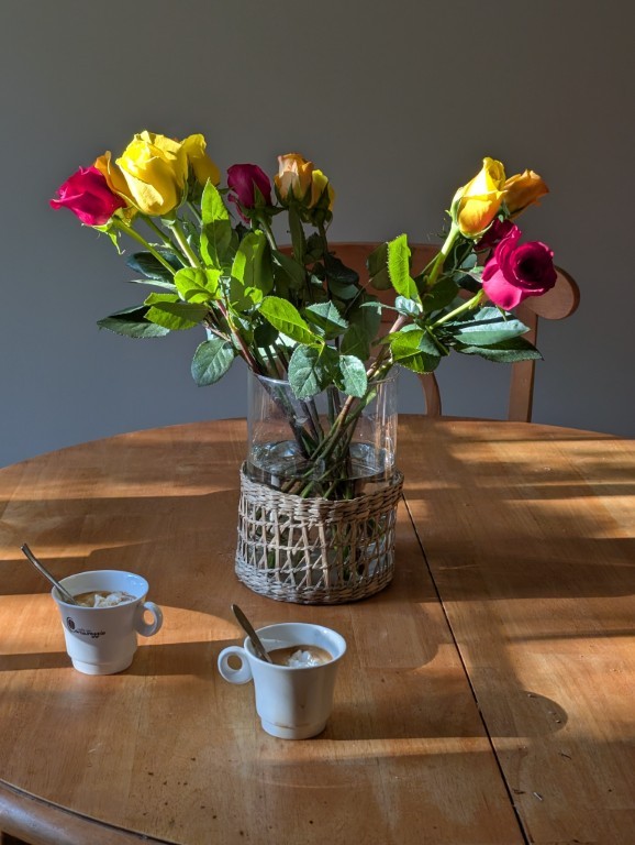
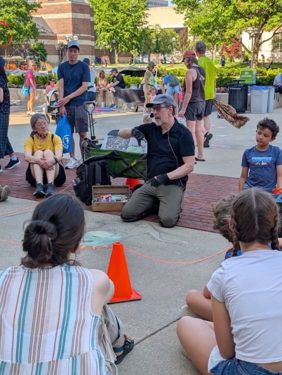
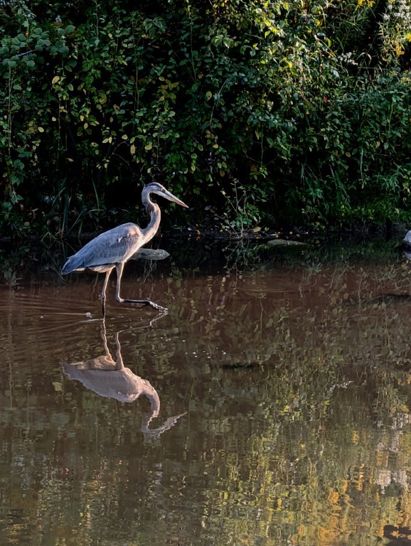
For many years now, at the end of December, I've been ordering a wall calendar with photos for the corresponding months of the past year. And, as has become a tradition, I also post a post with the same photos.
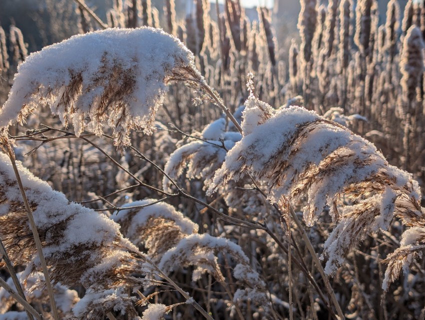
January
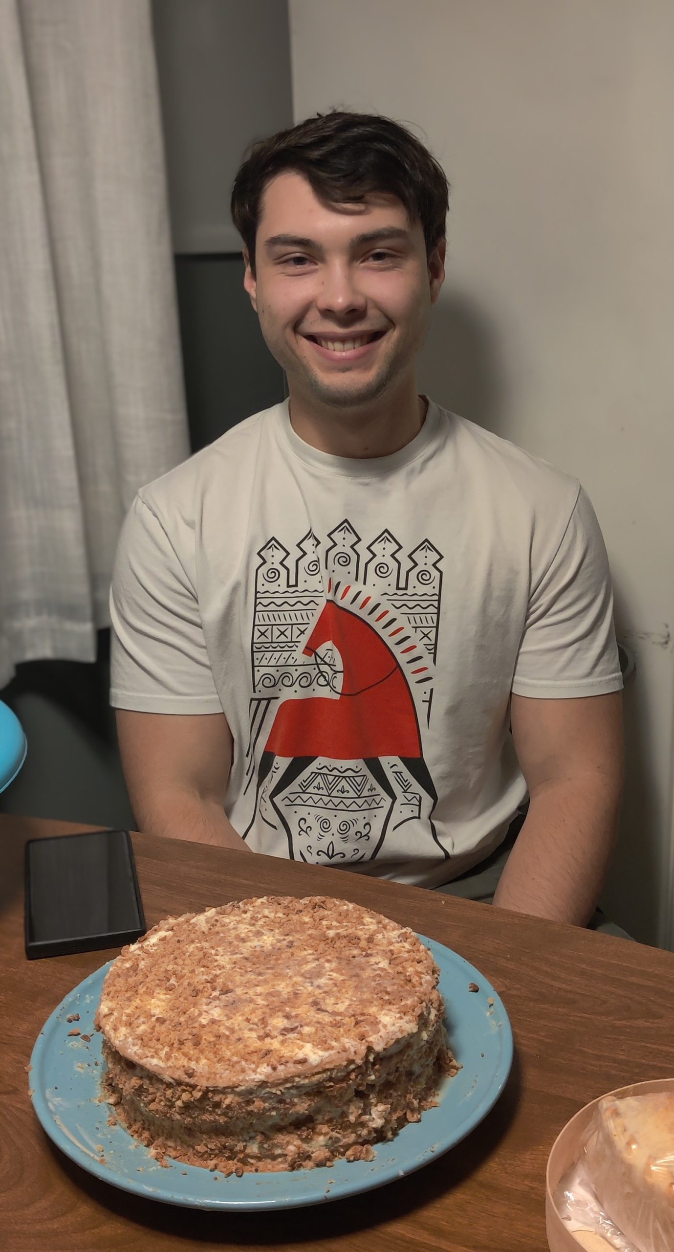
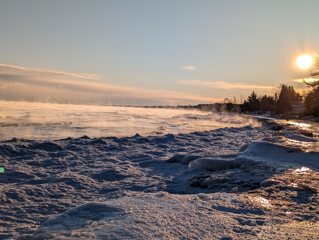
Just like the year before, we went to the very edge of the world—the Keweenaw Peninsula. There's snow, skiing, Lake Superior, which is beautiful in any season, and someone (not me 😔) turned 21.
February
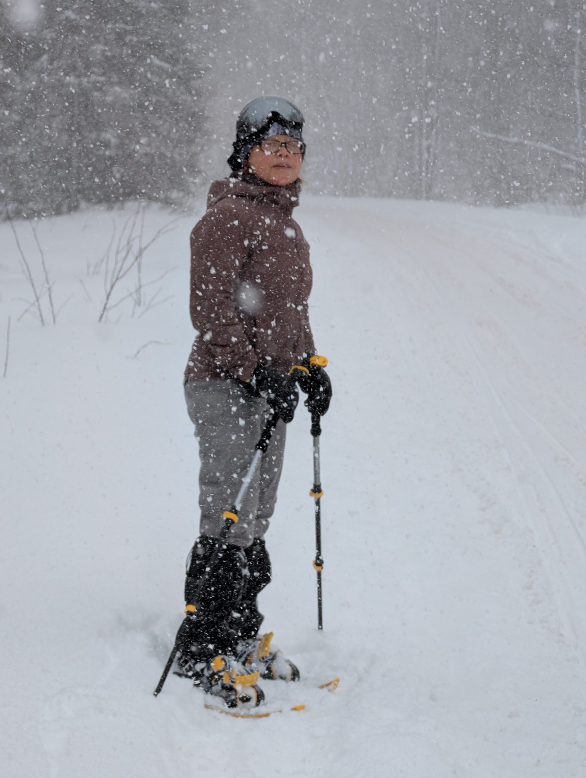
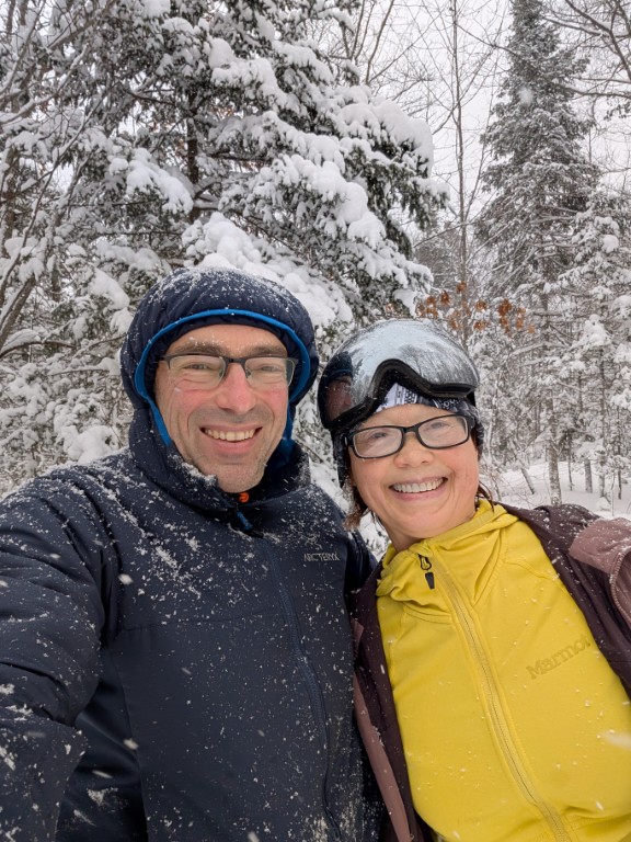
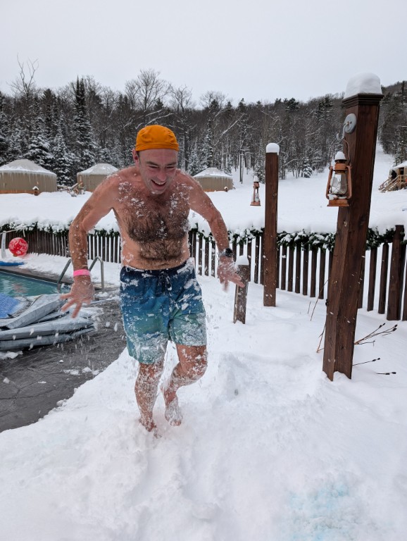
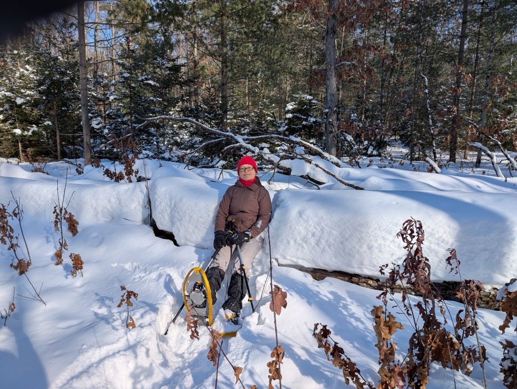
We went snowboarding again—this time in lower Michigan, near Manistee. Cross-country skiing, snowshoeing, Lake Michigan. I also worked.
March
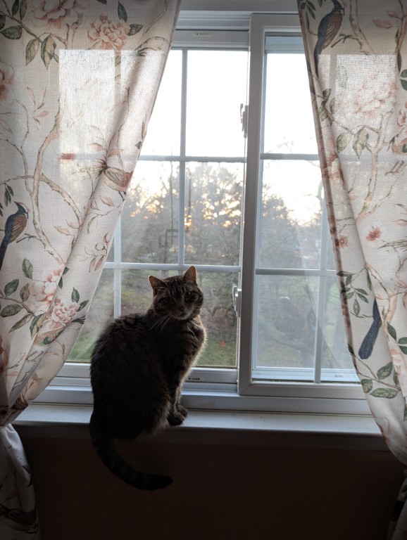
Natasha took a complicated route to visit her mother, and I stayed home with the cats...
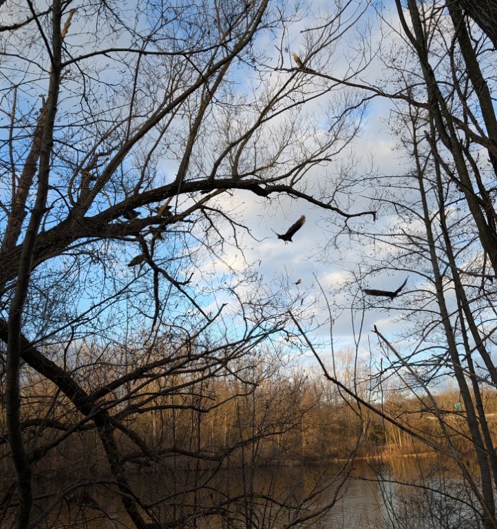
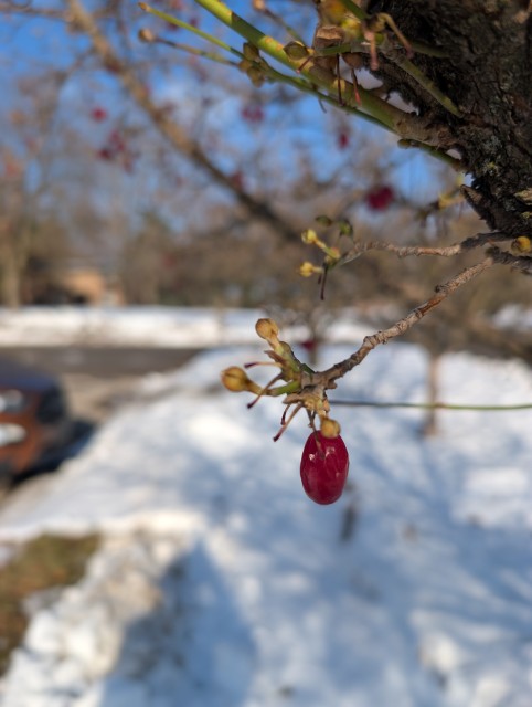
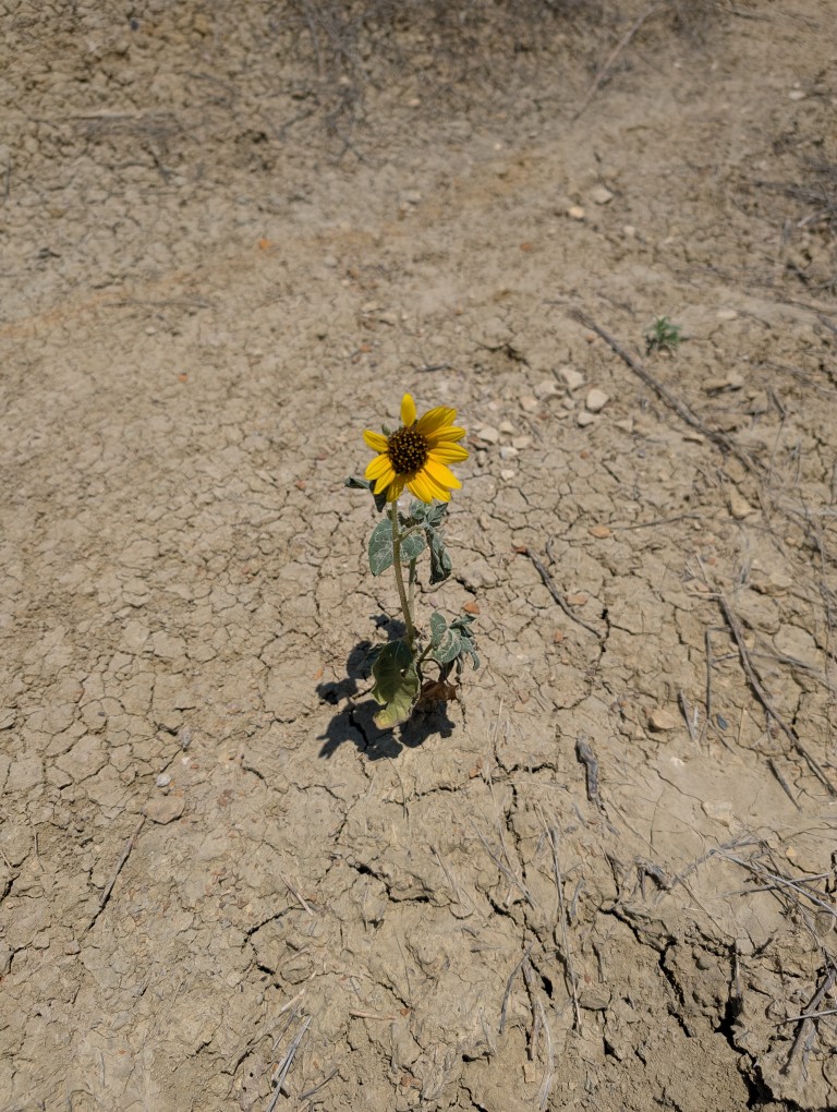
April
Spring is coming here, just in time for Natasha's arrival.
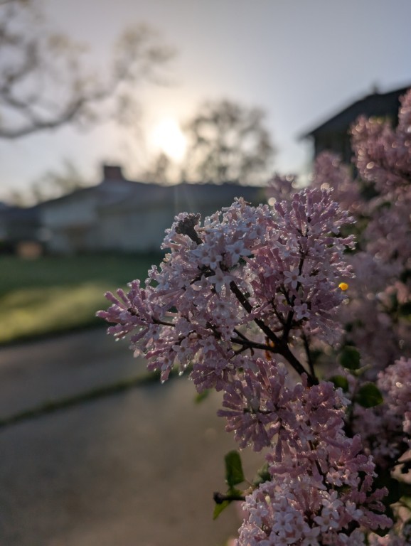
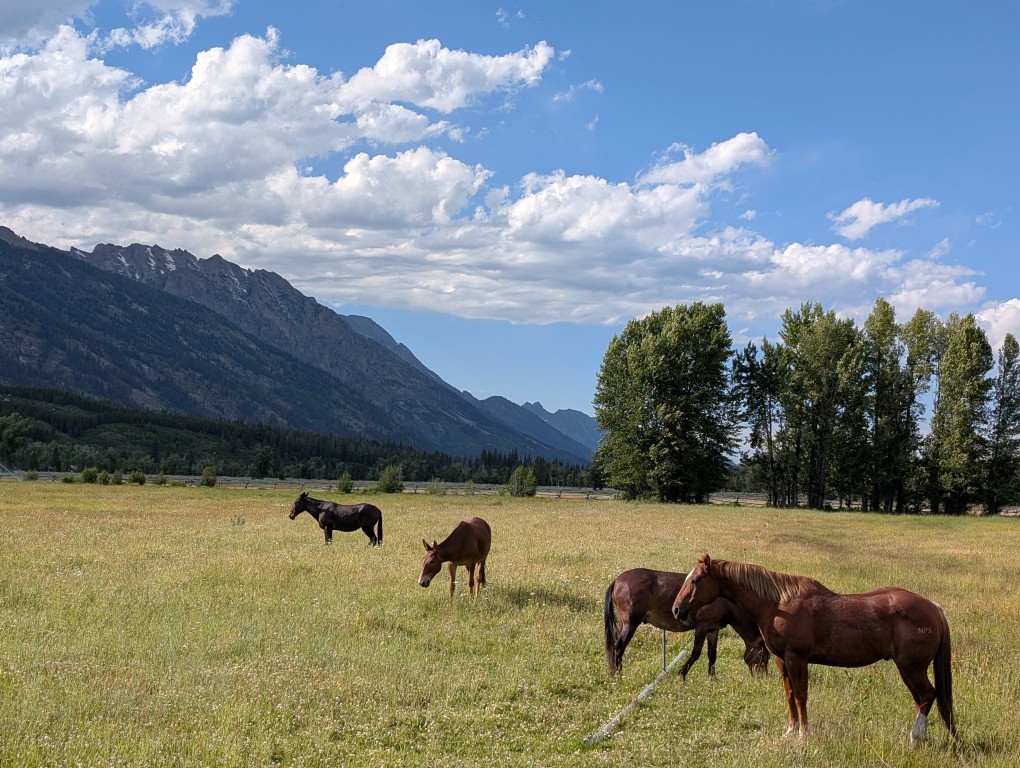
May
It's great at home, we're driving around the neighborhoods.
June
June in Ann Arbor is a time of peony blooms, summer festivals, and smog from the Canadian forest fires.
July
A three-week trip to the Northwest US: beautiful national parks, long drives, work on the road.
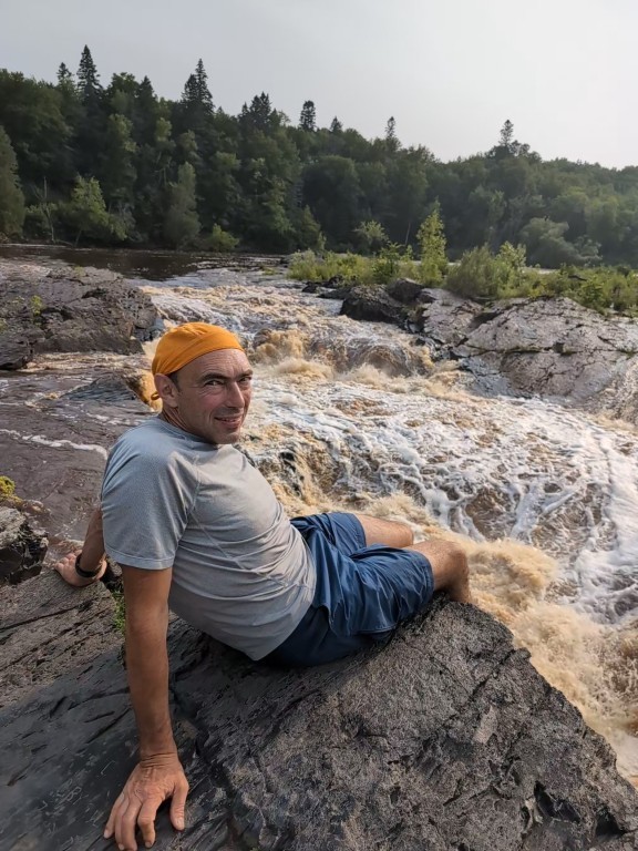
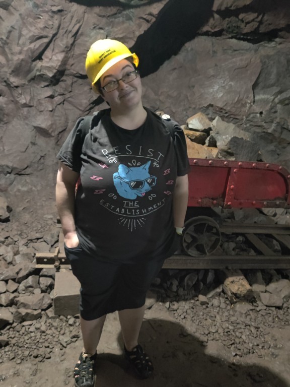
August
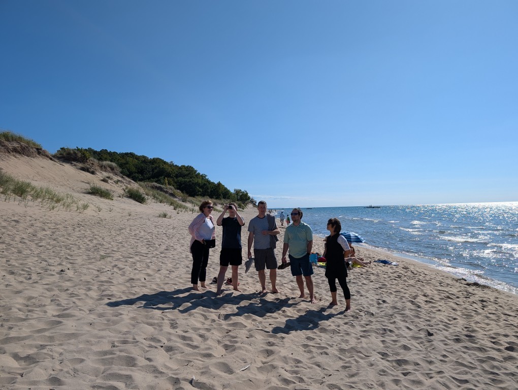
Another trip to Upper Michigan: the Keweenaw Peninsula is beautiful in both winter and summer, and meeting old friends.
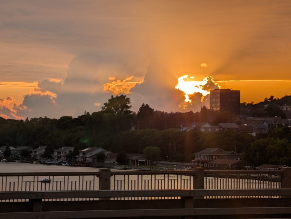
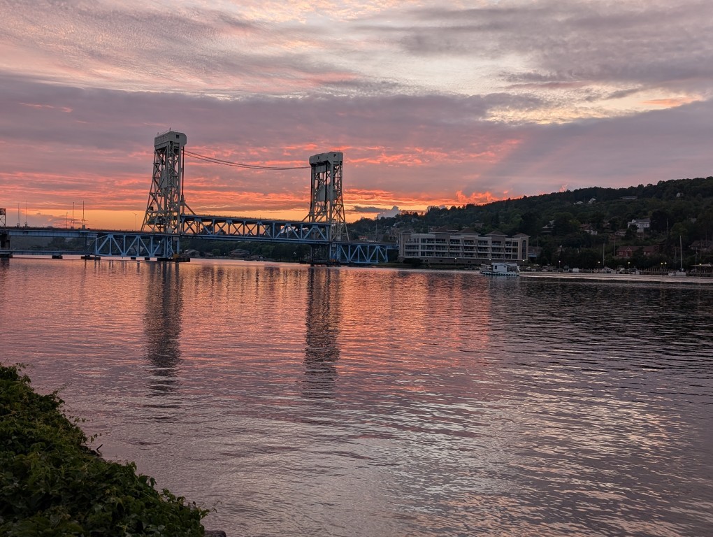
September
It's a time of festivals, changing colors of leaves, beautiful sunsets
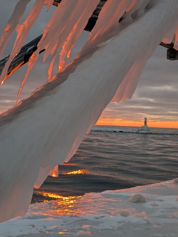
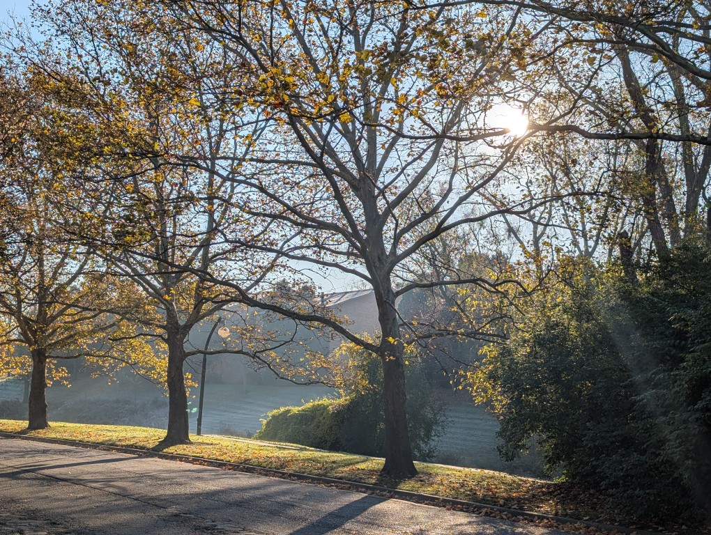
October
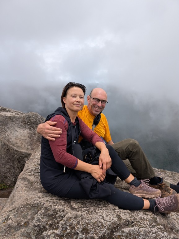
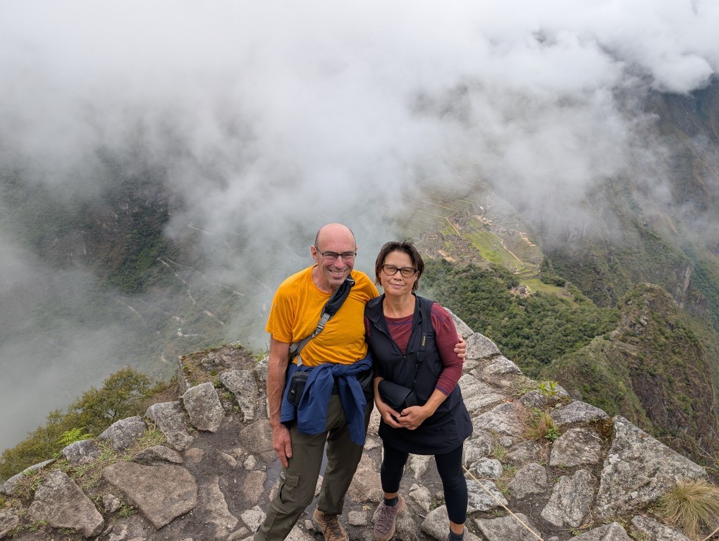
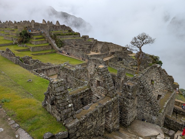
A Grand Trip to Peru: Machu Picchu, Cusco, Mountains, Rivers, Waterfalls…
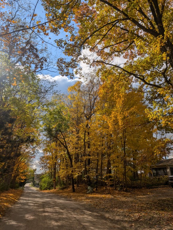
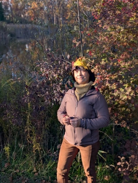
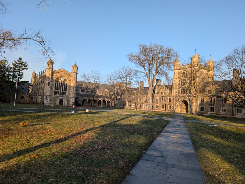
November
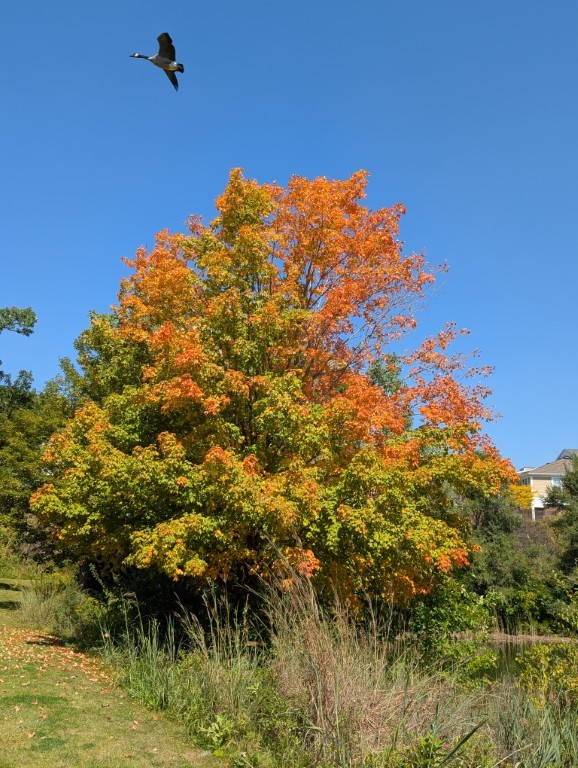
One of the most beautiful months we have here in Michigan: the trees are covered in colorful leaves, and the weather can feel almost like summer one day, and snow the next…
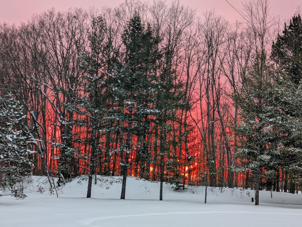
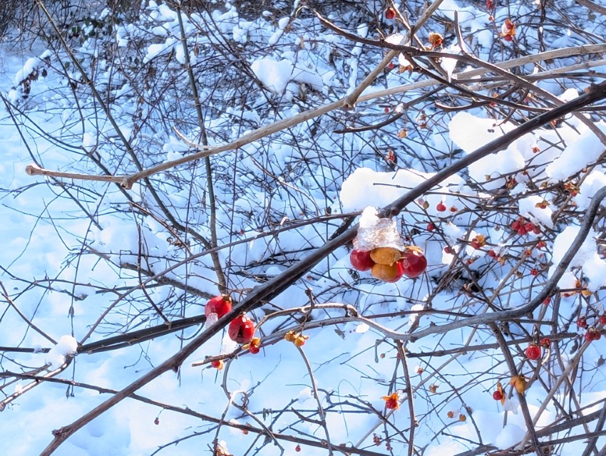
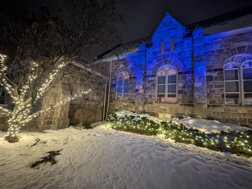
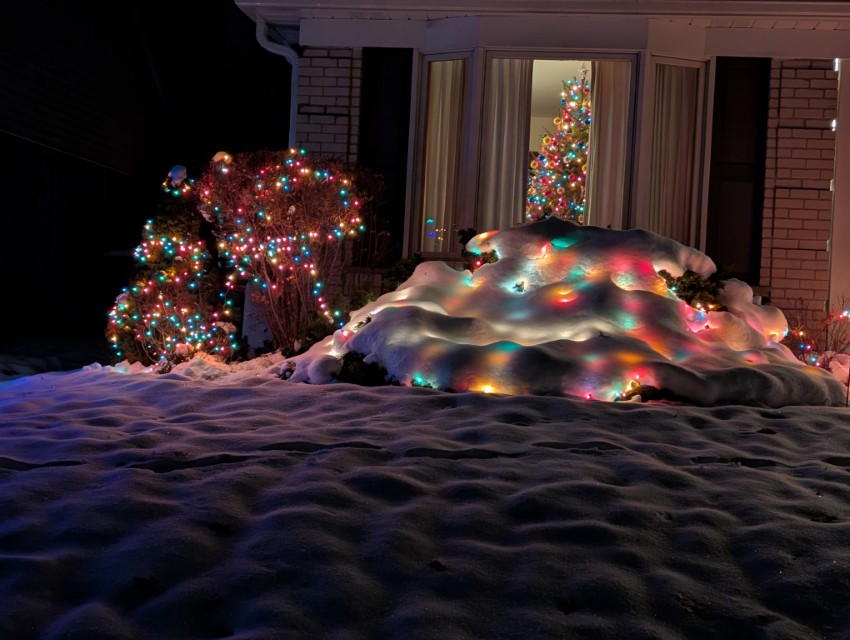
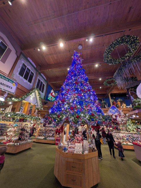
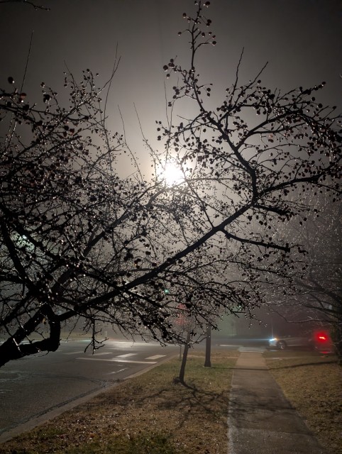
December
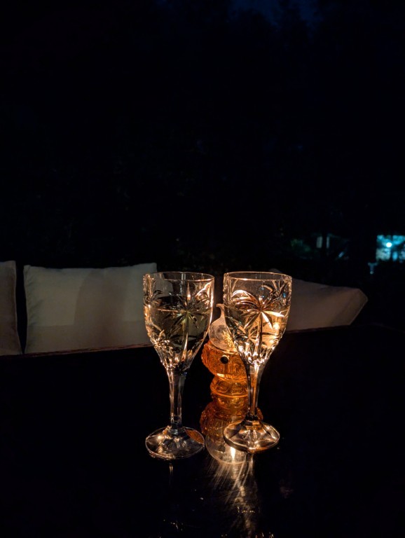
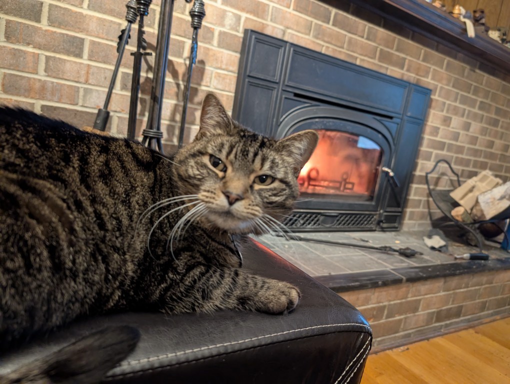
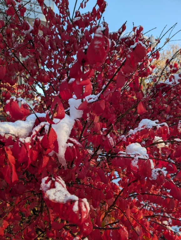
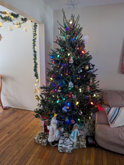
This year December has been very good – snow, several beautiful sunny days (last year there wasn’t a single sunny day in December), Christmas lights…
And the fact that there were occasional torrential rains and one day the temperature rose to +15 degrees – well, that’s what Michigan is for...
А то, что иногда шли проливные дожди и однажды температура поднялась до +15 градусов — так на то это и Мичиган…
Почти во всех наших поездках мы берем в аренду автомобиль — за пределами больших городов, это обычно лучший способ посмотреть новую страну. Перу не было исключением из этого правила, хотя, перед поездкой, я читал много пугающих вещей про особенности вождения тут.
Машина (Toyota Raise в очень базовой комплектации) обошлась нам дороже, чем машина подобного класса у нас в Америке, но это было ожидаемо. На удивление, она даже оказалась с автоматом — настоящая роскошь в стране третьего мира. На крутых горных серпантинах автомат, конечно, удобнее, хотя и ручная коробка у меня проблем не вызывает.
Я специально брал машину в классе “маленький SUV”, потому что ничего хорошего от местных дорог не ожидал (и не зря). Но от SUV у нашей машинки был только внешний вид и чуть более высокий, чем на стандартном седане, дорожный просвет: передний привод на грунтовке не тянул даже на небольшом подъеме, в чем мы сумели убедиться уже через 20 минут после выезда из рентовки: Google Map повел нас к первой точке (археологическому сайту) по какой-то совсем убитой грунтовке, мы доехали до слишком узкого моста, а при попытке разворота машина не смогла заехать немного в горку и тупо села. Хорошо, что мимо проходил какой-то местный пастух, Наташа села за руль, а мы с ним машину вытолкали. За труды пастух получил честно заслуженные 20 солов (около 4.5 долларов), а я приобрел ценный опыт и больше уже не застревал.
На машине мы проехали 9 дней и чуть больше 1000 километров — не слишком много, но, с учетом местных дорог, вполне достаточно. Про перуанских водителей писали, что на дорогах они ведут себя очень агрессивно и непредсказуемо. Возможно, это имеет место быть в Лиме (ВСЕ, кто писал про езду в Перу, заявляли, что в Лиме водить абсолютно нет смысла, и я им охотно верю), но мы ездили в районе Куско и вокруг, и там особой агрессии я не увидел. Да, стиль езды в Перу отличается от привычного нам американского и европейского, но это именно стиль, который можно и нужно освоить, чтобы не попадать в опасные ситуации. И стиль, во многом, вызван местными условиями: например, тут принято сигналить перед закрытым поворотом. В целом, я могу сказать, что ездить по Перу трудно, но вполне возможно.
Про дороги хочется сказать отдельно. Надо признать, что дороги явно становятся лучше — во многих местах мы видели дорожные работы или мы ехали по совсем свежему асфальту. Такое чувство, что Перу сейчас активно работает над улучшением доступа к своим археологическим сайтам, чтобы Мачу Пикчу не был единственным туристическим местом.
Нельзя доверяться Google Maps — несколько раз она заводила нас на ужасные грунтовки, по которым надо ездить на настоящих джипах, а не той городской машинке, что дали нам в прокате. При этом дважды мы потом выясняли, что рядом была приличная новая асфальтовая дорога, просто чуть длиннее. Возможно, дороги были слишком новыми?
Также Google Maps несколько раз пыталась направить нас по односторонним улицам против движения. Хорошо, что мы быстро поняли, как там обозначено направление движения (ни разу не по международным стандартам), и на такие разводки не попадались.
Из положительного можно отметить, что ни разу на перуанских дорогах не возникало сонливости за рулем. Наверное, потому, что одна из двух полос в любой момент может оказаться перекрыта упавшими с горы камнями, или же надо будет переезжать небольшой поток, текущий с горы прямо по асфальту, или же сбрасывать скорость перед немаркированными “лежачими полицейскими” (topes по-испански) — мы видели такое в Мексике. Особенность латиноамериканских topes в том, что они крутые и их надо проезжать ОЧЕНЬ медленно, намного медленнее чем у нас в США.
Несколько раз я читал на форумах про проблемы с перуанской дорожной полицией. Я даже заранее сделал за 20 долларов так называемую “Международную Лицензию” (International Driving Permit), хотя и знал, что она в Перу не нужна при наличии американских прав: где-то я вычитал, что её отсутствие послужило поводом для вымогания взятки. Но в единственный раз, когда нас остановили для проверки документов, то её никто не спросил: посмотрели мои права, документы на машину и пожелали счастливого пути.
В общем, это был интересный и полезный опыт. Все прошло хорошо, за исключением маленькой неглубокой царапины (не до железа даже) на борту машины. Не знаю даже, где я её приобрел: я про неё узнал только, когда сдавал машину обратно. Мне насчитали 100 с чем-то долларов, которые моя кредитка мгновенно вернула — у меня полное страховое покрытие.
В этой поездке многое было впервые — первый раз в Южной Америке и вообще в южном полушарии, первый раз (если не считать пост-советской Средней Азии в начале 90-х) в стране третьего мира, первый раз, когда я мог действительно использовать испанский для бытового общения…
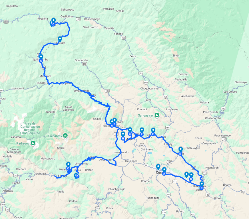
В Перу мы провели почти три недели — со второго по двадцатое октября. Поездка была разбита на три части:
Куско — 5 дней, два дня сразу после прилета, ещё два дня после возвращения из Мачу Пикчу, и ещё один день перед отлетом
Тропа Салкантай и Мачу Пикчу — 6 дней: четыре дня тропа, два дня — город Мачу Пикчу
Автомобильная поездка по долине Урубамба (и не только) — 9 дней.
Все запланированное было выполнено практически без накладок (мастерство в организации путешествий не пропьёшь), хотя местами было и не просто.
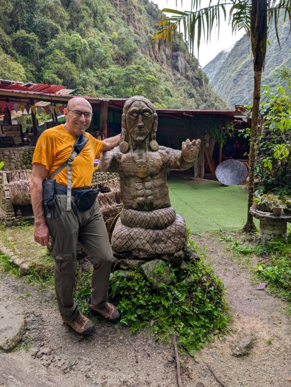
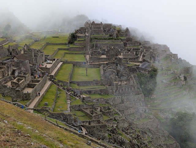
Machu Picchu: the town and the archaeological site.
We arrived at the town of Machu Picchu (officially called Aguas Calientes) in the late afternoon. We were really tired because the day had been arduous and challenging.
I can't say I liked the town, especially at first. Gray skies, a muddy, unpaved road toward Machu Picchu (the town itself was paved, after all), and a drizzle... Later, the rain stopped, but the sky remained gray.
But the hotel was quite comfortable, and there was hot water (true to the town's name: Aguas Calientes - Hot Waters / Hot Springs), internet, and the electricity never went out during the two days we spent there. Pure luxury!
Of course, our main goal was to visit Machu Picchu. That's not easy.
Firstly, the number of tickets is limited. If you want to have a choice, you need to buy tickets several months in advance. I bought them five months in advance. You need to buy them on official website.
Secondly, you can't just buy a ticket "to Machu Picchu." There are several routes, and you need to buy tickets for a specific route.
As a result, I bought tickets for two routes:
The most popular route is #2
Route #3 with the addition of Huayna Picchu.
Together, these routes allow you to walk around the entire Machu Picchu, and the mountain is an added bonus.
The internet suggested spreading the two visits over two different days to increase the chance of having at least one in good weather, but I looked at the travel time and decided I didn't want to do it twice. So I scheduled the visits back-to-back: at 7 a.m. to catch the morning light 😀, and at 9 a.m. I must say, this decision turned out to be a very good one: on the day of our visit, the weather cleared up just in time for the second route, but the next day it drizzled from morning until 2 p.m., when we left for home.
There are two different ways to get to the place:
Most people buy bus tickets. Buses run regularly, cost $12 each way, and the ride takes about an hour, including waiting in line.
Some especially brave ones choose to walk. One end takes at least an hour and a half, and the walk to Machu Picchu is quite difficult, as it involves a long, steep climb up stairs.
In the end, we chose the combined option—take the bus there and walk back. So I went to the bus station to buy bus tickets. Then I came back and went again 😣—it turns out these wonderful people need a passport to sell tickets.
I even understand why they need a passport: tickets are cheaper for Peruvians, and a passport is needed to identify who is Peruvian and who is not. But I was already buying the most expensive ticket for the "gringos." Apparently, they thought I was actually Peruvian (well, yeah, you can't tell me apart from a Peruvian) and was maliciously buying the most expensive tickets. And a photo of my passports on my phone didn't satisfy them—only originals, only hardcore.
Of course, I can't be bothered to walk to the hotel and back—the town is small, and the walk takes ten minutes at most. But this incident, I think, is typical for Peru: they love senseless controls.
For example, there were several checkpoints along the trail where you had to write down your last name, country, age, and passport number. At first, I thought they were trying to extort money from tourists, but they do it completely for free. And no one checks the information: I had the idea of registering in Russian as Emperor Maximilian I. I was too lazy to look up passport numbers, so I simply didn't write them down.
At hotels, too, they scan your passports when you check in, and then you have to fill in your last name, first name, age, and passport number on a form. Heck, you have a scan—so just fill it in yourself if you need to! But no, that's how it's supposed to be.
I wonder if this passion for control stems from the traditions of the Inca Empire, where control was absolutely total: North Korea, compared to that empire, would be a den of anarchy. Perhaps it was precisely thanks to this total control that 168 (in words: one hundred and sixty-eight) Spaniards took over a country with a population of 10 million in just a few years: all they had to do was seize the center and start issuing new commands, and the population, accustomed to obeying, didn't even utter a word.
But I digress. I did buy tickets for the second trip, so we got our tickets, raincoats, and passports ready and went to bed.
We woke up early this morning (we're always early on the trail, so it wasn't hard), and by 5:30 we were already having breakfast. Breakfast at the hotel, by the way, starts at 4:30—everything here is geared towards tourists visiting Machu Picchu.
Around 6:00 a.m., we went to the bus stop. A light drizzle was falling, and the line was long. The mood was so-so: neither one nor the other inspires enthusiasm. But I can't help but notice the resourcefulness of the Peruvians: street vendors stood in the doorways between the buildings near the line, offering raincoats. We don't need them—we have our own.
The line moves pretty quickly: a bus pulls up, a few people quickly board, and we move forward. Soon we're on the bus, taking us up a steep, serpentine road.
By the time we got off the bus, the rain had almost stopped. However, the golden morning light was gone—everything was obscured by fog. This, however, only added to the mystique of this amazing place.
It's hard to talk about Machu Picchu because you just need to see it bearded joke. The scale of the structures and the way they fit into the surrounding landscape make a great impression.
I can't help but mention the topic of polygonal masonry that occupied me in Peru. The fact is that here, as in many other places, two completely different stone laying technologies are used: the extremely high-tech polygonal masonry, where each stone (and these stones can be VERY large: in Ollantaytambo, for example, some stones weigh hundreds of tons) are processed in such a way that the gap between one and the next is about a millimeter. How a Stone Age civilization (they had bronze and copper tools, but in extremely small quantities and sizes) could fashion complex three-dimensional objects from solid andesite (and in Ollantaytambo, granite) blocks with such precision (they weigh from hundreds of kilograms to hundreds of tons—trying and adjusting them is impossible; everything must be done at once and then put in place) remains a mystery. It also remains a mystery why they had already lost this technology by the time the Spanish arrived.
There is also a much rougher masonry, where more or less suitable stones are connected with mortar:
The official theory is that the Incas used polygonal masonry for particularly important structures, and rough mortar for simpler ones. But this doesn't explain why one wall might begin with polygonal masonry and then continue with rough mortar:
Before my trip to Peru, I listened to a lot of YouTube shows (I actually listened to them while jogging), including some crazy theories from a Russian group of alternative-themed researchers who believed that polygonal masonry was the remains of an ancient high-tech civilization, while the rougher mortar-based masonry was the work of the Incas, who, as best they could, restored and completed the dilapidated ancient structures they inherited.
Despite its absurdity, this theory explains well the inconsistencies in buildings with combined masonry, in which the mortar masonry is ALWAYS higher (and therefore later) than the polygonal masonry.
However, I will not insist on this theory - it is too non-trivial and changes all existing ideas about the history of the development of world civilizations.
Bonus: Huayna Picchu Mountain
Our second route included a visit to the mountain Huayna Picchu. Before you reach the top of the mountain, there's another checkpoint where you need to write down your name, passport number, departure time, and something else.”Socialism is, first of all, accounting.” (V. Lenin). Although, in this case, keeping records is justified: it's easy to fall over on the mountain, so using the logbook (upon returning, you need to find your entry and check in) you can determine who went there and never returned.
Not everyone climbs this mountain because the mountain is high and the trail is steep:
But we did:
And we didn't regret it. Besides the mountain itself being interesting (and filling us with a sense of accomplishment), it offers excellent views of Machu Picchu. Just in time, the weather cleared up briefly, and the sun even appeared at times.
At the very top of the mountain there is a small platform where you can sit and take photos of the surrounding fog:
And then we went down the steep and slippery steps.
Although only a small percentage of the total number of visitors climb the mountain, there are still quite a few, and among them are some truly colorful characters. For example, at the summit, Natasha encouraged a bald, older man—he was flushed and steaming; he must have been struggling. Later, on the descent, this man overtook us as if we were standing still: he practically ran down the steep, slippery steps, easy and effortlessly. It seems he's significantly more physically fit than we are, and the steam coming off him was because he was also running up the mountain.
Or this colorful group of either Japanese or Koreans:
Overall, the climb up the mountain left me with no less of an impression than Machu Picchu itself. If you go there, I highly recommend it.
End of the day.
After Machu Picchu, we walked for a long time down steep old stairs from the mountain. At the very bottom there is Machu Picchu Museum, entrance to which is also covered by our ticket. It's not crowded because most tourists are returning on buses and don't notice it.
Well, then we had a rest, sat in the rain in hot spring, took a shower, and went to a nice restaurant to celebrate our wedding anniversary:
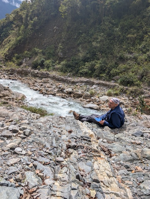
The next morning, breakfast was at 6:30, a downright decadent affair. Over breakfast, the host explained the next stage of the trail, and we set out around seven. The going is easy, but boring: a dirt road. However, it's a chance to observe the unwritten rules of local driving: they honk before blind turns. The roads are narrow, so if you come across an oncoming car around a bend, you could end up slamming into it. Incidentally, the notion that Peruvian drivers are extremely aggressive on the roads doesn't seem true to me: they simply often drive not according to written rules, but "by convention." But more on that later; we'll have another chance to test this out in practice.
Meanwhile, a family from Spain caught up with us, and we were chatting with them over dinner under the pass. We were exchanging impressions of Peru when we reached the bridge over the river. Here, the route splits: you can continue along the road, or you can turn onto a hiking trail along the other side of the river. We took the trail and didn't regret it.
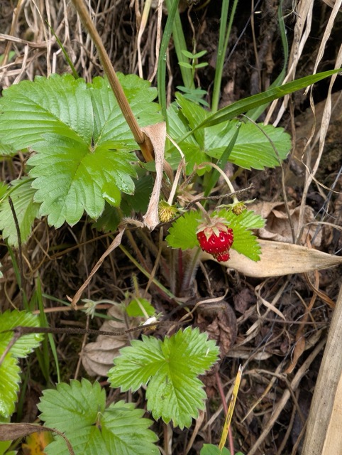
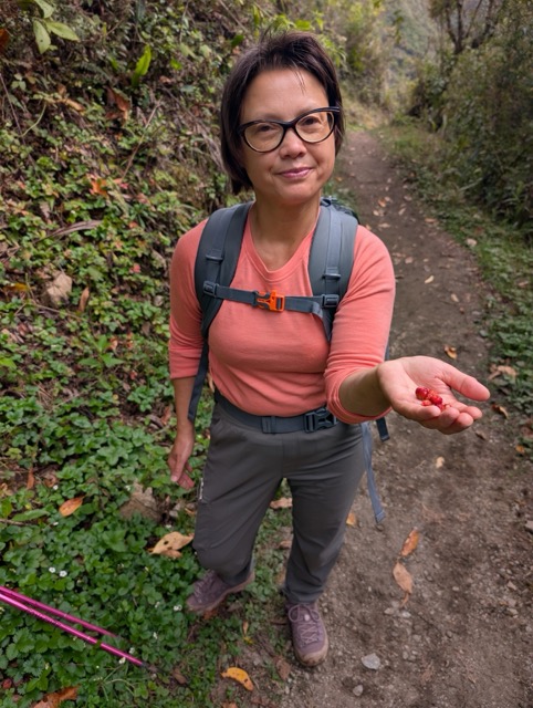
It would probably be easier to walk along the road: the trail goes up and down all the time. But there are strawberries here. Just ordinary wild strawberries, which don't grow here in Michigan. We hide them as we go, pick a few berries, and pop them into our mouths. That alone made the trail worth it.
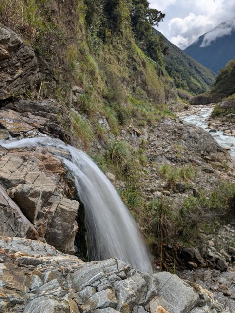
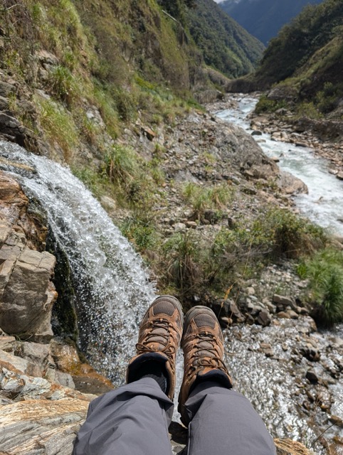
There are also streams here, flowing into the river. New metal bridges, painted bright green, span them, sometimes next to older wooden ones. It's clear the trail is being maintained.
We come across beautiful waterfalls. We stop at one of these spots to make coffee. It's a bit of a luxury, of course, but why not treat yourself?
Further on, the trail passes a campsite. The grass is trimmed and there are friendly dogs (they're everywhere here). There's also a kiosk selling freshly squeezed juices and fruit. My Spanish is enough to order a glass of juice, a large mango, and an avocado. We drink the juice right there and take the fruit with us.
Finally, we reach a small town. There's civilization here: a store, restaurants with clothes hanging over tables to dry, and a school with a school orchestra rehearsing in the courtyard.
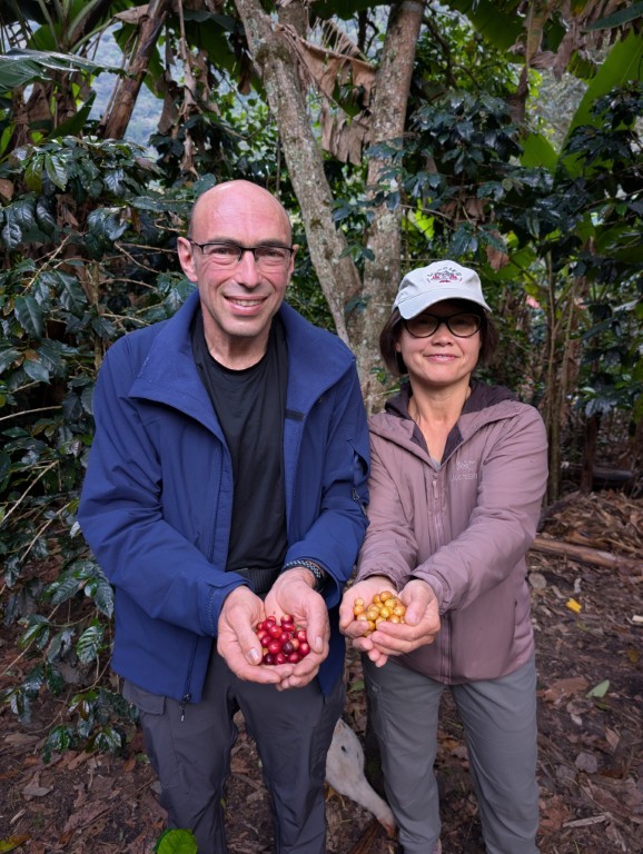
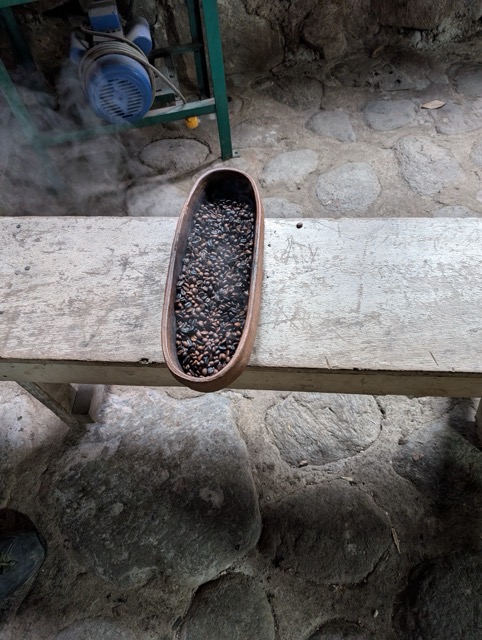
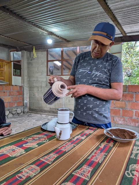
We cross a suspension bridge and soon reach our overnight stop: a coffee plantation. The electricity is out again (a common occurrence here), but there are hot showers. Also on the agenda today is a tour of the coffee plantation.
Coffee plantation tour.
When we checked in, Freddy, the owner (or manager) of the hotel, said there would be a plantation tour at 4 o'clock.
We had already taken a coffee plantation tour in Hawaii, so I thought I knew roughly what to expect.
However, I was mistaken. Firstly, the difference was in Freddie's personality. A very artistic person, he reminded me of Celentano in the film "The Taming of the Shrew.".
Freddy showed us his coffee trees: he has two varieties, Arabica and Brazilian, and there are also bananas, avocados, and coca. And all of this is not just there for nothing: the bananas and avocados provide the coffee trees with much-needed shade. He didn't say what the coca is for. Probably for the peace of mind.
Then we collected some coffee berries and Freddy tossed them into the bath: they'd need to soak for a few days. He gave us some already soaked ones from previous guests.
Then, using a special mechanical device, we separated the coffee beans from the husks and roasted the beans in a wood-fired oven. Finally, we ground the freshly roasted beans using a hand grinder with an attachment.
We woke up as the pre-dawn light began to filter through the transparent roof of our hut. Time to get up; a long day lies ahead. We need to cross the 19 kilometers of the pass.
We quickly pack our things into our backpacks, get dressed, and head to breakfast. We go fully dressed, because it's around freezing outside, and the cafeteria isn't much warmer.
We set off at six. Directly ahead is Salkantay Peak (6,721 meters), but we're not going there, we're heading to the pass of the same name. It's only 4,600 meters high, and local guides call it Gringo Killer. Well, let's see...
We're moving up slowly but steadily. We're probably a little slower than the current this time, but we're not in a race here. Eventually, we'll all get there…
Here's the pass. We're a bit tired, but very much alive.
The view of the peak from here is magnificent…
Well, time to go down. On the way, we heard what sounded like a train passing nearby. A small avalanche had descended from the peak. Far from anyone, no one was hurt. A reminder that it's not a good idea to relax in the mountains...
A few hundred meters from the pass, according to the map, there should be a water source. Here it is: a stream thoughtfully channeled through the neck of a plastic bottle. Thank you, unknown innovator! It's much more convenient to collect water this way.
We stop to make coffee. We have a stove, we bought gas in Cusco, and we've got a coffee maker to go…
While we're cooking, people are walking by. And some are riding: a group of reckless cyclists has climbed the pass.
After coffee and a rest, we're noticeably stronger, and we head downhill briskly. And then we discover that many people don't know how to descend properly. We have friends who enjoy trail running—running in the mountains. We can't do that, but we can do a few things. Specifically, when descending a moderately steep and non-slippery trail, you don't have to fight gravity, maintaining your balance after each step. This takes a lot of time and energy. It's much better to maintain dynamic balance, where instead of falling, you take another step. In practice, this is a semi-run with slightly bent legs, somewhat akin to skiing.
Of course, you need strong legs and good balance. And the chances of falling are higher, for example, if your foot keeps sliding downhill on a slippery surface after each step. That's why we have poles: they can help correct problems like these. In fact, I think poles are a game-changer on downhills and greatly increase speed. Some people simply fold them up and hang them on their backpacks. Wild (and very slow) people...
And so we reached the almost horizontal trail. The altitude was 3,400 meters, like in Cusco. The air was so thick, it was so easy to breathe! And then there were the restaurants…
Here we are—yet another shelter. It even has a shower, right in the room, with hot water! Hooray!
And the view from the gallery is beautiful...
We put our phones on charge and take a shower. Soon, a heavy rain begins.
It's a good thing we completed the route in eight hours, not the ten the map suggested. But the slower hikers got soaked; we were talking about this very thing with a family from Spain the next day.
There are many different ways to get to Machu Picchu:
The most popular way is by train. There are PeruRail , and IncaRai, It costs about the same. But it's relatively quick and convenient: many don't even stay overnight; they'll go there in the morning, run around Machu Picchu, and then straight back.
Cheaper, but much more troublesome: by bus to Hidroelectrica station, then just 10 kilometers on foot along railroad ties, and you're there. It's only $20 one way, but it takes a whole day: seven hours by bus, then a three-hour walk.
Hiking the classic Inca Trail. The downside is that you can't hike it on your own; you must join a group with local porters. It's expensive (starting at $1,000 per person), and I just don't like the idea of porters running ahead with heavy backpacks to set up camp before I arrive. I'm not quite ready for the role of a white sahib yet...
And the route that Natasha and I chose: hiking theSalkantay Trek. The advantage is that you can hike on your own or with guides, spend the night in the tent, or rent rooms along the way... We hiked on our own and chose the most common option: four days of walking, three overnight stays along the way, arriving at Machu Picchu on the fourth day, and spending the night there. Looking at the map, I was afraid that a significant portion of the route would be along the sides of roads, but that's not the case: almost the entire route follows scenic trails. If you want to cheat, you can cut corners—on the first day, ride directly to Lake Humantay instead of the trailhead, and on the third and fourth days, you can take a minibus or taxi for part of the way. But we completed the entire route with flying colors.
Weather
In Peru, there are two seasons: dry: May - October, and rainy: November - April.
We went in October, at the end of the dry season. Despite this, it rained every afternoon, and in Machu Picchu, it rained almost constantly. You need to be prepared for this and keep raincoats handy at all times.
Route and overnight stays
You have to understand that everything here is quite modest; a hot shower is a luxury 🙂. I liked all the accommodations and recommend them. In all three places, we had problems with electricity: during our first overnight stay, the power in the outlets simply went out after dark, even though the lamps were working (it turned out the outlets were powered by solar panels). In the other two places, the power went out for several hours in the entire village. So the first thing you need to do upon arrival is charge your phones.
All links lead to Booking.com. As it turned out, it wasn't necessary to book in advance (we went during the "low season").
Soraypampa Hostel (Soraypampa) is not a hotel, but a very basic shelter. All the accommodations there are pretty much the same, because Soraypampa isn't a residential village, but a point where the road ends. We had a small, unheated hut, but with warm blankets, so we didn't get too cold at night. The advantage of our shelter is that it's located right on the trail to Humantay Lake, so you don't have to waste time walking to the lake's trailhead. They also helped with transportation, which is convenient. Breakfast and dinner are available for an extra fee.
Salkantay Hostel Chaullay — It already feels like a real hotel, there was even a hot shower in the room 😀 Nice place with a wonderful view. Breakfast is included in the price.
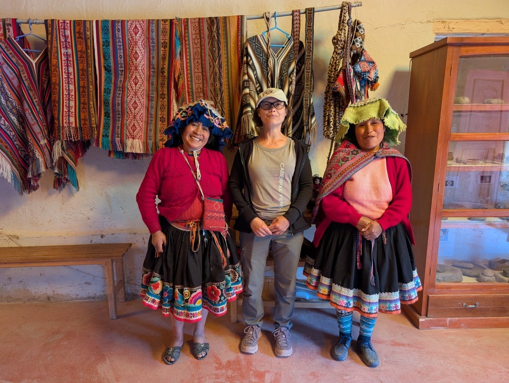
Lia B&B Lucmabamba — The most comfortable place we stayed. Situated on a coffee plantation. Freddy (the owner/manager of the hotel) gave us a fascinating tour of the plantation, showing us all the stages coffee goes through, from berry picking to brewing. Hot showers, breakfast, and dinner are included in the room.
In the city of Machu Picchu we spent the night in a hotel Panorama B&B. It's a nice, comfortable place, although quite expensive (the most expensive on our entire trip). But Machu Picchu is a completely touristy place, and everything there is much more expensive than elsewhere in Peru.
The patrolman approaches the car and says: - Sir, do you know what the maximum speed limit is here? - 55 miles per hour, I say. — And what speed were you driving? — I was driving with the flow of traffic! - No, sir! The traffic was going 60 miles per hour, and you were doing 70! - OK, I won't argue. — Where did you come from? — From Michigan. - Okay, sir. I'm giving you a warning, no more violations! - Thank you, officer!
I had a conversation like this with a traffic police officer just before entering the national park. Grand Teton — the mountains were visible right ahead. In fact, those mountains were the indirect reason I was pulled over: seeing the mountains, I stopped on the side of the road to take a photo, then sped up a bit, catching up with the group of cars I'd been driving with before… I was lucky the officer was kind, or maybe he didn't want to ruin my clean driving record: I haven't had a single violation for 15 years. But I learned my lesson and, from then on, simply put the car on autopilot to avoid exceeding the speed limit. And I later deleted the photo with the mountains because I had about a million of them, each one more beautiful than the last…
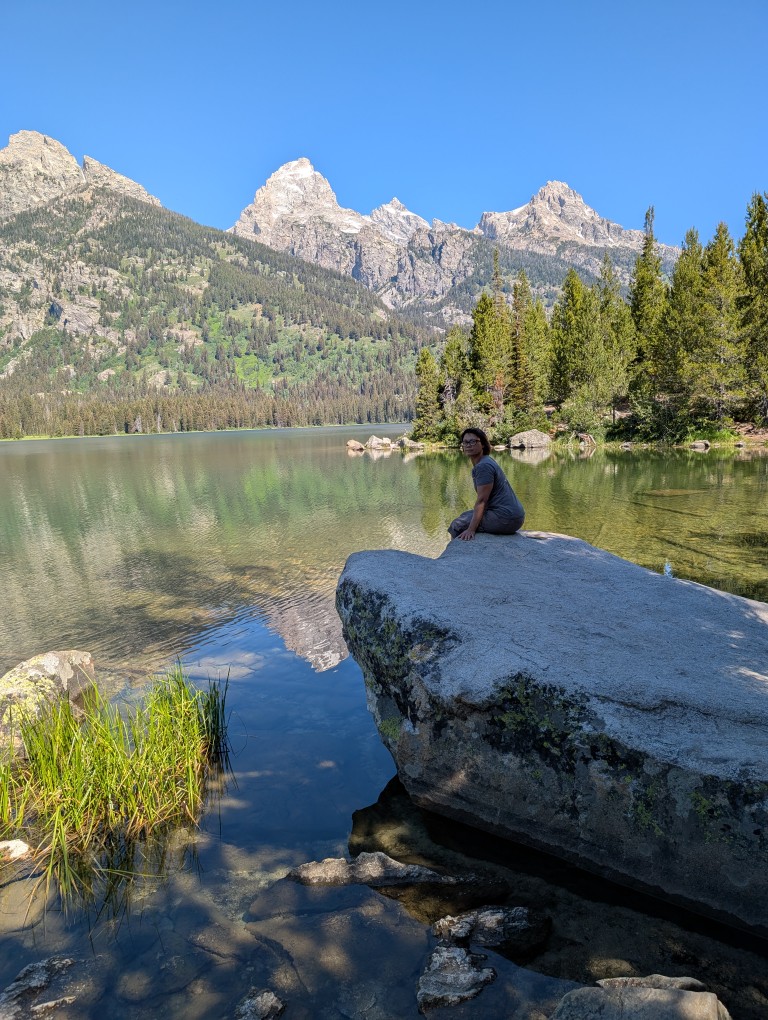
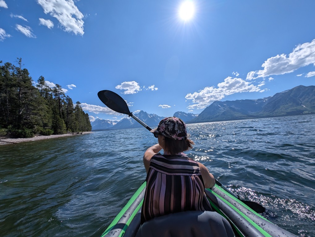
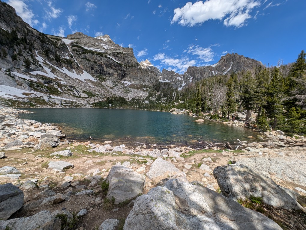
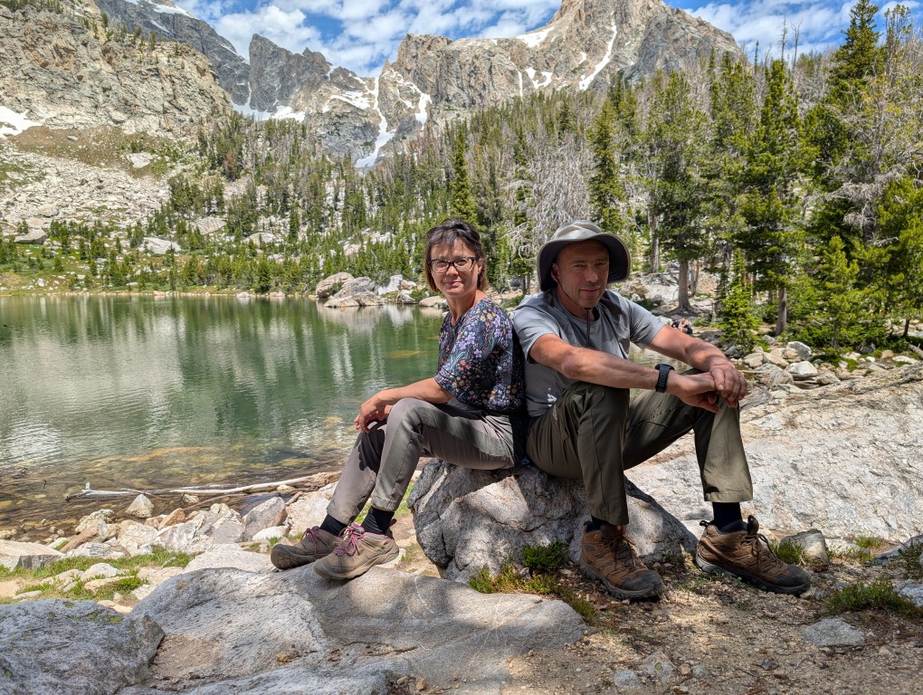
Grand Teton was the first park on our "must-see" list, and it was definitely worth it. From the very first moment, we couldn't stop admiring the views (and I kept remembering the joke:“Oh, Vanya, how beautiful!”). At one point we couldn’t resist stopping to take a few photos and walk along the path along the lake…
It was morning, too early to head to our campsite, so we headed straight to the trail. There are about a million trails there, but I had already made a list of the most picturesque ones.
As I walked along the trail, I discovered something pleasant: despite the fact that we had climbed quite a bit (the altitude was about 2,300 meters at the parking lot, and about 2,800 at the highest point of the trail), we didn't experience any signs of altitude sickness or even shortness of breath. This is probably because we we are in good physical shape We drove here for several days, gradually gaining altitude, and had time to acclimatize. However, physical fitness is also important: last year, when we drove from 0 meters above sea level in Hawaii to 900 meters above sea level and then walked to 4125 meters above sea level, we also felt relatively good.
One of the few inconveniences of the altitude (besides the cold nights) was that bottles of mineral water had to be opened very slooooowly. However, this rule is easy to remember after a few mineral water showers.
After the trail, it's time to check into the campsite—we'll be spending the next three nights there. It's a cozy, spacious site, close to the lake. The price is a bit outrageous: $60 a night. A year ago, we rented an entire house on the island of Crete, complete with a bedroom, kitchen, and living room, 100 meters from the sea, for less. But then again, what's Crete like, compared to Grand Teton?
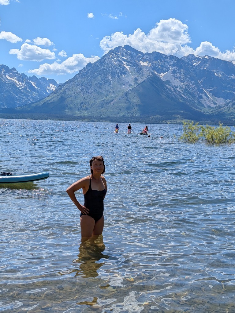
Well, since there is a lake, you should swim in it and float in the inflatable boat you brought with you:
We had a meeting scheduled for the evening with my colleague Kevin. Kevin and his wife are homeless, in the truest sense of the word. They sold their house (at a tidy profit) a few years ago and now live in a van they've customized. It has a large bed, a kitchenette with a gas stove (and oven), a compact shower and toilet, and a kerosene heater. All the available space seems to be taken up with sports equipment—skis, bicycles… And on the roof, they have solar panels and a Starlink antenna—which is how they both work. It's wonderful to be able to live and work without being tied to one place. When I was planning the trip, I asked Kevin about his experience using Starlink, and it turned out they were planning to visit roughly the same places. So we invited Kevin and his wife to stay at our site and meet in person: we all work remotely at the office, and before this, Kevin was just a picture on a monitor.
The guys arrived on time, and we had a really good time. It turned out we had a lot in common, especially a desire to travel. Although, of course, theirs is much stronger.
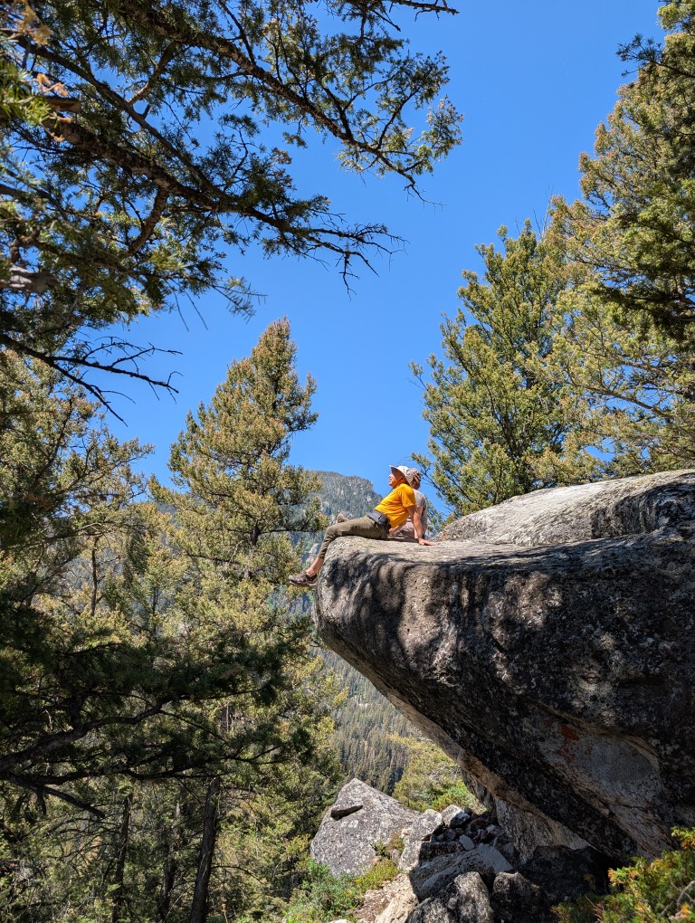
Paths
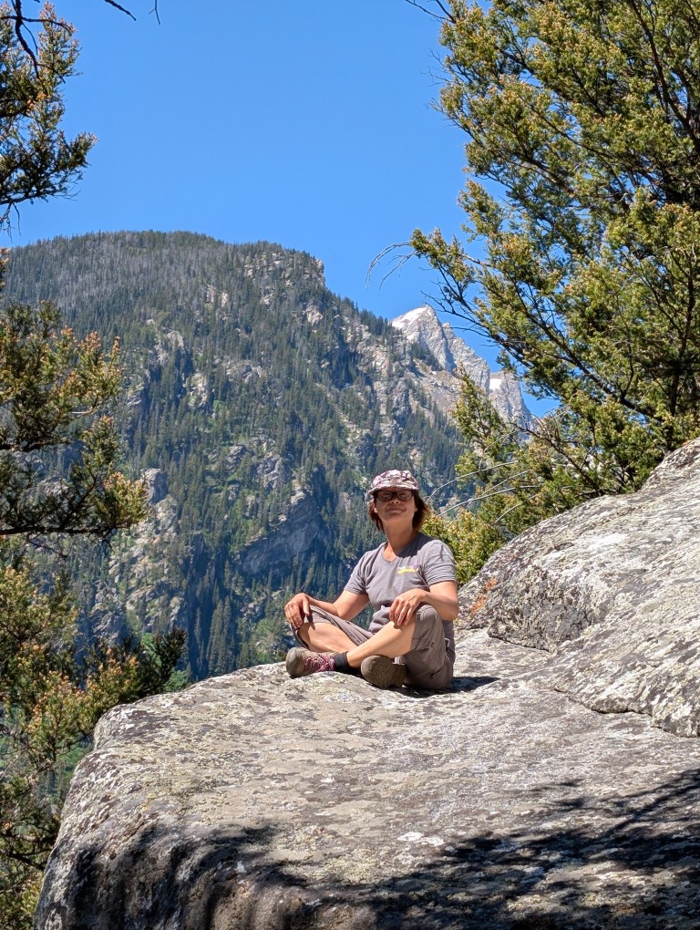
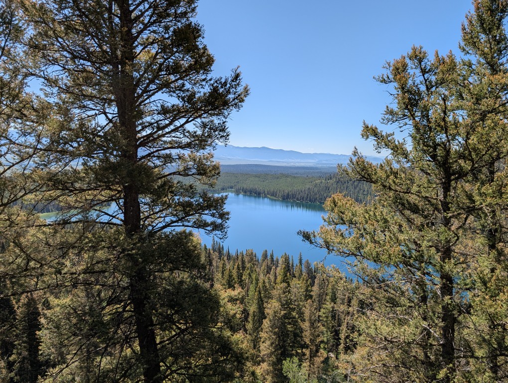
You have to go to Grand Teton for the beauty—the mountains, the lakes, the alpine meadows… And these beauties are best seen while hiking the trails. The park has plenty of them, for almost every level—from short paved trails to trails that, with our considerable experience, were truly challenging for us.
So all we did was hike. Taking advantage of the fact that local time is two hours behind Michigan, we easily got up early—around 6 a.m. We'd drink coffee, get ready, and before 7 a.m. we'd be at the next trailhead parking lot. This is important because later the parking lots will be full, and you'll have to get up somewhere further away. Walking is fine in the cool, but later it gets hot. But there's plenty of water here—streams are almost everywhere, so you don't have to skimp. We usually hiked until 3 or 4 p.m., then headed back to the campsite, swam in "our" lake, cooked dinner... In the evening, I'd briefly turn on Starlink to send a message to the family chat, download email, do another Spanish exercise... And in the morning—another trailhead.
Of the three days we spent in this park, my watch showed more than 40,000 steps on two days. That's about 30 kilometers, and we were also walking through the mountains. So we slept wonderfully, much better than at home. 🙂
Over the course of these three days, we accumulated about a million photos, despite trying to clean them up every evening. But it's so beautiful there, so there are still a lot left.
Here are a few that I like the most:
Well, and a few more:
Living creatures
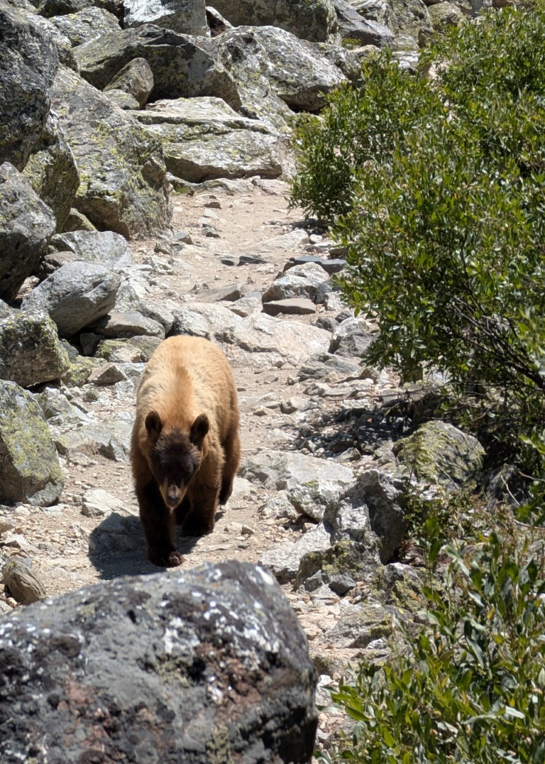
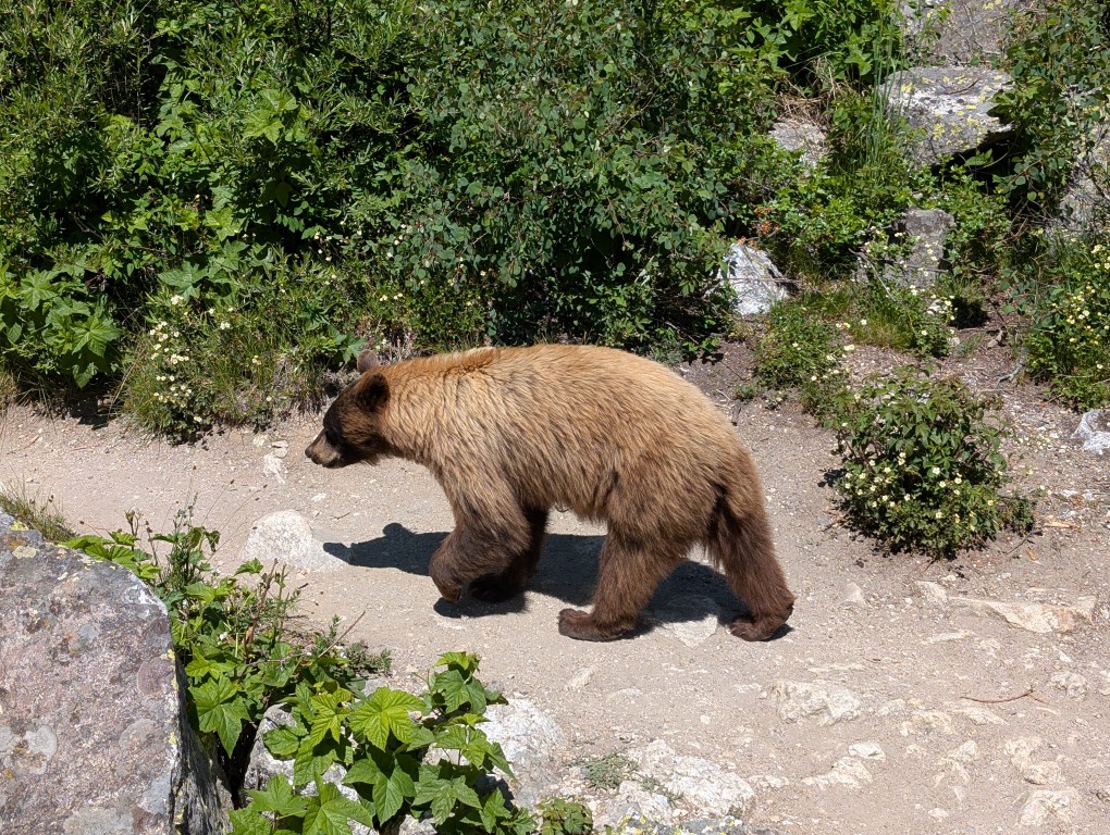
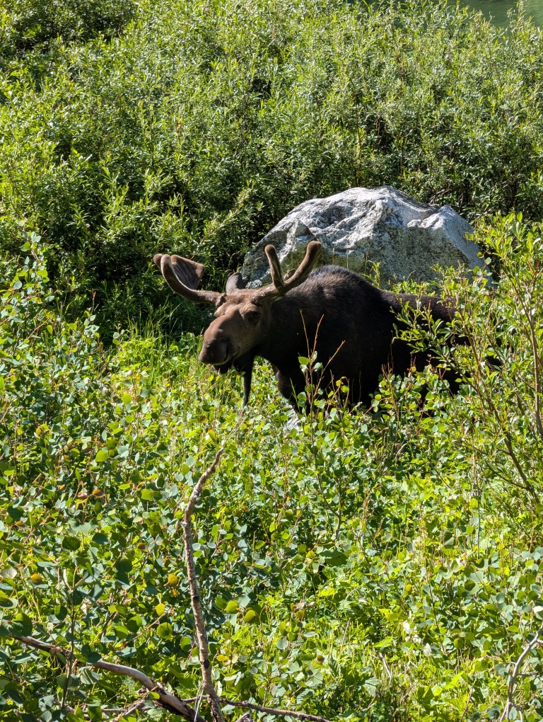
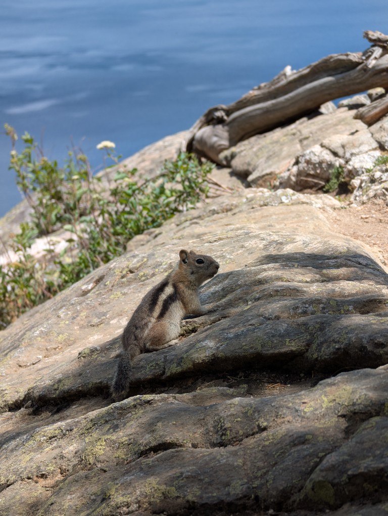
Besides tourists, the park is home to many other animals. The ubiquitous chipmunks scurry practically underfoot. Moose can be spotted in the distance—they like to hang out near water. And then there are the bears, of course. When we arrived at the campsite, I noticed that the local guard had a special "anti-bear" pepper spray canister hanging from his belt. I had one too—I'd bought it well in advance of the trip, but I'd carelessly forgotten it in the car several times. And then, on one of the trails, someone walking toward me said there was a bear up ahead. There was no canister—I figured we didn't need it with so many people there. Natasha, a few others, and I stepped aside and stood on a rock. And then he came walking toward us. We started shouting loudly to scare the bear and stop him from eating us, but he just walked past, not paying any attention to us. He probably thought to himself, “I’m so sick of these loud idiots…”.
There are two types of bears in the park: black and grizzly. This one clearly wasn't black, so we assumed it was a grizzly. Later, we discovered it was actually black, even though it was brown. 🙂 I looked online later to see how to tell a grizzly from a black bear: by the length of their claws. Grizzlies can have claws up to 10 centimeters long, while black bears are 2-3. So, you'll need to carry a tape measure...
Time to hit the road, old man, the climb is over...
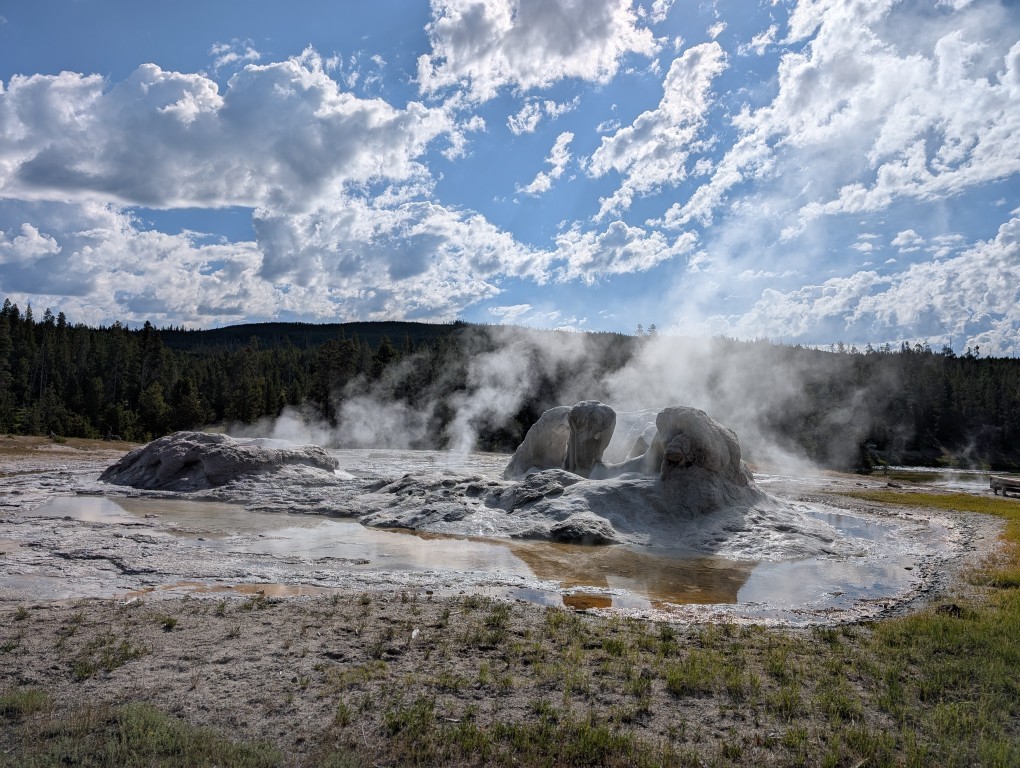
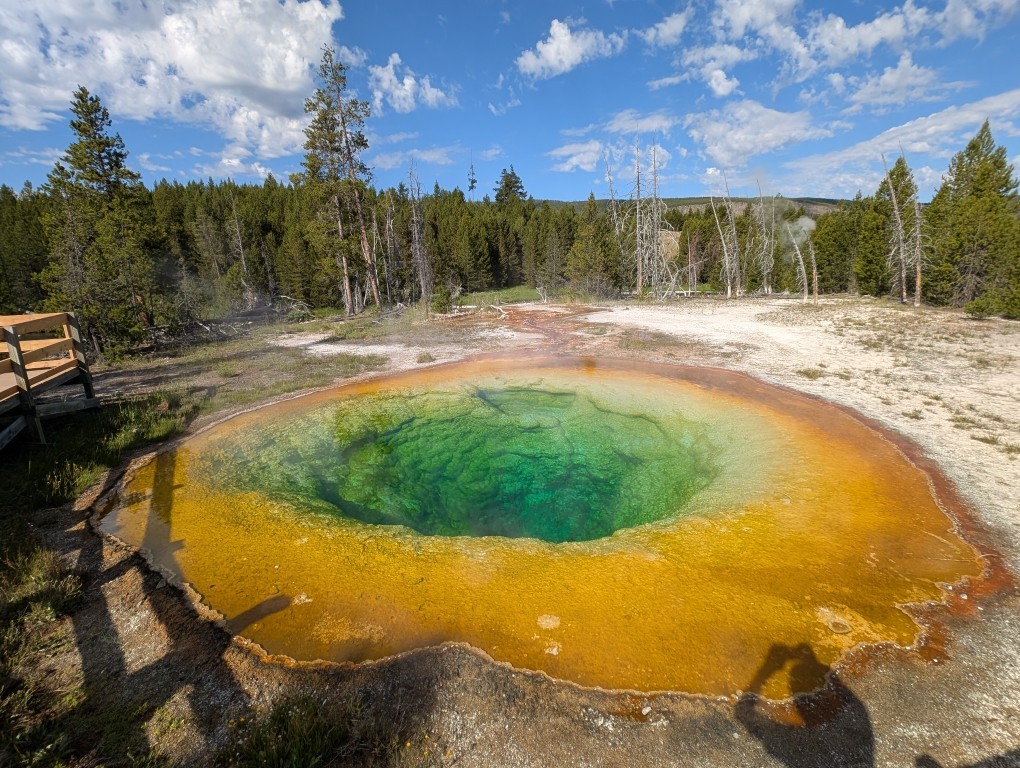
Three days flew by. Early in the morning, we packed up the tent and headed from our now-home base camp to Yellowstone Park. It wasn't far—only 40 minutes. But before that, we stopped at a "wild" hot spring. A cheerful nudist was already there, so Natasha simply warmed her feet in the spring, and I waded in. After three days of swimming in a cold lake, it was nice to be in the warm water.
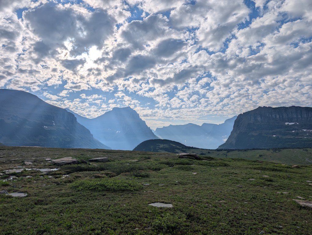
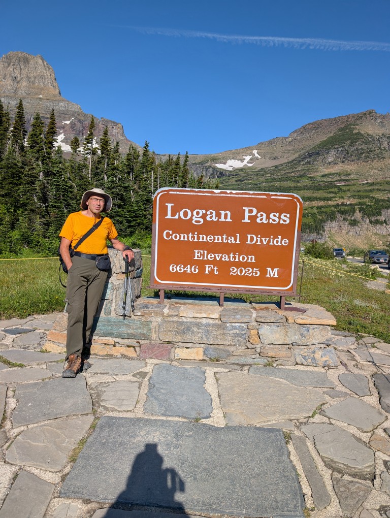
When I was planning my trip to Glacier NP, I almost accidentally came across a piece of news that made me a little nervous: the park, for the second year in a row, is allowing access to the road with the poetic name “Road to the Sun”"Only with special passes. Passes must be purchased, and although the price is purely symbolic ($1 per day), their supply is limited. This is how the park addresses the problem of overtourism. The problem with this road is that it's the only way to get around the park: trails to almost all the lakes, waterfalls, and other trails start from here.
There was still a month and a half left before the trip, but, as expected, all the passes had long since been purchased. I signed up for the pass availability notification mailing list (sometimes people cancel their purchased passes, and they become available again) and even received several notifications about vacancies. But every time I tried to buy one, it turned out someone else had already gotten it faster…
But later, I read the road information more carefully and calmed down: the road was closed after 7 a.m., and before that, entry was free. Considering I rented a place 10 minutes' drive from the park, and we planned to stay on Michigan time (two hours ahead of the park's time zone), there shouldn't have been any problems. And so it turned out.
The plan was to get up early and leave the hotel around 5:30 a.m., and we followed it. We quickly crossed the empty road to the park entrance and then drove more slowly along that very same Going to the Sun Road—the speed limit was 40 miles per hour.
Deep down, I hoped we'd keep going until the very end, because who in their right mind would wake up at 5:30 a.m.? However, the park sees over 3 million visitors a year, with around 800,000 of those in July. That's nearly 27,000 people a day—the population of a small town. And among that many, there are enough crazy people to cause a traffic jam on the park's only road, even at 6 a.m.
So soon we found ourselves at the tail end of a stream that was slowly rolling along the road. Slowly because the climb had just begun with a steep switchback, which even on an empty road wouldn't let you go very fast. It didn't bother us, though, because after the most picturesque serpentine in the world, The road we drove on last year in Greece doesn't scare us like that (though I'm a little apprehensive about the Peru trip—there will be plenty of switchbacks there). But we still have to keep the speed down…
At one point, we pull over to the side of the road and take a few photos—the view is so beautiful in the rays of the rising sun. Perhaps those five minutes would come back to haunt us later…
A few minutes later, we arrived at the visitor center parking lot, and I couldn't believe my eyes—the rather large parking lot was full. And mind you, it was 6:50 a.m.—normal people are still asleep at that hour. We had to keep driving. Several small parking lots on the side of the road were full, but finally, about a kilometer from where we were going, I saw a single empty spot where we could park. Perhaps if we hadn't stopped for those five minutes to take photos, we would have managed to park a little closer to the center. But the photos were worth it.
The view from our parking lot, however, was wonderful. Shivering slightly from the cold (the temperature this morning was just above freezing, with snow in places), we cooked breakfast on the stove, drank a traditional cup of cappuccino, and briskly headed back along the road to the trailhead.
We made our way back to the visitor center, the first route for today is trail to Hidden Lake. When I walk along trails like these, the first thing that comes to mind is "May Day demonstration." The trail is beautiful, short, and easy, so all those crowds that occupied our parking space are heading that way. And so are we, because what else could we do? 🙂 We didn't make it all the way to the lake—about halfway there, the trail was closed due to increased bear activity in the area. Considering I'd forgotten my bear spray in the car again, we decided not to risk crawling under the fence like some others… So we admired the scenery and turned back to the parking lot.
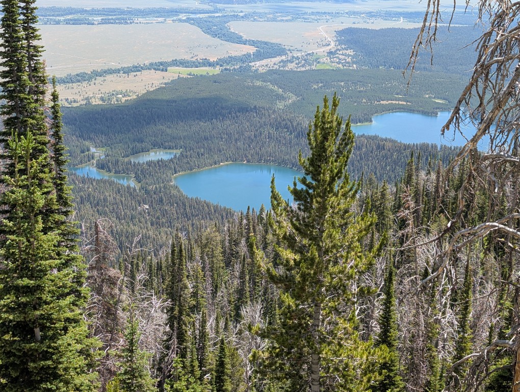
The main trail for today awaited us - Highline Trail (the high trail). It's long—40 miles—and people hike it for days, with tents. But we weren't tourists today, we were just out for a stroll, so we decided to walk it for a few hours (to a small pass near the summit).“Haystack”), and turn back.
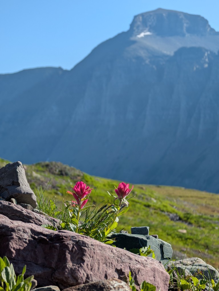
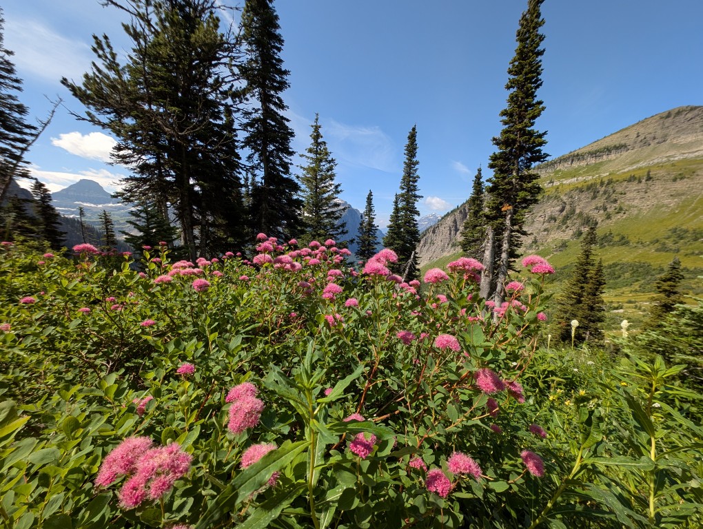
I must say, the trail turned out to be the most spectacular of these three very busy days. It's not difficult because it runs parallel to the slope, without significant changes in elevation, but it's very picturesque.
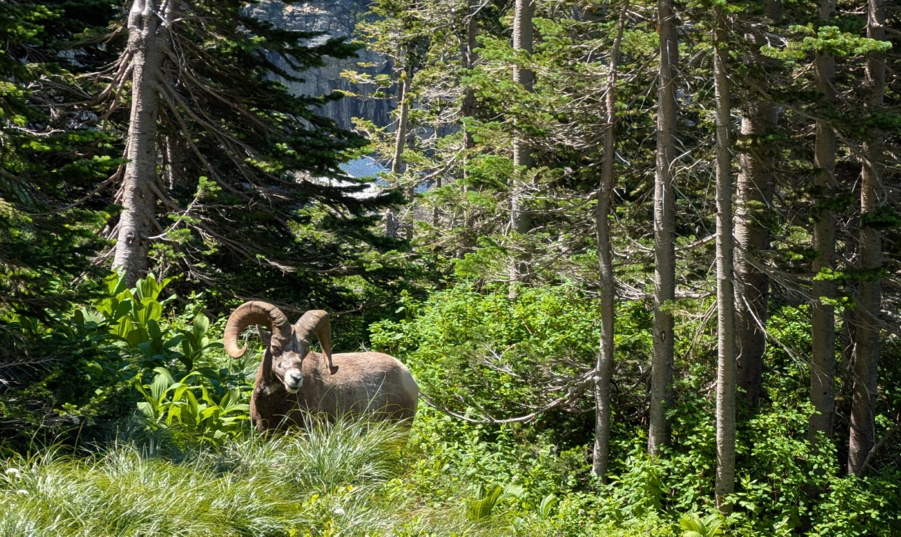
Moreover, since this is the only convenient trail running along the slope, local animals have taken a liking to it. So we encountered a deer (very close, we could reach it with our hand), a marmot (marmot "—it's not a swear word, but the Latin and English word for marmot," and "mountain sheep" (a bit off the trail, but that's for the best). We didn't encounter a bear, though—maybe next time.
Well, the landscapes there themselves are wonderful - I probably took at least a hundred photographs, so it was a real shame to clean them.
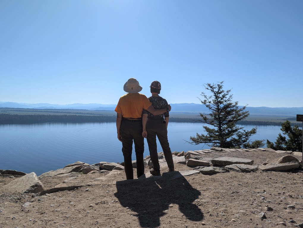
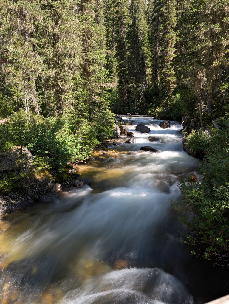
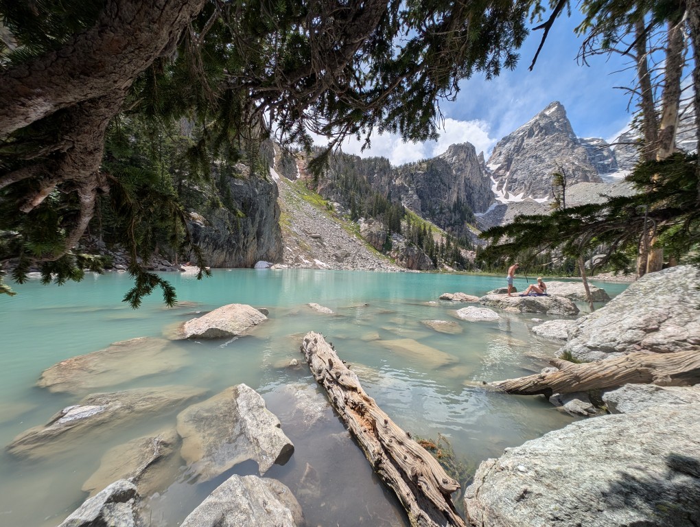
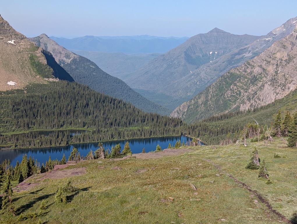
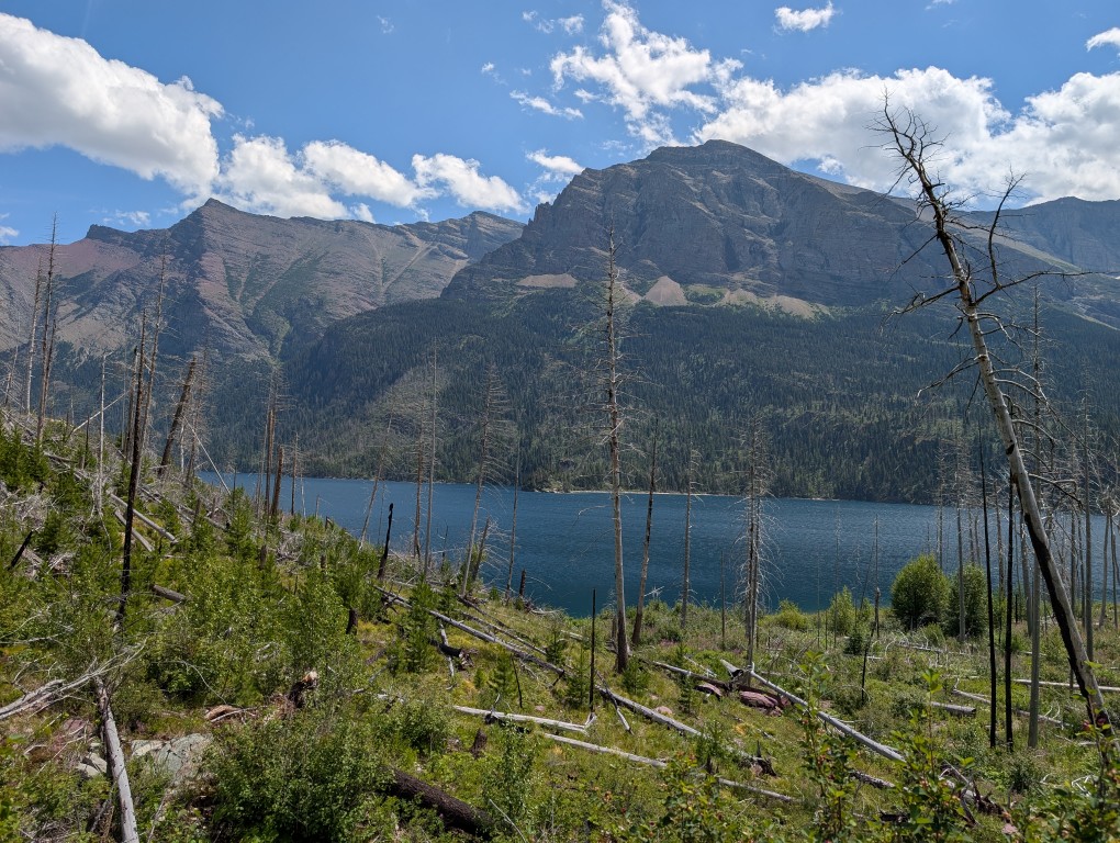
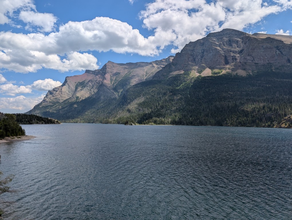
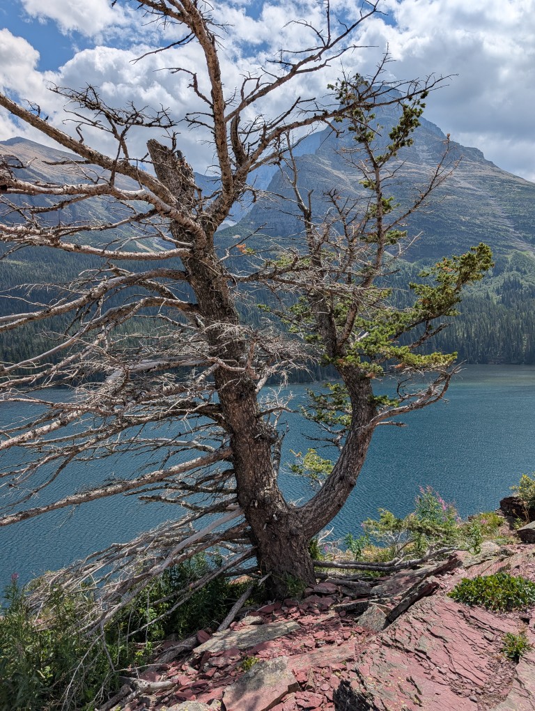
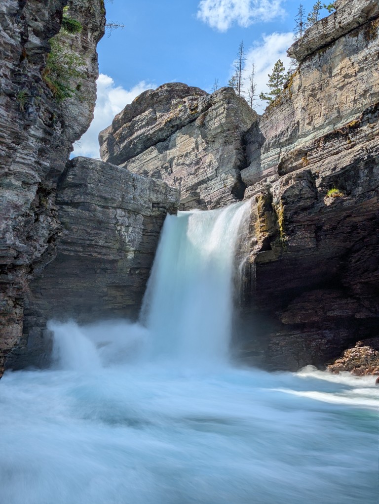
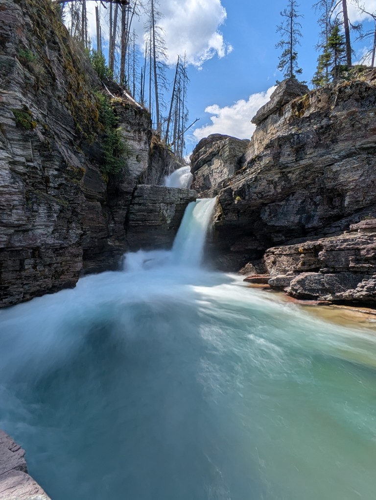
Returning back to the car, we had lunch and, since the sun was still high, we drove on to Lake St. Mary (Saint Mary Lake). This is a typical mountain lake, long and narrow, located in a small valley. Many streams flow into the lake, along which there are beautiful waterfalls - they were our target.
The trail to the waterfalls is very scenic, but, like many places in this park, it's a bit gloomy due to the large number of dead trees—apparently, a major fire raged here about 15 years ago. New growth is now growing, and the charred remains of the former trees stand as a reminder of the past cataclysm.
However, the overall impression is very bright and positive. The trail is easy and well-trodden.
The waterfalls themselves are beautiful (there is a cascade of three waterfalls).
More:
Some desperate girls jumped off the bridge into the water. We didn't.
After returning along the same trail, we took a long, leisurely ride back. Nearing the park's exit, we spotted a deer with classic antlers, just like a postcard, on the side of the road.
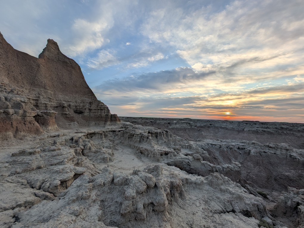
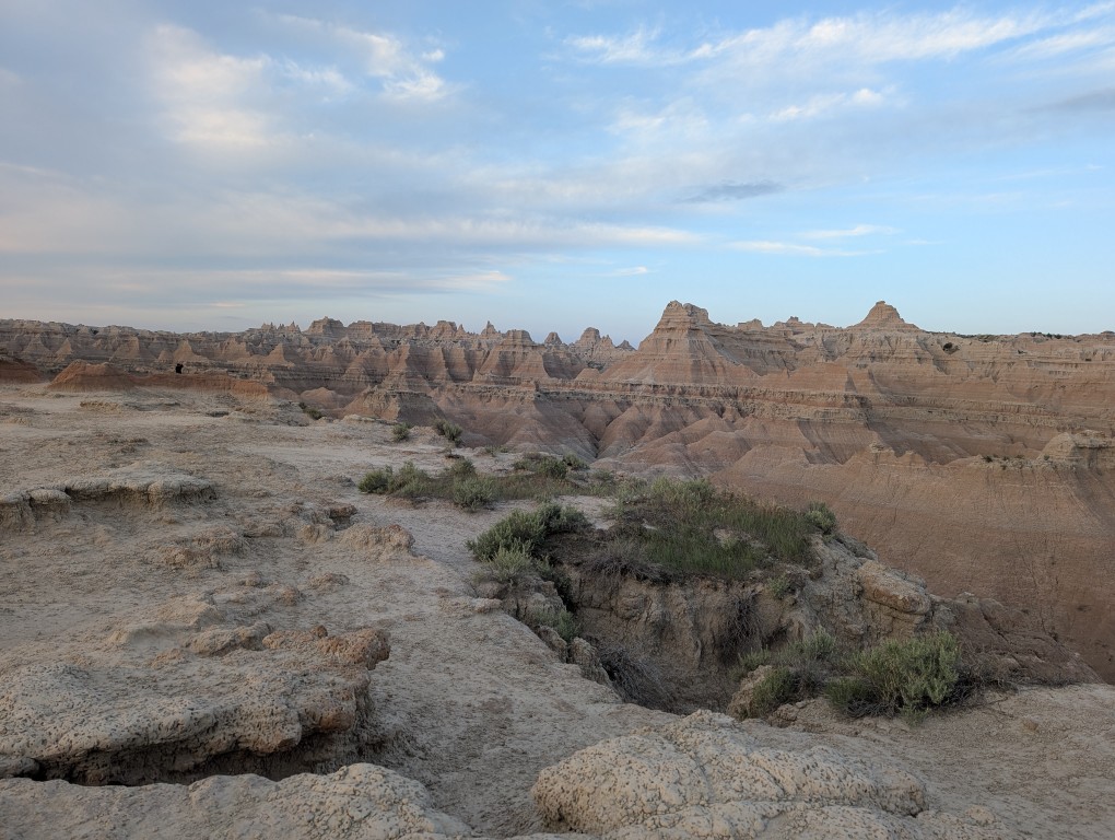
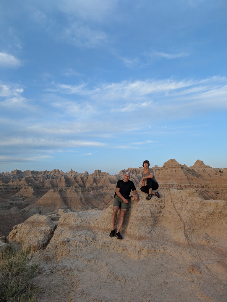
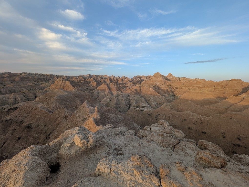
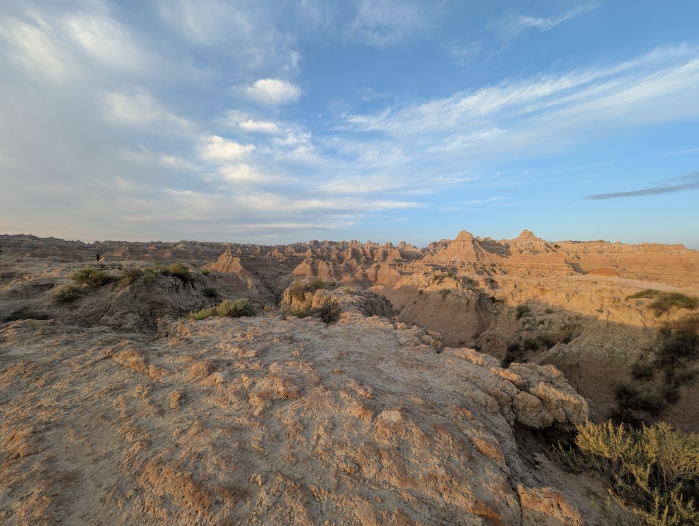
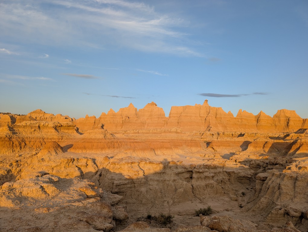
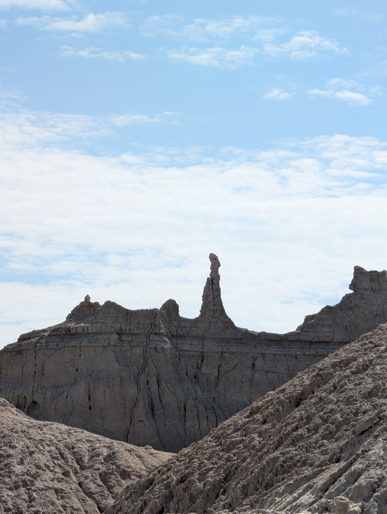
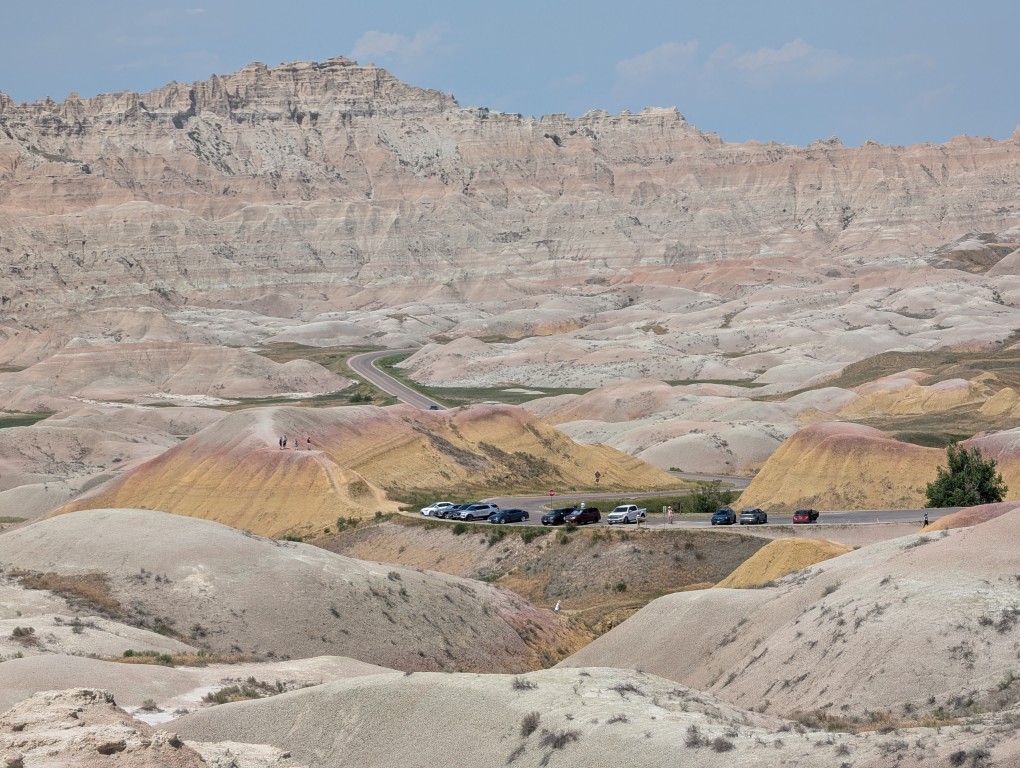
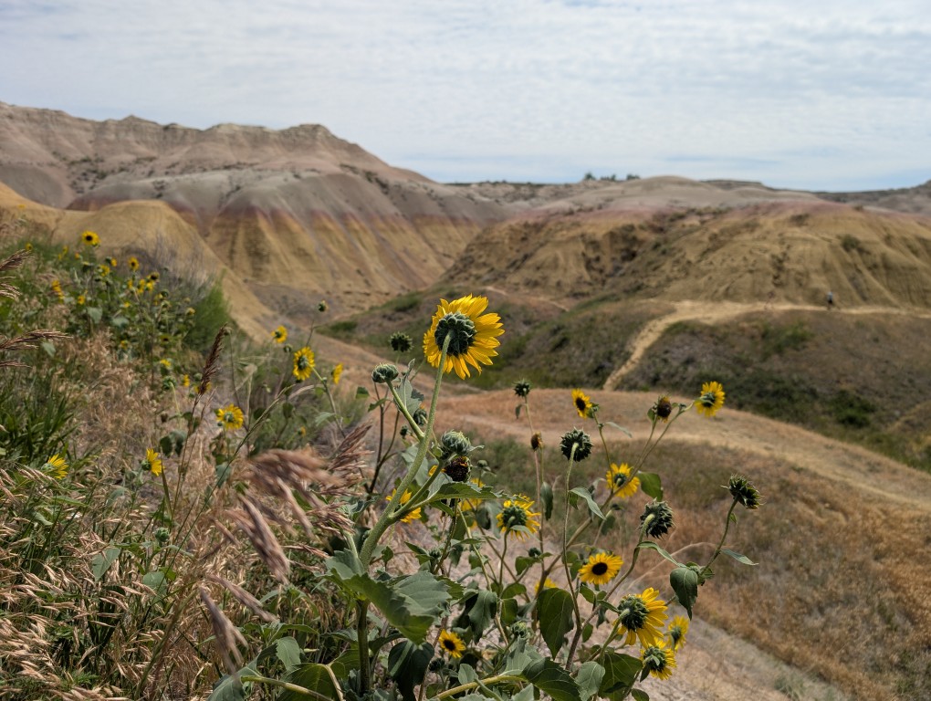
We woke up early this morning and headed to a nearby trail to see the cliffs in the morning light. When traveling west, it's very helpful to stick to our east coast schedule: go to bed early and wake up early. This allows us to easily get to the right spot before the crowds arrive. However, this didn't work everywhere: in Glacier Park, we left the cabin at 5:30 AM and arrived at the parking lot at our destination by 6:40 AM (yes, we drove for over an hour—the park is big), and the parking lot was already full. But Badlands isn't that popular, so there was only one other car there.
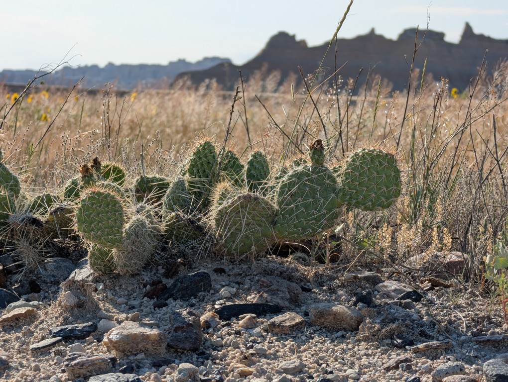
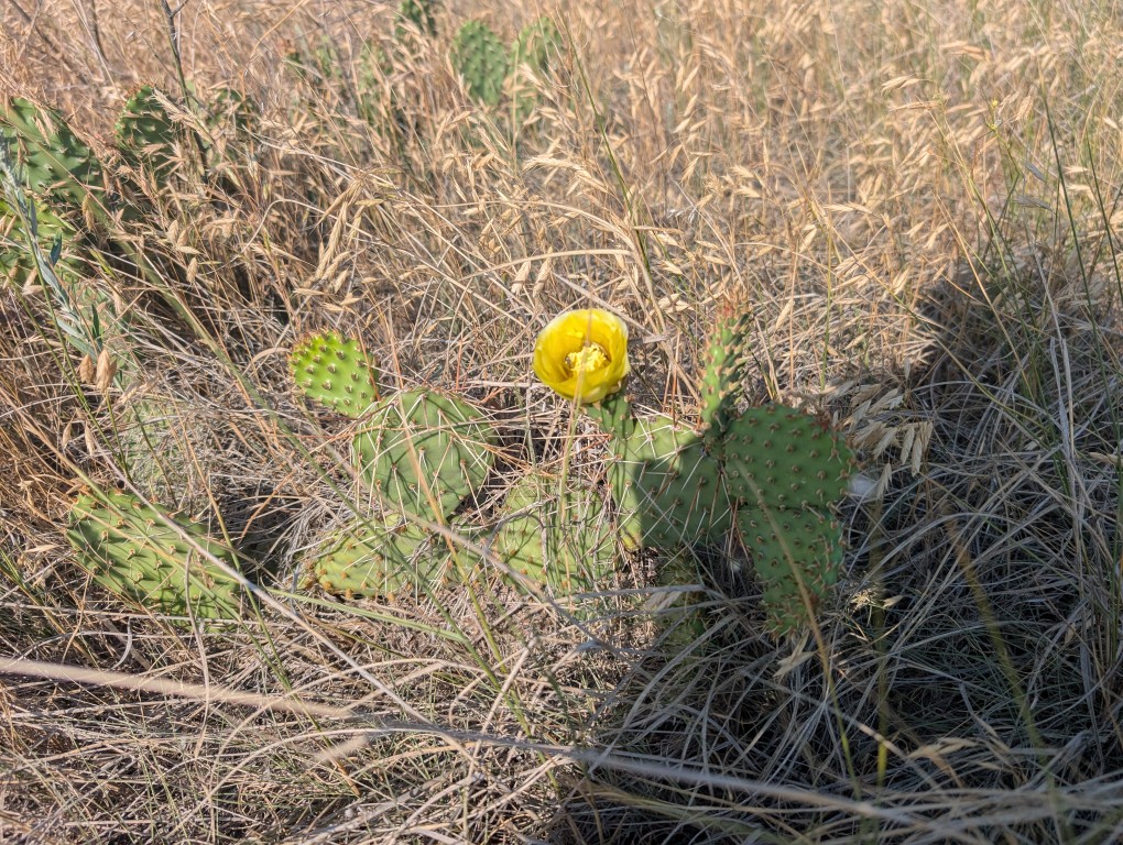
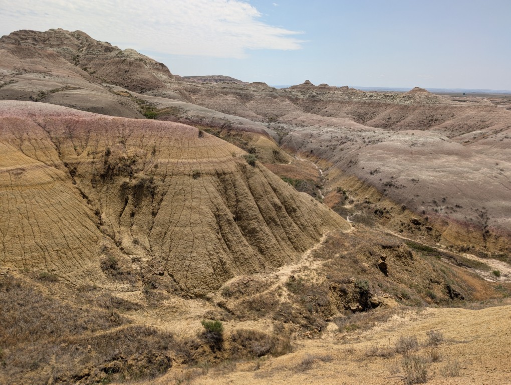
The sight of these cliffs, especially in the right light, is mesmerizing. But you immediately understand why the settlers heading west gave these places their name: they were more interested in growing grain and grazing livestock than in beauty. Agriculture in the local barren lands is very poor. Although there were a few settlements in these parts, especially after the railroad was built, they have not survived.
After walking along the trail, we had breakfast and drove along the road No. 240 (aka “Ring Road”"). The road itself isn't long—we covered less than 40 miles, and that was almost it. But there are numerous stops along the way where you can take in all sorts of beauty, walk a few miles along the trail, and then hop in the car, drive to the next stop, and repeat the whole thing. We stopped at almost every stop and soon began to recognize people doing the same, and even began to practically say goodbye to some of them. In total, the drive from the first stop along the road took about 7 hours. There were a couple more stops left, but we decided against it because the main attraction there were the prairie dogs, which we'd already seen (and rightly so, as it turns out—in other parks, they're completely unafraid of people and let you get much closer). So I later deleted all the photos of the dogs from that day.
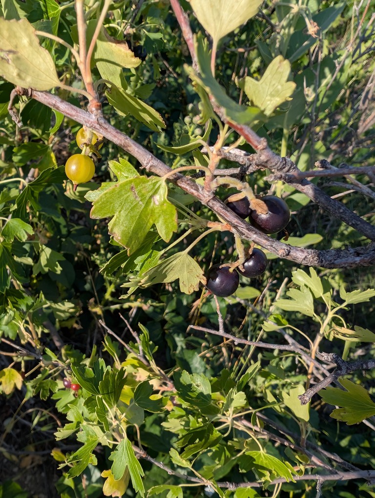
It's called "golden currant." The flavor is somewhere between currant and gooseberry.
So somewhere around one o'clock we finished and went to the nearest town called Wall, to the town pharmacy, to have lunch.
Walla City Pharmacy.
This drugstore is not just any drugstore—it has been there for about a hundred years, and, to some extent, it is one of the symbols of the American Dream.
If you go to pharmacy website, you can read its story there. In 1931, Ted and Dorothy Husted bought a struggling drugstore in the impoverished village of Wall. The village, located in the middle of nowhere in the middle of the prairie, had a population of 326, and the Great Depression was raging. So, business at the drugstore was going very badly.
Five years later, in 1936, Ted and Dorothy were ready to give up, but Dorothy had an idea. Highway 16-A (now I-90, but it wasn't built until after the war) ran nearby, and even then, quite a lot of people drove along it—on their way to Yellowstone or elsewhere in the West. So Ted put up a homemade sign along the road: stop by our drugstore, and we'll give you free ice water.
«Get a soda. . . Get a root beer. . . turn next corner . . . Just as near. . . To Highway 16 & 14. . . Free Ice Water. . . Wall Drug."»
Here's a quick clarification for those unfamiliar with our reality: American pharmacies make only a very small percentage of their total revenue from medications. Because if you have a business open from morning until night (and many pharmacies are open 24/7), why not sell all sorts of household essentials besides medications—batteries, flashlights, phone charging cables. And ice cream. And soda. And plastic-wrapped bread. And alcohol and cigarettes (which would also create potential drug buyers). And create a small nook where you can have a simple breakfast. It's good for the people, and the owner gets a little extra cash...
It was a hot summer, and Fords didn't have air conditioning back then, so the pharmacy ran out of crushed ice almost immediately, and they had to rush to make more from ice blocks (apparently they had a lot of them in stock). Naturally, many customers simply drank the water and left, but there were also plenty of people who bought something.
Currently, during peak season, the pharmacy is visited by about 20 thousand customers a day.
Of course, the old pharmacy is long gone. It's now a massive shopping mall, where you can probably find a pharmacy somewhere. All that remains of the old pharmacy is a museum. We didn't know its history back then, so we didn't go inside.
There are also plenty of souvenir shops, a chapel for travelers (Ted and Dorothy were Catholic), and a fast-food restaurant where you can buy delicious bison burgers and wash them down with free ice water.
Chapel.
The yellow cardboard cup contains the same water. The sign reads: "Free ice water at Wall's Drugstore.".
After lunch, full and satisfied, we headed to our next overnight stop—a campsite on the shore of a forest lake. But before that, we stopped at one more place— Mount Rushmore National Memorial. I hadn't really planned on going there, but it suddenly turned out that it was right on our route, only a 20-minute detour. So we decided to stop in.
There were presidents in the mountain, there was also a sculptor's workshop with a description of how it was all done, and a small path around the mountain.
Natasha looks quite harmonious on the threshold of the tipi.
The lake where we camped overnight, by the way, wasn't particularly impressive—just the day before, we'd been swimming in Michigan, and there's little that can compare. But I went for a swim anyway.