I'd been thinking about driving through the Southwest, stopping at all sorts of beautiful national parks, for a while. But I never had the time—such a trip requires at least two, preferably three weeks, and where would I find that time? And the kids might not enjoy the long drive. Finally, it all came together: the kids had grown up and moved away, I had more vacation time, working remotely allows me to work from anywhere, and my new car was just waiting to prove itself on a long road trip. So off we went.
Some statistics:
Miles/Kilometers Traveled: 5500 / 8800
Days: 22
States visited: 12 (of which one, Utah, was only visited for a few minutes, in a place called "«Four corners«)
«ЭТИМ ПОЛУКРЕСЛОМ МАСТЕР ГАМБС начинает новую партию мебели. 1865 г. Санкт-Петербург.» (И. Ильф, Е. Петров)
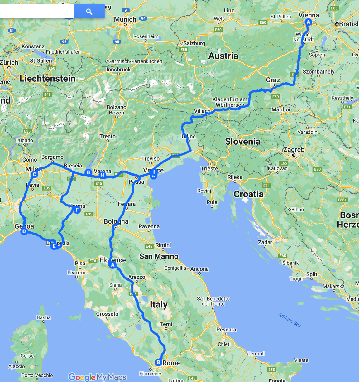
В этом году у нас появились новые возможности путешествовать. А раз появились, надо ими пользоваться — что мы и проделали. Мы затеяли большую «гибридную» поездку по Европе: Вена — Венеция — Милан — Cinque Terre — Верона — Флоренция — Рим. Гибридную, потому что две недели — это отпуск, а ещё три недели — это новое слово «workation»: поскольку я работаю удаленно, то почему бы мне и не поработать из Италии?
Ниже предлагаем отчет о нашей поездке — он будет пополняться.
Самоизоляция или как мы ходили в поход во время ковида.
Это случилось в те странные, тревожные времена, когда по миру расползся, как спрут, ковид и все сидели дома. Ходили в масках только в магазин за продуктами. Статистика говорит, что из-за пандемии многие разводились или впадали в депрессию. Нашей семьи это, к счастью, не коснулось. Мы нашли интересные места для самоизоляции: весной поездка по Blue ridge parkway во Флориду и летний поход в Колорадо по национальному лесу Arapahoe.
Это была отличная идея!
К походу готовились тщательно: были куплены теплые спальники, новые ботинки Денису, надувной коврик мне, особая походная еда. Денис выверял карты, я составляла список продуктов. А дети решили остаться дома. Это какой то новый этап в жизни нашей семьи; большие дети остались работать и присматривать за хозяйством, а родители уехали активно отдыхать.
С друзьями из Колорадо мы договаривались зумически. Нужно было понять, как сходить совместно в поход, соблюдая социальную дистанцию и получить от этого удовольствие. Обсудив важные моменты, мы договорились о дне X и месте предполагаемой встречи.
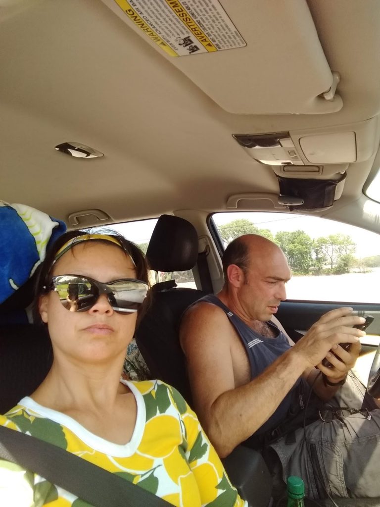
Было решено ехать на машине, во избежание нежелательных контактов в условиях covida. Как опытные » дальнобойщики», мы уже знаем как лучше скоротать многочасовую езду.
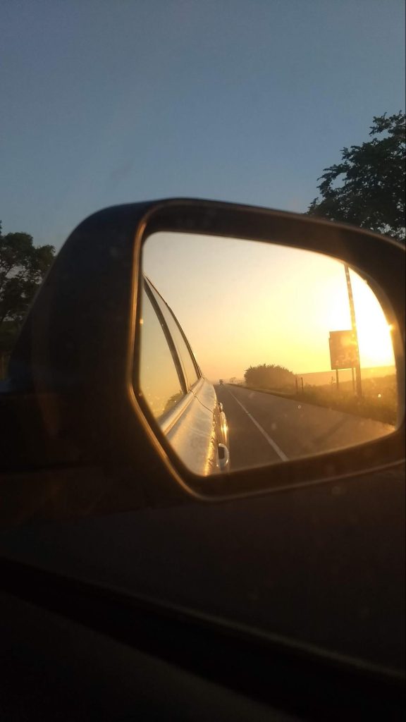
Во- первых, меняться каждые два часа, во-вторых, поставить интересную аудиокнигу, чтобы хватило надолго, в- третьих, останавливаться не слишком часто, делая хорошую разминку. Так было и в этот раз. Скучная и монотонная дорога по Великим равнинам уже не казалась такой нудной. Там, где раньше паслись стада бизонов, теперь тянутся бескрайние кукурузные поля. Индиана, Айова, Небраска, Вайоминг. Где-то посередине — полноводная река Миссисипи. По заведенной моей мамой традиции, в такую дорогу пекутся чебуреки. Проблема с остановкой на ночь была решена неожиданным образом. Денис вспомнил, что заднее сиденье машины складывается и получается вполне себе кровать . На пути следования обнаружились стоянки, прямо среди полей, где можно остановиться и поспать прямо в машине или поставить рядом палатку.
Для путешествия летом в условиях пандемии это, пожалуй, самый подходящий вариант . Обсуждая нынешнюю ситуацию, мы с Денисом сошлись во мнении, что поход по горам — самый лучший способ самоизоляции.
Три дня с друзьями
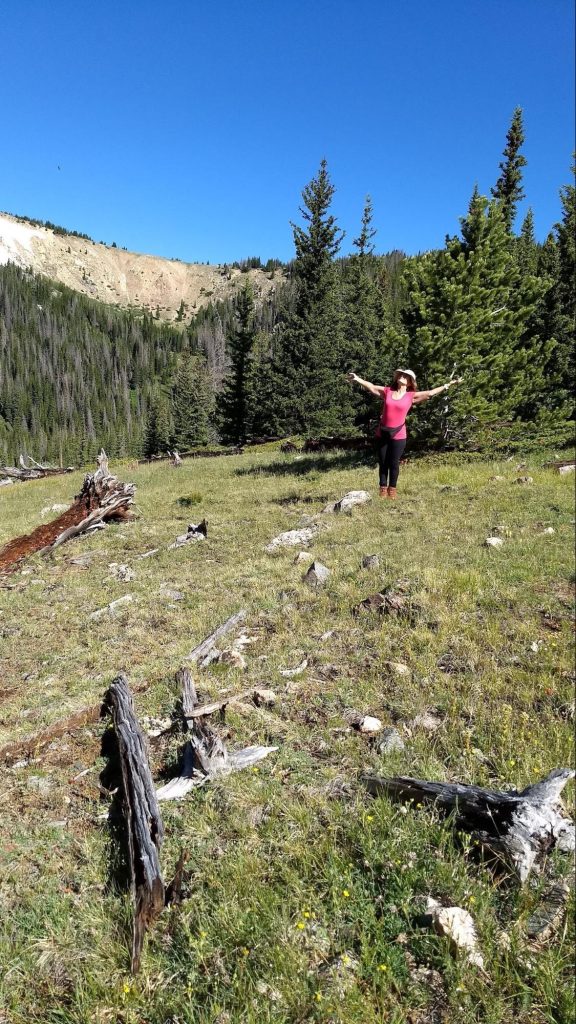
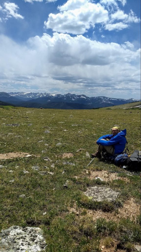
В ожидании друзей мы успели разбить лагерь и сбегать по короткой тропе к Бобровому водопаду. После грозы воздух был свеж, хорошо пахло мокрой хвоей. Сначала шлось легко, но потом, даже при небольшом подъеме дыхание стало сбиваться и заболела голова. Это началась акклиматизация нашего организма к горной местности. Бобровый водопад был прекрасен, но в какой то момент мы сбились с тропы, и, немного поплутав, вышли к лагерю лютеранской общины. Из домика вышел дюжий брат-лютеранин и объяснил, куда нам нужно идти, а чуть поодаль из леса вышел лось. Мы спросили : «Это ваше домашнее животное?» Тут оба ухмыльнулись в бороду и кивнули.
Ч — овы приехали на следующее утро, в десять, как и договаривались.
Теперь нас стало четверо. Мы встали на тропу по направлению к озеру Browns. Погода, облачная и жаркая сначала, стала портиться, пошел мелкий дождик. Пришлось достать накидки от дождя.В накидках все стали похожи на одногорбых верблюдов самых жизнерадостных цветов: оранжевый, синий,
зелёный и жёлтый. Так, под дождиком, пришлось пообедать в районе резервуара Команчи.
После обеда тропа стала круто забирать вверх. С набором высоты у меня опять разболелась голова, видимо организм ещё ещё не привык к разреженному горному воздуху. Похолодало. И в придачу ко всем напастям усилился дождь. Тем не менее медленно, но верно поднимались мы все выше. В какой то момент стали появляться снежники, а погода совсем сошла с ума: началась гроза, посыпался мелкий град с дождем. Я старалась гнать неприятные мысли о том, что в конце тропы, у озера, нельзя будет развести костер, погреться, просушить обувь и штаны. Здесь можно пользоваться только газовыми горелками. Время от времени налетали шквалистые порывы холодного ветра. Крутая тропа стала скользкой. Иногда приходилось идти через снежники, лежащие прямо на нашем пути. Верилось с трудом, что это июль, разгар лета. Но вот тучи стали рассеиваться, ветер успокоился и мы наконец добрались до места нашей стоянки около озера Browns . Здесь усталые путники разбили лагерь, приготовили ужин. Снова подумалось: как жаль, что нельзя развести костра, было бы теплее и веселее. А ужин был изысканный — бефстроганов с лапшой и грибами, сухие ржаные хлебцы с паштетом, чай с коньяком, конфетами и орешками. Честное слово, мы все это заслужили! Горячая еда настолько всех согрела, что мы отважились искупаться в высокогорном озере с ледяной водой. Искупаться — это значит броситься в воду на несколько секунд и сразу выскочить, энергично растираясь при этом полотенцем. В конце дня мы были вознаграждены роскошным розовым и лиловым закатом, что живописно отражался в озёрной воде.
Все, теперь спать, все устали, нужно набраться сил к завтрашнему дню.
Следующий день был ясным и теплым. Как будто не было ни снега, ни холодного ветра вчера, как будто после ноября сразу наступил улыбчивый апрель. И тропа, по которой мы шли называлась » Цветочной». Она сполна оправдывала свое название — розовые, жёлтые, фиолетовые и ярко красные цветы окружали нас со всех сторон на фоне сочной зелени.
Из знакомых я увидела медуницу и фиалку, гораздо больше было незнакомых мне цветов. Чистые горные ручьи иногда пересекали тропу и тогда ещё больше казалось что мы вернулись в весну .
Мы шли по склону невысокого хребта выше линии леса. Кругом, куда ни глянь, открывалась чудесная панорама гор. Этот день разительно отличался от предыдущего: и погода, и наличие прекрасных видов. А главное — плавный, пологий спуск вниз. Оттого наше путешествие больше походило на приятную прогулку, нежели на поход.
К обеду мы пришли к месту, где когда-то давно разбился военный самолёт. Обломки самолёта были разбросаны в радиусе ста метров. Некоторые из экипажа погибли. Жутковатое зрелище.
К вечеру мы добрались до стоянки у реки(?)
На ужин у нас в этот раз итальянская кухня — суп миннестроне с банкой тушёнки. Очень наваристый получился супчик. Приятно посидеть и поболтать с друзьями после целого дня ходьбы. Хорошо засыпать потом под звуки текущих вод. Хорошо.
Наутро выяснилось, что В. сильно стёр ноги. Как назло, большую часть пути пришлось идти круто вниз по каменистой дороге. Бедный В. совсем сбил пальцы ног. Мы предложили ему палки для ходьбы, чтобы отчасти перенести вес с ног на руки. Это немного помогло, но ноги все равно были в плачевном состоянии. Темп наш очень замедлился. Утешала мысль, что последняя треть пути более или менее ровная и несложная. Стали чаще отдыхать. На одном из привалов видели несколько колибри. В какой то момент мы вышли к парковке и после обеда распрощались с Ч — выми. Они поехали домой отдыхать, а нам предстояло одолеть два перевала на следующий день.
Самый трудный день
Утро в горах восьмого июля выдалось особенно свежим. Изо рта шел пар — градусов пять, не больше. И мы ещё раз порадовались теплым спальникам и горячему кофе. Кофейник в поход — это, конечно, пижонство, но свежая, бодрящая чашка кофе — маленькая радость каждого утра. Утренний холод подстегивал нас; на сборы и завтрак ушло совсем мало времени. А может быть к этому времени мы уже привыкли к походной рутине. Уже в 7:30 мы были готовы.
За водохранилищем Команчи было решено оставить рюкзаки за камушками, коих было в великом множестве разбросано вокруг, и сбегать по-быстрому на одноименное озеро.
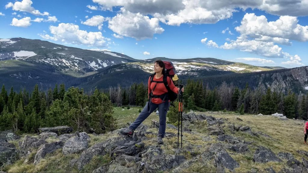
Оно оказалось небольшим, круглым, как тарелочка, с кристально чистой водой и живописно заросшими травой берегами. Уже через час мы вернулись к рюкзакам . Теперь нужно дойти до перекрестка и повернуть налево, к Бобровой тропе. Она сразу круто повела вверх. Несколько переходов по 50 минут мы набирали высоту. Пока тропа шла лесом, было довольно жарко. Когда же мы перевалили за три тысячи метров, все изменилось. Стало прохладно. Лес кончился, склоны были покрыты кустарником и весенними цветами.
Кое-где, как большие грязноватые перины, лежали большие участки снега. Некоторые из них были прямо на тропе, приходилось обходить их стороной. Из-за этого мы иногда сбивались с пути. Надо заметить, что тропа на высоте выглядит как некоторое, никем не утоптанное пространство, от одного тура до другого. Туры — пирамидки из камней — на фоне таких же камней или низкого кустарника не всегда видны. В этом случае сверялись по навигатору, вертели головой по сторонам, искали ориентиры — и в конце концов находили то, что искали. Странно, что перевалы здесь не носят названий, это просто точка с обозначением перепада высот. Вид с перевала был великолепный!
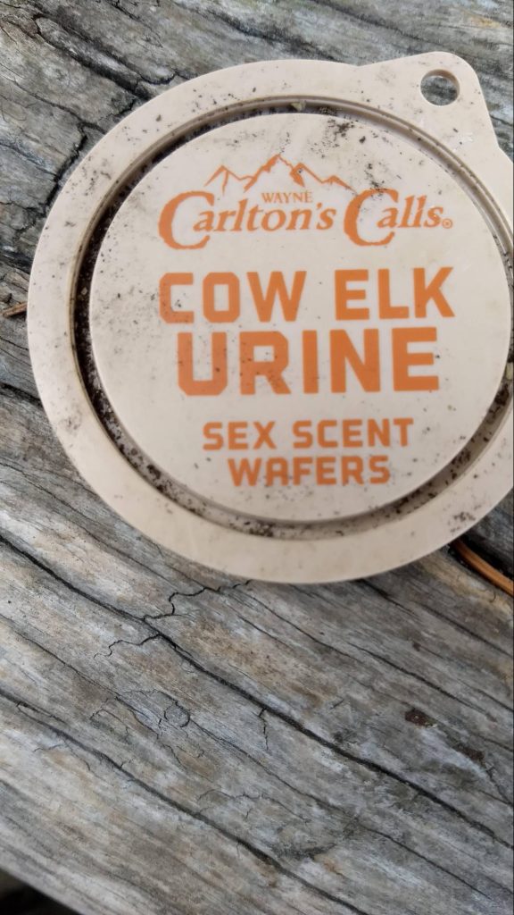
Невероятной красоты панорама открывалась со всех сторон. Создавалось ощущение нереальности происходящего. Но надо двигаться дальше. Тропа ведёт вниз, опять к границе леса. Там мы находим стоянку с черепами животных и очагом, выложенным из плоских камней. Уже в воображении рисовались картины камлающих шаманов в трансе с бубнами и плясками. Но эзотерические картинки быстро стёрла одна находка — маленькая крышечка с надписью » Моча лосихи».
Стало ясно( не сразу, конечно), что это стоянка охотников. Тут то мы снова сбились с пути. Нужно было пересечь быстрый горный ручей, но никакой переправы не было видно. В этом месте события стали развиваться стремительно: мы успели отдохнуть, пообедать, поругаться, искупать в ручье фотоаппарат и не только, обсохнуть на солнышке, найти тропу и снова помириться. Снова начался подъем наверх. На открытом склоне все время дул ветер. Он был не то чтобы холодный, но без куртки было бы некомфортно. Кроме того, лицо и руки нужно было время от времени спасать от жёсткого горного солнца. А природа здесь, на высоте, вела себя совершенно по-весеннему: таял снег, от него текли многочисленные ручьи, расцветали неприметные цветочки, насекомые и маленькие пичужки суетились около них. Теперь нужно немного отклониться от маршрута и сбегать налегке, без рюкзаков, к озеру Зеркальному. Это третье озеро в нашем путешествии. Оно действительно похоже на маленькое круглое зеркальце.
Кроме нас в него смотрелся весьма опасный снежный карниз. Казалось, он вот-вот обрушится и разобьёт зеркало вдребезги.
А дело шло к вечеру и мы порядком устали. Но нужно было взять ещё один перевал. Я пожалела, что мало поела за обедом. На обед у нас были копчёные колбаски, орехи, сухофрукты, финские корочки и бисквиты-сухарики. Пришлось подкрепиться энергетическим батончиком.Теперь тропа шла по каменистому плоскогорью, поросшему кое-где низкими кустами типа можжевельника. Денис предлагал разбить лагерь на высоте, но у меня начала болеть голова. Наверное акклиматизация не прошла до конца, а может быть сказывалась усталость, хотелось вниз, к лесу. Странные цветы стали попадаться нам на пути. Мы прозвали их «антиподсолнухами». При общем сходстве, они были меньше размером и отворачивали свои лица от солнца.
В какой то момент мы пересекли линию леса и вышли на явную тропу вниз. Здесь надо сказать, что тропы в лесах Команчи тщательно расчищаются егерями. По обе стороны от тропы такие непроходимые дебри, что не то что палатку поставить — пописать сходить невозможно. А место для стоянки нужно было срочно найти: силы были на исходе, ноги стали деревянными, солнце садилось и Денис явно начинал нервничать. И вдруг — удача! Около горного ручья обнаружился маленький пятачок для палатки и костра. Площадка, наверно, была расчищена как раз для таких припозднившихся, как мы, путешественников. На ужин — бефстроганов с картошкой из саморазогревающихся пакетов. Несмотря на усталость, мне было любопытно их опробовать. Заливаешь воду в отдельное отверстие в пакете и ждёшь. Никаких примусов, никаких костров. В пакете начинается химическая реакция с выделением тепла(я думаю, происходит гашение извести). Через 9 минут еда готова. Денис пробурчал, что это все баловство, съел свою порцию в один присест и заявил, что ему не понравилось. Ну, извините, у нас тут не ресторан с мишленовскими звёздами… Спать в этот вечер мы легли удивительно рано, ещё и десяти не было. Отключились мгновенно. Да и кто не заснёт после целого дня пути под колыбельную горного ручья?
День без приключений
Следующим утром стало ясно, что пройдено гораздо больше, чем предполагалось ранее. Кто бы мог подумать, что мы такие мощные ребята. Решили действовать по плану Б. Вернулись к машине, переоделись, пополнили запасы еды, выложили мусор, который тащили с собой. Мусором оказались те саморазогревающиеся пакеты, насыщенные водой и оттого тяжёлые. Пожалуй, больше не буду их брать.
Потом мы пошли по другому маршруту. Планировали идти полдня до водопада и оставшееся время отдыхать.
Так и сделали. Место для стоянки было неформальным. Егеря с нас могли бы содрать штраф. Но мы на свой страх и риск разбили лагерь там, потому, что соблазн был велик, уж очень красивое место.
Самый красивый день
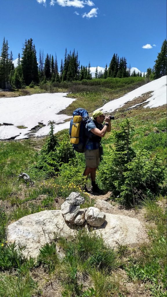
Надо напомнить, что еще накануне мы встали у водопада, а потом полдня предавались лени и прочим медитациям. Спать легли рано и, убаюканные шумом бегущей воды, быстро заснули. Было решено встать в 5:30 утра и пойти встречать рассвет . Местечко присмотрели ещё накануне — большая каменная нерукотворная платформа . Это удивительно — найти среди непроходимого леса такое удобное открытое пространство. Встали необыкновенно рано, ведь в начале июля солнце не спит долго. Только неисправимые романтики способны на такой подвиг. Было уже достаточно светло, крутая тропа хорошо просматривалась в предрассветных сумерках. Денис взял с собой примус и кофеварку, чтобы встречать новый день горячим кофе.
Розовая полоса на горизонте разгоралась и ширилась. Менялись оттенки, добавился густой оранжевый и красный . И вот над горизонтом показался край солнца. Хотелось, чтобы Денис остановился и перестал разрываться между фотоаппаратом и кофеваркой, просто бы стоял и смотрел. Но с другой стороны было ясно, что кто то же должен запечатлеть всю эту красоту. Неторопливо выкатывалось из-за гор солнце. Вершины были уже залиты розовым светом, но подножия оставались еще темными, укрытыми туманом.
Мы стояли с кру’жками горячего кофе в руках и встречали рассвет. Оранжевый свет перетёк в желтый, желтый рассеялся и побледнел. Так начался новый день.
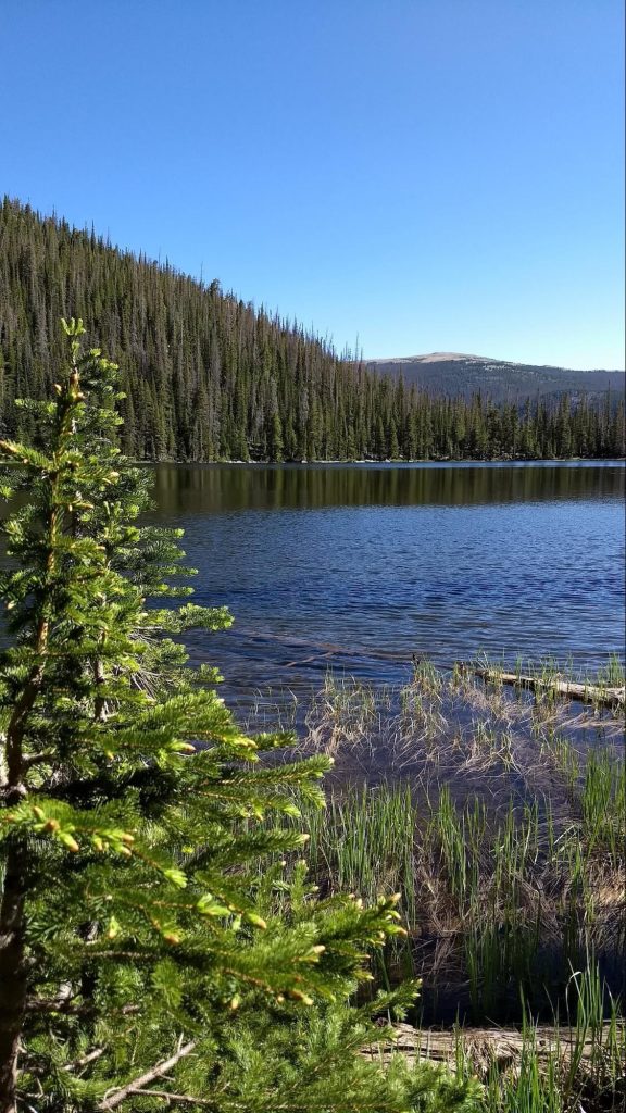
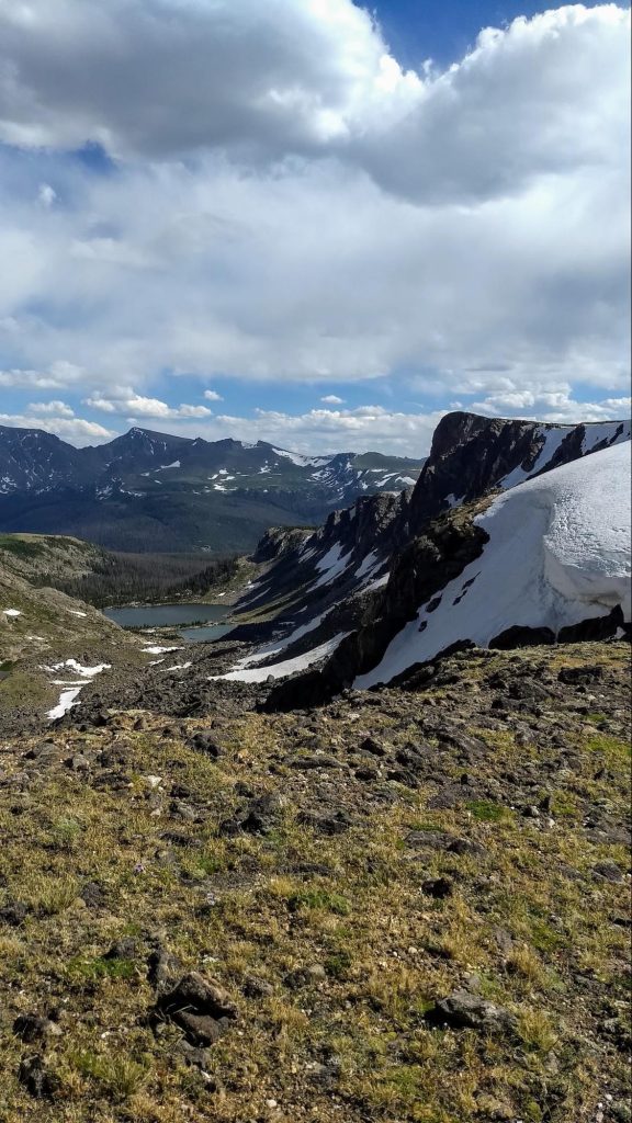
Мы спустились обратно к стоянке у водопада, позавтракали, уложили и спрятали за камнями рюкзаки. Теперь снова вверх. Всего одну милю пришлось идти, но что это была за миля! Тропа стала чрезвычайно замысловатой: приходилось пролезать между большими камнями, перебираться через камни, обходить камни стороной. На тропе выставлены туры, чтобы не заблудиться в каменных развалах, не потерять тропу. А над головой уже сияло синее небо и уцелевшие в июльской жаре снежные шапки. Скоро снежники стали попадаться у наших ног. Дыхание участилось, чувствовалась высота. Хорошо, что за неделю мы успели привыкнуть и подъем не казался таким трудным. Удивительно, как с набором высоты, природа приобретает все более весенний вид: свежая, зелёная трава, одуванчики и медуница, ледяные ручьи, вытекающие из под снежников. Это большое везение — видеть, как рождается горный ручей. Там, куда мы шли, образовалась между гор чаша. В нее стекали все растаявшие снега с окрестных вершин — и получилось идеально круглое озеро.
Наверное за это совершенство формы его и назвали Cirque lake. Только вместо арены кристально чистая вода. А мы, к счастью, были единственными зрителями в этом цирке. Чуть дальше, за развалами больших камней, обнаружилось ещё одно озеро — Emmaline. Оно не имело такой идеальной формы, как первое, но было по-своему живописно. Зубчатые вершины близких гор, похожих на башни замка, отражались в нем.
Большие валуны живописно лежали по берегам, покрытым яркими альпийскими цветочками. С другой стороны озера открывался изумительный по красоте вид . Плавные линии и оттенки синего: голубое небо, синеющие горы, дымчатые дали. Далеко внизу, в долине, можно было увидеть маленькие домики с красными крышами, наверняка чьи- нибудь лесные дачи. Подумалось — в одном из таких я бы хотела жить.
Это здорово — встать пораньше, встретить рассвет и подняться самыми первыми к горным озёрам! Мы уже спускались вниз, когда увидели, как группы туристов, одна за другой поднимаются туда, где мы только что побывали наедине с природой. И как хорошо, что никого, кроме нас там не было.
Наверное, когда-нибудь в будущем, я уеду жить в такое место, где есть горы. Наши друзья, что переехали недавно в Колорадо, зовут, и уже присмотрели дом по соседству. Но для этого ещё не настало время.
Метёт, беснуется январская пурга. И лес, и озеро — в холодной, мглистой дымке. И мечутся колючие снежинки, Ложатся в белопенные снега.
А я смотрю на зиму из окна, Ладони согревая чашкой чая… Там гнутся сосны, ветками качая, И тропка к озеру давно заметена.
Снег сыплет манной крупкой без конца. В сугробах елям так уютно спится. Не спит лишь любопытная лисица, И след свой оставляет у крыльца.
Приходят сумерки и голубеет лес, Укутан снегом, убаюкан воем вьюги. Как странно, под крещендо зимней фуги Заснул он и во тьме совсем исчез.
Метёт, беснуется январская пурга. И лес, и озеро — все теряется в белой дымке мелкого снега. Мелкие колючие снежинки похожи на рой рассерженных пчел — стремительно подлетают и так и норовят ужалить тебя в лицо. Уж мы то это точно знаем, потому что три с половиной часа откатались на горных лыжах на горе Богемия. На дворе -18°, снег и сильный ветер. Одежда заиндевела, замёрзли руки и ноги. Тем приятней было вернуться в домик у озера, отогреться под пледом, выпить горячего чая. Уже объявлен на завтра зимний шторм и даже отменены занятия в университете, где учится сын. А это случается нечасто. Я смотрю в большое окно, пью чай и вспоминаю наши предыдущие визиты в эти края.
Историческое
Мы опять здесь, около прекрасного озера Lac la belle. Кроме английских, здесь много французских названий, данных ещё в те давние времена, когда французы и англичане наперегонки осваивали новые земли. И долгое время они были глухими, непроходимыми дебрями, пока не пришел капитализм. Через пару столетий, после первого освоения территорий, во времена промышленной революции, появились и финские названия. Для разработок месторождений меди, обнаруженных в этих местах, срочно нужны были рабочие руки. В рамках этого грандиозного проекта приехали переселенцы из Северной Европы рубить лес, строить заводы и работать в медных шахтах. В городке Хэнкок имеется центр финского наследия и даже был маленький, но гордый университет “ Финляндия”, который функционировал более ста лет, пока его не подкосил ковид. Да, были времена, когда здесь жизнь кипела: строились рабочие посёлки, школы, прокладывались железные дороги, плавили медь. А к середине двадцатого века она кончилась. И все. Вспоминается город — призрак Файетт, который мы посещали летом, как часть нашей поездки вокруг озера Мичиган.
Там была своя заводская, хорошо отлаженная инфраструктура. Когда же выбрали всю руду, промышленность пришла в упадок. И так повсюду на верхнем полуострове. Ещё некоторые шахты можно было подремонтировать и сделать музеем, но многие так и стоят как ископаемые, облезлые и полуразрушенные, огороженные глухими заборами и дремучими лесами.
Первое знакомство
Наше семейство приехало сюда лет тринадцать назад на новенькой Subaru отметить новый год, покататься на лыжах а заодно испытать на прочность нашу машину. Помню, снег, конечно, уже лежал, но было тепло и мы тут же налепили с детьми небольшую толпу жизнерадостных снеговиков.
Из-за небольшого плюса горнолыжный склон ещё не функционировал и все наше семейство бодро каталось на беговых лыжах. Как оказалось позже, это было удачей, потому что на горе Богемия в принципе нет склонов для новичков. Мы едва ли осталось бы в живых после первого же спуска.
Тридцать первого декабря было решено поехать на водопады. Погода по-прежнему стояла не очень холодная и снега не то, чтобы очень много, но его оказалось достаточно, чтобы машина на грунтовке застряла в кювете. И мы потратили много сил, чтобы освободить машину из плена; и даже вызвали было буксировщик, но отменили, потому что справились сами. Пока мы с Денисом раскачивали и откапывали машину, дети катались на лыжах, а собака радостно бегала от от одного к другому, благо кроме нас по этой дороге никто не отважился поехать. Хорошо, что была еда и горячий чай в термосе.
Уставшие дети и собака могли подкрепиться и согреться в машине. Уже в сумерках мы вернулись в домик у озера и организовали праздничный обед, а потом смотрели семейный новогодний фильм и играли в Scrabble.
Нам предстояло уехать очень рано, потому что прогноз погоды обещал буран с пяти утра. Вещи были заранее уложены, оставалось только запрыгнуть в машину и срочно удирать от снежного шторма. В шесть утра снег сыпал изо всех сил, но дороги, к счастью, уже расчищены. Помню, мы с Денисом тогда шутили, что в России этот номер рано утром, первого января, не прошел бы.
Почему мы возвращаемся?
В тот раз все же удалось благополучно удрать от непогоды. Когда, много лет спустя, мы снова собрались зимой на север штата Мичиган, погода не захотела с нами кооперироваться. Несмотря на то, что зима 2024 года была очень мягкой, нас угораздило отправиться туда в тот единственный сильный снегопад, который случился за всю зиму. Вместо девяти мы ехали двенадцать часов и очень устали тогда. Но об этом уже есть отдельная история.
Отчего мы зачастили “на севера”? Дело в том, что Сёма учится там в политехническом университете. В середине января у сына день рождения и мы в какой-то момент решили, что было бы здорово отметить его по-семейному, в заодно увидеть качественную, снежную зиму.
В январе 2025, кроме дня рождения и катания на лыжах, особенно ярко запомнился последний день. Сначала был очень холодный, ясный рассвет над озером Верхним. Мы завтракали в кафетерии отеля Мариотт и смотрели как нехотя поднимается оранжевое солнце, бликуя на ледяных торосах, и даже выскочили на мороз, чтобы запечатлеть эту неземную красоту.
В то утро было -30°, но мы ,тем не менее, заехали на пустынный пляж озера Верхнего. Большая вода исходила паром, остывая в холодном воздухе, пульсировала мелкими волнами, смешанными со льдинками. В свете утреннего солнца все это выглядело почти нереально!
Затем мы заехали в ледяные пещеры близ местечка Эбен. Летом, наверное, это просто неприметный ручеёк, который стекает с каменного карниза. Но зимой здесь появляются огромные сосульки, которые, замерзая и смыкаясь сверху и снизу, образуют фантастические ледяные стены зеленовато-желтого оттенка. Ходить в этих чертогах снежной королевы нужно осторожно, кругом лёд! Хорошо, что у нас были с собой “кошки”.
Через полчаса после прогулки по пещерам, когда мы уже ехали дальше в сторону дома, погода вдруг резко испортилась. Небо заволокло, снежный заряд высыпался, как будто зима решила взять нас в плен. Чистая прежде дорога сразу стала белой и видимость скатилась до нуля. Пришлось сбросить скорость и пробираться наобум. Неожиданно пурга прекратилась — и вот опять хорошая дорога. Такие снежные диверсии преследовали нас на пути ещё два-три раза. И снова приходилось резко снижать скорость, потому что было не видно ни зги.
Когда мы проезжали вдоль северного берега озера Мичиган, я заметила то, что предполагала увидеть в этих краях и попросила Дениса остановиться.
Это какое-то особенное свойство воды. В других Великих озёрах вода как вода, а в Мичигане необыкновенная! При замерзании она приобретает ярко голубой оттенок. Мы прошли от заснеженного берега вглубь озера метров на десять. Там громоздились прозрачно — голубые глыбы льда. Было бы солнце, наверное они сверкали бы, как сапфиры! Но погода опять начала портиться и пришлось вернуться в машину.
Вскоре мы пересекли по мосту пролив между озерами Мичиган и Гурон. Утомленные впечатлениями и погодными условиями, мы решили сделать краткий перерыв. Уже за мостом заехали в маленький ресторанчик, съели по гамбургеру и уже без приключений добрались домой.
Озёрный эффект
В этом году зима пришла на удивление рано. Уже в конце ноября выпал снег и недели на три установился холод. И если на юге штата ещё случались оттепели, то на севере ничего не растаяло. К нашему приезду насыпало таких пышных снегов, что леса и маленькие поселения были покрыты полутораметровыми сугробами. Ножки в дорожных знаков в городке Калумет оказывались полностью погребенными под снегом. Обочины от расчищенного с дорог снега высились, как белые тоннели. Почтовые ящики, поскольку они тоже стоят у дороги, оказывались замурованными в толще снега и их приходилось расчищать.
Изрядное количество снега выпадает здесь из-за так называемого озёрного эффекта. Большая поверхность воды не замерзает полностью зимой, но, остывая при низких температурах, испаряется, и кристаллизируясь, превращается в снежинки.
Благодаря озерному эффекту каким интересным оказалось катание на горных лыжах! Я уже писала как-то о термине “пудра” относительно зимних видов спорта. Напомню — это когда катаешься по свежим сугробам. В этот раз я, наконец, поняла, как правильно управлять своим телом и ногами в условиях погружения по пояс в пышные снега. Не нужно опасаться необычной кондиции поверхности, ещё лучше пружинить ногами и закладывать не очень большие виражи. Казалось бы, делаешь все то же самое, но разница есть и какой же это кайф! Ты, как бы, пребываешь в мягкой перине, но при этом двигаешься. Двигаешься тоже мягко и плавно. Свежий снег, конечно, скрадывает скорость и не дай бог упасть в эти сугробы: выкарабкиваться из них будет довольно сложно, помню это по предыдущему разу. Но все равно катание по свежему снегу — это как изысканное блюдо для гурманов — хочется пробовать и смаковать.
Кивино — это полуостров на полуострове и, как это ни парадоксально звучит, достаточно далеко от морей и океанов. Если посмотреть на детальную карту, можно увидеть, что это самая северная неостровная часть штата Мичиган, этакий “мизинчик”, глубоко вдающийся в озеро Верхнее. Естественно, озёрный эффект здесь работает лучше всего. Лес, такой волшебный, стоит весь убеленный снегами. Какая красота! Иду на снегоступах и любуюсь каждым поворотом тропы. Иногда приходится пригибаться, проходя под отяжелевшими лапами елей. Бывает, ветви не выдерживают тяжести и целый сугроб скатывается тебе на спину, только успевай уворачиваться. Наконец погода солнечная и голубые тени расчертили все пространство между деревьями длинными волнистыми полосами. Это просто сказка!
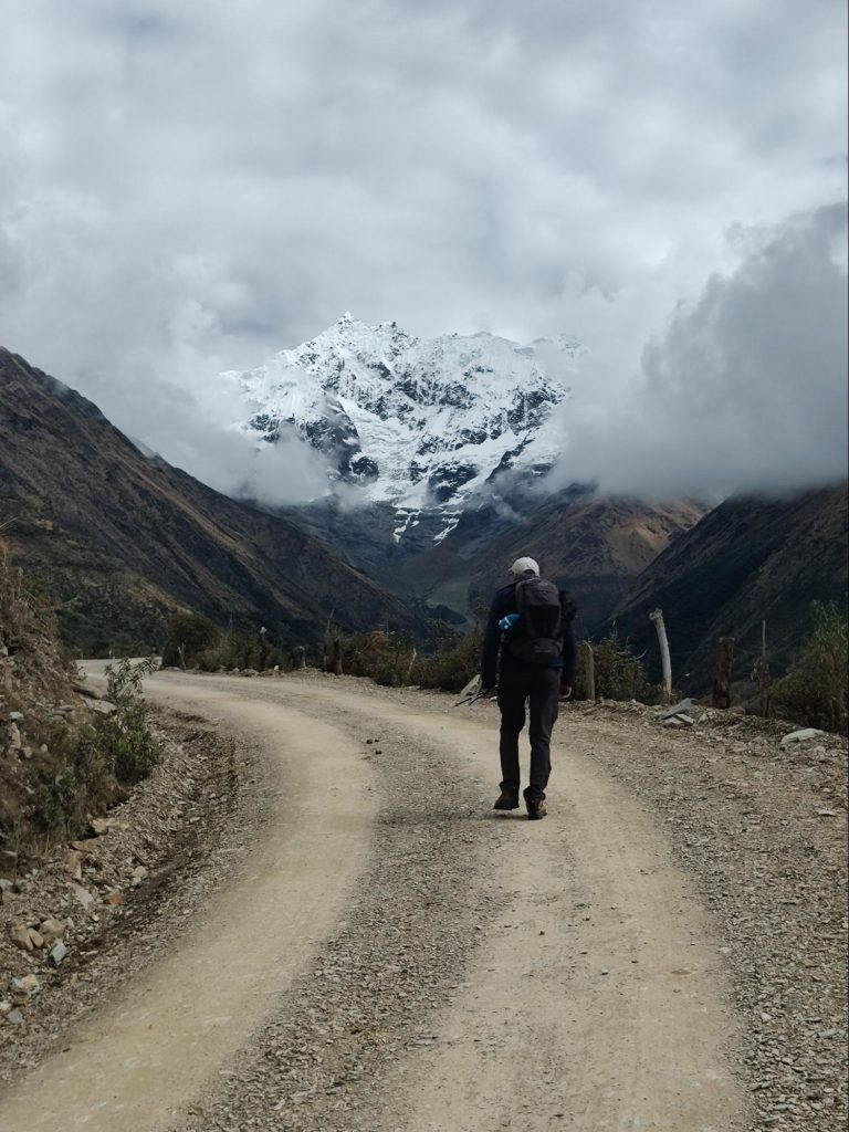
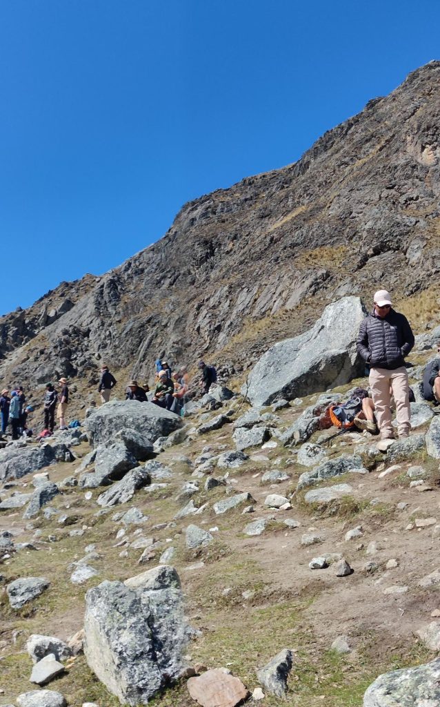
По тропе Салкантай шло большое количество народа: организованные группы, небольшие компании, пары, вроде нас, и одиночки.
Переночевав в туристических лагерях, вся эта орава двинула на перевал.
Большие группы шли не слишком быстро, растягиваясь в пространстве и собираясь на точках ожидания.
Тем виднее были отдельно идущие личности. Молли и Джеймс, те ребята, с кем мы вышли вместе на тропу, угнали далеко вперёд. Им хорошо, акклиматизация у них давно прошла, ведь четыре месяца уже болтаются по Южной Америке. А вот меня все ещё донимает головная боль. И я тащусь вверх, на перевал, еле-еле. Время от времени мы видим “ расписного” — молодого парня, покрытого татуировками с головы до ног. Он идёт с двумя попутчиками, которые потом откололись. Отчего-то с ним мы пересекались чаще, чем с другими. Мы даже стали шутить друг с другом.
Эй, я видела тебя в Сорайяпампе!
А вот и вы опять!
Увидимся вскоре!
Я знала, что увижу тебя здесь!
Ещё, немного, ребята, встретимся внизу!
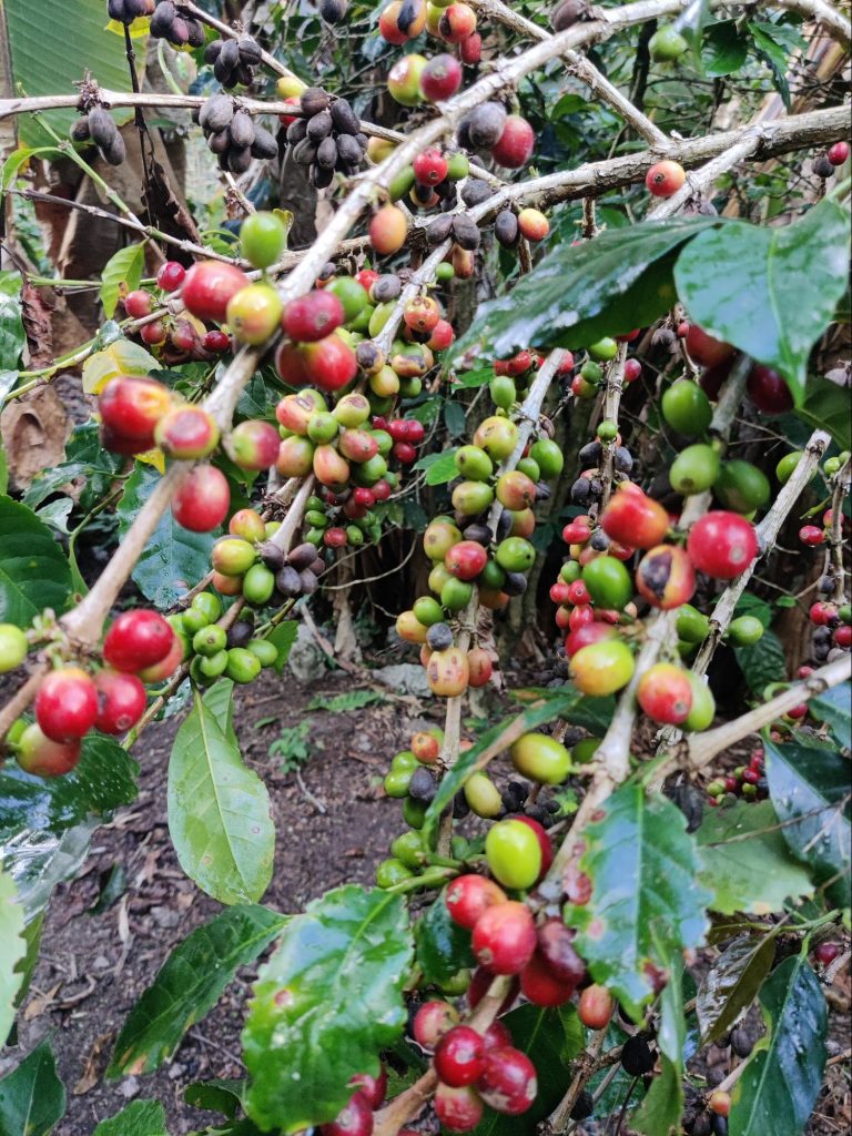
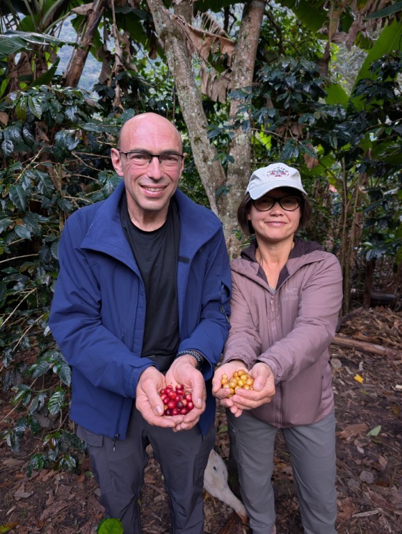
Была компания молодых немцев из Шварцвальда. На тропе мы их не видели, зато сидели и болтали за одним столом под перевалом Салкантай, а затем ночевали на одной и той же кофейной ферме. С Лукасом и его спутницами мы собирали кофе, а потом, посмотрев на этапы приготовления кофе, жарили его и пили все вместе.
Молли и Джеймс, кстати, тоже составили нам компанию.
В том же лагере, в Сорайяпампе, за ужином мы пытались поддерживать разговор и с соседями справа. Это была немолодая чета из Мадрида. Муж по-английски не говорил совсем, жена немного говорила. В нашем случае Денис немного знал испанский, а я могла вставить только английское словечко. Из-за языкового барьера и недостатка слов, разговор постоянно затухал. Но потом пришел их сын, подросток лет восемнадцати, с хорошим английским и сразу дело наладилось. На следующее утро, после взятия перевала, мы встретили их опять на пути и мило обменивались впечатлениями о вчерашнем дне. А потом дорожки наши разошлись и больше мы не виделись.
Каково же было удивление Молли и Джеймса, когда они увидели нас впереди в тот же день, когда все шли через перевал.
Ну вы быстрые, ребята, — сказали они.
До сих пор и нам и им было по пути, но в этот раз они ночевали в другом кемпинге. Зато через день мы снова встретились в домике для туристов, что на кофейной ферме.
Все эти люди, как и мы, шли в Мачу-Пикчу пешком и вероятность встретить их была достаточно высока.
С Молли и Джеймсом мы опять оказались в одном отеле. Просто удивительно, как совпали наши планы!
Вечером, гуляя по городку Мачу-Пикчу, мы встретили их, за кружкой пива, в компании кого бы вы думали? “ Расписного”! Была с ним девушка, которую мы тоже видели на перевале, но не знали, идёт ли она с кем-нибудь или сама по себе. Потом мы узнали, что она в пути уже два года, а “Расписной” уж не меньше. Эти ребята, наверное, легки на подъем: нашли попутчика, пошли с ним дальше, не понравилось — расстались.
“Уходишь — счастливо!
Приходишь — привет!”
А вообще, оказывается, много таких, которые все время находятся в пути, потому, что молоды, здоровы и не обременены.
Говорят, поколение зумеров склонно к аскетизму и эскапизму. Заработали, накопили сколько-нибудь деньжат и снова всё уходит на очередное путешествие.
Мы с Денисом, все же, несколько выделялись из общего фона. Постарше. С другой стороны, приятно было отметить, что находимся в хорошей физической форме. А желание уйти в дальние дали, в горы, в леса, на острова, вообще является основополагающим фактором нашей семьи.
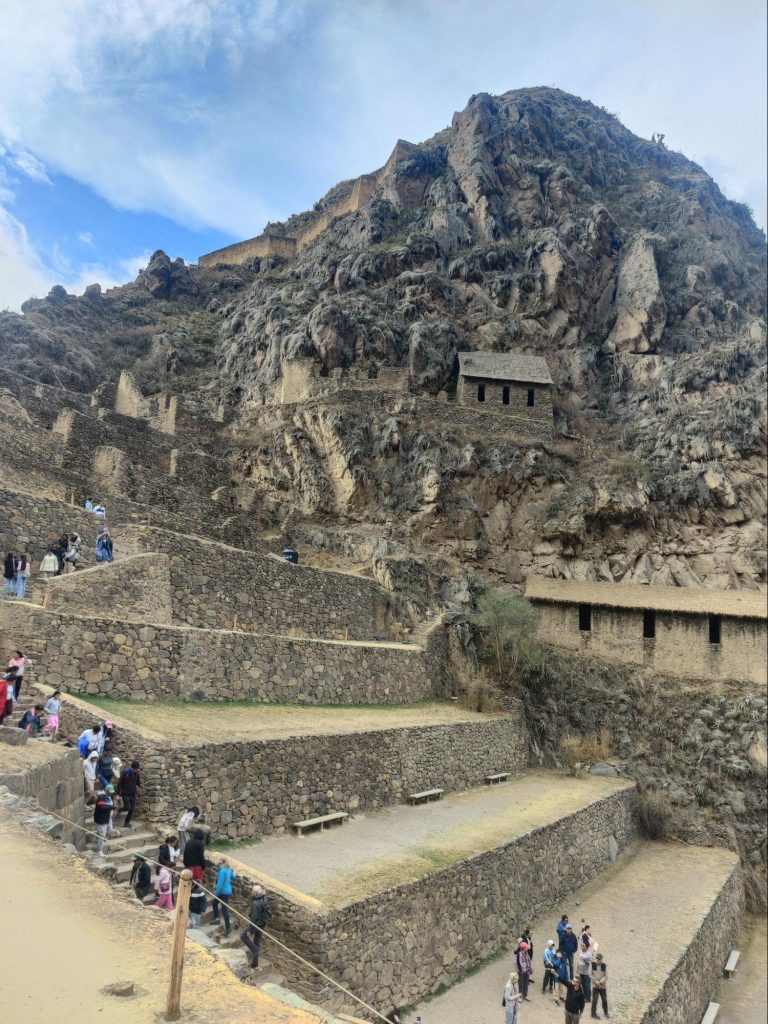
Никто до сих пор не знает, был ли ли это город, или может быть святилище, а может быть военное укрепление — у инков не было письменности.
Изначально место носило солнечное название, но его поменяли, когда в освободительном сражении с испанцами там погибли сотни туземцев. После этого место стало называться Саксайуаман: “Насыщение кондоров”. Сохранились описания испанцев, которые не слишком интересовались традициями порабощенных аборигенов. Но именно эти записи позволили воспроизвести некоторые архитектурные элементы этого места. Как раз в архитектуре инки были особенно сильны.
Чего стоит эта знаменитая полигональная кладка, когда огромные глыбы обтесывались ровно, что между двумя таким невозможно было просунуть иглу!
После того, как мы вернулись в Куско из путешествия по тропе Салкантай до Мачу Пикчу, было решено прогуляться пешком из отеля до Саксайуамана. Мы ведь недостаточно гуляли в последнее время.
Не в наших привычках нанимать гида, а тут решили. Верней он сам напросился. Здесь так принято. Но мы не пожалели. Это оказался антрополог на пенсии с хорошим английским. Он с большой убедительностью рассказывал о гениальности архитектора, спроектировавшего Саксайуаман.
Во- первых, сначала была построена модель не просто строений, но каждого камня в кладке. Во-вторых, городище( наверно это правильное сравнение) должно было быть построено в виде пумы — одного из священных животных инков. Если смотреть с высоты, можно увидеть голову пумы: глаза, нос, острые зубы. В-третьих, каждый камень камень был вытесан с учётом землетрясений. В-четвертых, как это было принято, выстроены трассы для сельскохозяйственной зоны. И ещё много тонкостей и деталей: гигантские пандусы для скатывания обтесанных глыб из каменоломен, акведук, дренаж и канализация, жилые постройки, инкрустация золотом. Было очень много красивых и грамотных решений.
Но после прихода испанцев многое было разрушено и из камней храмов инков были построены католические храмы.
Напоследок наш гид рассказал нам о священных камнях, которые накапливают энергию и передают их людям. Как люди, имеющие большую энергию могут делиться ею и даже лечить. Как в определенное время года, в сентябре, эти люди уходят в горы для целительных процедур.
И я спросила гида:
Вы правда верите в энергию священных камней?
Да!
Тогда как же вы, перуанцы, будучи католиками, верите в эти языческие обряды?
Католицизм у нас как оболочка, просто формальность, но древние обычаи и верования живут глубоко в сердце.
Я вспомнила тогда цветы на священном озере Хьюмантай и поняла, что это все те же перуанцы, древняя кровь которых не даёт забыть обычаи предков.
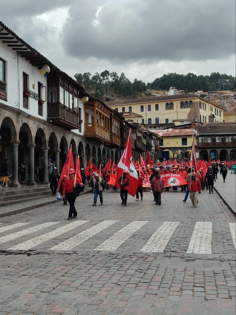
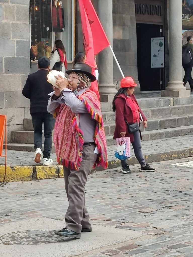
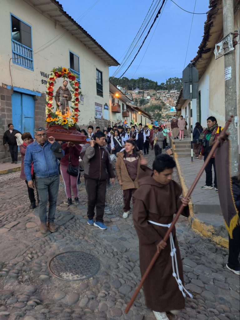
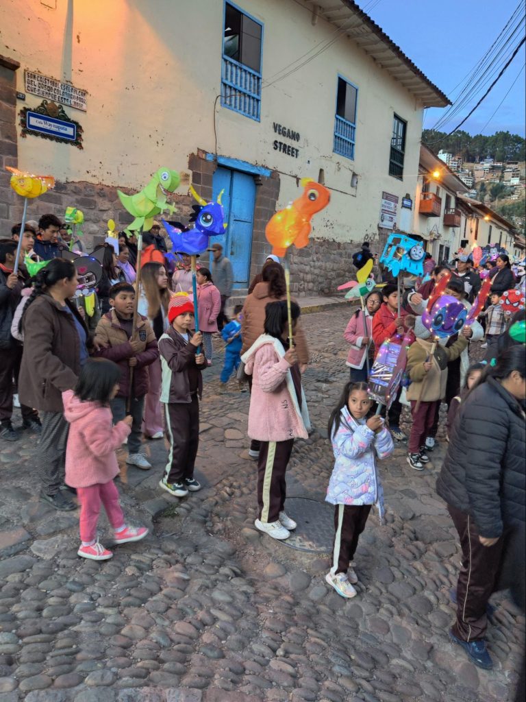
Ни в одной другой стране мы не видели столько шествий за два дня.
Сначала был какой-то протест. Люди с красными флагами, на которых Чегевара в берете, скандировали и требовали, и натужно гудели в раковину, обходя главную площадь по периметру.
Не знаю, чего хотели они, а я хотела, чтобы они немедленно прекратили это безобразие, потому, что дико болела голова. В итоге мы затаились в каком-то кафе, но их все равно было слышно.
Потом, под вечер было второе шествие, на этот раз религиозное.
Чествовали святого Франциска Ассизского. Студенты католического колледжа дудели в трубы, били в барабаны, несли иконы и фигуру святого в полный рост. Святой Франциск источал аскезу и благость, а за ним и за оркестром весело топала мелкая ребятня с фонариками в виде игрушек: машинки, динозавры, зверюшки.
Вот так то воспитывают в детях религиозный дух: кому не хочется пройтись с фонариком! Вот и святой Франциск ассоциируется у них с чем то приятным и весёлым. Дальше — отдадут тебя в школьный оркестр, чтобы играл религиозные гимны, хоругвь дадут в руки, если нет слуха и так далее. В итоге Перу остаётся глубоко религиозной страной.
Отходя в сторону, хочу сказать, что к Франциску Ассизкому у меня с некоторых времён особенно теплое отношение. Наши осенние путешествия уже стали традицией, а его день рожденья празднуется как раз в начале октября. Святой Франциск стал как бы спутником в наших странствиях. И мы, ни разу не католики, отмечаем его незримое присутствие рядом с нами в разных странах. Иногда я ловлю себя на том, что я мысленно разговариваю с ним, проходя мимо соборов и монастырей, построенных в его честь. В Австрии, в Перу, в Италии…“ Привет, святой Франциск! Мы и здесь тебя нашли. Ну как ты? С днём рождения! Увидимся!” Не осеняем себя крестами, не возносим молитв, просто видим в нем старого знакомого, с которым ещё встретимся в пути.
На следующий день несли какие-то мощи в стеклянном саркофаге. С музыкой, понятное дело.
Даже на тропе Салкантай, проходя мимо маленького поселка, мы увидели репетицию школьного оркестра и будущего шествия. Такие они, перуанцы, хлебом не корми, дай пройтись с помпой.
Сегодня утром валялась в номере по причине нездоровья — с улицы неслись звуки духового оркестра. “Вот неймётся им,” подумалось мне. Оказалось, неймётся, ещё как. Когда во второй половине дня мы отправились на возвышение Саксауман, оттуда тоже доносились звуки труб и барабанов.
Перуанцы — веселые люди. Отовсюду доносится музыка: из любого магазина, из любого кафе, из любой подворотни. Из такси, которое везёт нас в гостиницу, из микроавтобуса, что везёт нас к тропе, из собора, где идёт утренняя служба. Музыка несется из школы, где школьный оркестр репетирует концерт, от стройки, где отбойный молоток гремит громче, чем музыка. В центре города, где инфраструктура расположена особенно тесно, все это сливается во всеобщее ликование и голова идёт кругом. Музыка доносится сейчас, в десять вечера, когда, по идее, хочется уже уснуть, а у них все веселье.
Музыка — это хорошо, но я не привыкла к ней в таком количестве. И мы убегаем в горы.
В горах стало ясно, что от избытка музыки можно спрятаться только если ты один на тропе. Если же параллельно с тобой идёт организованная группа, то непременно из телефонов шерпов будет литься темпераментная музыка. В начале тропы Салкантай спрятаться от музыки было невозможно, потому что на перевал шли толпы и толпы народа. Исключением из этого музыкального насилия стал один паренёк из местных инструкторов, который не только легко и непринужденно шёл вверх, на перевал, но и подыгрывал себе на зампонье — инструменте из бамбуковых трубочек разной высоты. Мне даже показалось, что с такой музыкальной поддержкой идти стало легче.
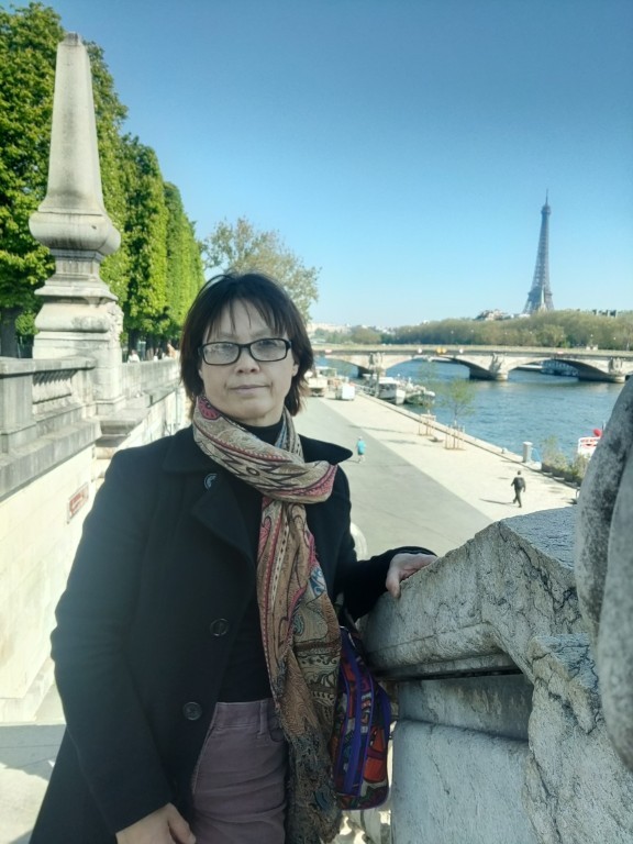
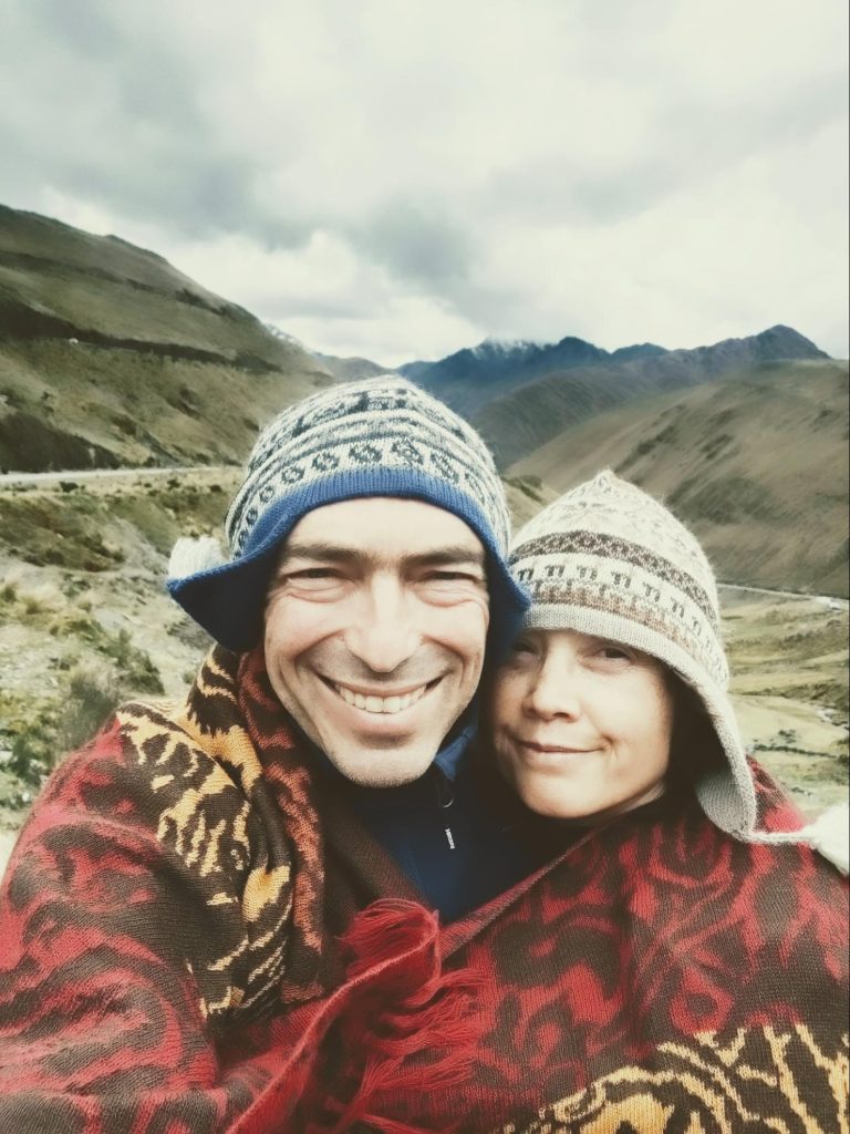
For many years now, at the end of December, I've been ordering a wall calendar with photos for the corresponding months of the past year. And, as has become a tradition, I also post a post with the same photos.
January
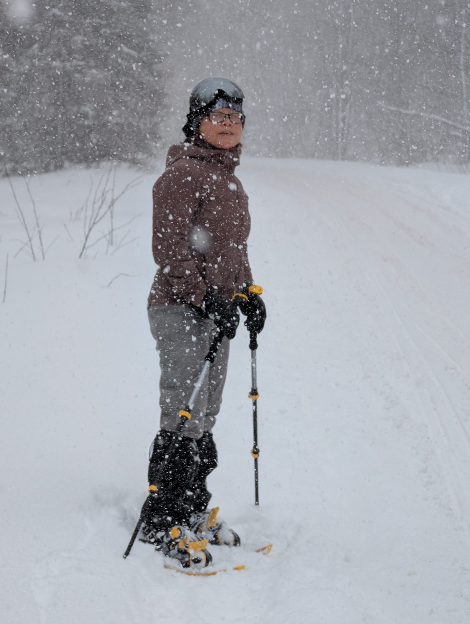
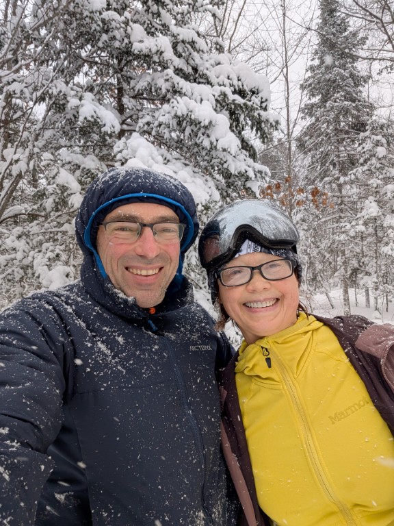
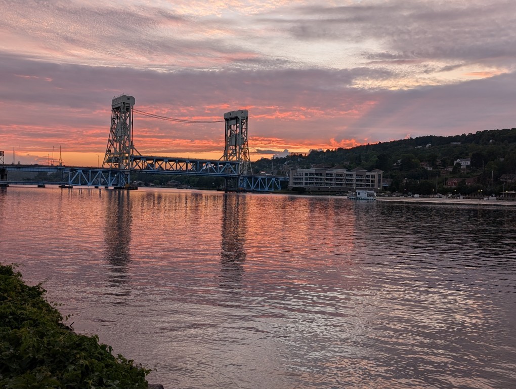
Just like the year before, we went to the very edge of the world—the Keweenaw Peninsula. There's snow, skiing, Lake Superior, which is beautiful in any season, and someone (not me 😔) turned 21.
February
We went snowboarding again—this time in lower Michigan, near Manistee. Cross-country skiing, snowshoeing, Lake Michigan. I also worked.
March
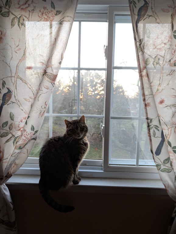
Natasha took a complicated route to visit her mother, and I stayed home with the cats...
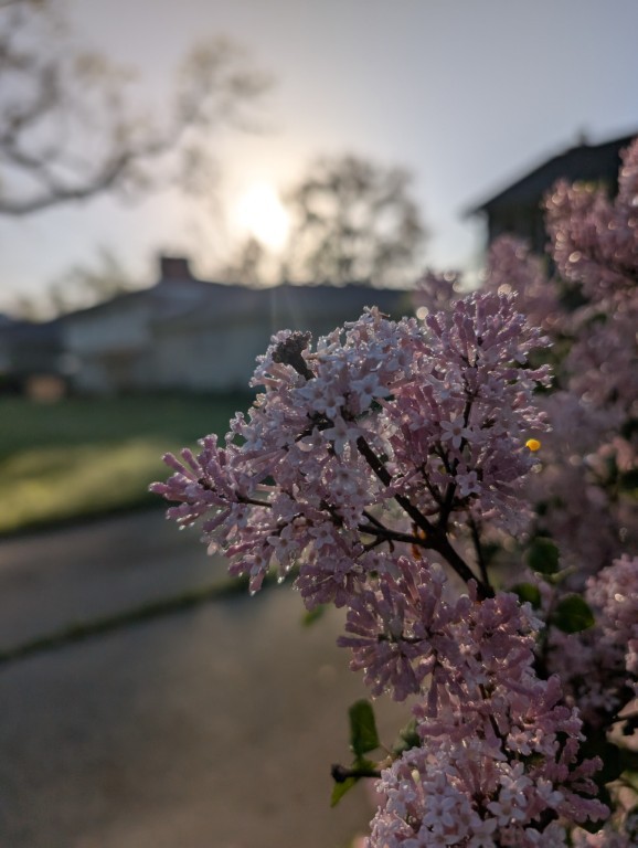
April
Spring is coming here, just in time for Natasha's arrival.
May
It's great at home, we're driving around the neighborhoods.
June
June in Ann Arbor is a time of peony blooms, summer festivals, and smog from the Canadian forest fires.
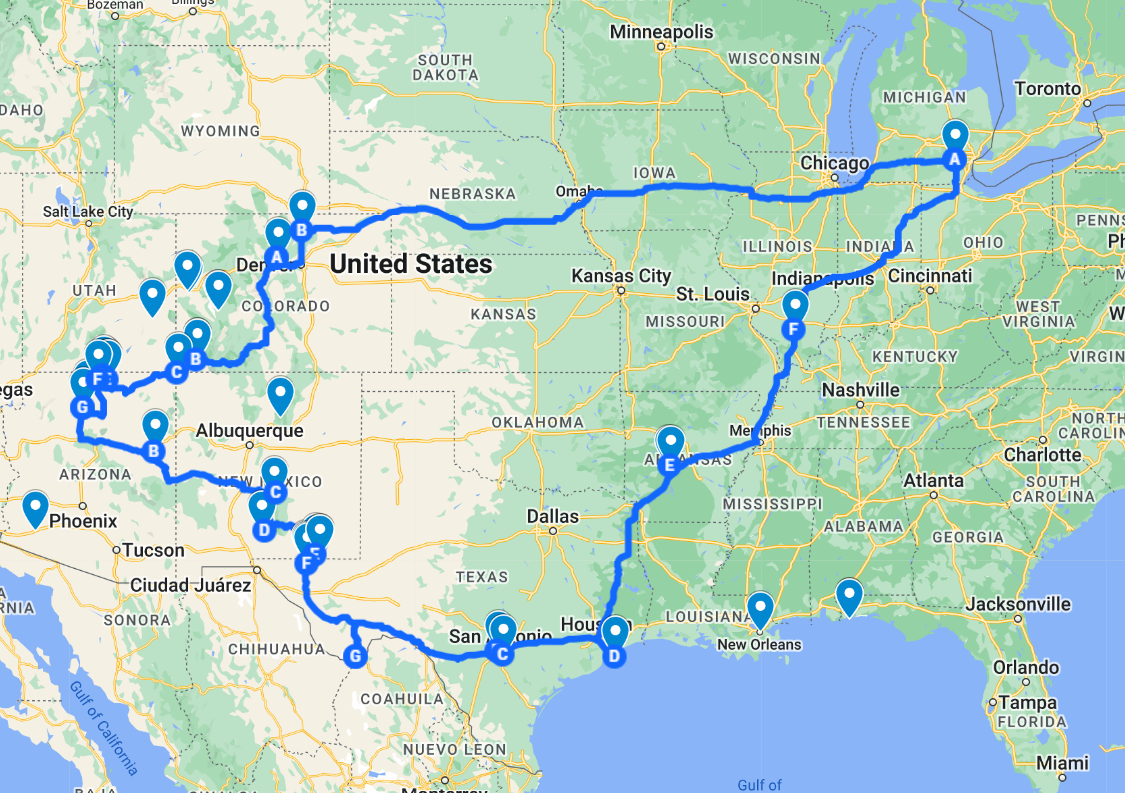
July
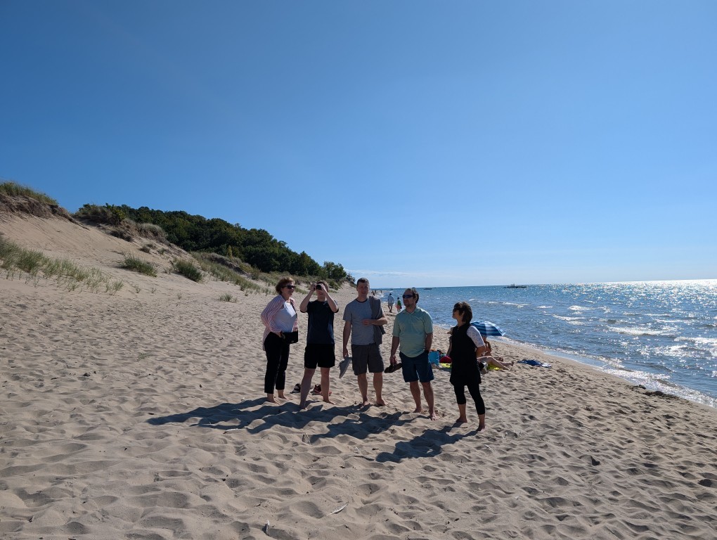
A three-week trip to the Northwest US: beautiful national parks, long drives, work on the road.
August
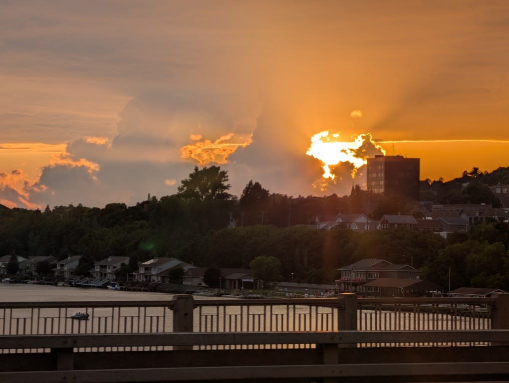
Another trip to Upper Michigan: the Keweenaw Peninsula is beautiful in both winter and summer, and meeting old friends.
September
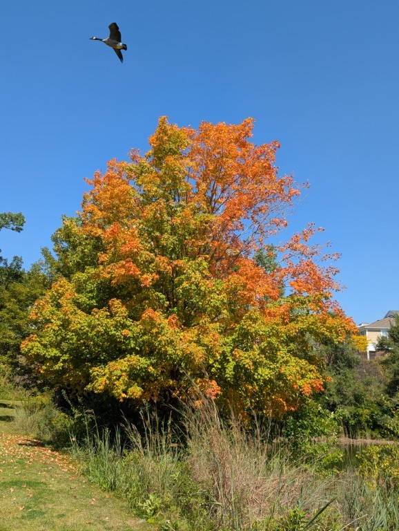
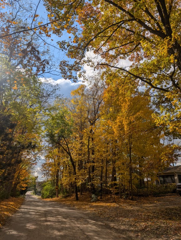
It's a time of festivals, changing colors of leaves, beautiful sunsets
October
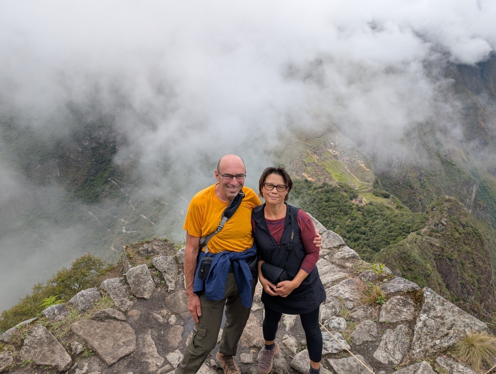
A Grand Trip to Peru: Machu Picchu, Cusco, Mountains, Rivers, Waterfalls…
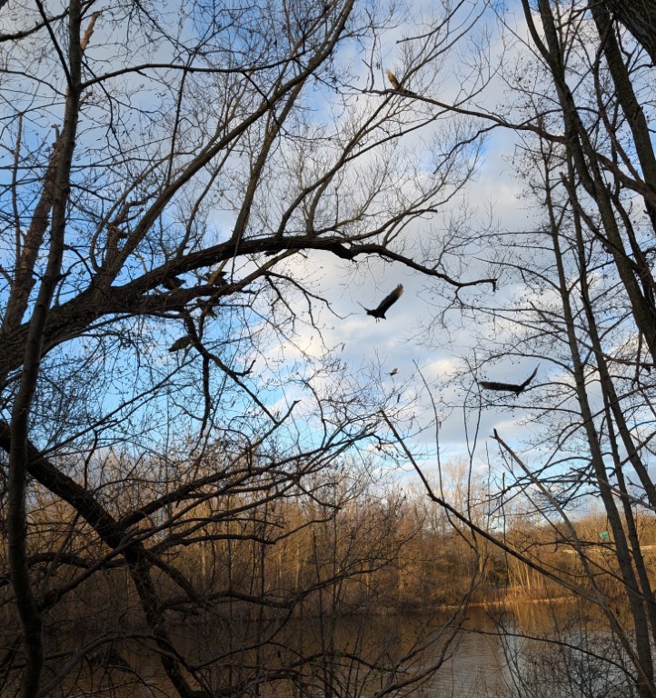
November
One of the most beautiful months we have here in Michigan: the trees are covered in colorful leaves, and the weather can feel almost like summer one day, and snow the next…
December
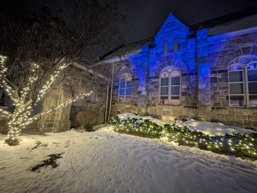
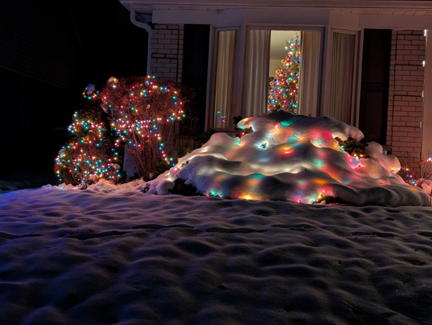
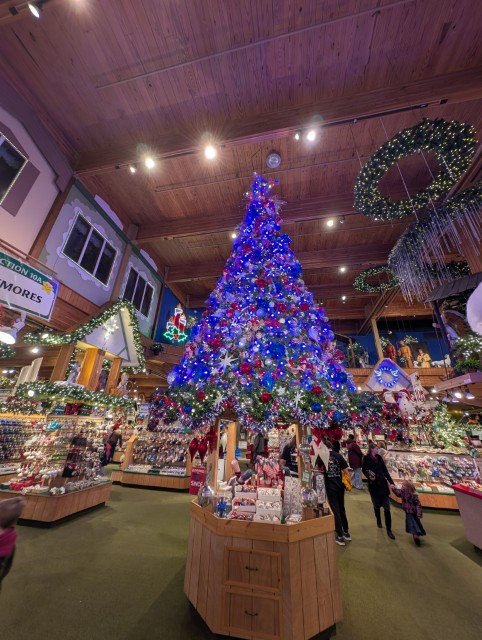
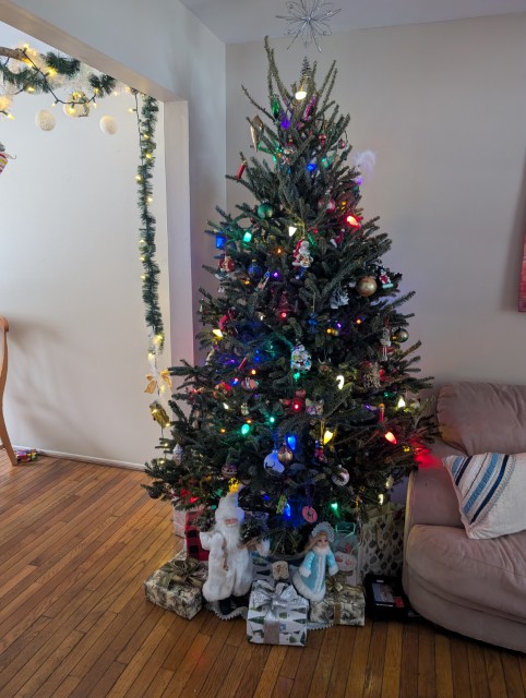
This year December has been very good – snow, several beautiful sunny days (last year there wasn’t a single sunny day in December), Christmas lights…
And the fact that there were occasional torrential rains and one day the temperature rose to +15 degrees – well, that’s what Michigan is for...
А то, что иногда шли проливные дожди и однажды температура поднялась до +15 градусов — так на то это и Мичиган…
Почти во всех наших поездках мы берем в аренду автомобиль — за пределами больших городов, это обычно лучший способ посмотреть новую страну. Перу не было исключением из этого правила, хотя, перед поездкой, я читал много пугающих вещей про особенности вождения тут.
Машина (Toyota Raise в очень базовой комплектации) обошлась нам дороже, чем машина подобного класса у нас в Америке, но это было ожидаемо. На удивление, она даже оказалась с автоматом — настоящая роскошь в стране третьего мира. На крутых горных серпантинах автомат, конечно, удобнее, хотя и ручная коробка у меня проблем не вызывает.
Я специально брал машину в классе “маленький SUV”, потому что ничего хорошего от местных дорог не ожидал (и не зря). Но от SUV у нашей машинки был только внешний вид и чуть более высокий, чем на стандартном седане, дорожный просвет: передний привод на грунтовке не тянул даже на небольшом подъеме, в чем мы сумели убедиться уже через 20 минут после выезда из рентовки: Google Map повел нас к первой точке (археологическому сайту) по какой-то совсем убитой грунтовке, мы доехали до слишком узкого моста, а при попытке разворота машина не смогла заехать немного в горку и тупо села. Хорошо, что мимо проходил какой-то местный пастух, Наташа села за руль, а мы с ним машину вытолкали. За труды пастух получил честно заслуженные 20 солов (около 4.5 долларов), а я приобрел ценный опыт и больше уже не застревал.
На машине мы проехали 9 дней и чуть больше 1000 километров — не слишком много, но, с учетом местных дорог, вполне достаточно. Про перуанских водителей писали, что на дорогах они ведут себя очень агрессивно и непредсказуемо. Возможно, это имеет место быть в Лиме (ВСЕ, кто писал про езду в Перу, заявляли, что в Лиме водить абсолютно нет смысла, и я им охотно верю), но мы ездили в районе Куско и вокруг, и там особой агрессии я не увидел. Да, стиль езды в Перу отличается от привычного нам американского и европейского, но это именно стиль, который можно и нужно освоить, чтобы не попадать в опасные ситуации. И стиль, во многом, вызван местными условиями: например, тут принято сигналить перед закрытым поворотом. В целом, я могу сказать, что ездить по Перу трудно, но вполне возможно.
Про дороги хочется сказать отдельно. Надо признать, что дороги явно становятся лучше — во многих местах мы видели дорожные работы или мы ехали по совсем свежему асфальту. Такое чувство, что Перу сейчас активно работает над улучшением доступа к своим археологическим сайтам, чтобы Мачу Пикчу не был единственным туристическим местом.
Нельзя доверяться Google Maps — несколько раз она заводила нас на ужасные грунтовки, по которым надо ездить на настоящих джипах, а не той городской машинке, что дали нам в прокате. При этом дважды мы потом выясняли, что рядом была приличная новая асфальтовая дорога, просто чуть длиннее. Возможно, дороги были слишком новыми?
Также Google Maps несколько раз пыталась направить нас по односторонним улицам против движения. Хорошо, что мы быстро поняли, как там обозначено направление движения (ни разу не по международным стандартам), и на такие разводки не попадались.
Из положительного можно отметить, что ни разу на перуанских дорогах не возникало сонливости за рулем. Наверное, потому, что одна из двух полос в любой момент может оказаться перекрыта упавшими с горы камнями, или же надо будет переезжать небольшой поток, текущий с горы прямо по асфальту, или же сбрасывать скорость перед немаркированными “лежачими полицейскими” (topes по-испански) — мы видели такое в Мексике. Особенность латиноамериканских topes в том, что они крутые и их надо проезжать ОЧЕНЬ медленно, намного медленнее чем у нас в США.
Несколько раз я читал на форумах про проблемы с перуанской дорожной полицией. Я даже заранее сделал за 20 долларов так называемую “Международную Лицензию” (International Driving Permit), хотя и знал, что она в Перу не нужна при наличии американских прав: где-то я вычитал, что её отсутствие послужило поводом для вымогания взятки. Но в единственный раз, когда нас остановили для проверки документов, то её никто не спросил: посмотрели мои права, документы на машину и пожелали счастливого пути.
В общем, это был интересный и полезный опыт. Все прошло хорошо, за исключением маленькой неглубокой царапины (не до железа даже) на борту машины. Не знаю даже, где я её приобрел: я про неё узнал только, когда сдавал машину обратно. Мне насчитали 100 с чем-то долларов, которые моя кредитка мгновенно вернула — у меня полное страховое покрытие.
В этой поездке многое было впервые — первый раз в Южной Америке и вообще в южном полушарии, первый раз (если не считать пост-советской Средней Азии в начале 90-х) в стране третьего мира, первый раз, когда я мог действительно использовать испанский для бытового общения…
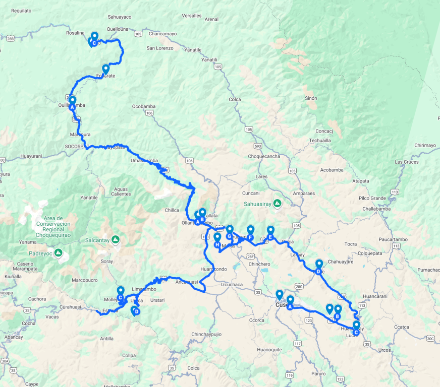
В Перу мы провели почти три недели — со второго по двадцатое октября. Поездка была разбита на три части:
Куско — 5 дней, два дня сразу после прилета, ещё два дня после возвращения из Мачу Пикчу, и ещё один день перед отлетом
Тропа Салкантай и Мачу Пикчу — 6 дней: четыре дня тропа, два дня — город Мачу Пикчу
Автомобильная поездка по долине Урубамба (и не только) — 9 дней.
Все запланированное было выполнено практически без накладок (мастерство в организации путешествий не пропьёшь), хотя местами было и не просто.
Сейчас девять утра и тропический ливень в Куиллабамбе. Окна открыты и я слышала сквозь сон, как полночи лил сильный дождь и где-то громыхал гром. На этот раз погода не захотела кооперироваться с нашими планами, поэтому приходится сидеть в номере гостиницы и ждать когда закончится ливень.
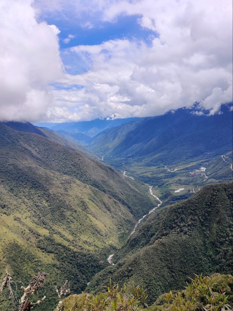
Накануне мы приехали в этот тропический город через живописный перевал Абра Малага.
Климатические зоны промелькнули перед лобовым стеклом машины, как в кино. Если в Оянтатамбе было + 15 на момент отъезда, то на самой высокой точке перевала только +6. А когда по крутым серпантинам мы спустились вниз, по другую сторону гор, там оказалось +34.
Кроме непривычной для нас осенней (или весенней, если учитывать, что в Перу весна) температуры, ничего выдающегося в городе Куиллабамба мы не нашли, хотя он достаточно большой и жизнь в нем кипит. Кипеж, в основном, вызывают маленькие машинки Тук-тук.
Они, хоть и медленные, но при этом очень суетливые: снуют под носом, неожиданно меняют полосу, так и ожидаешь от них какого-нибудь подвоха.
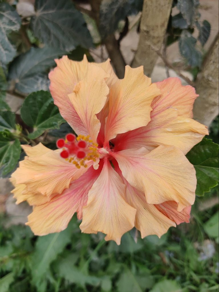
Мы нашли в Куиллабамбе только парочку симпатичных скверов, утопающих в тропических цветах, и ничего более.
Двери всяческих заведений везде раскрыты нараспашку, будь то стоматологический кабинет, ресторанчик, магазин, банк, больница, парикмахерская или аптека. Кондиционеров, понятно, нет.
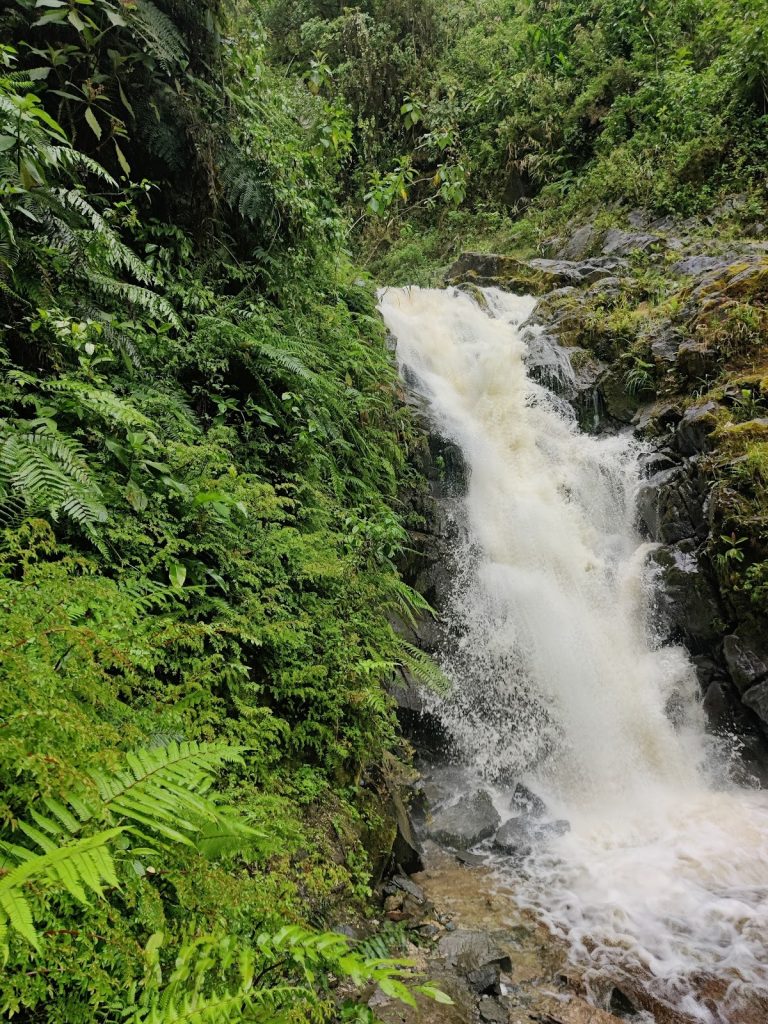
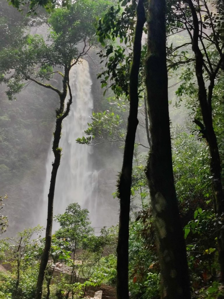
Тогда почему мы здесь? Это место стоит в стороне от маршрутов экскурсионных автобусов. Все дело в том, что в окрестностях находится много красивых водопадов в обрамлении пышной тропической растительности.
Наверное скоро большие туристические автобусы доберутся и сюда, потому, что когда мы приехали к водопаду, обнаружили, что проводятся активные работы по благоустройству тропы. Уже вымощен плитняком участок пути, возведены обзорные площадки и павильоны для отдыха. На будущей парковке лежат горы щебенки. Группа строителей таскает на своем горбу мешки с цементом вверх.
Нам повезло, когда мы поднялись к водопаду, других посетителей не было, только строители, да и те быстро ушли за новой партией цемента. Для купания в водопаде были взяты соответствующие принадлежности, но они не пригодились. Струи воды оказались настолько мощными, что мы сразу приняли душ из мелких брызг и немедленно промокли с головы до ног. Ещё со стороны было видно, насколько огромен этот водопад!
Часть его скрывала пышная зелень, но три больших уступа с бурно текущими водами были явно видны у подножия горы, со стороны цитрусовой фермы. Долго находиться близ водопада было совершенно невозможно и мы, мокрые насквозь, повернули обратно.
Если утром был дождь, то ближе к полудню стало проясняться и наша одежда почти высохла ещё до того, как мы вернулись к машине.
Поскольку на обратном пути распогодилось, появилась возможность увидеть ещё один водопад. Мы не заметили его раньше оттого, что все вокруг было затянуто облаками и туманами и находился он в некотором отдалении. К тому же мы сконцентрировались на непростом процессе езды по местным дорогам, которые сначала были ещё ничего, а потом превратились в сплошные ямы и колдобины с лужами вперемежку.
Такого огромного водопада я ещё никогда не видела!
Похоже источник бил с самой вершины горы. Разбиваясь о скалы, вода падала с немыслимой высоты, пробивая себе путь сквозь джунгли к реке Урубамбе. Четко мы могли видеть лишь нижнюю часть водопада, а все, что было вверху, терялось в голубой дымке.
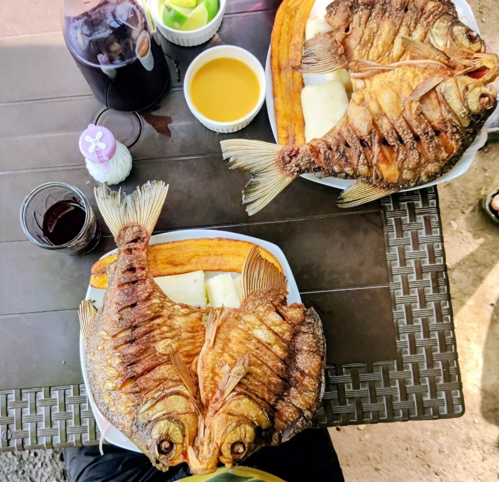
Следующим пунктом нашего путешествия должен был стать ресторан, где вкусно готовят рыбу. Гугл уверял нас, что он открыт.
Но мы то ведь уже тёртые калачи и знаем, что это не может быть абсолютно точной информацией. У ресторана не было никаких признаков жизни, и только две собаки облаяли нас, голодных. Поехали дальше. И, совсем недалеко, на берегу все той же Урубамбы, мы нашли прелестное местечко, райский уголок, где нам обещали жареную рыбу пако с гарниром из местных овощей. В этом чудесном садике никого не было, только лениво подметала пол девочка-подросток. Увидев нас, она позвала мать. Вероятно, когда туристический сезон уходит на спад, ресторанчики тоже перестают функционировать. Но нас все же согласились накормить. В ожидании обеда мы развлекались тем, что пытались сфотографировать большую бабочку. Каждое ее крылышко было с мою ладонь величиной, ярко голубого цвета с перламутровым отливом. А она, непоседа, все вилась около пальмы и ни за что не хотела присесть.
За скромную цену мы роскошно пообедали в придорожном ресторане и остались очень довольны. На гарнир к рыбе нам подали жареный плантейн и местную сладковатую картошку.
Там же мы первый раз попробовали чичу — популярный в Перу напиток из фиолетовой кукурузы. В нем небольшое, как в квасе, количество алкоголя и приятный, чуть сладковатый вкус.
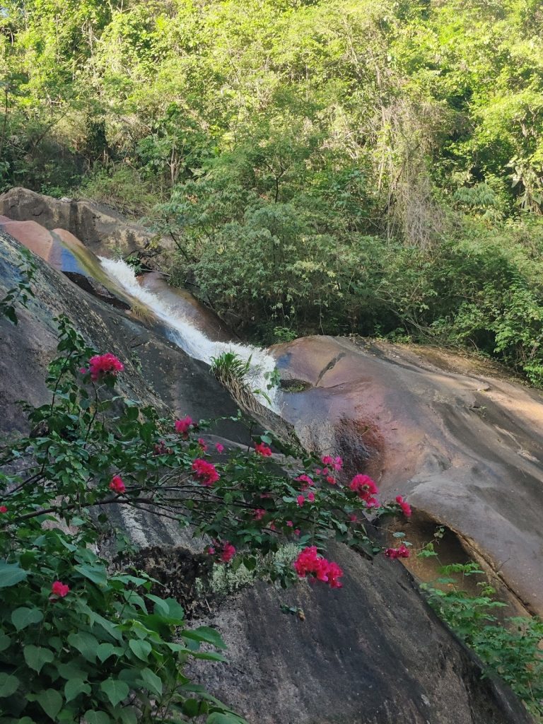
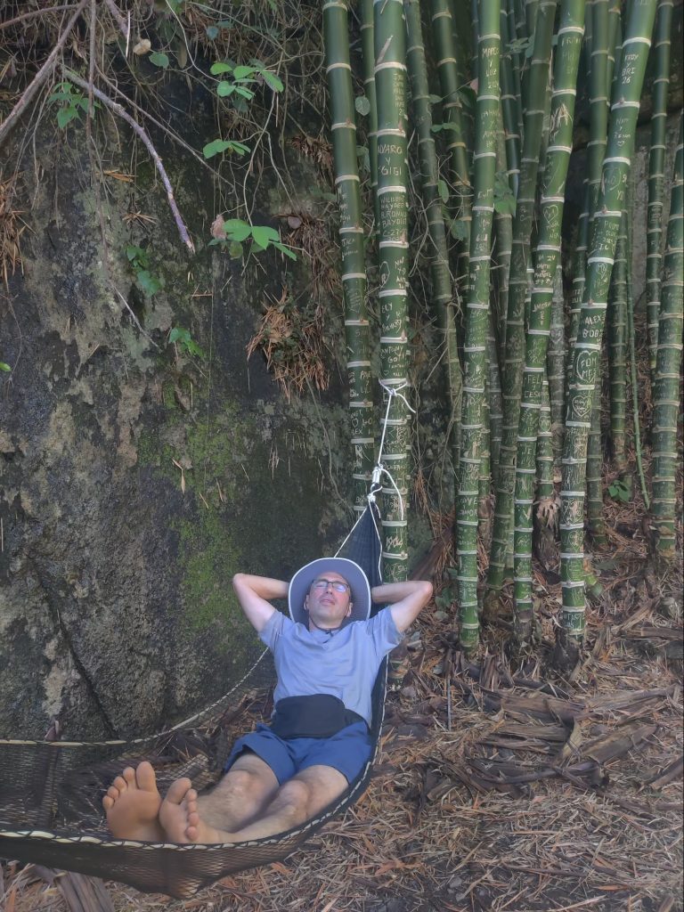
Потом был ещё один водопад, маленький и благоустроенный.
Этакая тропическая зона отдыха: тут тебе и бугенвиллия над струёй, и гамачки в зарослях бамбука, и прохладительные напитки, и скамеечки под сенью эвкалиптов. Ну, мы, конечно, не отказали себе в удовольствии, посидели и полежали под сенью дерев, сняли несколько фото и поехали в отель.
Этот отель — он как маленький островок привычной нам жизни. Чистый номер, хороший сервис, приглушенная музыка, садик с бассейном. А вокруг совершенно другая жизнь. Здесь особенно остро чувствуется, что Перу — страна третьего мира. На первом этаже почти каждого дома много маленьких тесных, магазинчиков с ширпотребом, тесно лежащим на полках и на полу. Громкая латино-американская музыка вырывается из каждого подобного заведения. И если ритм ещё как-то синхронизируется, то из мелодий и слов получается сущая какофония. Шум большого города растворяется в выхлопных газах старых автомобилей. Но люди и собаки дружелюбны.
Утром, после завтрака, мы собрались и поехали в обратный путь, снова через перевал Абра Малага.
Снова виражи и повороты, роскошные виды. Еде уже более уверенно, ибо знаем, чего ожидать. На самой высокой точке замечаем приземистое кафе и останавливаемся, чтобы выпить по чашечке кофе.
Кофе оказался отличным! И мы задержались в этом месте даже чуть дольше, чем хотели, устроив фотосессию в шляпах и пончо. Наверное многие путники благодарны владельцу кафе за это гостеприимное пристанище на холодном и ветреном перевале.
When Denis wrote about the long day, he didn't yet know that it wasn't the longest. The longest day was the last one. I'll explain my theory about why that happened. The day before, we'd been hiking along a picturesque section of the Salkantay trail, with magnificent views, wild strawberries, and pastoral meadows near tropical farms. The farms sold freshly squeezed fruit drinks. How could we refuse? Well, we drank a glass of orange and mango juice. We bought some juicy mango and avocado. Everything was fine until the evening, but then my temperature spiked, my stomach started churning, and I started acting up.
The next morning, things only got worse, but I still had to keep going. I had to shove down some of my breakfast with a couple of pills and exert myself once again. After saying goodbye to our hospitable host, Freddy, we set off. Soon, our trail merged with another—the Inca Trail. It was especially crowded in the morning because everyone had already gotten up, eaten breakfast, and packed their bags by around seven (some even earlier). Over time, the groups and individual tourists dispersed. But before that, we'd been walking at the same pace with some young people from Germany for a long time. Their pace spurred me on, and I was sweating, but I didn't slow down. The Peruvian guide even complimented me on my progress. We passed each other in a clearing, and suddenly, all our strength gave out. The only good thing about this was that the climb to the pass was over. Then came a long, long descent, because I could barely drag my feet and kept stopping to rest and drink water. Near the hydroelectric power station, the trail turned toward the railroad. At first, I thought, "How stupid to suggest tourists follow the railroad!" But it turned out to be extraordinarily beautiful, covered in thickets of heliconia along the sides and the sacred Urubamba River on the right.
While we were having a snack on the riverbank, we suddenly discovered the ruins of ancient walls visible on the other bank. Armed with binoculars, we spent a long time examining the ancient structure. It was likely part of the Machu Picchu Archaeological Reserve, inaccessible to tourists.
As we walked, it rained from time to time, then suddenly it cleared up as if nothing had happened and it became hot, the air was filled with the scent of unknown herbs.
We spent the last part of our journey along a road crisscrossed by tour buses, ferrying countless tourists to Machu Picchu. Naturally, there were no sidewalks or even separate paths. Once again, I thought about how nice it would be to create a more comfortable route for hikers. It may be a narrow valley, bordered by a river and steep cliffs, but a traveler doesn't need much. And walking along the paths, constantly crossing them for various reasons, is unsafe, as is the narrow dirt road with no shoulders.
By the end of the journey, I was so tired that I was moving my legs automatically. There's nothing worse than being in poor condition during a long journey! And most importantly, there's no regular transport there, only scheduled trains and tour buses, which aren't allowed to pick up travelers.
- I need to rest a little, -
I said when we checked into the hotel room, lay down on the bed and plunged into blissful idleness.
Only later, about two hours later, did I find the strength to take a shower. But I still didn't have enough strength to go to a restaurant to celebrate the end of the journey. And Denis, although he complained about the long journey and said he was tired, ran out for pizza, organized tea, and life began to improve.
What did we do after dinner? We rested, rested, and finally fell asleep. That's what our tired bodies needed.