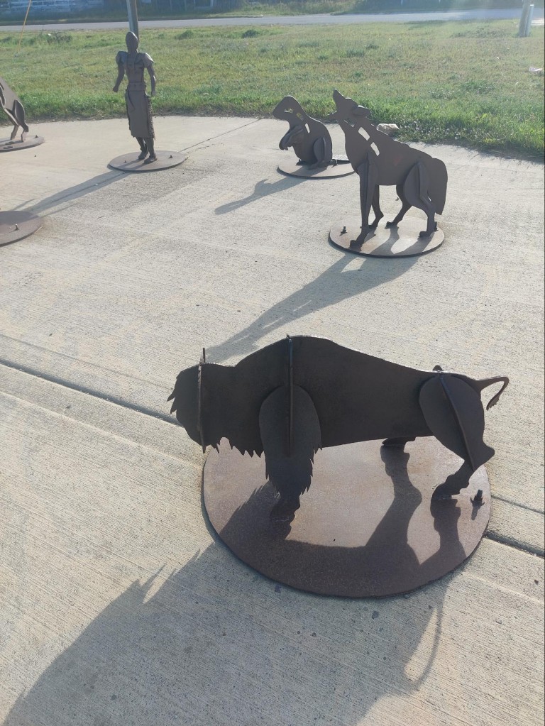
“In this town, we don’t tan — we rust.”
Machu Picchu: the town and the archaeological site.
We arrived at the town of Machu Picchu (officially called Aguas Calientes) in the late afternoon. We were really tired because the day had been arduous and challenging.
I can't say I liked the town, especially at first. Gray skies, a muddy, unpaved road toward Machu Picchu (the town itself was paved, after all), and a drizzle... Later, the rain stopped, but the sky remained gray.
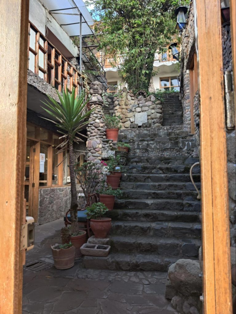
But the hotel was quite comfortable, and there was hot water (true to the town's name: Aguas Calientes - Hot Waters / Hot Springs), internet, and the electricity never went out during the two days we spent there. Pure luxury!
Of course, our main goal was to visit Machu Picchu. That's not easy.
Firstly, the number of tickets is limited. If you want to have a choice, you need to buy tickets several months in advance. I bought them five months in advance. You need to buy them on official website.
Secondly, you can't just buy a ticket "to Machu Picchu." There are several routes, and you need to buy tickets for a specific route.
As a result, I bought tickets for two routes:
- The most popular route is #2
- Route #3 with the addition of Huayna Picchu.
Together, these routes allow you to walk around the entire Machu Picchu, and the mountain is an added bonus.
The internet suggested spreading the two visits over two different days to increase the chance of having at least one in good weather, but I looked at the travel time and decided I didn't want to do it twice. So I scheduled the visits back-to-back: at 7 a.m. to catch the morning light 😀, and at 9 a.m. I must say, this decision turned out to be a very good one: on the day of our visit, the weather cleared up just in time for the second route, but the next day it drizzled from morning until 2 p.m., when we left for home.
There are two different ways to get to the place:
- Most people buy bus tickets. Buses run regularly, cost $12 each way, and the ride takes about an hour, including waiting in line.
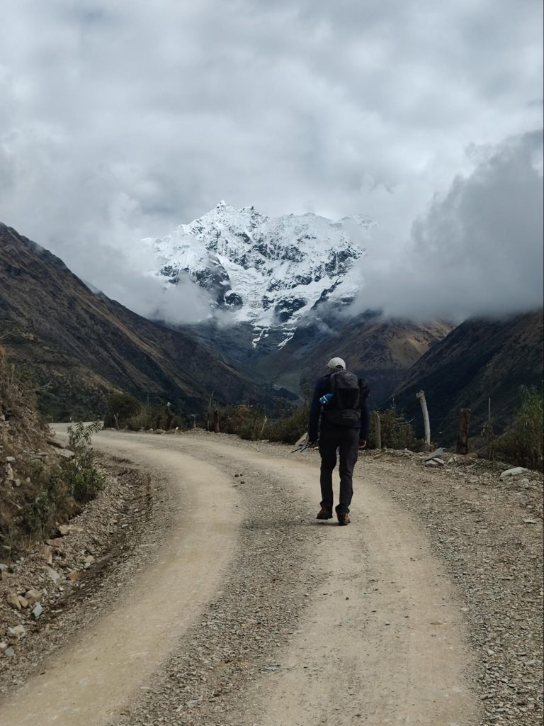
- Some especially brave ones choose to walk. One end takes at least an hour and a half, and the walk to Machu Picchu is quite difficult, as it involves a long, steep climb up stairs.
In the end, we chose the combined option—take the bus there and walk back. So I went to the bus station to buy bus tickets. Then I came back and went again 😣—it turns out these wonderful people need a passport to sell tickets.
I even understand why they need a passport: tickets are cheaper for Peruvians, and a passport is needed to identify who is Peruvian and who is not. But I was already buying the most expensive ticket for the "gringos." Apparently, they thought I was actually Peruvian (well, yeah, you can't tell me apart from a Peruvian) and was maliciously buying the most expensive tickets. And a photo of my passports on my phone didn't satisfy them—only originals, only hardcore.
Of course, I can't be bothered to walk to the hotel and back—the town is small, and the walk takes ten minutes at most. But this incident, I think, is typical for Peru: they love senseless controls.
For example, there were several checkpoints along the trail where you had to write down your last name, country, age, and passport number. At first, I thought they were trying to extort money from tourists, but they do it completely for free. And no one checks the information: I had the idea of registering in Russian as Emperor Maximilian I. I was too lazy to look up passport numbers, so I simply didn't write them down.
At hotels, too, they scan your passports when you check in, and then you have to fill in your last name, first name, age, and passport number on a form. Heck, you have a scan—so just fill it in yourself if you need to! But no, that's how it's supposed to be.
I wonder if this passion for control stems from the traditions of the Inca Empire, where control was absolutely total: North Korea, compared to that empire, would be a den of anarchy. Perhaps it was precisely thanks to this total control that 168 (in words: one hundred and sixty-eight) Spaniards took over a country with a population of 10 million in just a few years: all they had to do was seize the center and start issuing new commands, and the population, accustomed to obeying, didn't even utter a word.
But I digress. I did buy tickets for the second trip, so we got our tickets, raincoats, and passports ready and went to bed.
We woke up early this morning (we're always early on the trail, so it wasn't hard), and by 5:30 we were already having breakfast. Breakfast at the hotel, by the way, starts at 4:30—everything here is geared towards tourists visiting Machu Picchu.
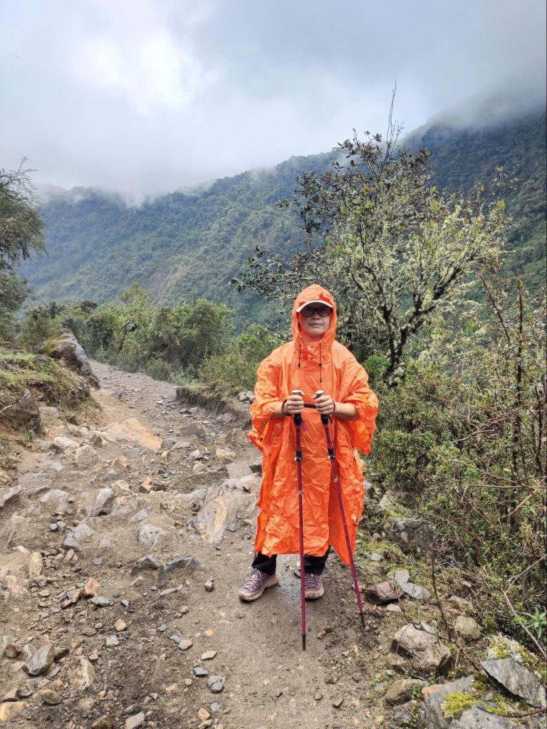
Around 6:00 a.m., we went to the bus stop. A light drizzle was falling, and the line was long. The mood was so-so: neither one nor the other inspires enthusiasm. But I can't help but notice the resourcefulness of the Peruvians: street vendors stood in the doorways between the buildings near the line, offering raincoats. We don't need them—we have our own.
The line moves pretty quickly: a bus pulls up, a few people quickly board, and we move forward. Soon we're on the bus, taking us up a steep, serpentine road.
By the time we got off the bus, the rain had almost stopped. However, the golden morning light was gone—everything was obscured by fog. This, however, only added to the mystique of this amazing place.
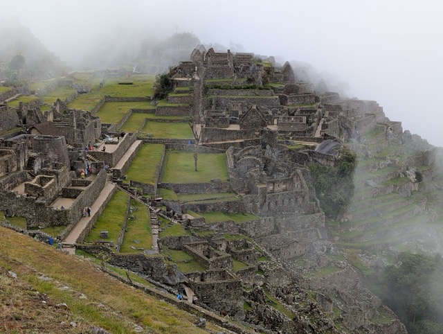


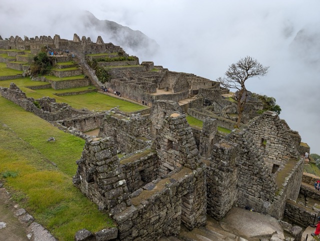

It's hard to talk about Machu Picchu because you just need to see it bearded joke. The scale of the structures and the way they fit into the surrounding landscape make a great impression.
I can't help but mention the topic of polygonal masonry that occupied me in Peru. The fact is that here, as in many other places, two completely different stone laying technologies are used: the extremely high-tech polygonal masonry, where each stone (and these stones can be VERY large: in Ollantaytambo, for example, some stones weigh hundreds of tons) are processed in such a way that the gap between one and the next is about a millimeter. How a Stone Age civilization (they had bronze and copper tools, but in extremely small quantities and sizes) could fashion complex three-dimensional objects from solid andesite (and in Ollantaytambo, granite) blocks with such precision (they weigh from hundreds of kilograms to hundreds of tons—trying and adjusting them is impossible; everything must be done at once and then put in place) remains a mystery. It also remains a mystery why they had already lost this technology by the time the Spanish arrived.

There is also a much rougher masonry, where more or less suitable stones are connected with mortar:

The official theory is that the Incas used polygonal masonry for particularly important structures, and rough mortar for simpler ones. But this doesn't explain why one wall might begin with polygonal masonry and then continue with rough mortar:

Before my trip to Peru, I listened to a lot of YouTube shows (I actually listened to them while jogging), including some crazy theories from a Russian group of alternative-themed researchers who believed that polygonal masonry was the remains of an ancient high-tech civilization, while the rougher mortar-based masonry was the work of the Incas, who, as best they could, restored and completed the dilapidated ancient structures they inherited.
Despite its absurdity, this theory explains well the inconsistencies in buildings with combined masonry, in which the mortar masonry is ALWAYS higher (and therefore later) than the polygonal masonry.
However, I will not insist on this theory - it is too non-trivial and changes all existing ideas about the history of the development of world civilizations.
Bonus: Huayna Picchu Mountain
Our second route included a visit to the mountain Huayna Picchu. Before you reach the top of the mountain, there's another checkpoint where you need to write down your name, passport number, departure time, and something else.”Socialism is, first of all, accounting.” (V. Lenin). Although, in this case, keeping records is justified: it's easy to fall over on the mountain, so using the logbook (upon returning, you need to find your entry and check in) you can determine who went there and never returned.
Not everyone climbs this mountain because the mountain is high and the trail is steep:

But we did:

And we didn't regret it. Besides the mountain itself being interesting (and filling us with a sense of accomplishment), it offers excellent views of Machu Picchu. Just in time, the weather cleared up briefly, and the sun even appeared at times.

At the very top of the mountain there is a small platform where you can sit and take photos of the surrounding fog:

And then we went down the steep and slippery steps.
Although only a small percentage of the total number of visitors climb the mountain, there are still quite a few, and among them are some truly colorful characters. For example, at the summit, Natasha encouraged a bald, older man—he was flushed and steaming; he must have been struggling. Later, on the descent, this man overtook us as if we were standing still: he practically ran down the steep, slippery steps, easy and effortlessly. It seems he's significantly more physically fit than we are, and the steam coming off him was because he was also running up the mountain.
Or this colorful group of either Japanese or Koreans:

Overall, the climb up the mountain left me with no less of an impression than Machu Picchu itself. If you go there, I highly recommend it.
End of the day.
After Machu Picchu, we walked for a long time down steep old stairs from the mountain. At the very bottom there is Machu Picchu Museum, entrance to which is also covered by our ticket. It's not crowded because most tourists are returning on buses and don't notice it.
Well, then we had a rest, sat in the rain in hot spring, took a shower, and went to a nice restaurant to celebrate our wedding anniversary: