Categories
Hikes Trips

Самоизоляция или как мы ходили в поход во время ковида.

Самоизоляция или как мы ходили в поход во время ковида.

Это случилось в те странные, тревожные  времена, когда по миру расползся, как спрут, ковид и все сидели дома. Ходили  в масках только в магазин за продуктами.  Статистика говорит, что из-за  пандемии  многие разводились или впадали в депрессию. Нашей семьи это, к счастью, не коснулось.  Мы нашли интересные места для самоизоляции: весной поездка по Blue ridge parkway во Флориду и летний поход в Колорадо по национальному лесу Arapahoe.

Это была отличная идея!

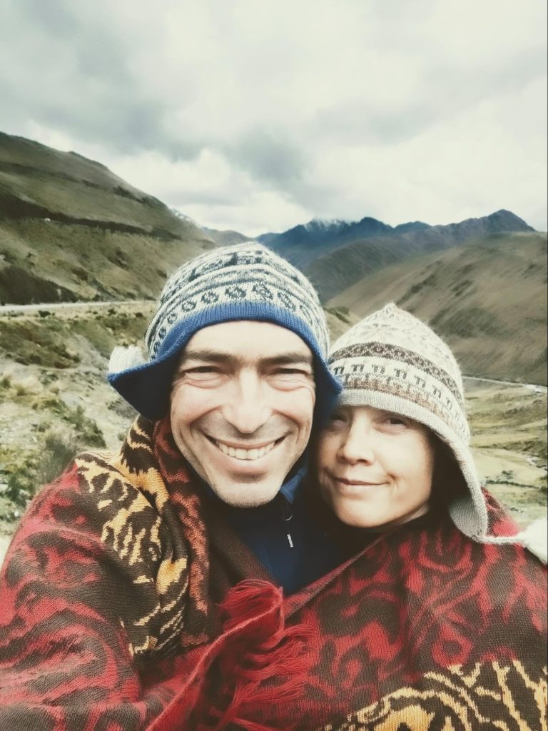
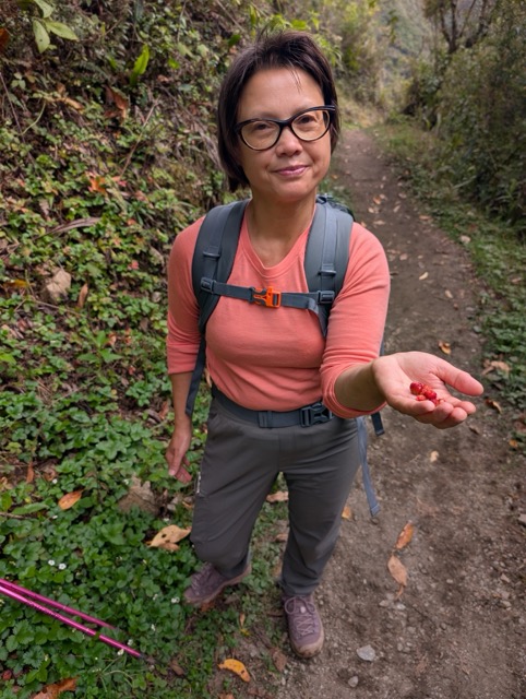
К походу готовились тщательно: были куплены теплые спальники, новые ботинки Денису, надувной коврик мне, особая походная еда. Денис выверял карты, я составляла список продуктов. А дети решили остаться дома. Это какой то новый этап в жизни нашей семьи; большие дети остались работать и присматривать за хозяйством, а родители уехали активно отдыхать. 

С друзьями из Колорадо мы договаривались зумически. Нужно было понять, как сходить совместно в поход, соблюдая социальную дистанцию и получить от этого удовольствие. Обсудив важные моменты, мы договорились о дне X и месте предполагаемой встречи.

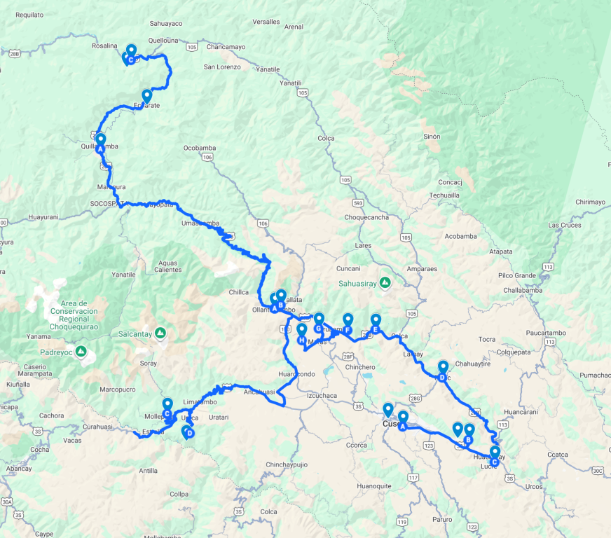
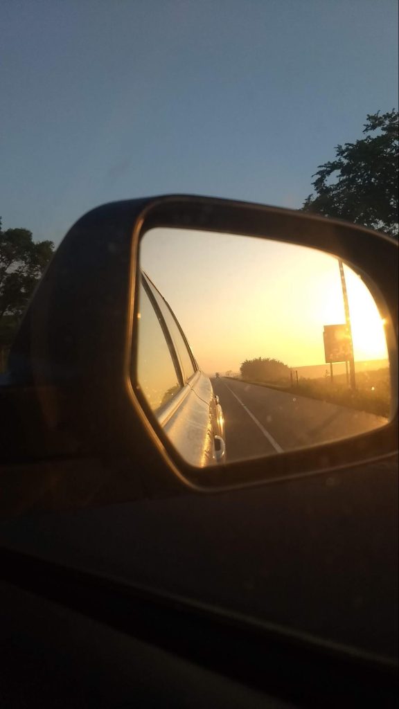
 Было решено ехать на машине, во избежание нежелательных контактов в условиях covida. Как опытные » дальнобойщики», мы уже знаем как лучше скоротать многочасовую езду.

Во- первых, меняться каждые два часа, во-вторых, поставить интересную аудиокнигу, чтобы хватило надолго, в- третьих, останавливаться не слишком часто, делая хорошую разминку. Так было и в этот раз. Скучная и монотонная дорога по Великим равнинам   уже не казалась такой нудной. Там, где раньше паслись стада бизонов, теперь тянутся бескрайние кукурузные поля. Индиана, Айова, Небраска, Вайоминг. Где-то  посередине — полноводная река Миссисипи.  По заведенной моей мамой традиции, в такую дорогу пекутся чебуреки. Проблема с остановкой на ночь была решена неожиданным образом. Денис вспомнил, что заднее сиденье машины складывается и получается вполне себе кровать . На пути следования обнаружились стоянки, прямо среди полей, где можно остановиться и поспать прямо в машине  или поставить рядом палатку.

Для путешествия летом в условиях пандемии это, пожалуй, самый подходящий вариант .  Обсуждая нынешнюю ситуацию, мы с Денисом сошлись во мнении, что поход по горам — самый лучший способ самоизоляции.

Три дня с друзьями

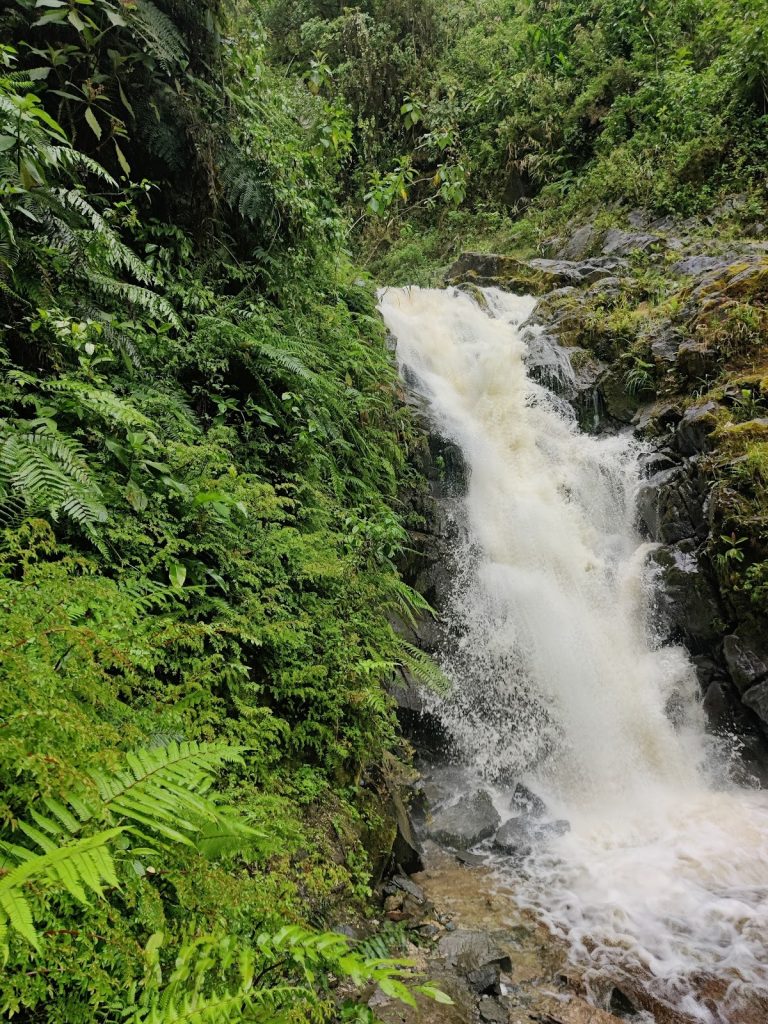
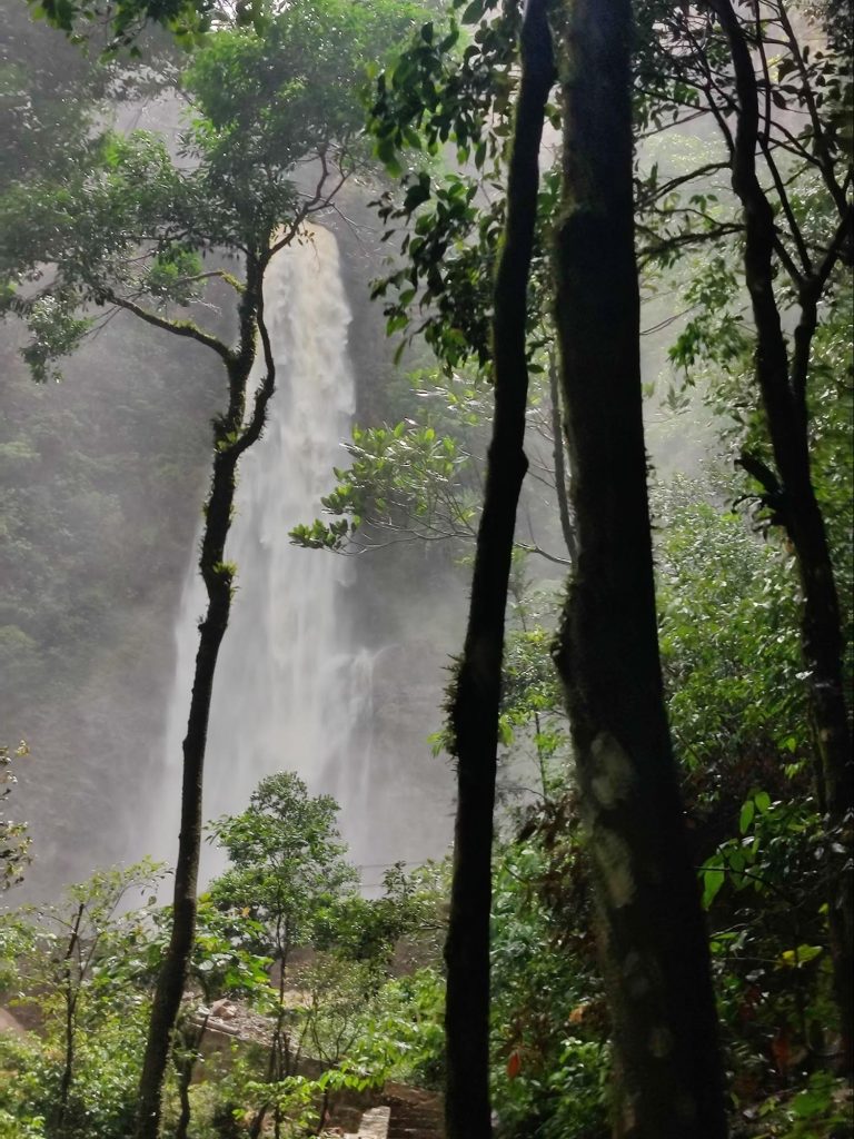
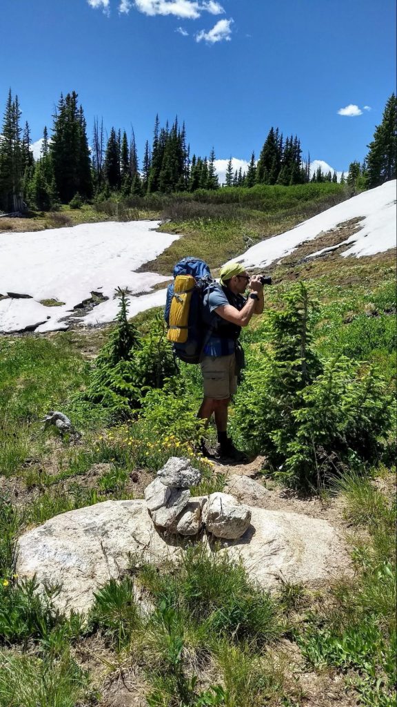
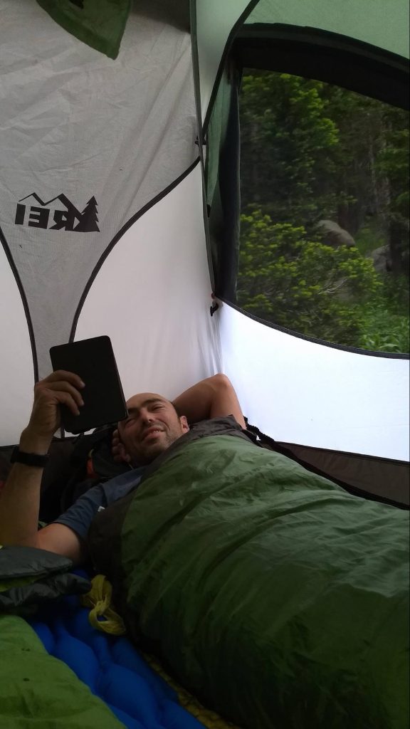
В ожидании друзей мы успели  разбить лагерь и сбегать по короткой тропе к Бобровому водопаду. После грозы воздух был свеж, хорошо пахло мокрой хвоей. Сначала шлось легко, но  потом, даже при небольшом подъеме дыхание стало сбиваться и заболела голова. Это началась акклиматизация нашего организма к горной местности. Бобровый водопад был прекрасен, но в какой то момент мы сбились с тропы, и, немного поплутав, вышли к лагерю лютеранской общины. Из домика вышел дюжий брат-лютеранин и объяснил, куда нам нужно идти, а чуть поодаль из леса вышел лось. Мы  спросили : «Это ваше домашнее животное?» Тут оба ухмыльнулись  в бороду и кивнули.

Ч — овы приехали на следующее утро, в десять, как и договаривались.

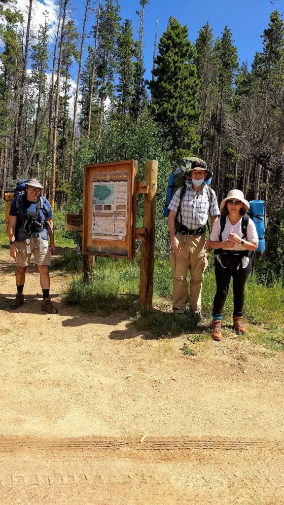
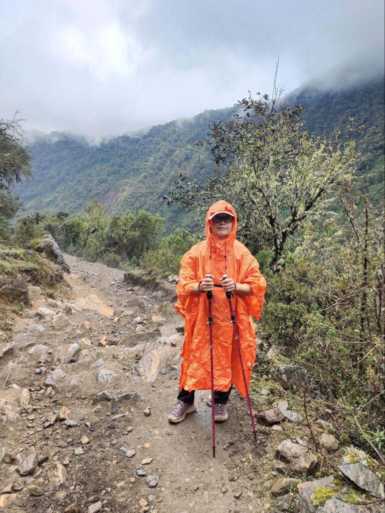
Теперь нас стало четверо.  Мы встали на тропу   по направлению к озеру Browns.  Погода, облачная и жаркая  сначала, стала портиться, пошел мелкий дождик. Пришлось достать накидки от дождя.В накидках все стали похожи на одногорбых верблюдов самых жизнерадостных цветов: оранжевый, синий, 

зелёный и жёлтый. Так, под дождиком, пришлось пообедать в районе резервуара Команчи.

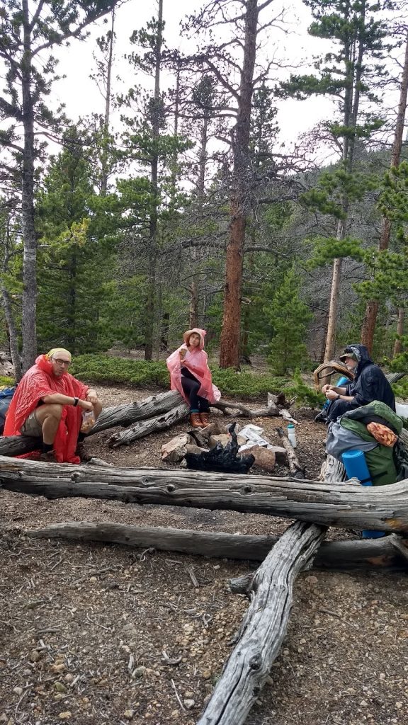
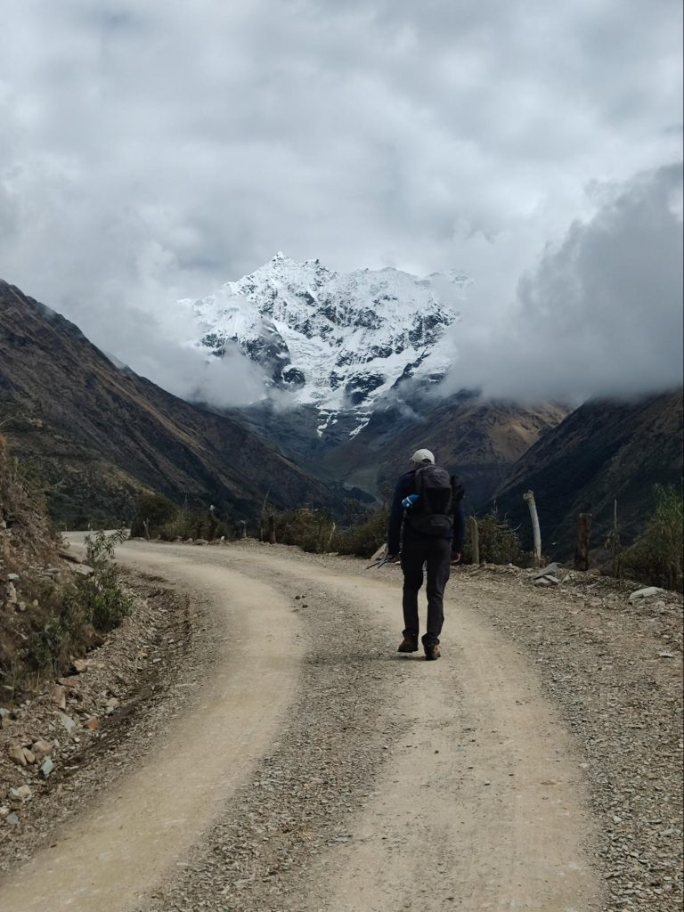
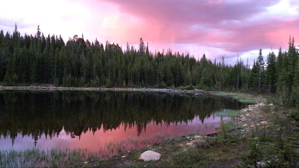
После обеда тропа стала круто забирать вверх. С набором высоты у меня опять разболелась голова, видимо организм ещё ещё не привык к разреженному горному воздуху. Похолодало. И в придачу ко всем напастям усилился дождь. Тем не менее медленно, но верно поднимались мы все выше. В какой то момент стали появляться снежники, а погода совсем сошла с ума: началась гроза, посыпался мелкий град с дождем. Я старалась гнать неприятные мысли о том, что в конце тропы, у озера, нельзя будет развести костер, погреться, просушить обувь и штаны. Здесь можно пользоваться только газовыми горелками. Время от времени налетали шквалистые порывы холодного ветра. Крутая тропа стала скользкой. Иногда приходилось идти через снежники, лежащие прямо на нашем пути. Верилось с трудом, что это июль, разгар лета. Но вот тучи стали рассеиваться, ветер успокоился и мы наконец добрались до места нашей стоянки около озера Browns .  Здесь усталые путники  разбили лагерь, приготовили ужин. Снова подумалось: как жаль, что нельзя развести костра, было бы теплее и веселее. А ужин был изысканный — бефстроганов с лапшой и грибами, сухие ржаные хлебцы с паштетом, чай с коньяком, конфетами и орешками.  Честное слово, мы все это заслужили!  Горячая еда настолько всех согрела, что мы отважились искупаться в высокогорном озере с ледяной водой. Искупаться — это значит броситься в воду на несколько секунд и сразу выскочить, энергично растираясь при этом полотенцем. В конце дня мы были вознаграждены роскошным розовым и лиловым закатом, что живописно отражался в озёрной воде.


Все, теперь спать, все устали, нужно набраться сил к завтрашнему дню. 

Следующий день был ясным и теплым. Как будто не было ни снега, ни холодного ветра вчера, как будто после ноября сразу наступил  улыбчивый апрель. И тропа, по которой мы шли называлась » Цветочной». Она сполна оправдывала свое название — розовые, жёлтые, фиолетовые и ярко красные цветы окружали нас со всех сторон на фоне сочной зелени.

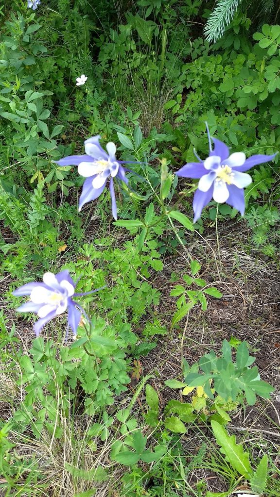
Из знакомых я увидела медуницу и фиалку, гораздо больше было незнакомых мне цветов. Чистые горные ручьи иногда пересекали тропу и тогда ещё больше казалось что мы вернулись в весну . 

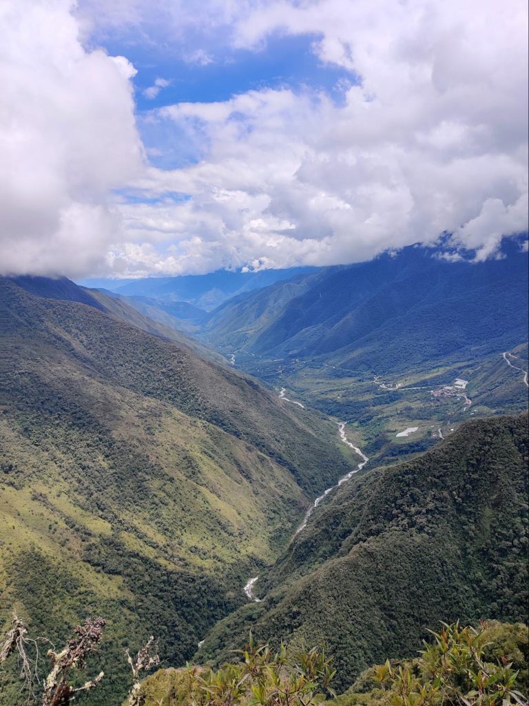
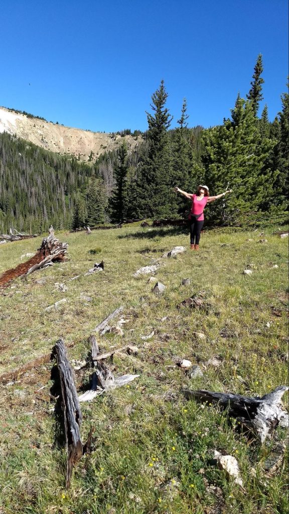
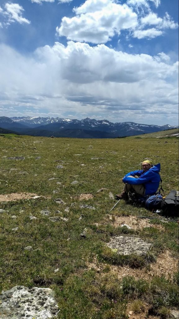
Мы шли по  склону невысокого хребта выше линии леса.  Кругом, куда ни глянь, открывалась чудесная панорама гор.  Этот день разительно отличался от предыдущего: и погода,  и наличие прекрасных видов. А главное — плавный, пологий спуск вниз. Оттого наше путешествие больше походило на приятную прогулку, нежели на поход.


К обеду мы пришли к месту, где когда-то давно разбился военный самолёт. Обломки самолёта были разбросаны в радиусе ста метров. Некоторые из экипажа погибли. Жутковатое зрелище. 

К вечеру мы добрались до стоянки у реки(?)

На ужин у нас  в этот раз итальянская кухня — суп миннестроне с банкой тушёнки. Очень наваристый получился супчик. Приятно посидеть и поболтать с друзьями после целого дня  ходьбы. Хорошо засыпать потом под звуки текущих вод. Хорошо.

Наутро выяснилось, что В. сильно стёр ноги.   Как назло,  большую часть пути пришлось идти круто вниз по каменистой дороге. Бедный В. совсем сбил пальцы ног. Мы предложили ему палки для ходьбы, чтобы отчасти перенести вес с ног на руки. Это немного помогло, но ноги все равно были в плачевном состоянии. Темп наш очень замедлился. Утешала мысль, что последняя треть пути  более или менее ровная и несложная. Стали чаще отдыхать. На одном из привалов видели несколько колибри. В какой то момент мы вышли к парковке и после обеда распрощались с Ч — выми. Они поехали домой отдыхать, а нам предстояло одолеть два перевала на следующий день. 

Самый трудный день

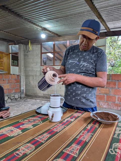
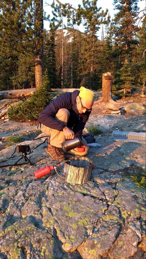
Утро в горах восьмого июля выдалось особенно свежим. Изо рта шел пар — градусов пять, не больше. И мы ещё раз порадовались теплым спальникам и горячему кофе. Кофейник в поход — это, конечно, пижонство, но свежая, бодрящая чашка кофе — маленькая радость каждого утра. Утренний холод подстегивал нас; на сборы и завтрак ушло совсем мало времени. А может быть  к этому времени мы уже привыкли к походной рутине. Уже в 7:30 мы были готовы.

За водохранилищем Команчи было решено оставить рюкзаки за камушками, коих было в великом множестве разбросано вокруг,  и сбегать по-быстрому на одноименное озеро. 

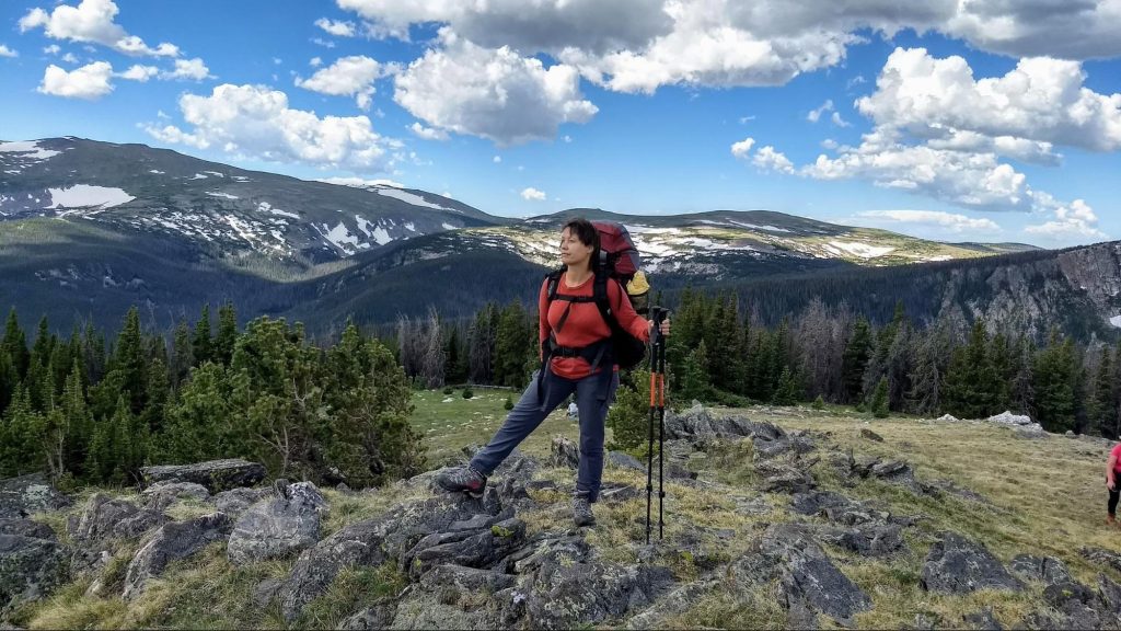
Оно оказалось небольшим, круглым, как тарелочка, с кристально чистой водой и живописно заросшими травой берегами. Уже через час мы вернулись к рюкзакам .  Теперь нужно дойти до перекрестка и повернуть налево,  к Бобровой тропе. Она сразу круто повела вверх. Несколько переходов по 50 минут мы набирали высоту. Пока тропа шла лесом, было довольно жарко. Когда же мы перевалили за три тысячи метров, все изменилось. Стало прохладно. Лес кончился, склоны были покрыты кустарником и весенними цветами.

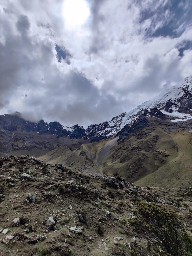
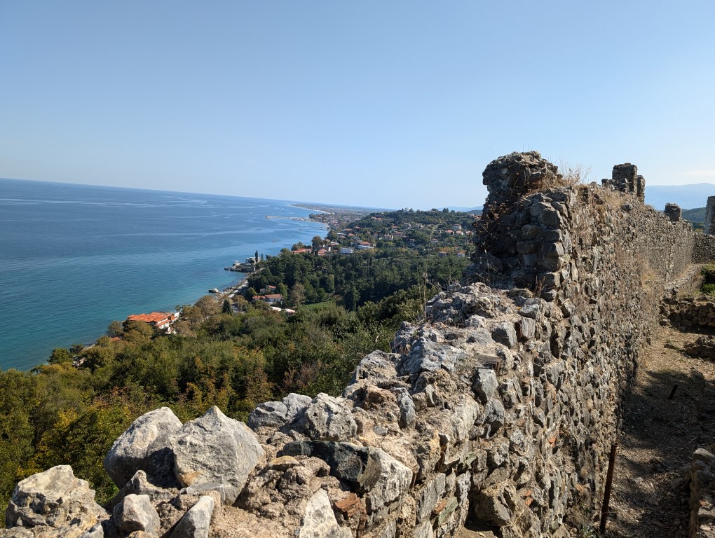
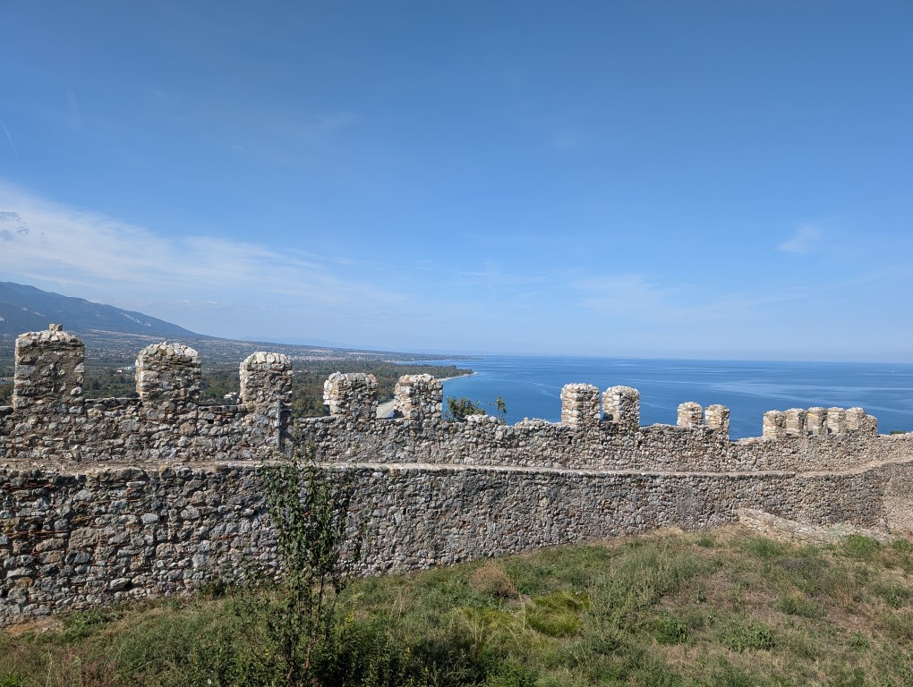
Кое-где, как большие грязноватые перины,  лежали большие участки снега. Некоторые из них были прямо на тропе, приходилось обходить их стороной. Из-за этого мы иногда сбивались с пути. Надо заметить, что  тропа  на высоте выглядит как некоторое, никем не утоптанное пространство, от одного тура до другого. Туры — пирамидки из камней — на фоне таких же камней  или низкого кустарника не всегда видны. В этом случае  сверялись  по навигатору, вертели головой по сторонам, искали ориентиры — и в конце концов находили то, что искали.  Странно, что перевалы здесь не носят названий, это просто точка с обозначением перепада высот. Вид с перевала был великолепный!

Невероятной красоты панорама открывалась со всех сторон.  Создавалось ощущение нереальности происходящего. Но надо двигаться дальше. Тропа ведёт вниз, опять к границе леса. Там мы находим стоянку с черепами животных и очагом, выложенным из  плоских камней. Уже в воображении рисовались картины камлающих шаманов  в трансе с бубнами и плясками. Но эзотерические картинки быстро стёрла одна находка — маленькая крышечка с надписью » Моча лосихи».

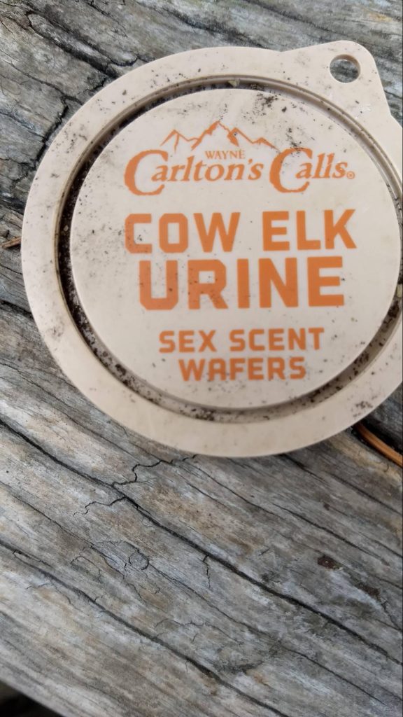
Стало ясно( не сразу, конечно), что это стоянка охотников. Тут то  мы снова сбились с пути. Нужно было пересечь быстрый горный ручей, но никакой переправы не было видно. В этом месте события стали развиваться стремительно: мы  успели отдохнуть, пообедать, поругаться, искупать в ручье фотоаппарат и не только, обсохнуть на солнышке, найти тропу и снова помириться. Снова начался подъем наверх. На открытом склоне все время дул ветер.  Он был не то чтобы холодный, но без куртки было бы некомфортно. Кроме того, лицо и руки нужно было время от времени спасать   от жёсткого горного солнца. А природа  здесь, на высоте, вела себя совершенно по-весеннему: таял снег, от него текли многочисленные ручьи, расцветали  неприметные цветочки, насекомые и маленькие пичужки суетились около них. Теперь нужно немного отклониться от маршрута и сбегать налегке, без рюкзаков, к озеру Зеркальному. Это третье озеро в нашем путешествии. Оно действительно похоже на маленькое круглое зеркальце.

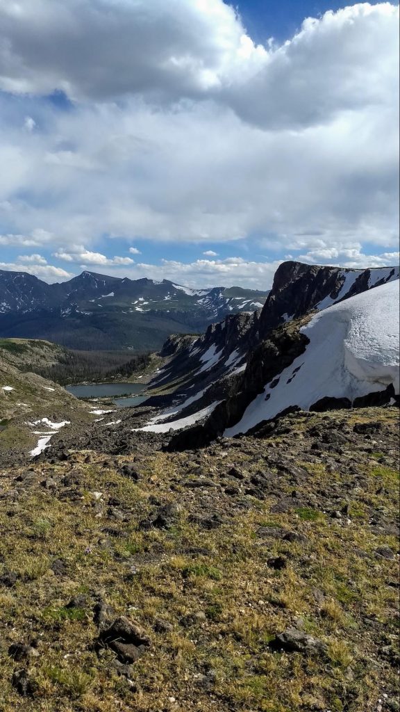
Кроме нас в него смотрелся весьма опасный снежный карниз. Казалось, он вот-вот обрушится и разобьёт зеркало вдребезги.

  А дело шло к вечеру и мы порядком устали. Но нужно было взять ещё один перевал. Я пожалела, что мало поела за обедом.  На обед у нас были копчёные колбаски, орехи, сухофрукты, финские корочки и бисквиты-сухарики. Пришлось подкрепиться энергетическим батончиком.Теперь тропа шла по каменистому плоскогорью, поросшему кое-где низкими кустами типа можжевельника. Денис предлагал разбить лагерь на высоте, но у меня начала болеть голова. Наверное акклиматизация не прошла до конца, а может быть сказывалась усталость, хотелось вниз, к лесу. Странные цветы стали попадаться нам на пути. Мы прозвали их «антиподсолнухами». При общем сходстве, они  были меньше размером и отворачивали свои лица от солнца.

В какой то момент мы пересекли линию леса и вышли на явную тропу вниз. Здесь надо сказать, что тропы в лесах Команчи тщательно расчищаются егерями. По обе стороны от тропы такие непроходимые дебри, что не то что палатку поставить — пописать сходить невозможно. А место для стоянки нужно было срочно найти: силы были на исходе, ноги стали деревянными, солнце садилось и Денис  явно начинал нервничать. И вдруг — удача! Около горного ручья обнаружился маленький пятачок для палатки и костра. Площадка, наверно, была расчищена как раз для таких припозднившихся, как мы, путешественников. На ужин —  бефстроганов с картошкой из саморазогревающихся пакетов. Несмотря на усталость, мне было любопытно их опробовать. Заливаешь воду в отдельное отверстие в пакете и ждёшь. Никаких примусов, никаких костров. В пакете начинается химическая реакция с выделением тепла(я думаю, происходит гашение извести). Через 9 минут еда готова. Денис пробурчал, что это все баловство, съел свою порцию в один присест и заявил, что ему не понравилось. Ну, извините, у нас тут не ресторан с мишленовскими звёздами… Спать в этот вечер мы легли удивительно рано, ещё и десяти не было. Отключились мгновенно. Да и кто не заснёт после целого дня пути под  колыбельную горного ручья?

День без приключений

Следующим утром стало ясно, что  пройдено гораздо больше, чем предполагалось ранее. Кто бы мог подумать, что мы такие мощные ребята. Решили действовать по плану Б. Вернулись к машине, переоделись, пополнили запасы еды, выложили мусор, который тащили с собой. Мусором оказались те саморазогревающиеся пакеты, насыщенные водой и оттого тяжёлые. Пожалуй, больше не буду их брать.

Потом мы пошли по другому маршруту. Планировали идти полдня до водопада и оставшееся время отдыхать.

Так и сделали. Место для стоянки было неформальным. Егеря с  нас могли бы содрать штраф. Но мы на свой страх и риск разбили лагерь там, потому, что соблазн был велик, уж очень красивое место. 

Самый красивый день

Надо напомнить, что еще накануне мы встали у водопада, а потом полдня предавались лени и прочим медитациям. Спать легли рано и, убаюканные шумом бегущей воды, быстро заснули. Было решено встать в 5:30 утра и пойти встречать рассвет . Местечко присмотрели ещё накануне — большая каменная нерукотворная платформа . Это удивительно — найти среди непроходимого леса такое удобное открытое пространство.  Встали необыкновенно рано, ведь в начале июля солнце  не спит долго.  Только неисправимые романтики способны на такой подвиг. Было уже достаточно светло,  крутая  тропа хорошо просматривалась в предрассветных сумерках.  Денис взял с собой примус и кофеварку, чтобы встречать новый день горячим кофе.

Розовая полоса на горизонте разгоралась и ширилась. Менялись оттенки, добавился густой оранжевый и красный . И вот над горизонтом показался край солнца. Хотелось, чтобы Денис остановился и перестал разрываться между фотоаппаратом и кофеваркой, просто бы стоял и  смотрел. Но с другой стороны было ясно, что кто то же должен запечатлеть всю эту красоту.  Неторопливо  выкатывалось из-за гор солнце. Вершины были уже залиты розовым светом, но подножия  оставались еще темными, укрытыми туманом.

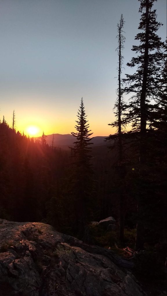
Мы стояли с кру’жками горячего кофе в руках и встречали рассвет. Оранжевый свет перетёк в желтый, желтый рассеялся и побледнел. Так начался новый день. 

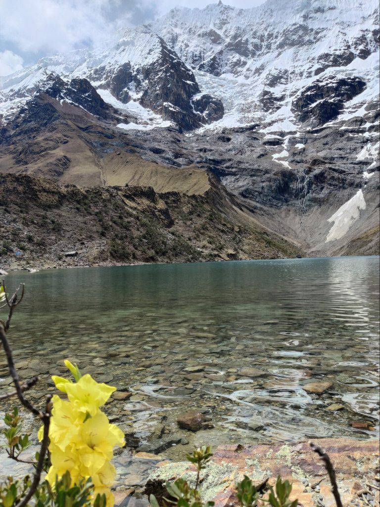
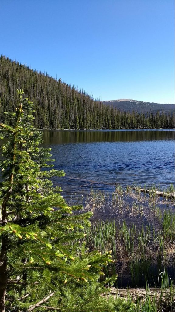
Мы спустились обратно к стоянке у водопада, позавтракали, уложили и спрятали за камнями рюкзаки. Теперь снова вверх. Всего одну милю пришлось идти, но что это была за миля! Тропа стала чрезвычайно замысловатой: приходилось пролезать между большими камнями, перебираться через камни, обходить камни стороной.  На тропе выставлены туры, чтобы не заблудиться  в каменных развалах, не потерять тропу. А над головой уже сияло синее небо и уцелевшие в июльской жаре снежные шапки. Скоро снежники стали попадаться у наших ног. Дыхание участилось, чувствовалась высота. Хорошо, что за неделю мы успели привыкнуть и подъем не казался таким трудным. Удивительно, как с набором высоты, природа приобретает все более весенний вид: свежая, зелёная трава, одуванчики и медуница, ледяные ручьи, вытекающие из под снежников. Это большое везение — видеть, как рождается горный ручей.  Там, куда мы шли, образовалась между гор чаша. В нее стекали все растаявшие снега с окрестных вершин — и получилось идеально круглое озеро.

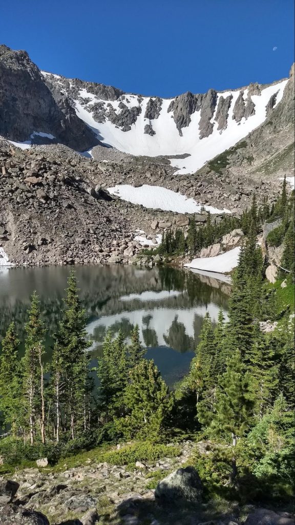
Наверное за это совершенство формы его и назвали Cirque lake. Только вместо арены кристально чистая вода. А мы, к счастью, были единственными зрителями в этом цирке. Чуть дальше, за развалами больших камней, обнаружилось ещё одно озеро — Emmaline. Оно не имело такой идеальной формы, как первое, но было по-своему живописно. Зубчатые  вершины близких гор, похожих на  башни замка,  отражались в нем.

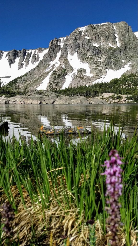
Большие валуны живописно лежали по берегам, покрытым яркими альпийскими цветочками. С другой стороны озера открывался изумительный по красоте вид .  Плавные линии и оттенки синего: голубое небо, синеющие горы,  дымчатые дали. Далеко внизу, в долине, можно было увидеть маленькие домики с красными крышами, наверняка чьи- нибудь лесные дачи. Подумалось — в одном из таких я бы хотела жить.

Это здорово — встать пораньше, встретить рассвет и подняться самыми первыми к горным озёрам! Мы уже спускались вниз, когда увидели, как группы туристов, одна за другой поднимаются туда, где мы только что побывали наедине с природой. И как хорошо, что никого, кроме нас там не было. 

    Наверное, когда-нибудь в будущем, я уеду жить в такое место, где есть горы. Наши друзья, что переехали недавно в Колорадо, зовут, и уже присмотрели дом по соседству. Но для  этого ещё не настало время.

Categories
Hikes Trips

По Перу на автомобиле

Почти во всех наших поездках мы берем в аренду автомобиль — за пределами больших городов, это обычно лучший способ посмотреть новую страну. Перу не было исключением из этого правила, хотя, перед поездкой, я читал много пугающих вещей про особенности вождения тут. 

Машина (Toyota Raise в очень базовой комплектации) обошлась нам дороже, чем машина подобного класса у нас в Америке, но это было ожидаемо. На удивление, она даже оказалась с автоматом — настоящая роскошь в стране третьего мира. На крутых горных серпантинах автомат, конечно, удобнее, хотя и ручная коробка у меня проблем не вызывает.

Я специально брал машину в классе “маленький SUV”, потому что ничего хорошего от местных дорог не ожидал (и не зря). Но от SUV у нашей машинки был только внешний вид и чуть более высокий, чем на стандартном седане, дорожный просвет: передний привод на грунтовке не тянул даже на небольшом подъеме, в чем мы сумели убедиться уже через 20 минут после выезда из рентовки: Google Map повел нас к первой точке (археологическому сайту) по какой-то совсем убитой грунтовке, мы доехали до слишком узкого моста, а при попытке разворота машина не смогла заехать немного в горку и тупо села. Хорошо, что мимо проходил какой-то местный пастух, Наташа села за руль, а мы с ним машину вытолкали. За труды пастух получил честно заслуженные 20 солов (около 4.5 долларов), а я приобрел ценный опыт и больше уже не застревал.

На машине мы проехали 9 дней и чуть больше 1000 километров — не слишком много, но, с учетом местных дорог, вполне достаточно. Про перуанских водителей писали, что на дорогах они ведут себя очень агрессивно и непредсказуемо. Возможно, это имеет место быть в Лиме (ВСЕ, кто писал про езду в Перу, заявляли, что в Лиме водить абсолютно нет смысла, и я им охотно верю), но мы ездили в районе Куско и вокруг, и там особой агрессии я не увидел. Да, стиль езды в Перу отличается от привычного нам американского и европейского, но это именно стиль, который можно и нужно освоить, чтобы не попадать в опасные ситуации. И стиль, во многом, вызван местными условиями: например, тут принято сигналить перед закрытым поворотом. В целом, я могу сказать, что ездить по Перу трудно, но вполне возможно.

Про дороги хочется сказать отдельно. Надо признать, что дороги явно становятся лучше — во многих местах мы видели дорожные работы или мы ехали по совсем свежему асфальту. Такое чувство, что Перу сейчас активно работает над улучшением доступа к своим археологическим сайтам, чтобы Мачу Пикчу не был единственным туристическим местом.

Нельзя доверяться Google Maps — несколько раз она заводила нас на ужасные грунтовки, по которым надо ездить на настоящих джипах, а не той городской машинке, что дали нам в прокате. При этом дважды мы потом выясняли, что рядом была приличная новая асфальтовая дорога, просто чуть длиннее. Возможно, дороги были слишком новыми? 

Также Google Maps несколько раз пыталась направить нас по односторонним улицам против движения. Хорошо, что мы быстро поняли, как там обозначено направление движения (ни разу не по международным стандартам), и на такие разводки не попадались.

 Из положительного можно отметить, что ни разу на перуанских дорогах не возникало сонливости за рулем. Наверное, потому, что одна из двух полос в любой момент может оказаться перекрыта упавшими с горы камнями, или же надо будет переезжать небольшой поток, текущий с горы прямо по асфальту, или же сбрасывать скорость перед немаркированными “лежачими полицейскими” (topes по-испански) — мы видели такое в Мексике. Особенность латиноамериканских topes в том, что они крутые и их надо проезжать ОЧЕНЬ медленно, намного медленнее чем у нас в США. 

Несколько раз я читал на форумах про проблемы с перуанской дорожной полицией. Я даже заранее сделал за 20 долларов так называемую “Международную Лицензию” (International Driving Permit), хотя и знал, что она в Перу не нужна при наличии американских прав: где-то я вычитал, что её отсутствие послужило поводом для вымогания взятки. Но в единственный раз, когда нас остановили для проверки документов, то её никто не спросил: посмотрели мои права, документы на машину и пожелали счастливого пути. 

В общем, это был интересный и полезный опыт. Все прошло хорошо, за исключением маленькой неглубокой царапины (не до железа даже) на борту машины. Не знаю даже, где я её приобрел: я про неё узнал только, когда сдавал машину обратно. Мне насчитали 100 с чем-то долларов, которые моя кредитка мгновенно вернула — у меня полное страховое покрытие.

Back to Contents

Categories
Hikes Trips

Через перевал в тропики

Сейчас девять утра и тропический ливень в Куиллабамбе. Окна открыты и я слышала сквозь сон, как полночи лил сильный дождь и  где-то громыхал гром. На этот раз погода не захотела кооперироваться с нашими планами, поэтому приходится сидеть в номере гостиницы и ждать когда закончится ливень. 

Накануне мы приехали в этот  тропический город через живописный перевал Абра Малага.

Климатические зоны промелькнули перед лобовым стеклом машины, как в кино. Если в Оянтатамбе было + 15 на момент отъезда, то на самой высокой точке перевала только +6. А когда по крутым серпантинам мы спустились вниз, по другую сторону гор, там оказалось +34. 

Кроме непривычной для нас осенней (или весенней, если учитывать, что в Перу весна) температуры, ничего выдающегося в городе Куиллабамба мы не нашли, хотя он достаточно большой и жизнь в нем кипит. Кипеж, в основном, вызывают маленькие машинки Тук-тук. 

Они, хоть и медленные, но при этом очень  суетливые: снуют под носом, неожиданно меняют полосу, так и ожидаешь от них какого-нибудь подвоха.

Мы нашли  в Куиллабамбе только парочку симпатичных скверов, утопающих в тропических цветах, и ничего более.

Двери  всяческих заведений везде раскрыты нараспашку, будь то стоматологический кабинет, ресторанчик, магазин, банк, больница, парикмахерская или аптека. Кондиционеров, понятно, нет.

Тогда почему мы здесь? Это место стоит в стороне от маршрутов экскурсионных автобусов. Все дело в том, что в окрестностях находится много красивых водопадов в обрамлении пышной тропической растительности.

Наверное скоро большие туристические автобусы доберутся и сюда, потому, что когда мы приехали к водопаду, обнаружили, что проводятся активные работы по благоустройству тропы. Уже вымощен плитняком участок пути,  возведены обзорные площадки и павильоны для отдыха. На будущей парковке лежат горы щебенки. Группа строителей таскает на своем горбу мешки с цементом вверх. 

Нам повезло, когда мы поднялись к водопаду, других посетителей не было, только строители, да и те быстро ушли за новой партией цемента. Для купания в водопаде были взяты  соответствующие принадлежности, но они не пригодились. Струи воды оказались настолько мощными, что мы сразу приняли душ из мелких брызг и немедленно промокли с головы до ног. Ещё со стороны было видно, насколько огромен этот водопад!

Часть его скрывала пышная зелень, но три больших уступа с бурно текущими водами были явно видны у подножия горы, со стороны цитрусовой фермы. Долго находиться близ водопада было совершенно невозможно и мы, мокрые насквозь, повернули обратно.

Если утром был дождь, то ближе к полудню стало проясняться и наша одежда почти высохла ещё до того, как мы вернулись к машине.

Поскольку на обратном пути распогодилось, появилась возможность увидеть ещё один водопад. Мы не заметили его раньше оттого, что все вокруг было затянуто облаками и туманами и находился он в некотором отдалении. К тому же мы сконцентрировались на непростом процессе езды по местным дорогам, которые сначала были ещё ничего, а потом превратились в сплошные ямы и колдобины с лужами вперемежку. 

Такого огромного водопада я ещё никогда не видела!

Похоже источник бил с самой вершины горы. Разбиваясь о скалы, вода падала с немыслимой высоты, пробивая себе путь сквозь джунгли к реке Урубамбе. Четко мы могли видеть лишь нижнюю часть водопада, а все, что было вверху, терялось в голубой дымке. 

 Следующим пунктом нашего путешествия должен был стать ресторан, где вкусно готовят рыбу. Гугл уверял нас, что он открыт.

Но мы то ведь уже тёртые калачи и знаем, что это не может быть абсолютно точной информацией. У ресторана не было никаких признаков жизни, и только две собаки облаяли нас, голодных. Поехали дальше. И, совсем недалеко, на берегу все той же Урубамбы, мы нашли прелестное местечко, райский уголок, где нам обещали жареную рыбу пако с гарниром из местных овощей. В этом чудесном садике  никого не было, только лениво подметала пол девочка-подросток. Увидев нас, она позвала мать. Вероятно, когда туристический сезон уходит на спад, ресторанчики тоже перестают функционировать.  Но нас все же согласились накормить. В ожидании обеда мы развлекались тем, что пытались сфотографировать большую бабочку. Каждое ее крылышко было с мою ладонь величиной, ярко голубого цвета с перламутровым отливом. А она, непоседа, все вилась около пальмы и ни за что не хотела присесть. 

За скромную цену мы роскошно пообедали в придорожном ресторане и остались очень довольны. На гарнир к рыбе нам подали жареный плантейн и местную сладковатую картошку.

Там же мы первый раз попробовали чичу — популярный в Перу напиток из фиолетовой кукурузы. В нем небольшое, как в квасе, количество алкоголя и приятный, чуть сладковатый вкус.

Потом был ещё один водопад, маленький и благоустроенный. 

Этакая тропическая зона отдыха: тут тебе и бугенвиллия над струёй, и гамачки в зарослях бамбука, и прохладительные напитки,  и скамеечки под сенью эвкалиптов. Ну, мы, конечно, не отказали себе в удовольствии, посидели и полежали под сенью дерев, сняли несколько фото и поехали в отель.

Этот отель — он как маленький островок привычной нам жизни. Чистый номер, хороший сервис, приглушенная музыка, садик с бассейном.  А вокруг совершенно другая жизнь. Здесь особенно остро чувствуется, что Перу — страна третьего мира. На первом этаже  почти каждого дома много маленьких тесных, магазинчиков с ширпотребом, тесно лежащим на полках и на полу. Громкая латино-американская музыка вырывается из каждого  подобного заведения. И если ритм ещё как-то синхронизируется, то из мелодий и слов получается сущая какофония. Шум большого города растворяется в выхлопных газах старых автомобилей. Но люди и собаки дружелюбны.

Утром, после завтрака, мы собрались и поехали в обратный путь, снова через перевал Абра Малага.

 Снова виражи и повороты, роскошные виды. Еде уже более уверенно, ибо знаем, чего ожидать. На самой высокой точке замечаем приземистое кафе и останавливаемся, чтобы выпить по чашечке кофе. 

Кофе оказался отличным! И мы задержались в этом месте даже чуть дольше, чем хотели, устроив фотосессию в шляпах и пончо. Наверное  многие путники благодарны  владельцу кафе за это гостеприимное пристанище на холодном и ветреном перевале.

Back to Contents

Categories
Hikes Trips

Day four

When Denis wrote about the long day, he didn't yet know that it wasn't the longest. The longest day was the last one. I'll explain my theory about why that happened. The day before, we'd been hiking along a picturesque section of the Salkantay trail, with magnificent views, wild strawberries, and pastoral meadows near tropical farms. The farms sold freshly squeezed fruit drinks. How could we refuse? Well, we drank a glass of orange and mango juice. We bought some juicy mango and avocado. Everything was fine until the evening, but then my temperature spiked, my stomach started churning, and I started acting up.

The next morning, things only got worse, but I still had to keep going. I had to shove down some of my breakfast with a couple of pills and exert myself once again. After saying goodbye to our hospitable host, Freddy, we set off. Soon, our trail merged with another—the Inca Trail. It was especially crowded in the morning because everyone had already gotten up, eaten breakfast, and packed their bags by around seven (some even earlier). Over time, the groups and individual tourists dispersed. But before that, we'd been walking at the same pace with some young people from Germany for a long time. Their pace spurred me on, and I was sweating, but I didn't slow down. The Peruvian guide even complimented me on my progress. We passed each other in a clearing, and suddenly, all our strength gave out. The only good thing about this was that the climb to the pass was over. Then came a long, long descent, because I could barely drag my feet and kept stopping to rest and drink water. Near the hydroelectric power station, the trail turned toward the railroad. At first, I thought, "How stupid to suggest tourists follow the railroad!" But it turned out to be extraordinarily beautiful, covered in thickets of heliconia along the sides and the sacred Urubamba River on the right.

While we were having a snack on the riverbank, we suddenly discovered the ruins of ancient walls visible on the other bank. Armed with binoculars, we spent a long time examining the ancient structure. It was likely part of the Machu Picchu Archaeological Reserve, inaccessible to tourists. 

As we walked, it rained from time to time, then suddenly it cleared up as if nothing had happened and it became hot, the air was filled with the scent of unknown herbs.

We spent the last part of our journey along a road crisscrossed by tour buses, ferrying countless tourists to Machu Picchu. Naturally, there were no sidewalks or even separate paths. Once again, I thought about how nice it would be to create a more comfortable route for hikers. It may be a narrow valley, bordered by a river and steep cliffs, but a traveler doesn't need much. And walking along the paths, constantly crossing them for various reasons, is unsafe, as is the narrow dirt road with no shoulders.

By the end of the journey, I was so tired that I was moving my legs automatically. There's nothing worse than being in poor condition during a long journey! And most importantly, there's no regular transport there, only scheduled trains and tour buses, which aren't allowed to pick up travelers.

- I need to rest a little, -

I said when we checked into the hotel room, lay down on the bed and plunged into blissful idleness.

Only later, about two hours later, did I find the strength to take a shower. But I still didn't have enough strength to go to a restaurant to celebrate the end of the journey. And Denis, although he complained about the long journey and said he was tired, ran out for pizza, organized tea, and life began to improve. 

What did we do after dinner? We rested, rested, and finally fell asleep. That's what our tired bodies needed.

Back to Contents

Categories
Hikes Trips

Machu Picchu and around

“In this town, we don’t tan — we rust.”

Machu Picchu: the town and the archaeological site.

We arrived at the town of Machu Picchu (officially called Aguas Calientes) in the late afternoon. We were really tired because the day had been arduous and challenging. 

I can't say I liked the town, especially at first. Gray skies, a muddy, unpaved road toward Machu Picchu (the town itself was paved, after all), and a drizzle... Later, the rain stopped, but the sky remained gray. 

But the hotel was quite comfortable, and there was hot water (true to the town's name: Aguas Calientes - Hot Waters / Hot Springs), internet, and the electricity never went out during the two days we spent there. Pure luxury!

Of course, our main goal was to visit Machu Picchu. That's not easy.

Firstly, the number of tickets is limited. If you want to have a choice, you need to buy tickets several months in advance. I bought them five months in advance. You need to buy them on official website.

Secondly, you can't just buy a ticket "to Machu Picchu." There are several routes, and you need to buy tickets for a specific route. 

As a result, I bought tickets for two routes:

  • The most popular route is #2
  • Route #3 with the addition of Huayna Picchu.

Together, these routes allow you to walk around the entire Machu Picchu, and the mountain is an added bonus.

The internet suggested spreading the two visits over two different days to increase the chance of having at least one in good weather, but I looked at the travel time and decided I didn't want to do it twice. So I scheduled the visits back-to-back: at 7 a.m. to catch the morning light 😀, and at 9 a.m. I must say, this decision turned out to be a very good one: on the day of our visit, the weather cleared up just in time for the second route, but the next day it drizzled from morning until 2 p.m., when we left for home.

There are two different ways to get to the place:

  • Most people buy bus tickets. Buses run regularly, cost $12 each way, and the ride takes about an hour, including waiting in line.
  • Some especially brave ones choose to walk. One end takes at least an hour and a half, and the walk to Machu Picchu is quite difficult, as it involves a long, steep climb up stairs.

In the end, we chose the combined option—take the bus there and walk back. So I went to the bus station to buy bus tickets. Then I came back and went again 😣—it turns out these wonderful people need a passport to sell tickets. 

I even understand why they need a passport: tickets are cheaper for Peruvians, and a passport is needed to identify who is Peruvian and who is not. But I was already buying the most expensive ticket for the "gringos." Apparently, they thought I was actually Peruvian (well, yeah, you can't tell me apart from a Peruvian) and was maliciously buying the most expensive tickets. And a photo of my passports on my phone didn't satisfy them—only originals, only hardcore.

Of course, I can't be bothered to walk to the hotel and back—the town is small, and the walk takes ten minutes at most. But this incident, I think, is typical for Peru: they love senseless controls.

For example, there were several checkpoints along the trail where you had to write down your last name, country, age, and passport number. At first, I thought they were trying to extort money from tourists, but they do it completely for free. And no one checks the information: I had the idea of registering in Russian as Emperor Maximilian I. I was too lazy to look up passport numbers, so I simply didn't write them down.

At hotels, too, they scan your passports when you check in, and then you have to fill in your last name, first name, age, and passport number on a form. Heck, you have a scan—so just fill it in yourself if you need to! But no, that's how it's supposed to be.

I wonder if this passion for control stems from the traditions of the Inca Empire, where control was absolutely total: North Korea, compared to that empire, would be a den of anarchy. Perhaps it was precisely thanks to this total control that 168 (in words: one hundred and sixty-eight) Spaniards took over a country with a population of 10 million in just a few years: all they had to do was seize the center and start issuing new commands, and the population, accustomed to obeying, didn't even utter a word.

But I digress. I did buy tickets for the second trip, so we got our tickets, raincoats, and passports ready and went to bed.

We woke up early this morning (we're always early on the trail, so it wasn't hard), and by 5:30 we were already having breakfast. Breakfast at the hotel, by the way, starts at 4:30—everything here is geared towards tourists visiting Machu Picchu.

Around 6:00 a.m., we went to the bus stop. A light drizzle was falling, and the line was long. The mood was so-so: neither one nor the other inspires enthusiasm. But I can't help but notice the resourcefulness of the Peruvians: street vendors stood in the doorways between the buildings near the line, offering raincoats. We don't need them—we have our own.

The line moves pretty quickly: a bus pulls up, a few people quickly board, and we move forward. Soon we're on the bus, taking us up a steep, serpentine road.

By the time we got off the bus, the rain had almost stopped. However, the golden morning light was gone—everything was obscured by fog. This, however, only added to the mystique of this amazing place.

It's hard to talk about Machu Picchu because you just need to see it bearded joke. The scale of the structures and the way they fit into the surrounding landscape make a great impression.

I can't help but mention the topic of polygonal masonry that occupied me in Peru. The fact is that here, as in many other places, two completely different stone laying technologies are used: the extremely high-tech polygonal masonry, where each stone (and these stones can be VERY large: in Ollantaytambo, for example, some stones weigh hundreds of tons) are processed in such a way that the gap between one and the next is about a millimeter. How a Stone Age civilization (they had bronze and copper tools, but in extremely small quantities and sizes) could fashion complex three-dimensional objects from solid andesite (and in Ollantaytambo, granite) blocks with such precision (they weigh from hundreds of kilograms to hundreds of tons—trying and adjusting them is impossible; everything must be done at once and then put in place) remains a mystery. It also remains a mystery why they had already lost this technology by the time the Spanish arrived.

There is also a much rougher masonry, where more or less suitable stones are connected with mortar:

The official theory is that the Incas used polygonal masonry for particularly important structures, and rough mortar for simpler ones. But this doesn't explain why one wall might begin with polygonal masonry and then continue with rough mortar:

Before my trip to Peru, I listened to a lot of YouTube shows (I actually listened to them while jogging), including some crazy theories from a Russian group of alternative-themed researchers who believed that polygonal masonry was the remains of an ancient high-tech civilization, while the rougher mortar-based masonry was the work of the Incas, who, as best they could, restored and completed the dilapidated ancient structures they inherited.

Despite its absurdity, this theory explains well the inconsistencies in buildings with combined masonry, in which the mortar masonry is ALWAYS higher (and therefore later) than the polygonal masonry.

However, I will not insist on this theory - it is too non-trivial and changes all existing ideas about the history of the development of world civilizations.

Bonus: Huayna Picchu Mountain

Our second route included a visit to the mountain Huayna Picchu. Before you reach the top of the mountain, there's another checkpoint where you need to write down your name, passport number, departure time, and something else.”Socialism is, first of all, accounting.” (V. Lenin). Although, in this case, keeping records is justified: it's easy to fall over on the mountain, so using the logbook (upon returning, you need to find your entry and check in) you can determine who went there and never returned.

Not everyone climbs this mountain because the mountain is high and the trail is steep:

But we did:

And we didn't regret it. Besides the mountain itself being interesting (and filling us with a sense of accomplishment), it offers excellent views of Machu Picchu. Just in time, the weather cleared up briefly, and the sun even appeared at times.

At the very top of the mountain there is a small platform where you can sit and take photos of the surrounding fog:

And then we went down the steep and slippery steps.

Although only a small percentage of the total number of visitors climb the mountain, there are still quite a few, and among them are some truly colorful characters. For example, at the summit, Natasha encouraged a bald, older man—he was flushed and steaming; he must have been struggling. Later, on the descent, this man overtook us as if we were standing still: he practically ran down the steep, slippery steps, easy and effortlessly. It seems he's significantly more physically fit than we are, and the steam coming off him was because he was also running up the mountain.

Or this colorful group of either Japanese or Koreans:

Overall, the climb up the mountain left me with no less of an impression than Machu Picchu itself. If you go there, I highly recommend it.

End of the day.

After Machu Picchu, we walked for a long time down steep old stairs from the mountain. At the very bottom there is Machu Picchu Museum, entrance to which is also covered by our ticket. It's not crowded because most tourists are returning on buses and don't notice it. 

Well, then we had a rest, sat in the rain in hot spring, took a shower, and went to a nice restaurant to celebrate our wedding anniversary:

Back to Contents

Categories
Hikes Trips

Long day

We woke up as the pre-dawn light began to filter through the transparent roof of our hut. Time to get up; a long day lies ahead. We need to cross the 19 kilometers of the pass.

We quickly pack our things into our backpacks, get dressed, and head to breakfast. We go fully dressed, because it's around freezing outside, and the cafeteria isn't much warmer. 

We set off at six. Directly ahead is Salkantay Peak (6,721 meters), but we're not going there, we're heading to the pass of the same name. It's only 4,600 meters high, and local guides call it Gringo Killer. Well, let's see...

We're moving up slowly but steadily. We're probably a little slower than the current this time, but we're not in a race here. Eventually, we'll all get there…

Here's the pass. We're a bit tired, but very much alive.

The view of the peak from here is magnificent…

Well, time to go down. On the way, we heard what sounded like a train passing nearby. A small avalanche had descended from the peak. Far from anyone, no one was hurt. A reminder that it's not a good idea to relax in the mountains...

A few hundred meters from the pass, according to the map, there should be a water source. Here it is: a stream thoughtfully channeled through the neck of a plastic bottle. Thank you, unknown innovator! It's much more convenient to collect water this way.

We stop to make coffee. We have a stove, we bought gas in Cusco, and we've got a coffee maker to go…

While we're cooking, people are walking by. And some are riding: a group of reckless cyclists has climbed the pass.

After coffee and a rest, we're noticeably stronger, and we head downhill briskly. And then we discover that many people don't know how to descend properly. We have friends who enjoy trail running—running in the mountains. We can't do that, but we can do a few things. Specifically, when descending a moderately steep and non-slippery trail, you don't have to fight gravity, maintaining your balance after each step. This takes a lot of time and energy. It's much better to maintain dynamic balance, where instead of falling, you take another step. In practice, this is a semi-run with slightly bent legs, somewhat akin to skiing.

Of course, you need strong legs and good balance. And the chances of falling are higher, for example, if your foot keeps sliding downhill on a slippery surface after each step. That's why we have poles: they can help correct problems like these. In fact, I think poles are a game-changer on downhills and greatly increase speed. Some people simply fold them up and hang them on their backpacks. Wild (and very slow) people...

And so we reached the almost horizontal trail. The altitude was 3,400 meters, like in Cusco. The air was so thick, it was so easy to breathe! And then there were the restaurants…

Here we are—yet another shelter. It even has a shower, right in the room, with hot water! Hooray!

And the view from the gallery is beautiful...

We put our phones on charge and take a shower. Soon, a heavy rain begins.

 It's a good thing we completed the route in eight hours, not the ten the map suggested. But the slower hikers got soaked; we were talking about this very thing with a family from Spain the next day.

Back to Contents

Categories
Hikes Trips

Strawberry Trail

The next morning, breakfast was at 6:30, a downright decadent affair. Over breakfast, the host explained the next stage of the trail, and we set out around seven. The going is easy, but boring: a dirt road. However, it's a chance to observe the unwritten rules of local driving: they honk before blind turns. The roads are narrow, so if you come across an oncoming car around a bend, you could end up slamming into it. Incidentally, the notion that Peruvian drivers are extremely aggressive on the roads doesn't seem true to me: they simply often drive not according to written rules, but "by convention." But more on that later; we'll have another chance to test this out in practice.

Meanwhile, a family from Spain caught up with us, and we were chatting with them over dinner under the pass. We were exchanging impressions of Peru when we reached the bridge over the river. Here, the route splits: you can continue along the road, or you can turn onto a hiking trail along the other side of the river. We took the trail and didn't regret it. 

It would probably be easier to walk along the road: the trail goes up and down all the time. But there are strawberries here. Just ordinary wild strawberries, which don't grow here in Michigan. We hide them as we go, pick a few berries, and pop them into our mouths. That alone made the trail worth it.

There are also streams here, flowing into the river. New metal bridges, painted bright green, span them, sometimes next to older wooden ones. It's clear the trail is being maintained. 

We come across beautiful waterfalls. We stop at one of these spots to make coffee. It's a bit of a luxury, of course, but why not treat yourself? 

Further on, the trail passes a campsite. The grass is trimmed and there are friendly dogs (they're everywhere here). There's also a kiosk selling freshly squeezed juices and fruit. My Spanish is enough to order a glass of juice, a large mango, and an avocado. We drink the juice right there and take the fruit with us.

Finally, we reach a small town. There's civilization here: a store, restaurants with clothes hanging over tables to dry, and a school with a school orchestra rehearsing in the courtyard. 

We cross a suspension bridge and soon reach our overnight stop: a coffee plantation. The electricity is out again (a common occurrence here), but there are hot showers. Also on the agenda today is a tour of the coffee plantation.

Coffee plantation tour.

When we checked in, Freddy, the owner (or manager) of the hotel, said there would be a plantation tour at 4 o'clock. 

We had already taken a coffee plantation tour in Hawaii, so I thought I knew roughly what to expect. 

However, I was mistaken. Firstly, the difference was in Freddie's personality. A very artistic person, he reminded me of Celentano in the film "The Taming of the Shrew.". 

Freddy showed us his coffee trees: he has two varieties, Arabica and Brazilian, and there are also bananas, avocados, and coca. And all of this is not just there for nothing: the bananas and avocados provide the coffee trees with much-needed shade. He didn't say what the coca is for. Probably for the peace of mind.

Then we collected some coffee berries and Freddy tossed them into the bath: they'd need to soak for a few days. He gave us some already soaked ones from previous guests.

Then, using a special mechanical device, we separated the coffee beans from the husks and roasted the beans in a wood-fired oven. Finally, we ground the freshly roasted beans using a hand grinder with an attachment.

The coffee turned out delicious!

Back to Contents

Categories
Hikes Trips

Day one


We are in Peru

It's spring here now, which means the rainy season is about to begin. We've already been getting light showers daily. But we've been successfully avoiding them. And now it's pouring. And we're under the roof of a small hut for hikers on the Salkantay trail.

Luckily, today's route was completed two hours earlier than the map indicated; otherwise, we would have been soaked. The rain had already terrified the hikers today, and they had to get out their raincoats, but then it changed its mind and let the sun shine for a while.

The Salkantay Trail leads to Machu Picchu, an ancient Inca city. Denis came up with the idea of hiking it as a great alternative to organized tours. Knowing they were paid for it, we still didn't want to use the Sherpas. But it was hardly a real hiking trip either, as we were traveling light, with practically no food, tents, or sleeping bags. Such journeys have long been practiced by wandering people, but for us, it was a new experience.

A visit to Machu Picchu was meant to be the highlight of our trip, so we prepared seriously. After arriving in Cusco, we spent two days getting used to the thin mountain air, walking through the historic part of the city.

Of course, the streets are up and down, just the way we like them, which should help us on the trail. We're temporarily leaving our hotel. Our suitcases with civilian clothes are in storage. Our light backpacks are packed.

Very early in the morning, we boarded the minibus that would take us to the trailhead. I thought I'd get a nap, but it didn't work out. Very soon, we found ourselves on steep, serpentine bends. I started to feel nauseous. Since we were in the back seat, we were bouncing around more than the others. Denis moved to the center and started looking straight ahead, saying it was the best way to get over motion sickness. I mitigated it with mint gum and wiping my face with cold condensation from the window. Don't blame me for that, I was really sick then. When we stopped for breakfast in one of the mountain villages, I was completely hungry; I couldn't even swallow a bite. But Denis, I noticed, had recovered and was tucking into some fruit. Later, we decided that this had been the hardest part of our journey.

How good it was to get out of the stuffy car and breathe in the clean mountain air!

A couple of about thirty-five years old joins us on the trail. They speak English, and we exchange a few words. We head in the same direction and agree to meet later at camp.

The trail immediately climbs steeply. In the thin mountain air, my head immediately starts to ache and I feel slightly nauseous. Perhaps it's the effects of driving on mountain roads, or maybe altitude sickness is taking its toll. We continue along the trail, and Mount Salkantay looms ahead, as if encouraging us.

The trail leveled out, and for a long time we walked along a narrow channel filled with water. But you can't drink it. We've been warned. In these parts, only bottled water is allowed because there are a lot of livestock, which can carry diseases.

About two and a half hours later, we reach the Surayapampa tourist camp. Here we'll spend the night in a small wooden cabin with a proper bed and a transparent roof.

In the meantime, we can relax in a wooden chair and drink some coca tea. The taste is pleasant, but it didn't overly perk us up. 

We met the same guys who started with us there, and we finally got to know each other and even started chatting over a glass of tea. They're Molly and James, from Australia, they've been saving up for three years for a big trip and are now exploring Latin America for seven months straight.

Our cultural program for this day also includes a visit to the sacred Humantai Lake. 

There's only a short climb left, but reaching new heights is challenging. There are a lot of day trippers from Cusco, so the trail is crowded. One large group of tourists is already descending. They encourage us, telling us in various languages that it won't be long now. 

The lake, with Mount Salkantay in the background, was beautiful. We were advised to climb the hill near the lake.

Indeed, the water, viewed from above, took on shades of blue and turquoise. Fortunately, the sun came out, and the colors sparkled even more vividly. The glacier was reflected in the lake like a white tongue. The lake is sacred; one is not allowed near the water. Here, as in Hawaii, flowers are brought to sacred sites. A bouquet of yellow gladioli looked strange against the cold water.

And who brings them? Surely not Catholics, or Peruvians? Who are these pagans? But perhaps they're still preserved somewhere along the ancient Inca Trail. 

We return to camp. The walk back is much easier. Just as we enter our hut, it starts to rain. What luck! We rest, stretched out on the bed. It gets rapidly colder by evening, but it's good that there are at least four blankets. A little later, they feed us dinner. The warmth from dinner dissipates instantly as I brush my teeth outside with cold water in the thick evening twilight, with the temperature around zero. Quick, under four blankets! I need to make another effort and put on thermal pajamas. Through the glass roof of our hut, I can see the sharp teeth of Salkantay suffused with a purple twilight.

It's warm under four blankets, but my hands are cold because they're holding the phone. There's a book on the phone that I'm reading before bed. But I can't read for long because there's no power and I don't want to waste the battery. And why is there no power? Because, as it turns out, the electricity in the sockets comes from solar panels. No sun, no current. It's good that the light bulb is powered by another source (probably batteries). If only I'd known, we could have charged the phones earlier in the day! I put the phone aside and close my eyes. The warmth of four blankets induces drowsiness. It's still incredibly early, about seven in the evening, but considering we woke up at 4:30 in the morning and have to get up at five tomorrow, it's probably not that early. The fatigue of the first day is catching up with me, and I fall asleep thinking about how, on our summer trip, with the same air temperature, we felt great in a tent, in a sleeping bag. And here, with four blankets, it's not that hot.

Back to Contents

Categories
Hikes Trips

Salkantay Trail, or walking to Machu Picchu

There are many different ways to get to Machu Picchu:

  • The most popular way is by train. There are PeruRail , and IncaRai, It costs about the same. But it's relatively quick and convenient: many don't even stay overnight; they'll go there in the morning, run around Machu Picchu, and then straight back.
  • Cheaper, but much more troublesome: by bus to Hidroelectrica station, then just 10 kilometers on foot along railroad ties, and you're there. It's only $20 one way, but it takes a whole day: seven hours by bus, then a three-hour walk.
  • Hiking the classic Inca Trail. The downside is that you can't hike it on your own; you must join a group with local porters. It's expensive (starting at $1,000 per person), and I just don't like the idea of porters running ahead with heavy backpacks to set up camp before I arrive. I'm not quite ready for the role of a white sahib yet...
  • And the route that Natasha and I chose: hiking theSalkantay Trek. The advantage is that you can hike on your own or with guides, spend the night in the tent, or rent rooms along the way... We hiked on our own and chose the most common option: four days of walking, three overnight stays along the way, arriving at Machu Picchu on the fourth day, and spending the night there. Looking at the map, I was afraid that a significant portion of the route would be along the sides of roads, but that's not the case: almost the entire route follows scenic trails. If you want to cheat, you can cut corners—on the first day, ride directly to Lake Humantay instead of the trailhead, and on the third and fourth days, you can take a minibus or taxi for part of the way. But we completed the entire route with flying colors.

Weather

In Peru, there are two seasons: dry: May - October, and rainy: November - April. 

We went in October, at the end of the dry season. Despite this, it rained every afternoon, and in Machu Picchu, it rained almost constantly. You need to be prepared for this and keep raincoats handy at all times. 

Route and overnight stays

You have to understand that everything here is quite modest; a hot shower is a luxury 🙂. I liked all the accommodations and recommend them. In all three places, we had problems with electricity: during our first overnight stay, the power in the outlets simply went out after dark, even though the lamps were working (it turned out the outlets were powered by solar panels). In the other two places, the power went out for several hours in the entire village. So the first thing you need to do upon arrival is charge your phones. 

All links lead to Booking.com. As it turned out, it wasn't necessary to book in advance (we went during the "low season").

  • Soraypampa Hostel (Soraypampa) is not a hotel, but a very basic shelter. All the accommodations there are pretty much the same, because Soraypampa isn't a residential village, but a point where the road ends. We had a small, unheated hut, but with warm blankets, so we didn't get too cold at night. The advantage of our shelter is that it's located right on the trail to Humantay Lake, so you don't have to waste time walking to the lake's trailhead. They also helped with transportation, which is convenient. Breakfast and dinner are available for an extra fee.
  • Salkantay Hostel Chaullay — It already feels like a real hotel, there was even a hot shower in the room 😀 Nice place with a wonderful view. Breakfast is included in the price. 
  • Lia B&B Lucmabamba — The most comfortable place we stayed. Situated on a coffee plantation. Freddy (the owner/manager of the hotel) gave us a fascinating tour of the plantation, showing us all the stages coffee goes through, from berry picking to brewing. Hot showers, breakfast, and dinner are included in the room.

In the city of Machu Picchu we spent the night in a hotel Panorama B&B. It's a nice, comfortable place, although quite expensive (the most expensive on our entire trip). But Machu Picchu is a completely touristy place, and everything there is much more expensive than elsewhere in Peru.

Hiking diary

Categories
Hikes Trips

Mount Olympus and its surroundings

Platamon Fortress

We were very lucky with the weather in Greece. Almost every day was sunny, but it wasn't too hot: after all, late September and October are more comfortable than summer.

Only one day promised rain, but we were lucky: the day before we had hiked through the Vikos Canyon, and the weather was beautiful. Today we had to go further, so the rain wasn't too bad. However, we should have left earlier and driven through one of the most the most picturesque serpentines in the world before the rain.

Greece is truly an amazing country! Where else will a woman with the simple Greek name of Athena feed you breakfast and then help you carry your suitcases to the car?

 Ironically, we were lucky with the weather here too: the clouds thickened just long enough to create dramatic lighting and a light drizzle, but then the sky cleared, and we were back in sunny weather. Apparently, all the rain had stayed behind the mountain.

The journey isn't particularly long—about four hours to the coastal town of Leptorakia. But first, we'll drive a little further to the fortress. Platamon — It was built by the Crusaders in the 13th century. As is typical here, it stood on the site of an older Greek settlement—the city of Heraklion. The fortress is small and doesn't boast many visitors, despite its beautiful views.

After admiring the views of the fortress, we headed to our town, fortunately only a 10-minute drive away. It's a pleasant resort town, now half-empty due to the end of the season (though the water is very warm). I was a little surprised by the abundance of hotels and cottages for rent to tourists: when I searched for accommodation on booking.com, I didn't see any of this. Apparently, the locals have their own pride and look down on Booking.com. I'll have to keep this in mind if we go to Greece again. We checked into a cozy and almost empty hotel on the second line—a 10-minute walk to the beach. But that wasn't a problem for us, so we went swimming right away. There weren't many people, and Russian was clearly audible. Perhaps it's too cold for the locals? After all, the water temperature was only 25 degrees.
However, local residents were also present on the beach:

Mount Olympus National Park“

Swimming in the sea is wonderful, of course, but that's not why we came here. Our goal today is to climb Mount Olympus. Unfortunately, it takes two days to reach the summit, including an overnight stay at a shelter. We don't have the time or equipment for that, so we'll hike halfway—right up to this shelter.

Spiridula, the cheerful hostess of our hotel, feeds us a hearty breakfast, and we set off. It's a forty-minute drive, and, of course, it's a serpentine mountain road. However, after the road to Papingo, that's nothing to us.

The trail is very popular—we arrived quite early, but the parking lot was already quite full, and we constantly had to pass slower groups. The walking is fairly easy, and the weather was perfect.

We've finally reached the shelter! You can spend the night there (but you have to bring your own bedding) and buy food—surprisingly, it's not too expensive. Many, like us, simply reach the shelter and turn back, but others stay here for a few days and make radial excursions.

Interestingly, the shelter has no water source: all the water (at least the drinking water) is brought in. There are several tanks of industrial water, which is undrinkable. I wonder where it comes from? It's impossible to get here by car.

It would have been nice to stay here overnight and reach the summit, but apparently it wasn't meant to be. We take photos at the edge of the trail and, after a short rest, descend, passing or skirting large groups slowly making their way up.

Along the way, we encounter a caravan carrying supplies uphill. It's surprising that, despite such complex and time-consuming logistics, a bottle of water at the shelter costs about two euros—it would probably be more expensive at our department store.

The walk turned out to be neither difficult nor too long – about half a day, so we had time to have lunch, swim in the sea and watch the sun set behind Mount Olympus.

Go to Greek Trip Homepage.