For many years now, at the end of December, I've been ordering a wall calendar with photos for the corresponding months of the past year. And, as has become a tradition, I also post a post with the same photos.
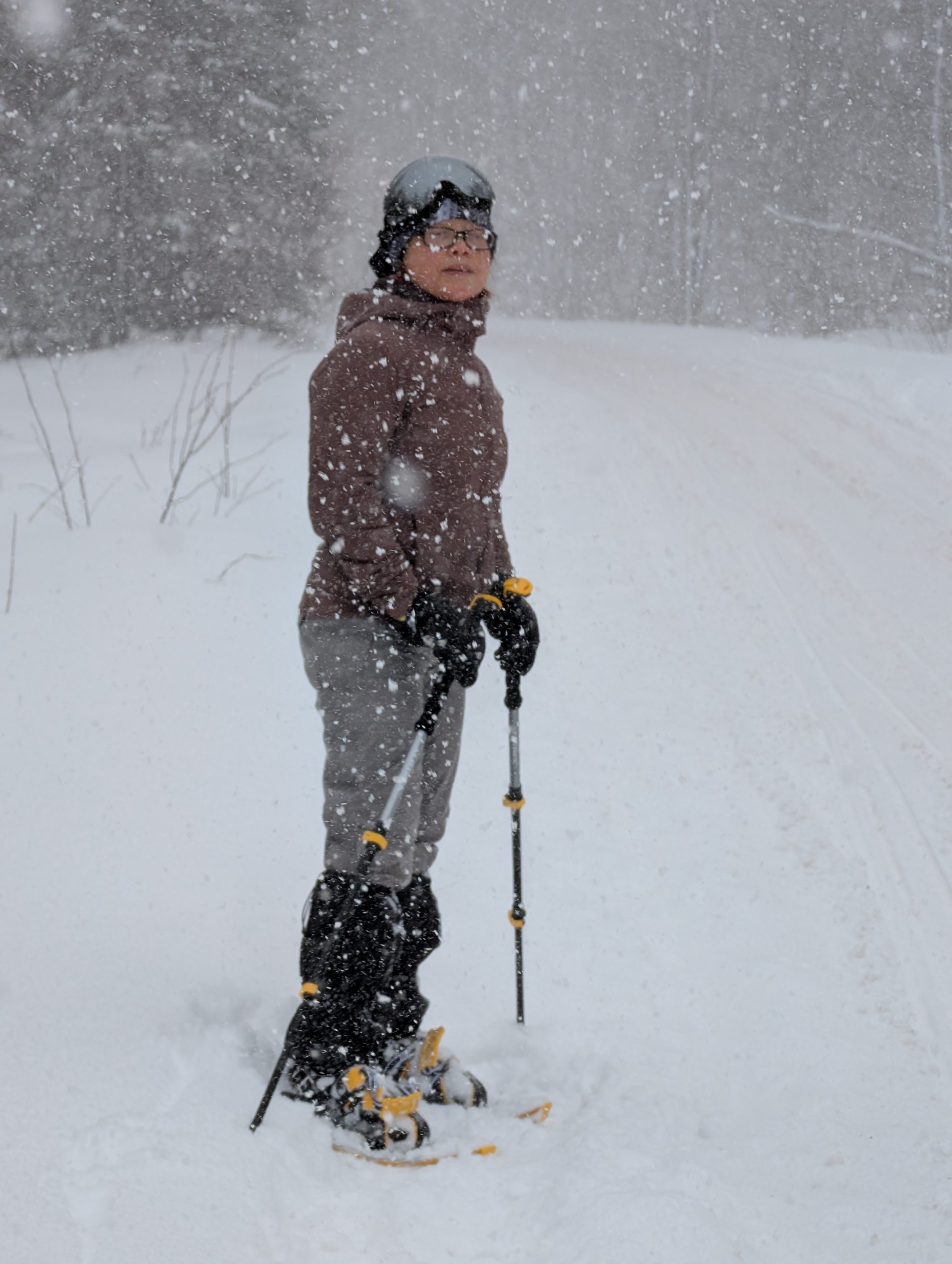
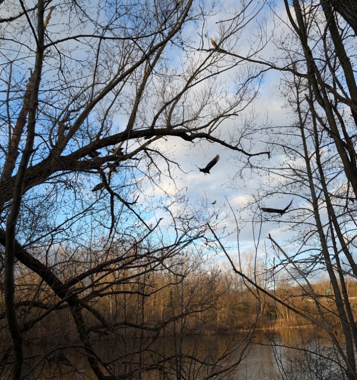
January
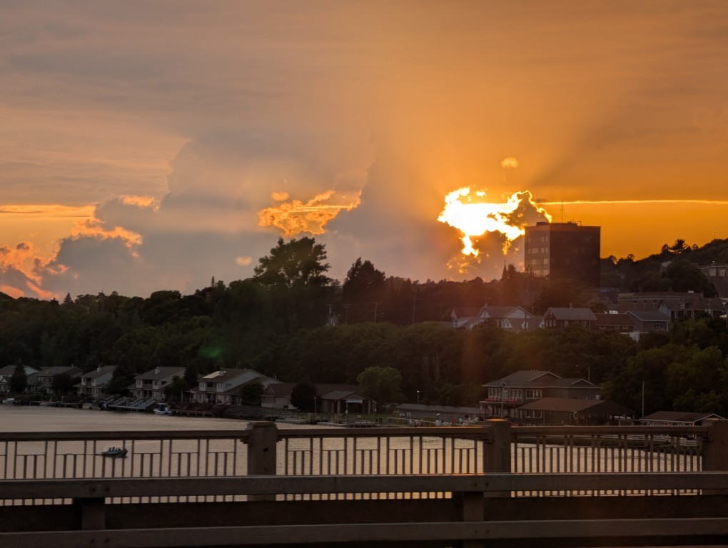
Just like the year before, we went to the very edge of the world—the Keweenaw Peninsula. There's snow, skiing, Lake Superior, which is beautiful in any season, and someone (not me 😔) turned 21.
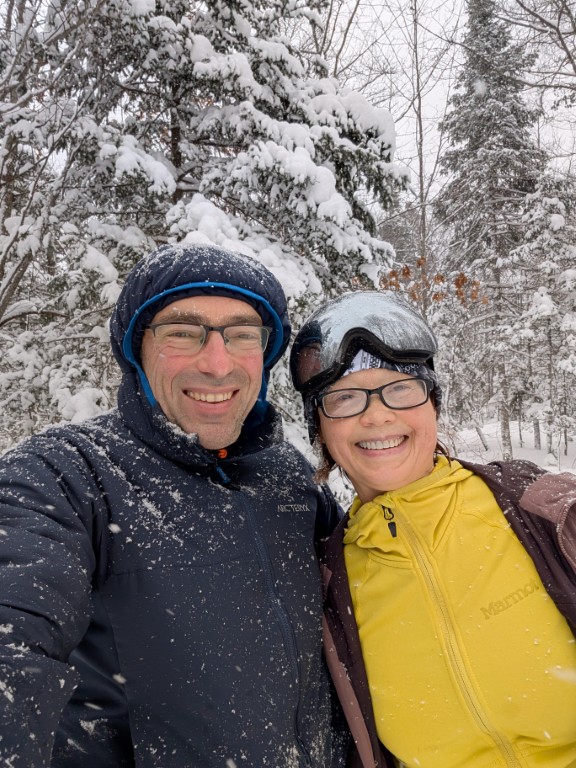
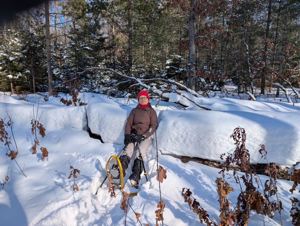
February
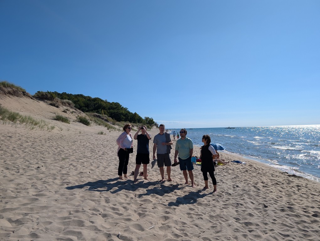
We went snowboarding again—this time in lower Michigan, near Manistee. Cross-country skiing, snowshoeing, Lake Michigan. I also worked.
March
Natasha took a complicated route to visit her mother, and I stayed home with the cats...
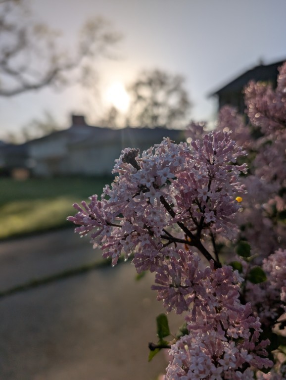
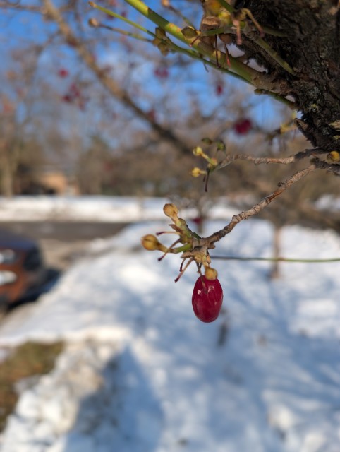
April
Spring is coming here, just in time for Natasha's arrival.
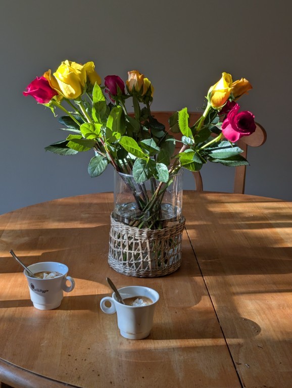
May
It's great at home, we're driving around the neighborhoods.
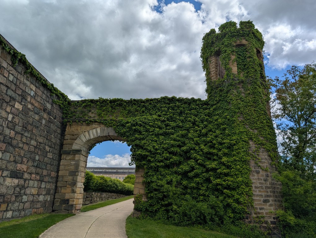
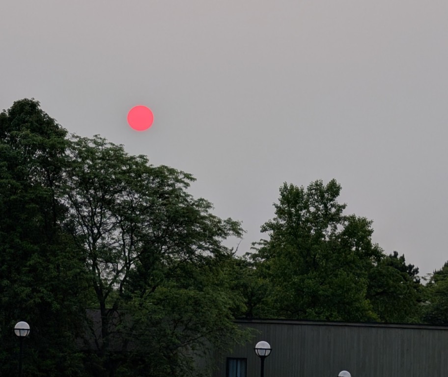
June
June in Ann Arbor is a time of peony blooms, summer festivals, and smog from the Canadian forest fires.
July
A three-week trip to the Northwest US: beautiful national parks, long drives, work on the road.
August
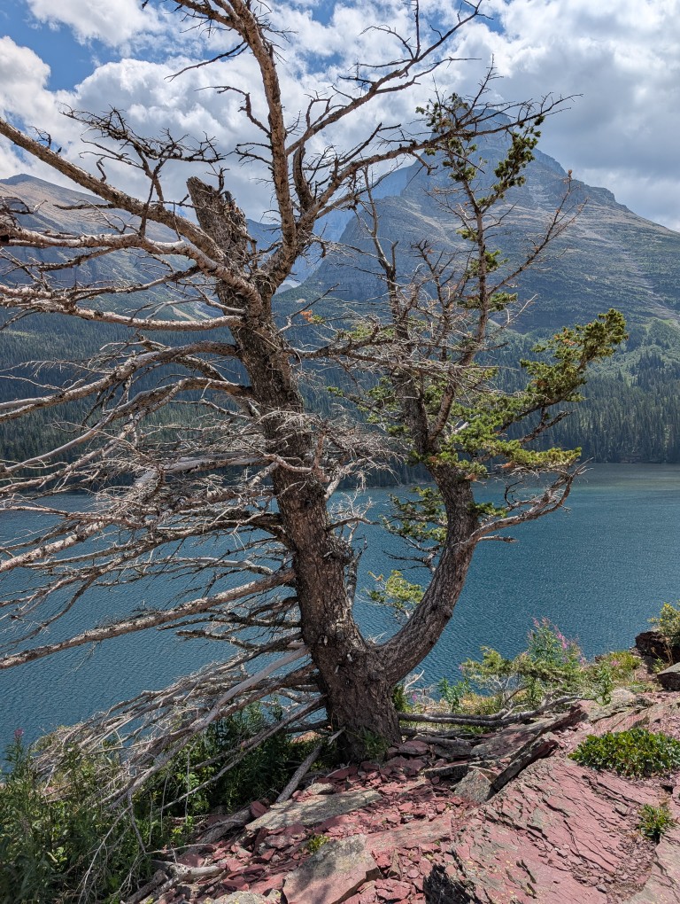
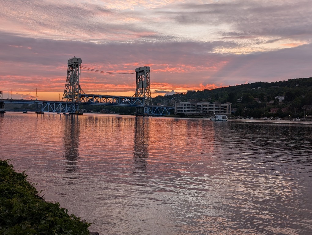
Another trip to Upper Michigan: the Keweenaw Peninsula is beautiful in both winter and summer, and meeting old friends.
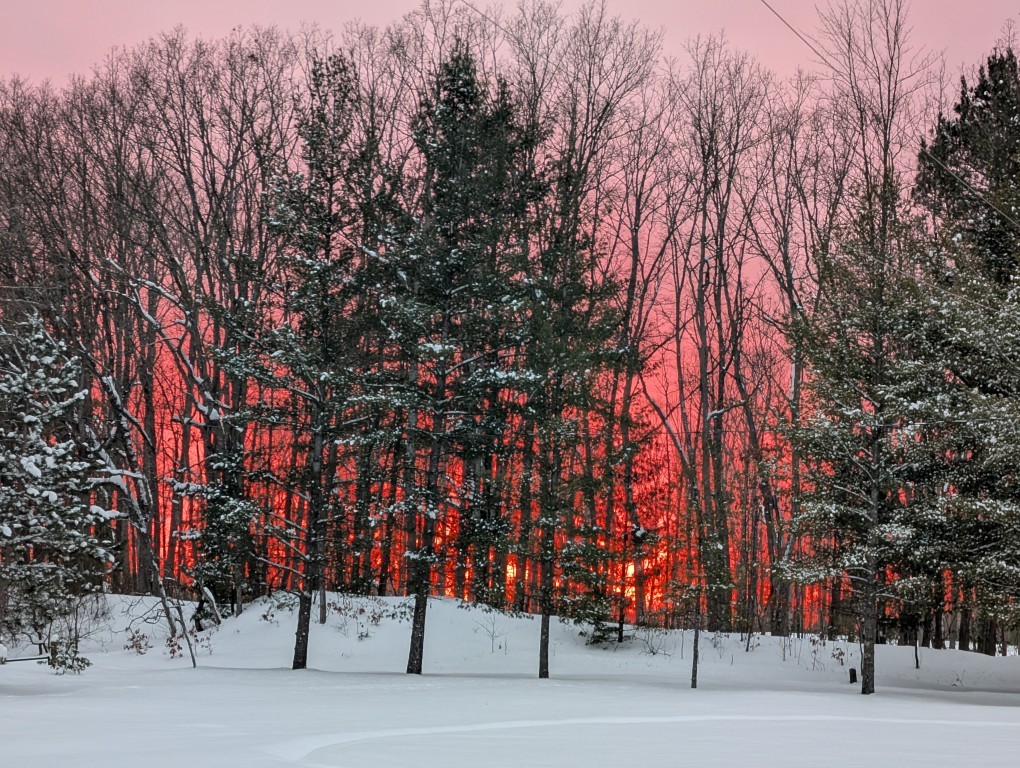
September
It's a time of festivals, changing colors of leaves, beautiful sunsets
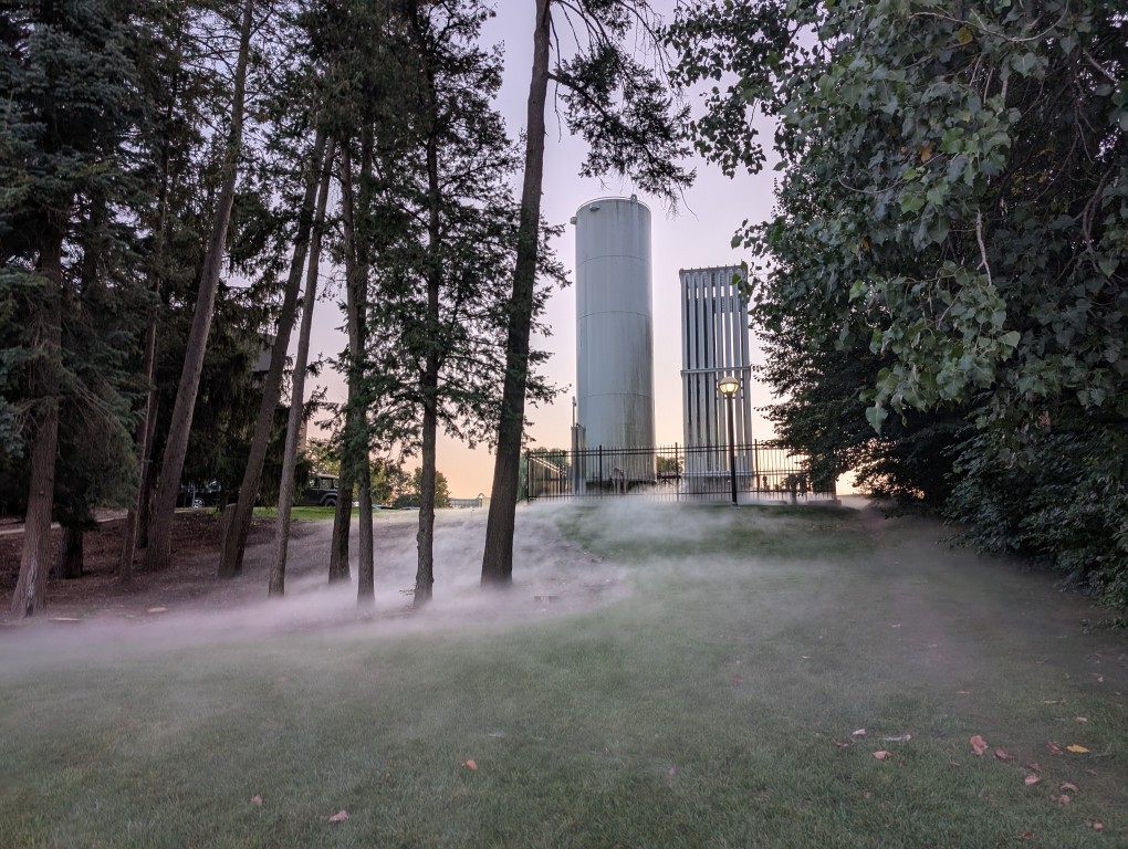
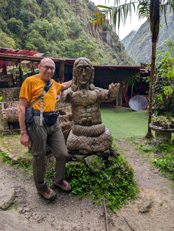
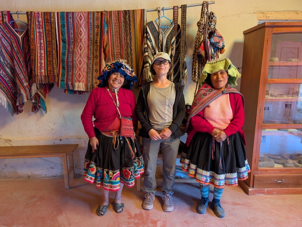
October
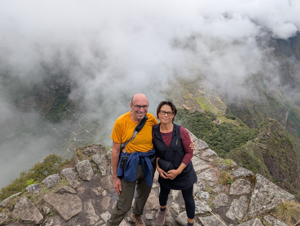
A Grand Trip to Peru: Machu Picchu, Cusco, Mountains, Rivers, Waterfalls…
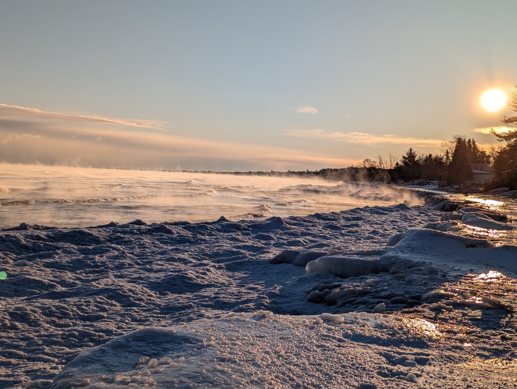
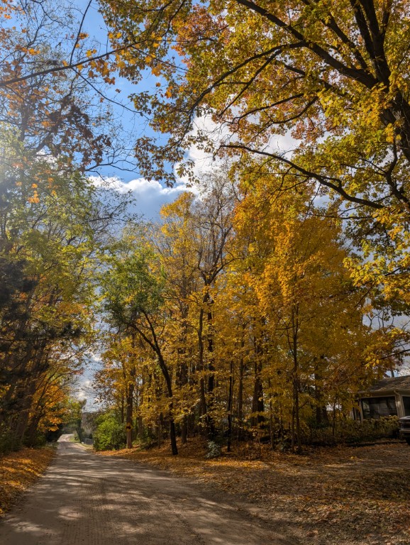
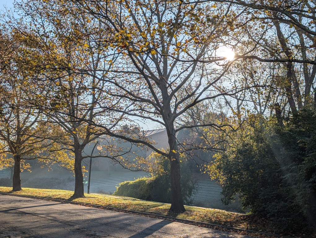
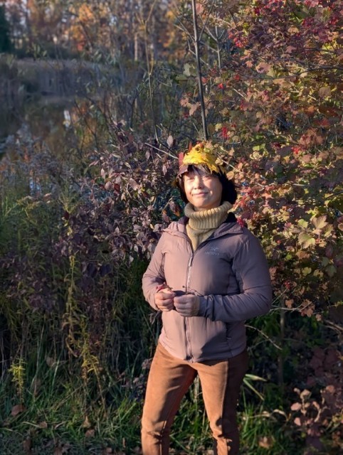
November
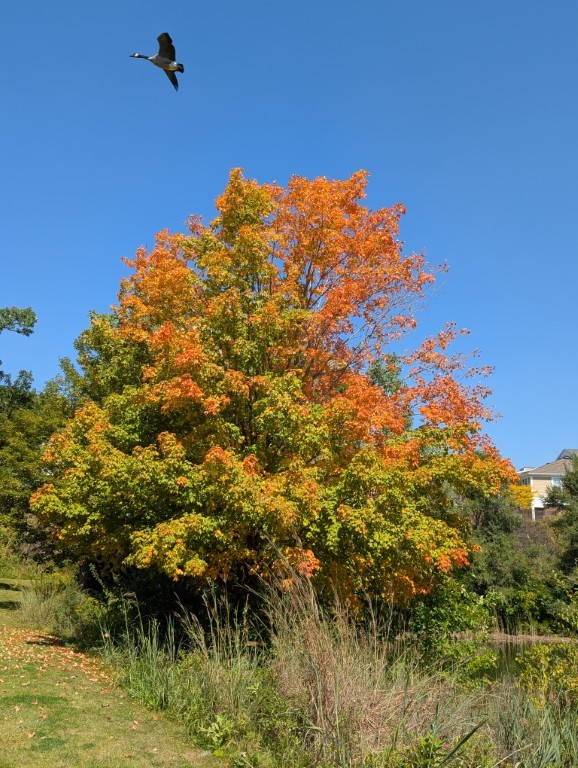
One of the most beautiful months we have here in Michigan: the trees are covered in colorful leaves, and the weather can feel almost like summer one day, and snow the next…
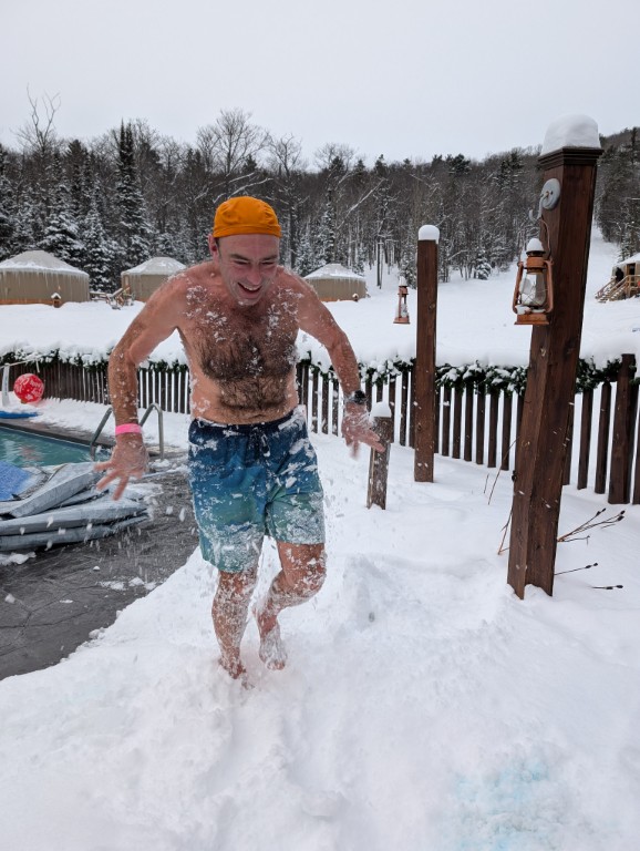
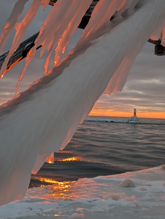
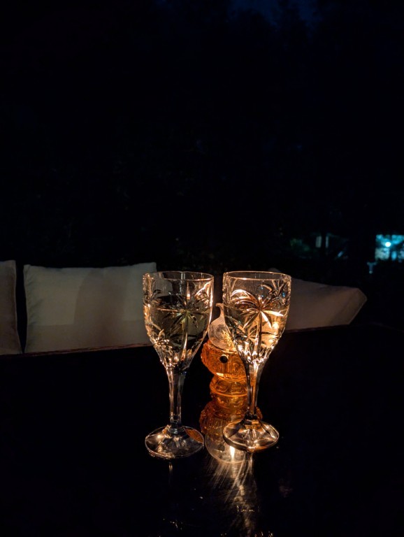
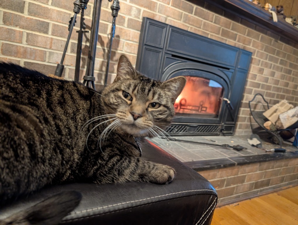
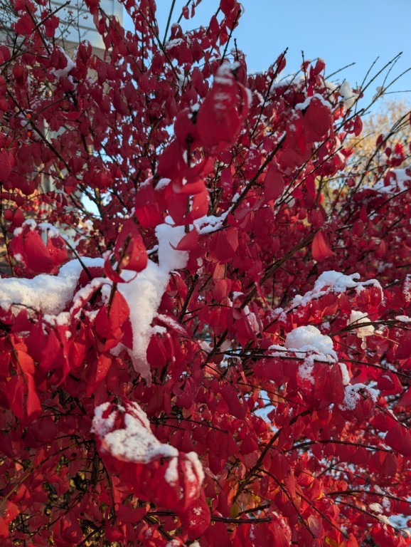
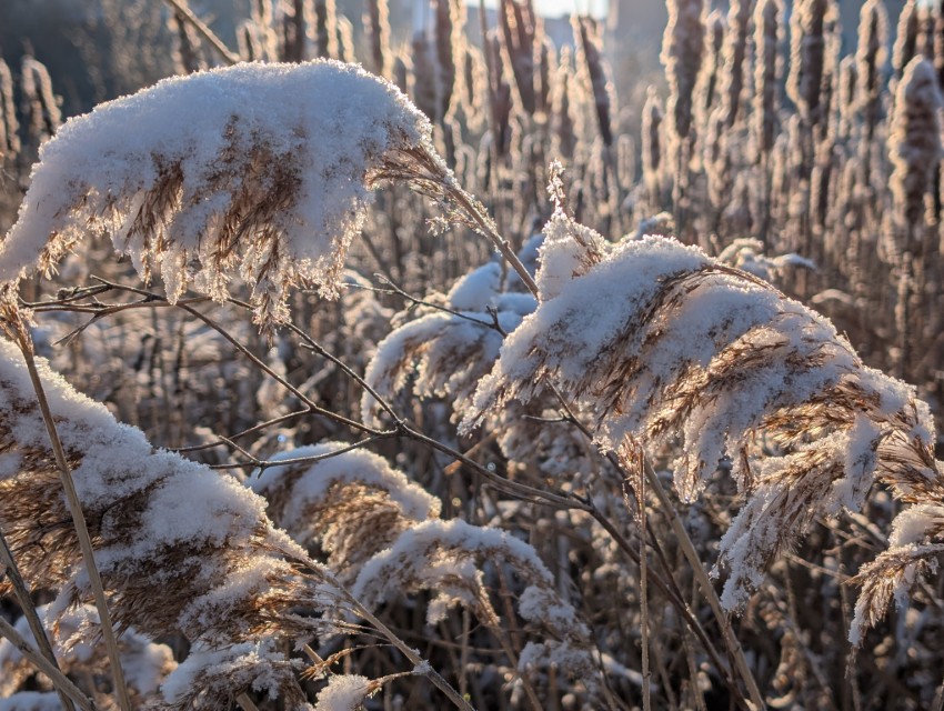
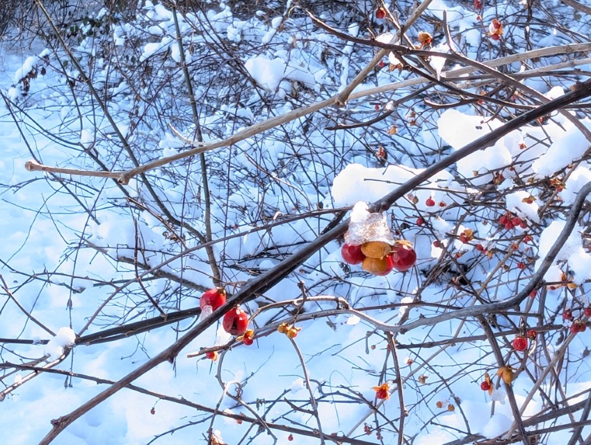
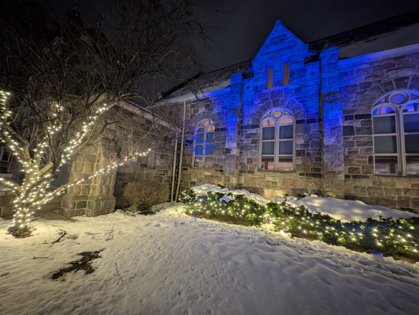
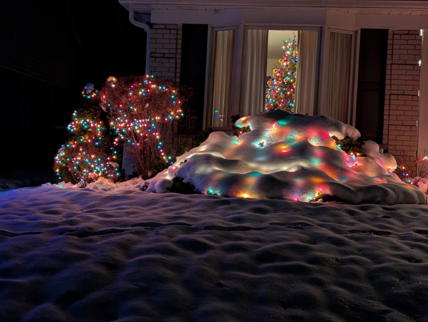
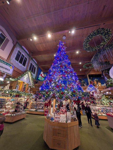
December
This year December has been very good – snow, several beautiful sunny days (last year there wasn’t a single sunny day in December), Christmas lights…
And the fact that there were occasional torrential rains and one day the temperature rose to +15 degrees – well, that’s what Michigan is for...
А то, что иногда шли проливные дожди и однажды температура поднялась до +15 градусов — так на то это и Мичиган…
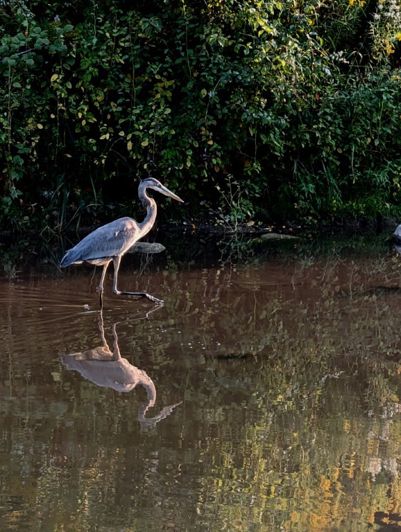
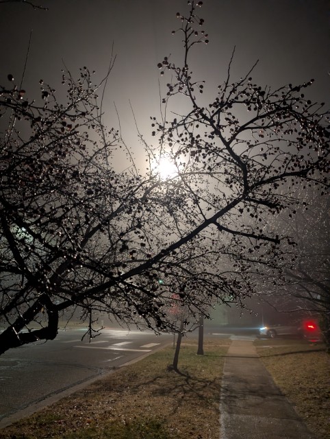
Ugh, it's so cold here in the mornings! Warm clothes, a cup of coffee, and the knowledge that in a couple of hours it will feel like summer again are enough to warm you up. Quick, grab a hot cup of coffee and get going! Fog spreads across Lake Lewis like pink cotton wool. Again, the fisherman's vague silhouette in the same spot. Maybe he's always here?
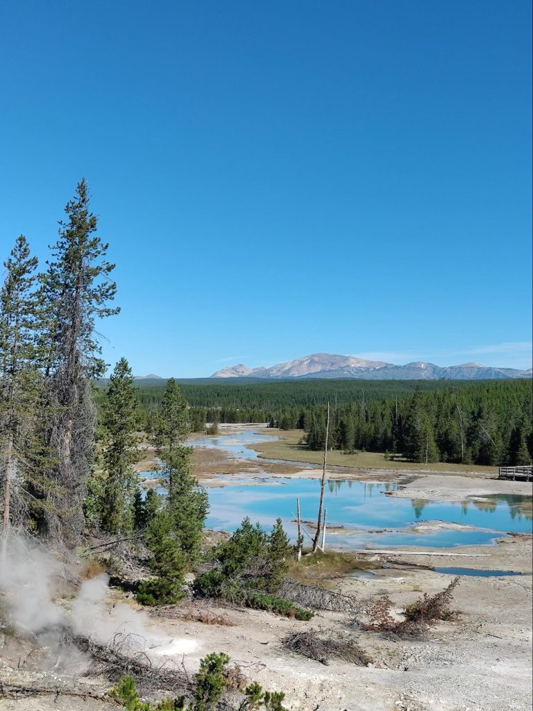
A deer with powerful antlers cautiously crosses the road. We slow down for a moment and wait. About ten minutes later, the road turns toward Yellowstone Lake.
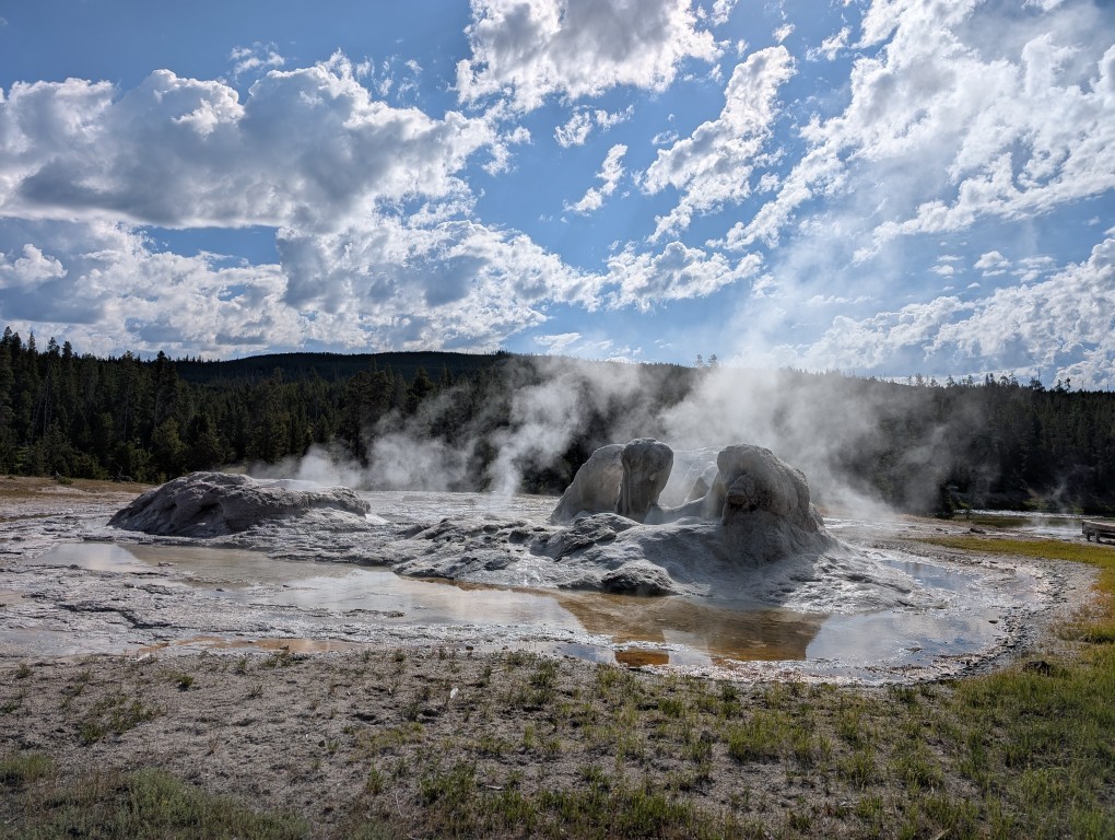
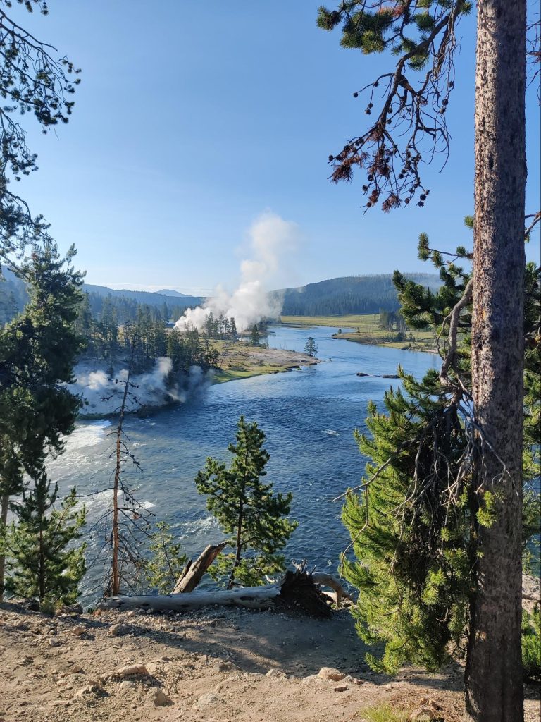
The scenery here is magnificent, too. Now we're driving along the coast. This time, without stopping, we pass the nearest geyser field. The sun shines through the clouds of steam. It's absolutely beautiful! It feels like a special place, like a place where clouds are born.
In the slanting rays of the morning sun everything sparkles: the water, the wet rocks, the dew on the grass.
This morning, we're incredibly lucky with our encounters with wildlife. We see pelicans splashing around on the lake, and then we encounter a large herd of elk. They're large and unhurried. They're used to the close attention of people and the fact that no one will bother them here. The most important thing for everyone, human and animal, is to know their limits. The information brochures say that the distance between you and a moose should be at least the length of two buses, and if you encounter a bear, the distance should be tripled.
Let's move on - and here's another gift from nature!
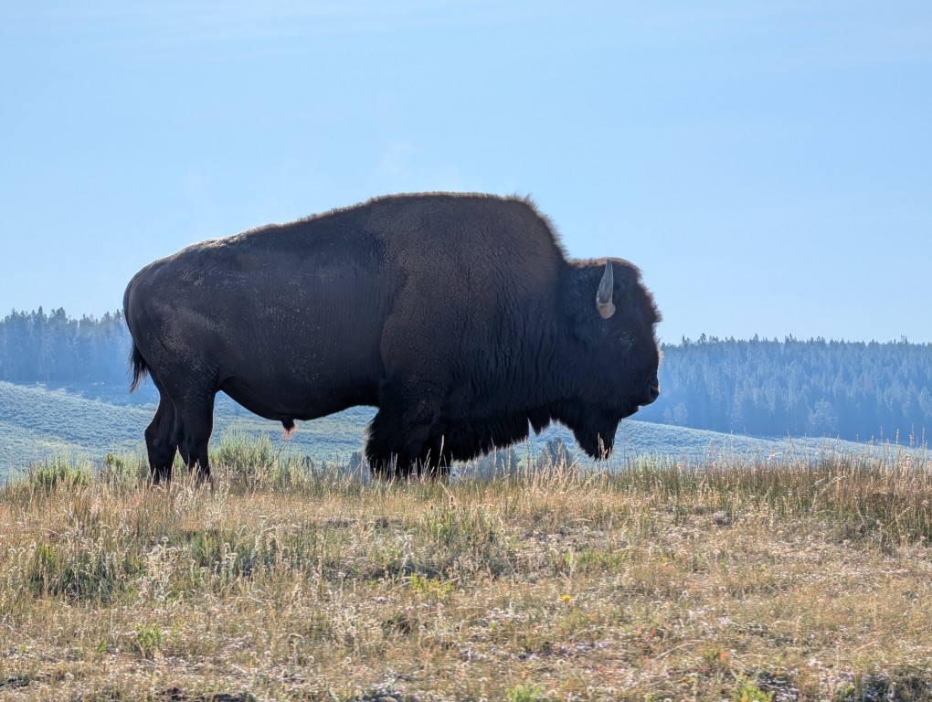
A bison stands like a mighty boulder beside the road. He's enormous and imperturbable. The beast's size is impressive. A monolith! A colossus! Naturally, we stop on the side of the road and, without getting out of the car, take photos of the animal right from the open window.
River and canyon
Today, a significant portion of my time is devoted to the Yellowstone River. It can't simply be described as "wide and majestic" or "turbulent and wild." It takes on a unique character in different sections of its course.
At the next stop, from the high, steep bank, you can see the steam from the hot springs rising above the wide river. Here, the water is calm and peaceful. But around the next bend, the banks narrow and the current becomes swift. And the river is unrecognizable. Just ten minutes ago, it was flowing leisurely, but suddenly, as if it had gone berserk, foaming and angry, bursting into a narrow canyon with a roar.
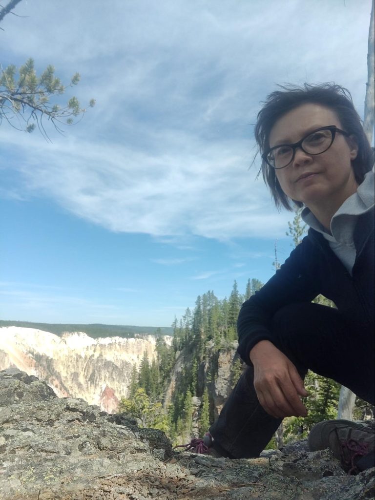
It's amazing how diverse the landscapes of Yellowstone National Park are! Besides geysers and hot springs, there are high mountains, high plateaus, and numerous cold, clear lakes. It even has its own Grand Canyon. That's where we arrived that morning.
Since there were no tables nearby, we had to settle down on large flat stones near the parking lot and have breakfast there.
A clear, sunny morning promises us a multitude of beautiful views. We follow the trail leading to Lenta Lake. The section that runs along the edge of the canyon is incredibly picturesque. I want to capture every outcrop of yellow rocks, every bend in the river below, in the deep gorge, every tree leaning precariously over the canyon's steep slope. There, at the bottom, the morning fog still lingers, but the slopes are already illuminated by the morning sun.
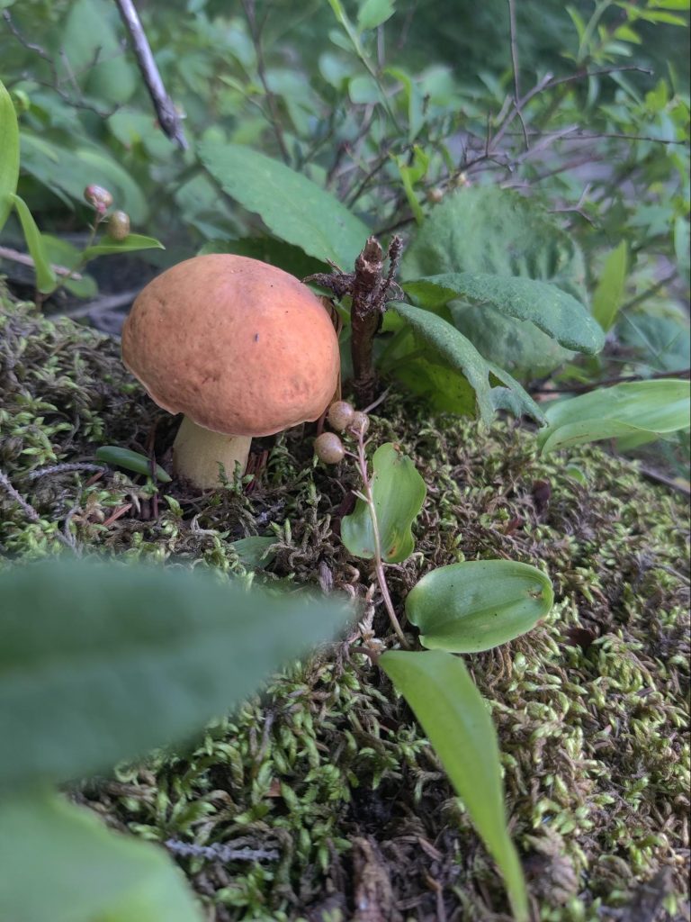
In the morning, there aren't many tourists yet, so we continue along the trail alone. The mosquitoes were just waiting for this. Starved by the solitude, they attacked us with all their might. The power of a single mosquito isn't great, but when they gather in an army, you have to fight them off in earnest. Despite everything, we conquered this trail, reaching an elongated lake overgrown with leaves. Our reward was a large porcini mushroom.
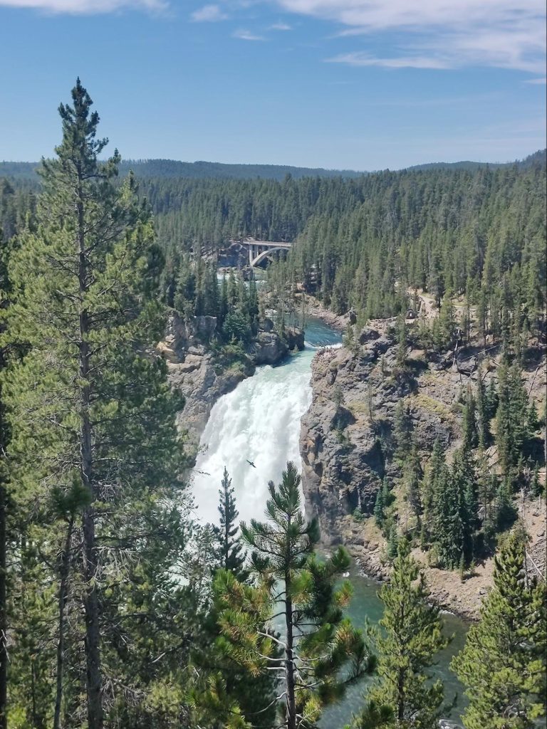
Waterfalls
By the time we get back to the parking lot, it's already quite hot. We take off our excess gear and head to the waterfalls, which are also located on the Yellowstone River.
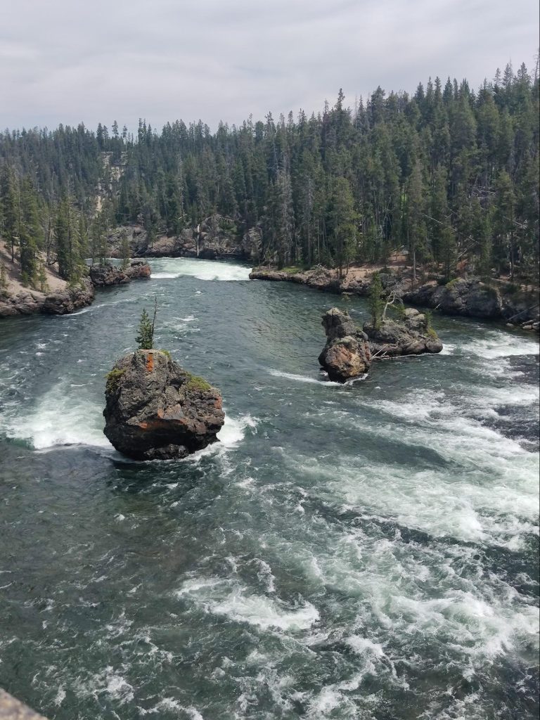
The Lower Canyon is wider and lower, the Upper Canyon is higher and more powerful, each beautiful in its own way. Numerous observation platforms allow us to see this natural wonder from different angles. In one place, a steep but well-trodden path leads almost to the very bottom of the canyon near the waterfall. In another, you can stroll along a trail further upstream, where numerous small rocky islands, each with a single tree, are scattered throughout the river's center.
At the third and fourth observation decks you can see the waterfall from the very edge of a picturesque cliff.
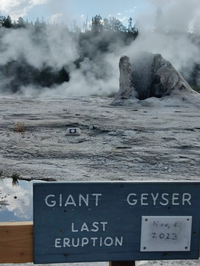
Mud volcano
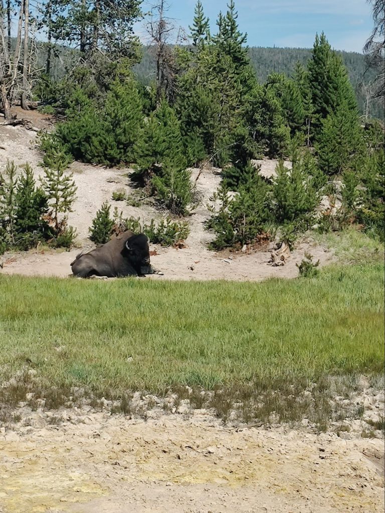
On the way back, we stop for lunch at Muskrat Creek. This rest area is a great place to take a short break. In the green valley, under the shade of a spreading tree, you can set up a camp stove on a table and cook some soup. We need to refresh ourselves and gain strength before heading to another interesting spot. About forty-five minutes later, we head to a spot called Mud Volcano (or Angry Volcano?) to see the murky puddles pulsating under the pressure of steam from the depths of the earth.
This, surprisingly, is also quite spectacular! At the foot of the hill, steam erupts from a crevice with a distinctive raspy sound. Water the color of liquid cement ripples and creates a small wave. This geyser is called "Dragon's Mouth.".
Nearby, slightly larger, murky lakes sigh and gurgle. Each one imagines itself a sea and produces a powerful surf. This large movement of low water is disorienting and even a little frightening. Moreover, the smell of sulfurous fumes is much stronger here than in other places, making it difficult to linger for long. But the bison lying nearby apparently doesn't care.
He's used to the smell of rotten eggs, but we aren't. The world of geysers is so diverse!
Evening
In the afternoon, passing the Fisherman Bridge, we decide to stop at a tourist village on the shore of Yellowstone Lake. There's a small museum there with taxidermied animals native to the park. We take in all the exhibits in about fifteen minutes and then head to the lakeshore. It's time to kick off our sandals, go barefoot, and soak our tired feet in the warm sand! By evening, the sand has warmed up, but the lake remains as cold as ever. Nevertheless, Denis decides he absolutely must take a swim. You can't last long in this icy water, but three minutes is enough for him to casually remark, "Yeah, I swam in Yellowstone Lake too."”
We've seen so much today! To say we're tired is an understatement. Full of impressions, we head to the campsite to rest. Looking forward to potatoes with mushrooms for dinner.
It turned out to be strong and resilient: it traveled with us all day without spoiling. When I cut it open, it was still crisp and white inside, without a single wormhole. But even half a mushroom was enough to fill my stomach. What to do with the other half? Saving it for tomorrow wouldn't make sense. Roast it? I didn't feel like doing anything else but resting. So I simply cut the mushroom into pieces and scattered them among the nearby stumps. It was our little tribute to the forest deities. I checked in the morning—almost all of it had been eaten by the local creatures. We're not the only ones who love mushrooms!
July 13
Norris Basin
In the morning, we pack up our camp. It's quick and easy. Everyone knows what they're packing. I'm responsible for the tent and everything inside it, and Denis is responsible for the camp kitchen. I'm responsible for collecting trash and keeping the campground clean, and Denis packs the bulky items into the car: the cooler, camp chairs, and the backpack with the tent, mats, and sleeping bags.
On the way to the next valley of geysers we stop by a waterfall (Gibbon falls).
Because it's only seven in the morning, it's completely hidden in shadow. Unfortunately, there's no time to wait for better light; we take a few photos and move on.
Early in the morning we arrive at Norris Basin, another large area with geysers.
It's divided into two unequal halves. First, we head to Porcelain Meadow. Like other similar places, there are wooden paths here. This meadow differs from the others in that the geysers and hot springs have a cloudy, milky-white hue.
The opal-colored water contrasts stunningly with the green streams that spread widely across the whitish, brown-streaked, and occasionally yellow and orange, earth. A veritable feast of color and beauty!
And above all this colorful joy, numerous geysers steam. It's noticeably warmer here, and the air is so saturated with moisture that you need to remember to wipe your camera lens. Otherwise, everything turns out hazy, like fog.
As we walk to the other side of the clearing along the Black Trail, we notice that the spacious parking lot is already completely occupied. Cars are parked even where there are warning signs warning that rocks from the erupting geyser may reach these areas.
Yes! They do exist! Park staff can likely monitor their activity and close dangerous areas promptly, otherwise there wouldn't be such an influx of tourists. They say that in the past, people sealed one such violent geyser with stones. Modern scientists consider this an act of violence against nature. Since then, the geyser has ceased to pose a danger. But who knows, maybe one day the "champagne bottle" effect might occur, where the cork can burst with redoubled force under the pressure of the gases.
As we pull out of the parking lot, our spot is immediately taken by others eager for a spectacle. It's a good thing we arrived here early in the morning.
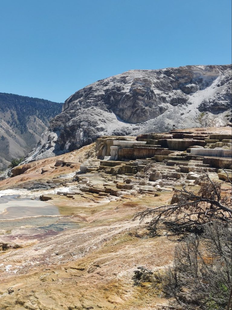
Upper and lower terraces
The last point we wanted to visit in Yellowstone National Park was the Upper and Lower Terraces.
They are stepped formations of white and yellowish-brown flowers. This is another interesting example of the park's diverse landscapes. July 13th was probably the hottest day. Moreover, we had to climb up and down numerous steps connecting the different levels of the terraces.
My strength began to rapidly evaporate along with the sweat. To top it all off, there was no shade anywhere. And that was just the tip of the iceberg. When we descended the mountains, it became clear it was much hotter below; the thermometer on the bank building showed 37 degrees Celsius.
A good way to combat overheating is to drink a bottle of water and eat some ice cream. That's what we did a little later.
Yellowstone Park left a lasting impression on us. We'd traveled and seen so much before, it's hard to surprise us anymore. But geysers, a unique natural phenomenon, were our first experience. And like children, we wandered around and marveled at everything. We took an incredible number of photos, which I'm sure we'll look at again and again.
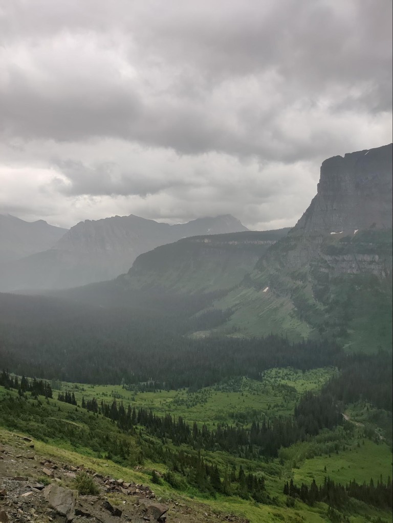
Needless to say, we rose early again the next morning. It had become a tradition, and we'd developed certain traditions that we'd stick to throughout the trip. The weather forecast wasn't promising this time: rain for most of the day. But what could we do? We had to get going. After all, tomorrow we'd leave Glacier, and today we'd have to cross Logan Pass again and reach the park from the other side. There should be some beautiful trails there, too.
The weather is gloomy.
Mists and clouds drift between the mountains, making it gloomy but still very picturesque. The promised rain hasn't arrived yet, and the "Going to the Sun" mountain road is easy to drive at a normal pace. We cross the pass without difficulty, pass by Lake St. Mary, arrive at the park gates, and are turned away. Apparently, the same rules apply here: if you can get in before seven, go ahead; if not, you must schedule a time in advance.
We eventually found other trails. One of them turned out to be particularly sad to walk because it passed through a burnt forest.
These areas were probably devastated by large fires 10-15 years ago. They destroyed a significant portion of the forests on this side of the mountains. As we climbed higher, we could see the skeletons of dead trees sticking out for miles around. The only relief was that young pine trees were already clustered around them, and raspberry patches and blueberry fields carpeted the previously scorched slopes.
And yet, we left the trail and headed toward the waterfall. By this time, it was already raining, fortunately not very heavily. The narrow trail leading to the waterfall was lined with tall grasses, enough to soak us waist-deep in just five minutes. After a while, our boots began to squelch. We decided to walk to the waterfall despite the weather. This area boasts a stunning combination of rock colors. Rock outcrops of dark red, burgundy, and brown are interspersed with unexpectedly vibrant, greenish-blue inclusions. A stunning contrast of cool and warm tones!
The waterfall turned out to be pretty, though not very tall, yet turbulent. And then there's the color. The water here shimmers in every shade of green. Even on a rainy day, it seemed vibrant—emerald, covered in lush lacework of white foam.
By this point, we were practically soaked from head to toe. It was a relief to return to the car, find dry clothes, take off our wet boots, and put on flip-flops. We could adjust the warm air and head back. But we'd have to drive more carefully now, because the steep turns of the mountain road were glistening with rain, and Logan Pass was completely hidden in the clouds.
The road from the pass
We take our time, occasionally entering thick fog, slowing our already slow speed. But sometimes, suddenly, the clouds part and a patch of gloomy landscape opens up. Sometimes distant mountains are visible, their peaks seemingly existing on their own, surrounded by clouds on all sides. Even below us, there are clouds.
Despite the bad weather, we stop at various interesting places on the way back.
We drove along this same road yesterday, but we were so tired that stopping anywhere else would have been difficult and wouldn't have been much fun. In one beautiful spot, for example, there was a snowfield, eroded by a stream from below, forming a low tunnel. But you can't walk through it because the heavy, compact snow could collapse at any moment. Around another bend was a long rock wall, down which a small but wide waterfall flowed, as if licking the stone. It was so close that the spray flew right onto the road. A beautiful and dangerous place! We didn't stop at the numerous viewpoints because visibility on that cloudy day left much to be desired. Moreover, the day before, we had had such a wonderful opportunity to see so many picturesque landscapes that it made no sense to get out in the rain. But we decided to stop at the triple arch.
It's part natural, part man-made: a road tunnel was dug into the rock where a natural arch already existed. A small stream flowed next to one of them, forming a miniature waterfall. Luckily, the weather had cleared at that moment, and a beautiful view could be seen from the natural arch's opening. It's amazing! We saw so many of them during our trip, we never got tired of them!
The Last Trail
When we descended, hope rose that the weather would finally improve. We decided to have lunch at home, rest a bit, and then head out somewhere else in the late afternoon. Around four o'clock, the clouds dispersed, the sun dried the grass and trails, and we set off along another trail. Here, we were promised a forest lake and a good chance of seeing wildlife. The lake turned out to be small and charming, surrounded by tall spruce trees and a beaver lodge on the far shore. But we weren't particularly lucky with wildlife; we only saw a partridge.
But her behavior was downright textbook, just like Charushin's. When she saw us, she didn't fly away, but began quietly clucking. At first, we didn't understand why the bird wasn't flying away, but upon closer inspection, we noticed: one chick under a stump, one in a hole, one behind a knot. Another, the bravest one, stood on a fallen tree trunk and cheeped. I took a photo of it and said:
Naughty boy! Do what your mother tells you! Hide quickly!
And we quickly moved on along the trail so as not to upset the partridge, especially since it was getting close to sunset, and we still had half an hour to drive along a bumpy, winding dirt road.
Well, our time in Glacier Park is ending, and it's time to pack up and head back. For seasoned travelers like us, it's a matter of twenty minutes. One last night in our temporary shelter—and then we're on our way home.
July 20
Last morning at Glacier
So, the things are collected and packed into the car.
Early in the morning, we regretfully leave Glacier National Park. It's so beautiful here! And even the morning chill and yesterday's rain didn't spoil the overall impression.
It seems as if yesterday's clouds haven't drifted far away, but have lingered in every valley and mountain fold. We make our way through the gray fog to admire the sunrise over the mountain lake for the last time.
Majesty and tranquility. Trite, yet so true, words that can describe the state of nature at the moment when the sun rises over the mountains.
Just before the park gates, we see a black bear leisurely crossing the road from the car window. It's a good sign! Montana's very nature has given us a parting gift. We should definitely come back here, since it's been so kind to us...
Blackfoot Tribe
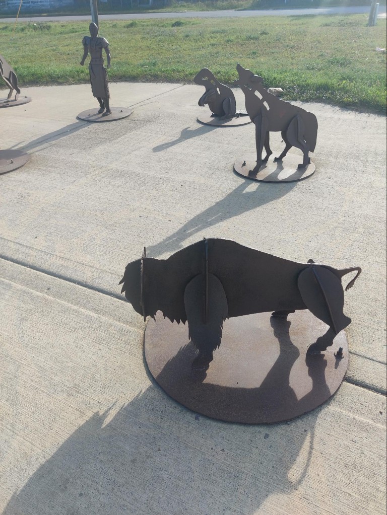
We drive for another two hours through narrow valleys between the mountains. The sun rises higher and the fog reluctantly creeps into the lowlands, toward the rivers and lakes. The slopes become more gentle, and after a while we find ourselves back on the prairie. Around nine o'clock in the morning, my stomach is clamoring for breakfast. On the plain, at the foot of the mountains, we decide to make our first stop and eat. We found a suitable place—a park on the Blackfoot Indian Reservation. A large cultural heritage center has been built nearby, but due to the early hour and the weekend, it's closed. While breakfast is being prepared, I manage to look at the metal figures nearby.
It turns out these are characters from a Native American creation legend. It's a familiar story: a bored Creator was amusing himself, fashioning a moon, sun, and stars from mud, and creating humans and animals. He settled them all on Earth. But humans (once again!) proved treacherous and unworthy. Then, enraged, God abandoned them on Earth and, accompanied by his "stars," flew off to the heights. Beforehand, he caused a flood to undo the results of his failed project. The wise old man Napi remained on Earth. This assistant of God's brought everything back to order. He climbed a high mountain, caught clouds with a rainbow rope, stopped the downpour, and asked the animals to retrieve some mud from the bottom to recreate dry land. Possessing special powers, the animals could take the form of humans.
Unlike previous generations, they were righteous and began a new life on earth. They were the ancestors of the Blackfoot tribe.
Much time has passed since then. The righteous have become lesser, otherwise they wouldn't have left so much trash in the park where we had breakfast. And the gas station seemed somehow unkempt. Only legends of former greatness remain.
Echoes of a Legend
And again, we're driving all day across the Great Plains. The weather, sunny at the start of the journey, is starting to deteriorate. Ahead, across the deserted, arrow-flat road, a storm front is visible. We even had to change our next overnight stop because we didn't want to set up camp in the rain. We decided to keep going, especially since there was still plenty of time before sunset. And so we bravely drive into the storm. At times, it pours so hard that we have to slow down to twenty miles per hour. We drive leisurely in the rain for two hours, and even the thought occurs: "“
Probably the Indian god has once again decided to send a flood, it seems that it is not enough for him.”
When a rainbow appears on the horizon towards evening, the feeling of the presence of a legend arises again.
Apparently, old Napi himself stretched out a rope—a rainbow—to disperse the clouds. So the rain will soon end.
And so it turned out. When we arrived at the U.S. Army Corps of Engineers campsite, near the dam and Fort Peck, it was warm and dry. We pitched our tent without any problems, made dinner, and even managed to stroll along the banks of the Missouri River at sunset.
Only recently did I have a brilliant idea: the name "Montana" could be translated as "mountain country." It's so obvious, how could I have never realized it before! It's just strange that this Spanish word has penetrated so far north. From the windows of our farmhouse in Helena, large mountains were visible only in the distance, on both sides of a large valley. But as we approached Glacier National Park, we realized the state's name wasn't given without reason.
It was a strange day. We had to leave the cabin by ten in the morning. Denis "left for work" early. I made breakfast, packed my things, and carried them out to the car.
We then moved to the back of a large Costco store. It was deserted, and we could set up a camp chair for Denis, who immediately "went into a work meeting," pulling out his laptop and putting on his headphones. Meanwhile, I walked around the building and went shopping, picking up groceries for the rest of the trip. Then we gassed up and moved to a small park, where Denis continued working while I strolled around the neighborhood.
Gold was once mined in these areas. The surface of the earth has been dug up and ground down. Large piles of stones still lie there, a reminder of bygone times. Now, paths for joggers and cyclists run between them. People walk their dogs where a gold vein once ran. Now there's a golf course where warehouses and barracks once stood. And flax and sunflowers grow in the rubble.
We had lunch in the same park and finally moved on. Once again, our route crossed vast deserted areas with scattered livestock farms. There were no high mountains here yet; these were treeless, sun-baked hills. Big mountains lay ahead.
Arriving at Glacier
We reach Glacier National Park in a few hours. Our accommodation is ten minutes away. Housing prices within the park are several times higher, so it's more economical to stay outside. We also don't have to pay entry fees each time because we have an annual pass to all the national parks.
The exterior of our place is rather modest. It doesn't look like a hotel, with just five separate rooms. I think "rooms" would be a more appropriate term. But inside, everything is organized efficiently, like a studio: one large space for all amenities except the bathroom. One corner is partitioned off for the kitchen and dining area, another for a large bed and nightstands, and a third, near the entrance, has a coat rack and a small sofa. In short, it has everything necessary for a temporary stay. We spent three days there quite comfortably.
Although "lived" isn't quite the right word. When you're there to eat, sleep, and shower, but spend a significant portion of your time in the mountains, it's hardly a full-fledged "life.".
After dinner that evening, we still had a little time to walk around the area, eat our fill of the irga (serviceberry), which had ripened in huge quantities, and go to rest.
July 17
Morning in the mountains
On the morning of July 17th, in the middle of summer in Montana, our hands are freezing from the cold, and we're wearing long pants, sweaters, and jackets. It's a shame I didn't bring a hat; it would have definitely come in handy, and gloves wouldn't have hurt either, because it's around freezing outside again. The mountains are beautiful, but it's so cold here in the mornings!
First we head to Glacier to watch the sunrise at Lake McDonald.
A number of morning landscape enthusiasts have already gathered on the shore near the tourist village. Everyone is dressed warmly, some are warming up with coffee bought right there at the coffee shop. The lake is picturesquely nestled in a narrow valley between the mountains. The bluish pre-dawn twilight is slowly dissipating, and the first rays of sun are appearing over the peaks. It's beautiful! It was worth getting up at six in the morning for.
But this is not difficult for us, because we continue to live on Michigan time.
For those long morning contemplations of the mountain lake, people not only come warmly dressed but also bring blankets and throws. They probably find it comforting to meditate, wrapped in an extra warm layer, but for us, it's getting too cold to watch the sunrise. We want to get moving, to finally warm up. Hurry, hit the trail!
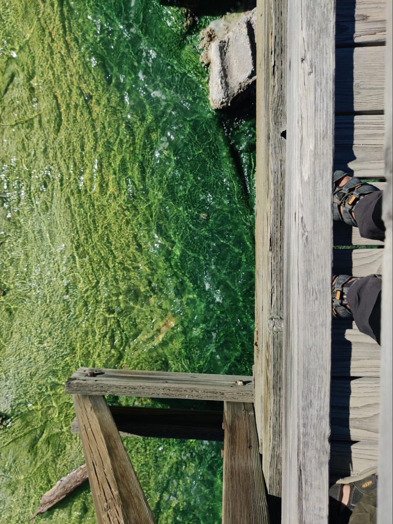
Two trails. McDonald River.
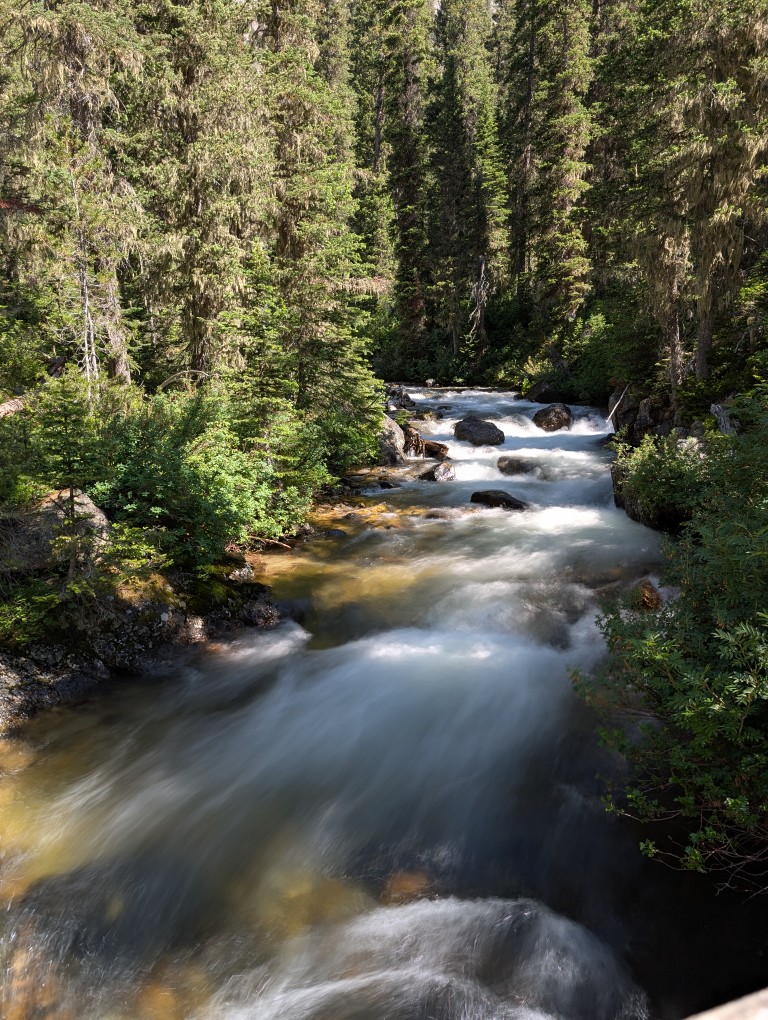
Despite the early hour, we didn't immediately find parking at the trailhead; almost all of it was occupied. The Kedrovaya Trail is quite small, barely accessible even in a wheelchair. Wooden paths and bridges cross a mountain stream on the damp, marshy soil. A miniature canyon has formed here. The stream, squeezed between rocks, churns and foams, creating whirlpools. The clear water glistens with an emerald green sheen. You can gaze at the flowing water for a long time, but then it gets cold again, and you have to move on.
The second trail, "Avalanche," is longer and leads gently upward. It should have been called "People's Trail," because so many people were constantly walking along it. At the end of the trail is a round green lake.
It's beautiful, but we'd already seen similar ones in Grand Teton and weren't particularly surprised. Then there was another trail we tried, but turned back because it wasn't anything special. Perhaps we were simply becoming jaded by the beauty of nature.
There were other beautiful places that our friend and advisor, the artificial intelligence, recommended visiting. We got in the car and drove off in search of picturesque landscapes.
For some time, the road ran alongside the McDonald River. Every turn begged to be painted: green, clear water, small waterfalls, rapids and riffles, forested rock folds, scattered boulders, and pebble banks. Small parking areas along the roadside offer a place to stop and admire the beauty.
A cow elk stood in the shallows, browsing on leaves from a bush. A crowd of people were curiously watching and photographing this wonder. I was watching not so much the animal as the observers. It was very much like a royal diner surrounded by vassals! They were all afraid to make a loud noise or make an unnecessary movement, walking on tiptoe, while the cow elk sipped leisurely, paying no attention to anyone. She was the queen here!
The Rocky Cape Trail“
We decided to return home, as it was approaching two o'clock. After lunch and a short rest, we set off on the Rocky Cape trail, which led us to the other side of Lake McDonald. It had become quite warm, even hot. The air smelled richly of herbs and sun-warmed pine trees. The bushes of serviceberry, wild strawberries, and thickets of blueberries made our journey even more pleasant.
And we had a wonderful dessert after dinner!
On the shore, far from the tourist spots, we suddenly encountered a group from a "pioneer camp" with cold-hardy children of local descent. Although the water temperature was around 15°C (60°F), these children splashed happily in the lake until the camp counselor blew a whistle to call them to shore. Some of them were dissatisfied with the time it was time to leave. Even Denis couldn't swim for more than three minutes, probably because he's not a pioneer from the Montana mountains. And I just watched the whole thing from the shore.
From Kamenisty Mys we saw the lake from a slightly different angle.
And it turned out to be incredibly beautiful, too. Surrounded by mountains, everything looks beautiful, doesn't it? On the way back, we hung out in the blueberry patches some more, stuffed ourselves with berries until we were sick, and decided it was time to go home. At some point, it became clear we'd covered quite a bit today. Denis glanced at his smartwatch and said we'd walked almost forty thousand steps. In my head, like Winnie the Pooh, I composed a marching-style "walker" song, which I immediately played loudly, for the entire forest to lift my spirits.
We have walked forty thousand steps! And we'll go another forty thousand, Because we, because we, Because we are strong And the two of us!
There were more verses about our heroic deed, but they come easily and are easily forgotten. Besides, Denis doesn't encourage my poetic experiments. He's shy.
We slept well that night. Physical activity and prolonged exposure to fresh air are beneficial for sleep. Denis later remarked more than once that he slept better in the tent. The idea was born that at home we could set him up in the backyard, in a tent, and let him inside to shower, eat, and go to work.
Today we're leaving Grand Teton National Park and heading to Yellowstone. It's not far. Most road trippers plan to visit these two places together. But before we leave, we thought we'd take a dip in a hot spring.
The morning, as we know, is quite chilly in the mountains. That didn't stop Denis, and I, shivering, decided against taking a dip. At first, there was a dewy trail, then a river blocked our path. For some reason, there was no bridge, so we had to wade across. It wasn't much fun in a temperature of +9°C. When we arrived at the spring, a fan of morning hot baths was already soaking there. He sat relaxed in the spring, looking out at the mountains bathed in morning light and listening to country music.
He was middle-aged and potbellied, with a drooping mustache and long gray hair. He was also completely naked. Closer to nature than ever. He greeted us casually and struck up a light conversation. Easy chat. Who we were and where we were from. He was from Idaho, came here often, and loved this place. Denis climbed into the spring, and I waded in ankle-deep and also tried to enjoy the morning view of the mountains, but it didn't work out because I was attacked by a swarm of wild, vicious mosquitoes. I immediately decided to do my exercises standing in the spring, as I had left my mosquito repellent in the car.
Dear friends! Let's begin our morning exercises: arm rotations, torso rotations, head rotations, and slapping the bitten areas! Okay, good! Be more alert! Be more energetic! Let's move on to water treatments! Oh, yes, we've already moved on.
Denis, apparently, was also bothered by the mosquitoes or he felt sorry for me, he didn’t sit for long and we drove on.
Popular science
Yellowstone is just a stone's throw away; half an hour and we're there. That hot spring was the first sign that the geysers were very close. And then it was like we were in a science fiction film.
And indeed, this park was well-known long before we arrived in America. It was probably the unforgettable Senkevich, host of the "Film Travelers' Club," who told us about it on TV. It was a great show. I remember circling it in a bold oval in the paper TV program guide, along with cartoons and "In the Animal World." Later, in the 1990s, it became possible to watch National Geographic films. You can almost hear the announcer's voice behind the screen:
Yellowstone National Park
Founded in 1872, Yellowstone National Park is the world's first national park, renowned for its geothermal landscape and geysers. The famous Yellowstone National Park is a biosphere reserve and, thanks to its unique topography, is listed as a UNESCO World Heritage Site.
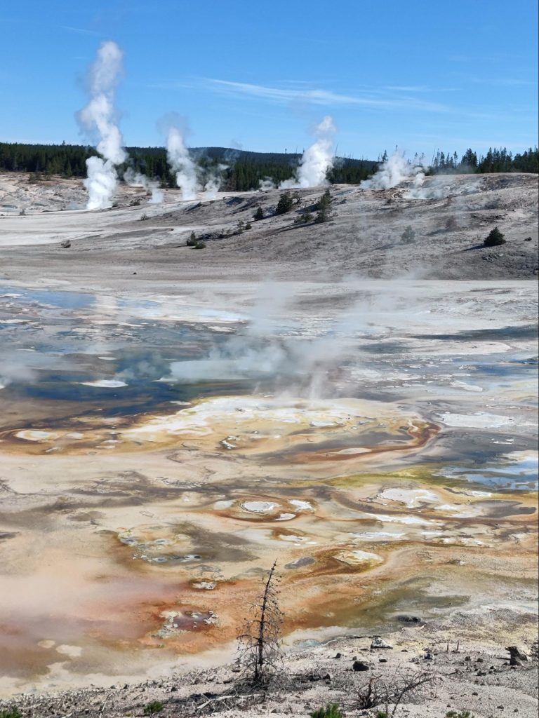
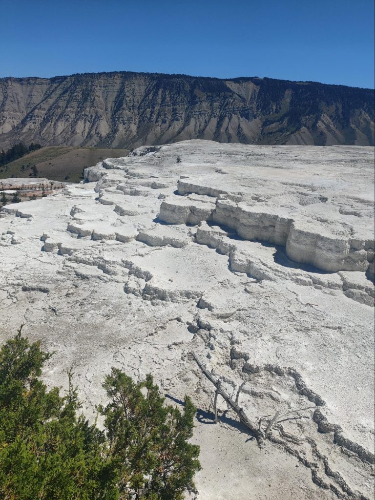
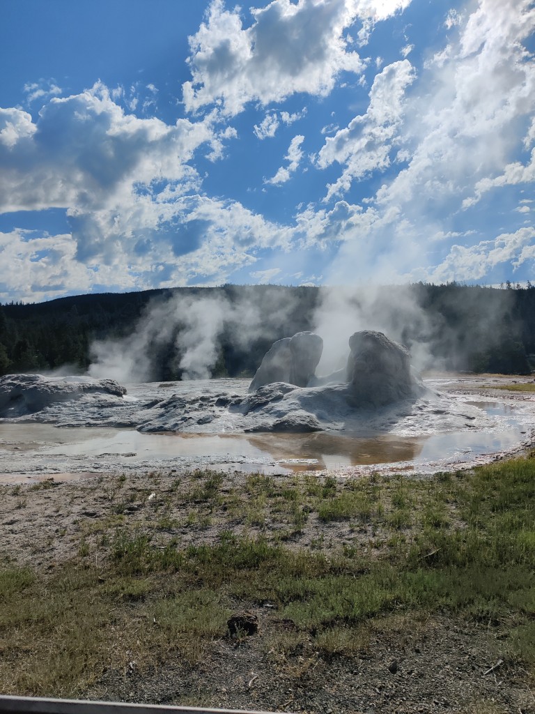
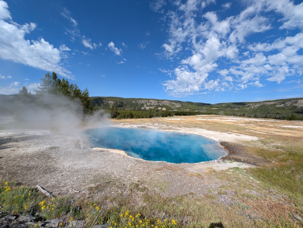
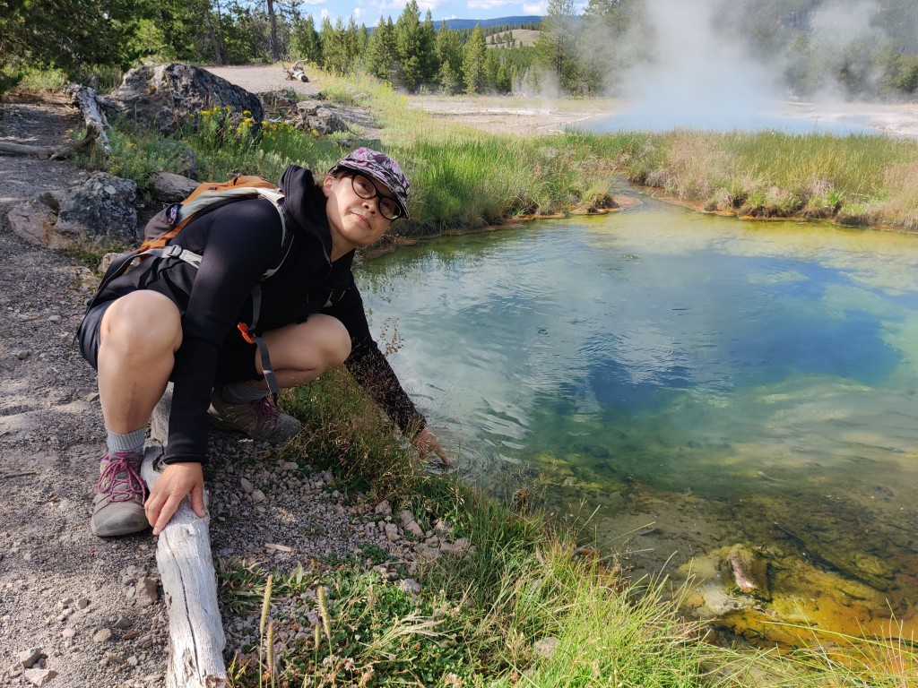
We enter the park from the "West Thumb." The first impression is that this place has a life of its own. The geysers are both beautiful and dangerous. Filled with a wonderful turquoise hue, they gurgle and sigh, emitting mists of sulfur.
We later learned that the bluer the water, the hotter the spring. Getting too close is prohibited. We walk only on specially constructed wooden walkways. The crust that covers the spaces between the geysers creates the illusion of solid ground, but in reality, you could fall into hell, into a fiery Gehenna. Bison, however, apparently are allowed in. Their tracks are visible in large numbers from everywhere.
Geysers are like people: no two are alike, even if they look similar. This depends on a variety of factors: depth, temperature, rock and soil composition, age, and much more.
Some geysers are coloured in the brightest shades of blue-green and orange, others are pale, with a whitish edge, and others are turbid, like clayey slurry.
Some release occasional bubbles, others seem to boil, and still others gush with varying frequency and power. Many simply "breathe" steam.
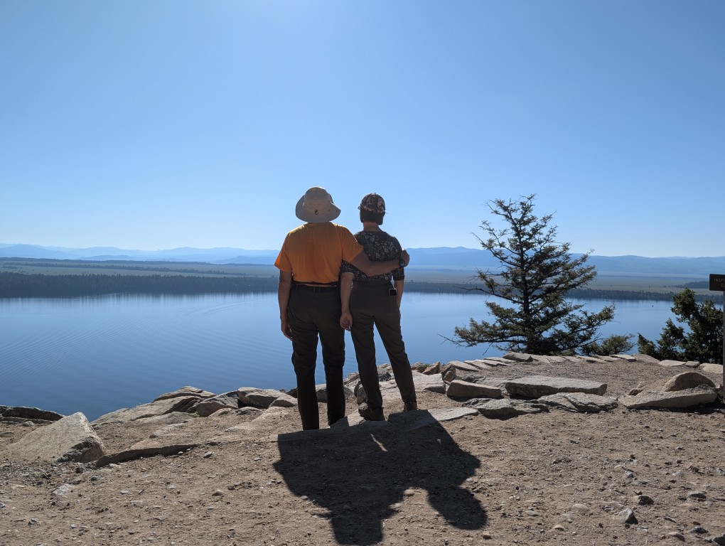
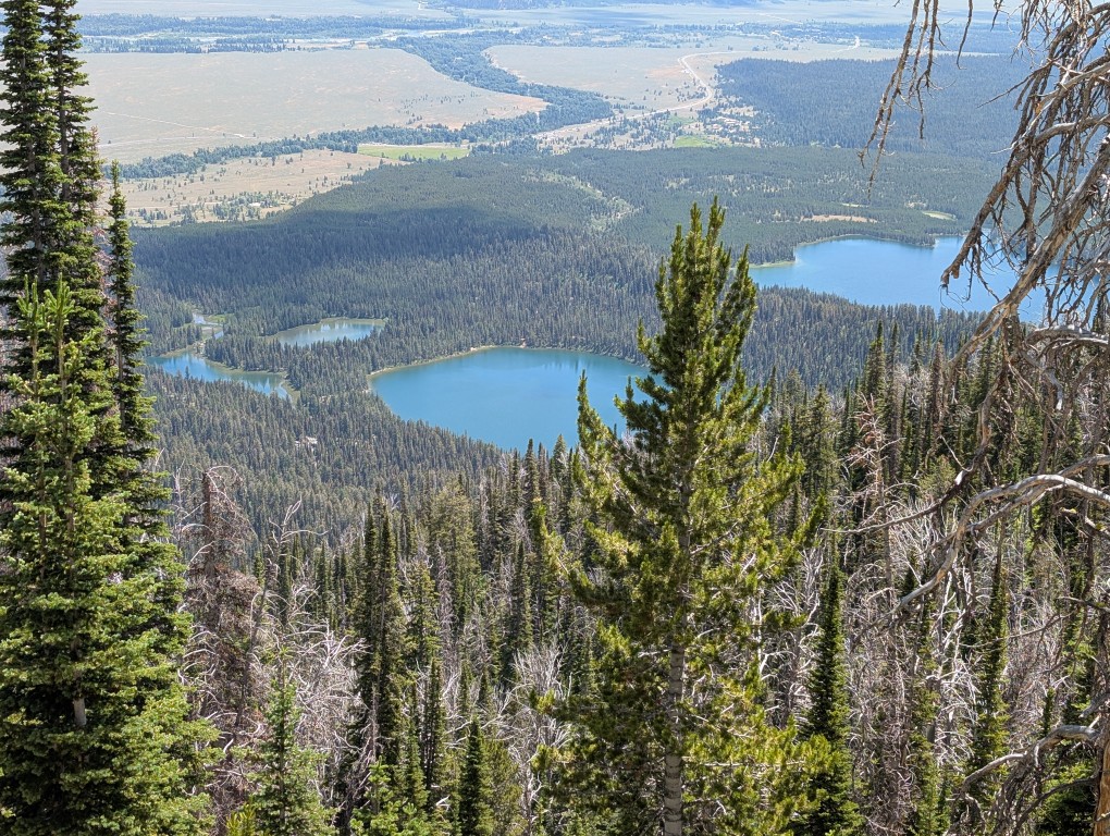
The place where we first saw geysers is on the shore of Yellowstone Lake. Crystalline water fills the caldera of a volcano so huge and ancient that scientists didn't discover it right away. The diameter of the crater measures several square kilometers of lake water and forest (85 by 45 km). It's hard to imagine how powerful the volcano must have been in its youth. Incidentally, volcanologists haven't ruled out the idea that Yellowstone will one day awaken. Imaginative filmmakers have long since dreamed up a horror story about it.
Enchanting
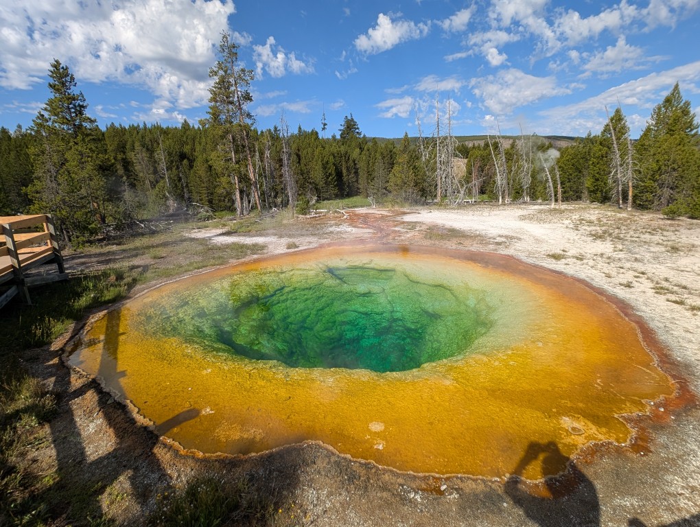
We arrive at our next destination around midday. The large parking lot is filled with cars, and we park on the side of the road, quite a ways from the trailhead leading to the overlook. It's located on a hillside overlooking Yellowstone's crown jewel, Prismatic Hot Spring.
This is one of the largest, and therefore the most vibrant and visited, springs. It's a magical sight: bright turquoise water, edged in yellow and orange, the size of a small lake. From afar, people can be seen walking around it on a wooden platform.
It is not customary to linger at the observation deck for long: take a few photos and leave, because more and more people keep arriving.
The flow of tourists thins out if you follow the trail from the observation deck to Fairy Falls.
And only a few people reach the Imperial Geyser. And completely in vain! The trail is easy, with no elevation changes. The only downside is that it winds through open space for a long time. The trail first leads to a tall, but not very powerful, waterfall.
The stream has carved a shallow cave in the rock, creating a small pool. Those in the know bring bathing suits. How pleasant it must be to find yourself in a shady waterfall on a hot day! But we decide to move on. The trail then leads us through the forest and becomes more pleasant. Eventually, we come to an orange stream that flows into an orange swamp.
This brings to mind a song about everything being orange. And the water was warm. Walking along a path alongside a stream, we come to the Imperial Geyser. This is one of those geysers that gush with remarkable persistence. The geyser is located away from popular spots. It's not fenced off by a walkway, but you don't want to get any closer, it's so violent.
The trail continues up the slope, leading deep into the sun-baked hills. We decide to just take a look at the geyser from above and turn back. Near the stream, Denis suddenly gets the idea to soothe his poorly cracked heels in the hot, and presumably healing, water. Even though we've already had a hot bath today, another one won't hurt. I waste no time, fortifying myself with wild strawberries and serviceberries and "singing orange songs.".
This time, our temporary shelter is a campsite near Lewis Lake. Previously, we camped on the shores of Jackson Lake. I note again that very few Native American names have survived in Wisconsin and Montana, but it's a different story here in Michigan. The hot day quickly turns into a cool evening as the sun sets. After dinner, we manage to admire the sunset over the lake before retiring to bed.
How wonderful, how wise of us to bring warm sleeping bags, warm socks, and thermal underwear! I considered grabbing a knitted hat. I didn't, but I always used the warm hood of my sleeping bag for sleeping in the mountains. Despite it being the height of summer, the morning temperatures were close to freezing. Once again, I needed to summon the willpower to crawl out of my warm sleeping bag, sip some hot coffee, and continue onward in search of new experiences, because our motto is "the early you rise, the more you see.".
Lake Lewis is beautiful in the mornings, too. It's shrouded in mist, pink in the rays of the rising sun. A fisherman, a lone gray figure, flashed past the window and disappeared around the bend.
Old faithful and others
We arrive at the tourist village of "Old Faithful." There are several similar places in Yellowstone. It houses hotels and cottages, an information center with a museum and souvenir shops, shops, a gas station, an auto repair shop, and ample parking.
The façade of the largest hotel overlooks a field of geysers. One of them,“Old faithful”, has been gushing with enviable consistency for many years.
Hence the name, which can be translated as “old man”, “seasoned” or “old soldier”Its behavior is predictable, and a nearby sign displays the approximate time of the next eruption. A viewing platform with benches has been built for viewing the active geyser: come, sit, and watch an educational film about the wonders of nature on a large screen.
But we arrive quite early and have to wait. It's a good thing the sun has already warmed the air a bit, although we don't feel like taking off our jackets just yet. While we wait for the show, we walk along the wooden walkways and look at the smaller geysers.
You can even warm up a bit in their warm vapors. At some point, we decided to have breakfast. Cheese sandwiches and hot tea from a thermos should also help warm us up further. The action begins when we settle down on a bench with food. A fair number of people have already gathered, despite the early hour. Many people have come with large professional cameras. At first, the geyser spouts irregular little fountains, as if testing the water. The splashes of water become more intense. And then the "old one" gushes forth powerfully, at full force. Clouds of steam billow from the geyser, like from a steam locomotive.
The fountain's jet, by my estimate, reaches 12 meters in height. In the morning light, everything looks unreal, truly like something out of a movie. The spectacle is mesmerizing. The geyser gushes for about ten minutes, then its activity subsides, and only clouds of steam emerge from the mouth, like the sighs of a tired old man.
We continue our journey on foot along the bridges that run between geysers and hot springs. Most have resonant names: "Cyclops," "Artemis," "Castle," and the geysers "Diamond," "Emerald," "Turquoise," and others.
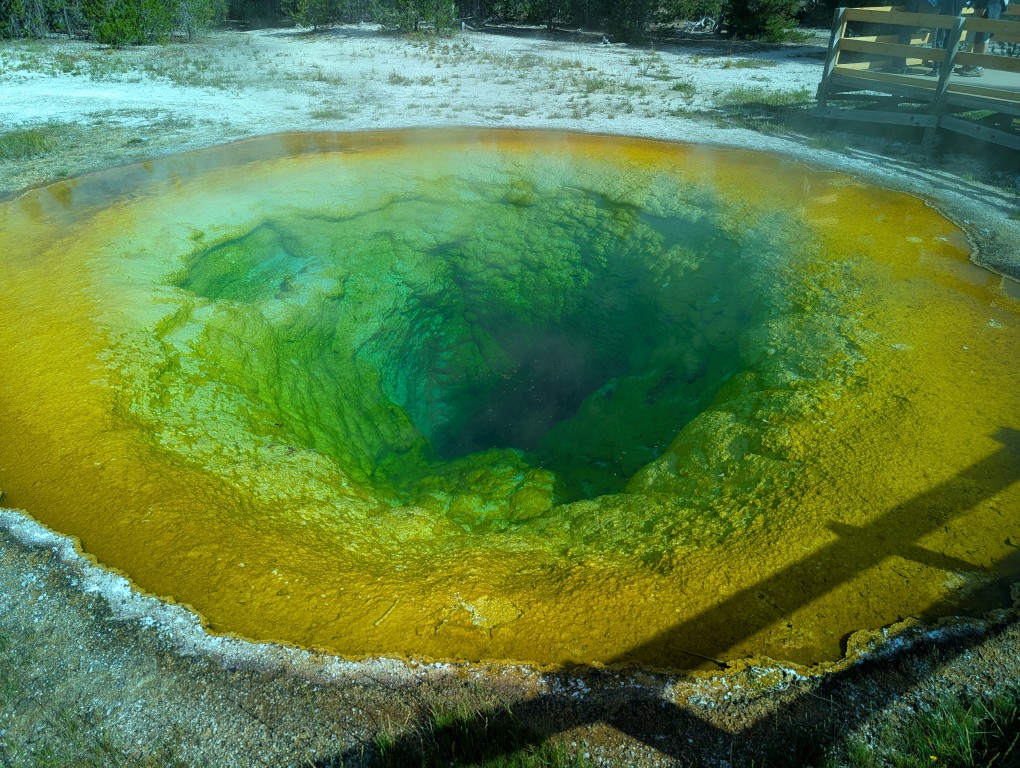
Prismatic
A trail called "Power Line" leads from the far end of the clearing. There's nothing particularly remarkable about it, except for a good view of the Valley of Geysers in some places. It was here that we saw bison for the first time. The trail leads us to the Prismatic hot spring, which we'd only seen the day before from the observation deck.
The valley where it's located is covered in places with a whitish crust, in others with yellow, sulfurous puddles, and in some places with rusty orange streams. It's around eleven in the morning, but the parking lots are already full and cars are lined up along the side of the road. It's a good thing that's not an issue for us today, because we've arrived on foot. A long line of tourists walks along a platform around the small lake. A young Korean blogger is reporting passionately, holding a selfie stick at arm's length. He gestures with his other hand, making it perfectly clear what he's saying. The people around him are understanding and carefully step around the blogger, creating a space around him.
“"Prismatic" is beautiful, but for some reason I prefer ebullient sources like Old Faithful, where the beauty is, I would say, dynamic rather than static.
On the way back it’s already quite hot, and besides, the trail goes through open space.
We're already feeling a bit tired from all the walking, but we haven't seen everything in the "Old Faithful" area yet. What a vast area it is! It would have been faster by car, but on foot you see more, noticing details you wouldn't notice while driving fast.
Firehole River
We continue along the same wooden paths around the part of the valley where we haven’t been yet and return to the car.
According to the plan, the return route runs through a picturesque canyon along the Firehole River (actually, "fire hole" is a very strange name for a river). There's no need to rush here, as the winding road is squeezed between the river and sheer cliffs. Small parking areas are frequent, literally every five hundred meters, because every bend in the river is incredibly picturesque.
You have to stop to take in all this wondrous beauty. We were hoping to find a spot to cook lunch with a nice view, but it was all cramped and uncomfortable, and we'd have liked a table.
Hemmed in on both sides by rocks, the river was at first wild, beating furiously against rocks and boulders.
Then the banks widened. Here the river became more spacious and calm. A hot spring must have flowed into the river upstream, because the water at our next stop was much warmer than in other Yellowstone lakes and rivers. Denis went for a swim, while I made sandwiches that kept us going until evening.
Modern technologies in camping
That evening, we lit a fire and finally cooked a hot dinner, having lived on dry rations all day. It was buckwheat with meat, prepared in the freezer especially for this trip. Very convenient: just add boiling water, and in five minutes the food is ready.
We were once again delighted to have purchased this unit, which allows us to eat home-cooked food in almost any conditions.
After dinner, Denis set up Starlink, which allowed us to chat with the kids and check email. In Yellowstone, it's likely only the hotels have a connection, so the aforementioned device has become widespread among car tourists. We've seen Starlink devices on more than one occasion while traveling. Thanks to Elon Musk for internet access in the wildest places!
We've earned this rest: sitting in a camp chair, I'm reading a strange Kurt Vonnegut book, and Denis is studying Spanish. A thought crosses my tired mind: "Don't forget to put all the food in the special metal box, because the ranger warned me that a bear has taken a liking to the campsite." Before bed, we brush our teeth with some trepidation, away from the tent, because the smell of toothpaste also seems to attract bears. It's only nine o'clock, and the blue twilight is slowly deepening. Our campsite neighbors are chatting and singing songs, and we're already changing into thermal pajamas. They're thin, but so warm! The new generation of synthetic fibers will keep you warm in any weather! Well, almost any. That's it, we climb into our sleeping bags and—good night!
The patrolman approaches the car and says: - Sir, do you know what the maximum speed limit is here? - 55 miles per hour, I say. — And what speed were you driving? — I was driving with the flow of traffic! - No, sir! The traffic was going 60 miles per hour, and you were doing 70! - OK, I won't argue. — Where did you come from? — From Michigan. - Okay, sir. I'm giving you a warning, no more violations! - Thank you, officer!
I had a conversation like this with a traffic police officer just before entering the national park. Grand Teton — the mountains were visible right ahead. In fact, those mountains were the indirect reason I was pulled over: seeing the mountains, I stopped on the side of the road to take a photo, then sped up a bit, catching up with the group of cars I'd been driving with before… I was lucky the officer was kind, or maybe he didn't want to ruin my clean driving record: I haven't had a single violation for 15 years. But I learned my lesson and, from then on, simply put the car on autopilot to avoid exceeding the speed limit. And I later deleted the photo with the mountains because I had about a million of them, each one more beautiful than the last…
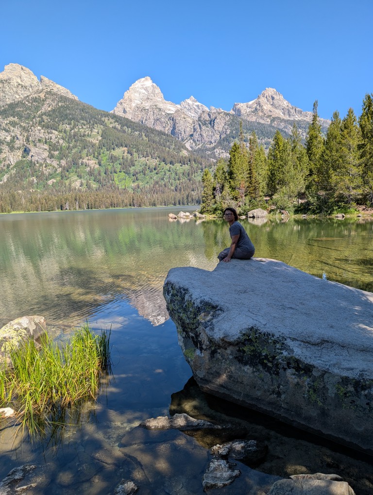
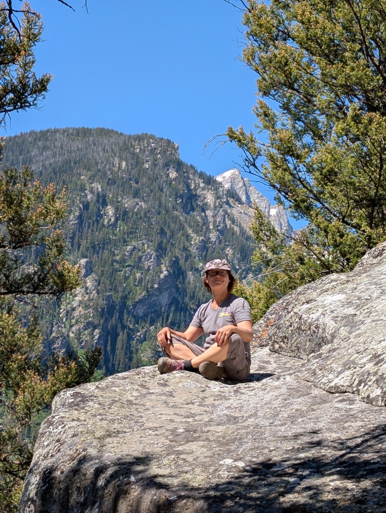
Grand Teton was the first park on our "must-see" list, and it was definitely worth it. From the very first moment, we couldn't stop admiring the views (and I kept remembering the joke:“Oh, Vanya, how beautiful!”). At one point we couldn’t resist stopping to take a few photos and walk along the path along the lake…
It was morning, too early to head to our campsite, so we headed straight to the trail. There are about a million trails there, but I had already made a list of the most picturesque ones.
As I walked along the trail, I discovered something pleasant: despite the fact that we had climbed quite a bit (the altitude was about 2,300 meters at the parking lot, and about 2,800 at the highest point of the trail), we didn't experience any signs of altitude sickness or even shortness of breath. This is probably because we we are in good physical shape We drove here for several days, gradually gaining altitude, and had time to acclimatize. However, physical fitness is also important: last year, when we drove from 0 meters above sea level in Hawaii to 900 meters above sea level and then walked to 4125 meters above sea level, we also felt relatively good.
One of the few inconveniences of the altitude (besides the cold nights) was that bottles of mineral water had to be opened very slooooowly. However, this rule is easy to remember after a few mineral water showers.
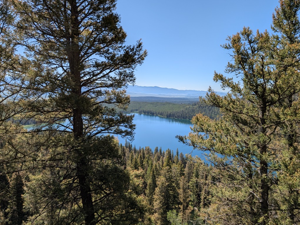
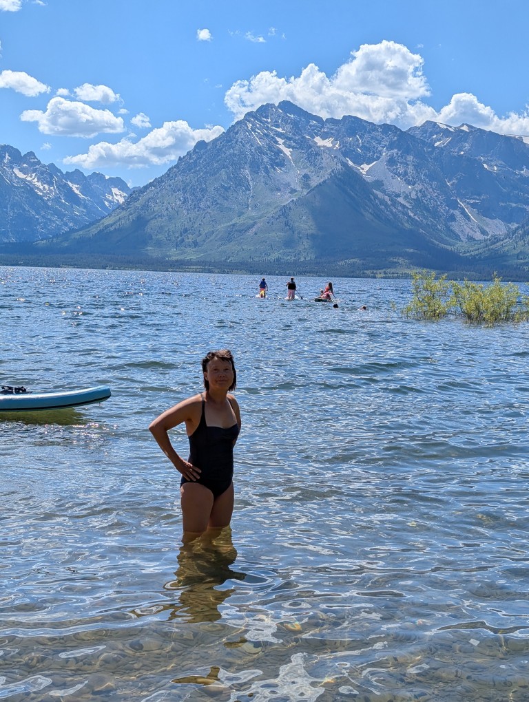
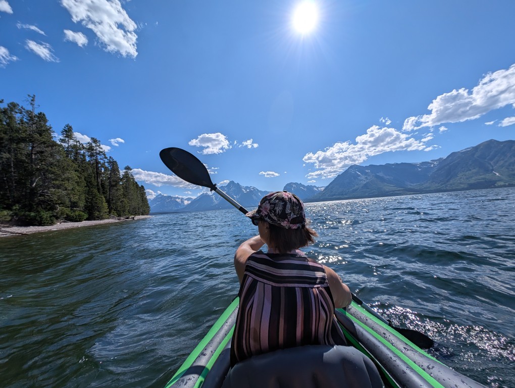
After the trail, it's time to check into the campsite—we'll be spending the next three nights there. It's a cozy, spacious site, close to the lake. The price is a bit outrageous: $60 a night. A year ago, we rented an entire house on the island of Crete, complete with a bedroom, kitchen, and living room, 100 meters from the sea, for less. But then again, what's Crete like, compared to Grand Teton?
Well, since there is a lake, you should swim in it and float in the inflatable boat you brought with you:
We had a meeting scheduled for the evening with my colleague Kevin. Kevin and his wife are homeless, in the truest sense of the word. They sold their house (at a tidy profit) a few years ago and now live in a van they've customized. It has a large bed, a kitchenette with a gas stove (and oven), a compact shower and toilet, and a kerosene heater. All the available space seems to be taken up with sports equipment—skis, bicycles… And on the roof, they have solar panels and a Starlink antenna—which is how they both work. It's wonderful to be able to live and work without being tied to one place. When I was planning the trip, I asked Kevin about his experience using Starlink, and it turned out they were planning to visit roughly the same places. So we invited Kevin and his wife to stay at our site and meet in person: we all work remotely at the office, and before this, Kevin was just a picture on a monitor.
The guys arrived on time, and we had a really good time. It turned out we had a lot in common, especially a desire to travel. Although, of course, theirs is much stronger.
Paths
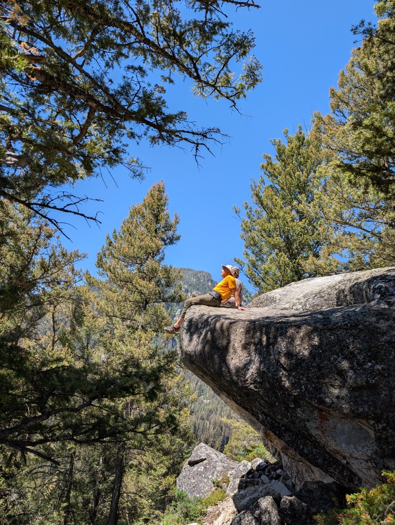
You have to go to Grand Teton for the beauty—the mountains, the lakes, the alpine meadows… And these beauties are best seen while hiking the trails. The park has plenty of them, for almost every level—from short paved trails to trails that, with our considerable experience, were truly challenging for us.
So all we did was hike. Taking advantage of the fact that local time is two hours behind Michigan, we easily got up early—around 6 a.m. We'd drink coffee, get ready, and before 7 a.m. we'd be at the next trailhead parking lot. This is important because later the parking lots will be full, and you'll have to get up somewhere further away. Walking is fine in the cool, but later it gets hot. But there's plenty of water here—streams are almost everywhere, so you don't have to skimp. We usually hiked until 3 or 4 p.m., then headed back to the campsite, swam in "our" lake, cooked dinner... In the evening, I'd briefly turn on Starlink to send a message to the family chat, download email, do another Spanish exercise... And in the morning—another trailhead.
Of the three days we spent in this park, my watch showed more than 40,000 steps on two days. That's about 30 kilometers, and we were also walking through the mountains. So we slept wonderfully, much better than at home. 🙂
Over the course of these three days, we accumulated about a million photos, despite trying to clean them up every evening. But it's so beautiful there, so there are still a lot left.
Here are a few that I like the most:
Well, and a few more:
Living creatures
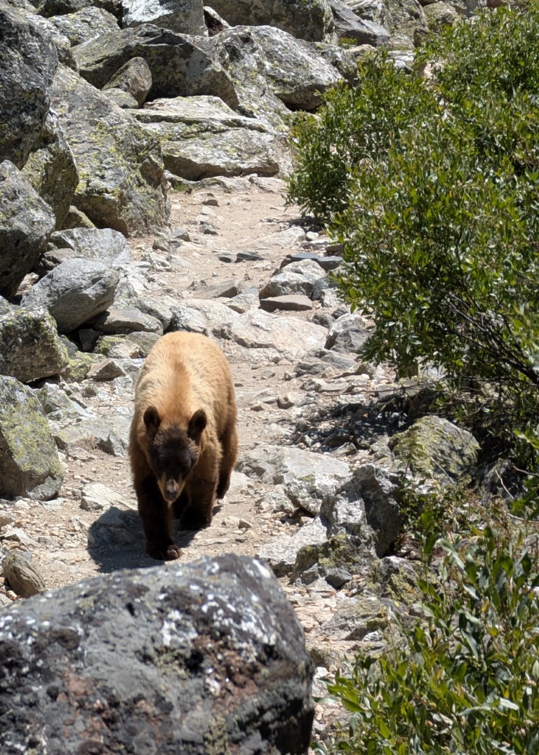
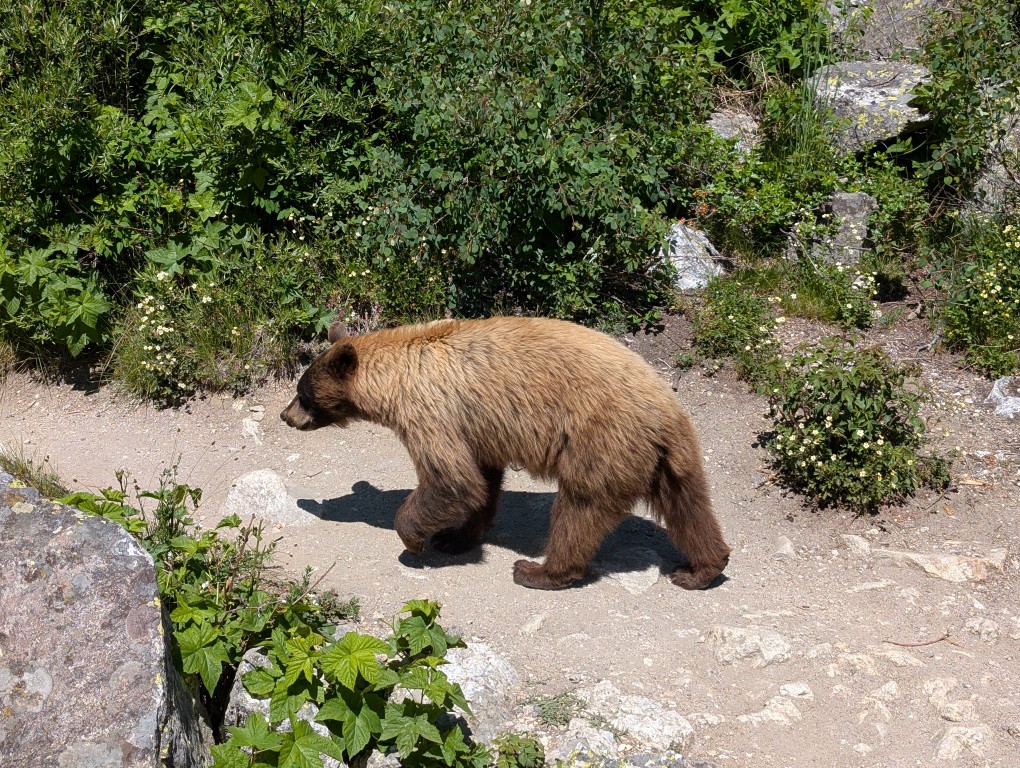
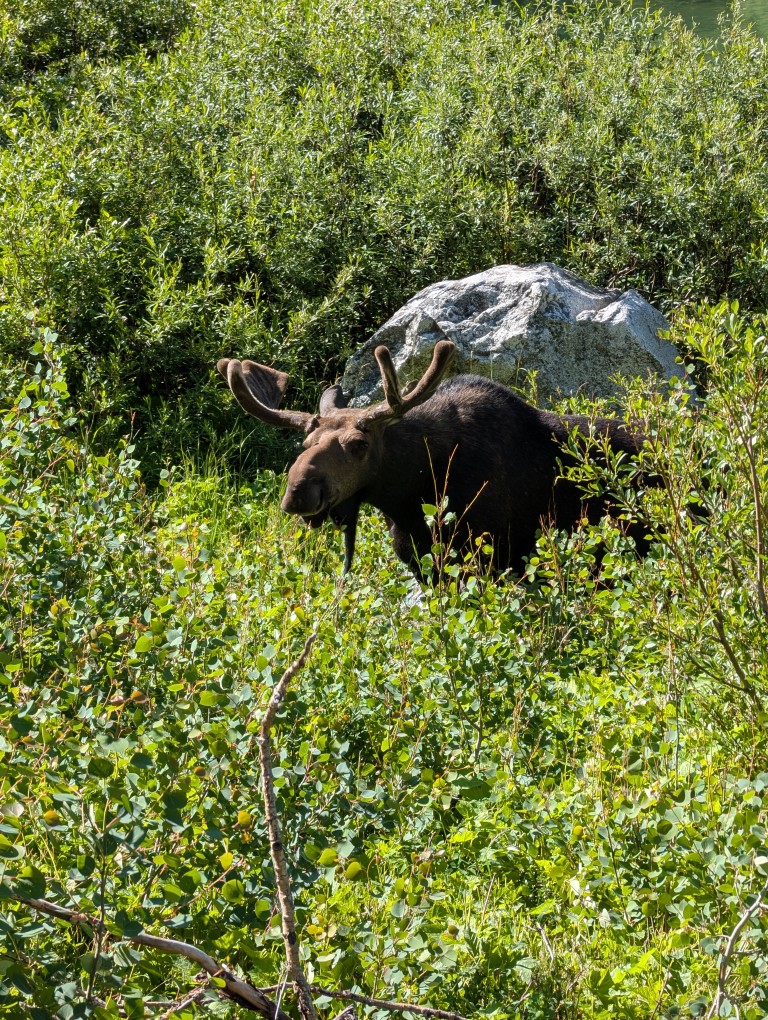
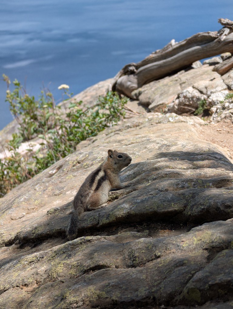
Besides tourists, the park is home to many other animals. The ubiquitous chipmunks scurry practically underfoot. Moose can be spotted in the distance—they like to hang out near water. And then there are the bears, of course. When we arrived at the campsite, I noticed that the local guard had a special "anti-bear" pepper spray canister hanging from his belt. I had one too—I'd bought it well in advance of the trip, but I'd carelessly forgotten it in the car several times. And then, on one of the trails, someone walking toward me said there was a bear up ahead. There was no canister—I figured we didn't need it with so many people there. Natasha, a few others, and I stepped aside and stood on a rock. And then he came walking toward us. We started shouting loudly to scare the bear and stop him from eating us, but he just walked past, not paying any attention to us. He probably thought to himself, “I’m so sick of these loud idiots…”.
There are two types of bears in the park: black and grizzly. This one clearly wasn't black, so we assumed it was a grizzly. Later, we discovered it was actually black, even though it was brown. 🙂 I looked online later to see how to tell a grizzly from a black bear: by the length of their claws. Grizzlies can have claws up to 10 centimeters long, while black bears are 2-3. So, you'll need to carry a tape measure...
Time to hit the road, old man, the climb is over...
Three days flew by. Early in the morning, we packed up the tent and headed from our now-home base camp to Yellowstone Park. It wasn't far—only 40 minutes. But before that, we stopped at a "wild" hot spring. A cheerful nudist was already there, so Natasha simply warmed her feet in the spring, and I waded in. After three days of swimming in a cold lake, it was nice to be in the warm water.
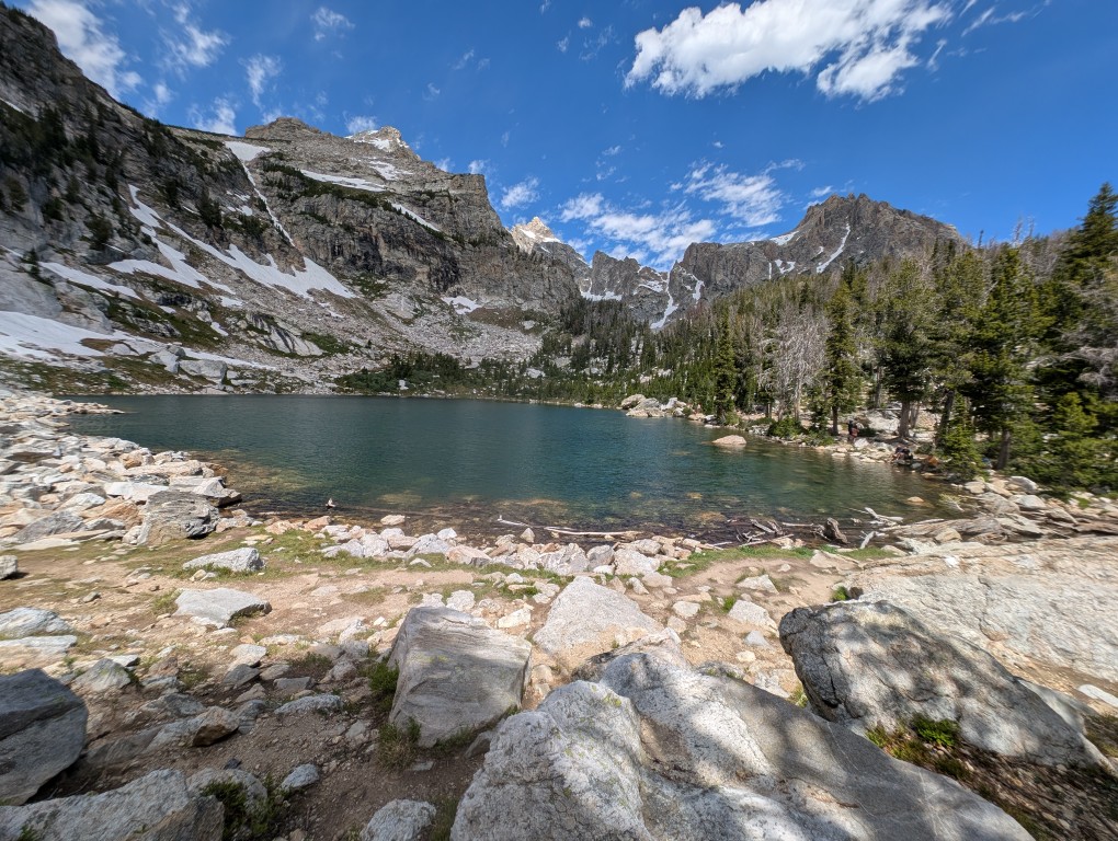
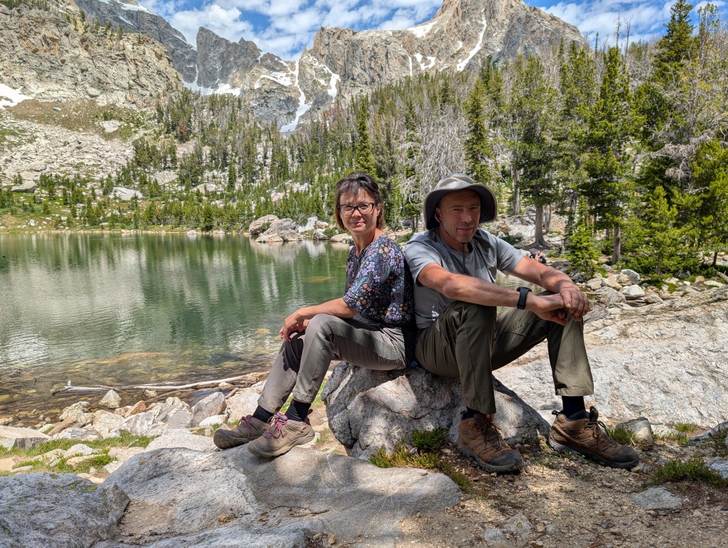
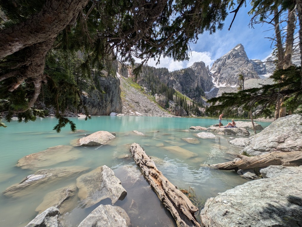
The day before, Kevin and Kasha, our new acquaintances, had run to the high-mountain lake "Amphitheater" and inspired us. We certainly didn't try to replicate their feat of running the entire route. But the trail turned out to be easy, with gentle switchbacks and observation platforms. Another thing is that the climb takes much longer on foot. Most people travel lightly, with small backpacks for day trips. There were runners, like Kevin and Kasha. And then there were those heading to the high-altitude campsite with heavy backpacks and special canisters for storing food from bears. Denis even regretted not planning a hike into the wilderness. But it was still good, especially once we got higher. The high-mountain meadows are ablaze with flowers. Every bend in the trail opens up to a stunning panorama. Everything is in full view. And somewhere higher up, there are more lakes, and that's where we're heading. First, a small lake called Surprise appeared, then another, larger one. It's surrounded by mountains on all sides, like an amphitheater. That's what they called it. We're sitting on the rocks, taking in all this beauty. There are about seven other people here. We weren't even that tired, and when a turnoff to another trail appeared, we decided to go and see what was there, just a short distance away, about 600 meters up. We weren't even stopped by the warning sign saying, "Are you ready for what comes next?" We thought, what could possibly be there? Well, a ravine. No big deal. It turned out to be not just a ravine, but also loose scree, which requires a fairly steep climb, and then the trail, which is even steeper. Moreover, there were no visible markings or signs to indicate the direction, which was confusing. And, surprisingly, there were quite a few people on such a difficult section. Mostly young people. There was even a reckless mother with a baby in a backpack, who was jumping defiantly over the boulders.
Denis was clearly not happy with this addition to the planned route. He suggested turning back. But I decided that since I had the time and energy, I should go for it. I don't know what Denis thought when we reached the end of the trail, near Delta Lake, but I didn't regret it.
A very picturesque place.
The return journey seemed easier. At first, the walking poles were a great help. But after an hour, fatigue suddenly set in. Even the invigorating water of the mountain streams only provided a brief refreshment. I longed to get to the campsite and get some proper rest.
We walked a lot that day.
Some people wash off the road dust in a civilized shower, while others "take" a dip in the lake. A spicy Japanese soup helps us replenish our strength. This is enough for me to sit with a book and write travel notes, and for Denis to take a Spanish lesson and answer client emails. It's still light, but I'm already very sleepy. Tomorrow we'll continue on to Yellowstone.
I'm lying in the tent, listening to what's going on around me. I can hear a violent wind rising in the treetops, howling and howling. The thin fabric of our temporary shelter flutters timidly in anticipation of a downpour. In the distance, I can hear rumbles of thunder and a growing roar—a storm is approaching. I say out loud, "A storm is coming..." Denis snores, confirms through his sleep—aha...—turns over onto his other side and goes back to sleeping, as if nothing had happened. A man's lucky! He falls asleep in half a minute and knows no worries. And here I am, imagining all sorts of misfortunes. Judging by the approaching thunderstorm, it's going to be a serious one. Now the first handfuls of drops are splashing forcefully onto the roof. And off it goes! The rain has begun to pound with terrible force. It pours down, gurgling, flowing around the tent from all sides. The air was filled with moisture and the smell of ozone.
I'm not afraid of a thunderstorm, but the tent site is too packed down, the water won't soak in, and it's slightly sloped—it'll probably seep under the floor. Oh, I should have tightened the guy lines on the sides better! But it doesn't seem to be dripping inside... Denis's sleeping pad is too short—part of his sleeping bag will definitely get wet... Stuff?! It's stowed in the car. Good. I feel the top corners of the tent—sure enough, they're already damp. Oh, damn, it's going to get worse if the storm doesn't stop. The phone! Put it on the mesh shelf under the ceiling, quick! It's crazy, it's already almost two in the morning... Sleep, sleep!
The storm ebbed and flowed, pouring down all night. My thoughts swirled and haunted me. Just as I closed my eyes, another source of worry emerged. It spoke in Denis's voice:
Well, shall we get up?
What?! It's already... How long?
Well, yes, we wanted to stay on Michigan time.
In a light rain, we awkwardly stuffed the tent into a waterproof bag and the sleeping pads into a backpack. We quickly gathered our other belongings—thankfully, we'd packed almost everything away the night before—and drove away from this rainforest. More thunder rumbled from the sky after us, but fortunately, we and the cloud were heading in different directions. Outside the car, it was damp, gray, and gloomy, just like my sleep-deprived body. Oh, if only I could use some coffee right now! But the forest around us was still wet, and the gas station coffee was lousy. Besides, it was still very early. I glanced at Denis. He was as alert and fresh as a daisy. At least he'd gotten enough sleep; let him drive, and I'll take a nap, I suppose… And to the drone of the audiobook, I drifted off to sleep.
Devil's Tower
When I open my eyes, everything around me looks different. The forest has given way to gently rolling hills, and the clear morning sun shines above them. The road is easy and dry. And right ahead, a giant rock rises like a monolith. It stands out so strangely in the overall landscape. Why alone? After all, if there are mountains, there are many of them, but here, all alone, there's nothing special, as a friend of mine says. But that's precisely what's so interesting.
There are many legends and theories surrounding Devil's Tower's origins. One is that it's a "reverse volcano." That is, whatever was in the crater, likely lava, fossilized and remained, while the volcano itself eroded over millions of years. It's unclear, however, why this is an isolated incident.
Ah, my zest for life has awakened, which means I managed to get some sleep. We pull over to the side of the road and photograph the cliff from afar. The morning light makes for some excellent shots. Against the blue sky, Devil's Tower looks fantastic!
Another ten minutes later we arrive at the foot of the monolith, where there is a recreation area.
In the center of the clearing, a large black man in bright red robes sits in the lotus position, offering prayers, facing the rock. "We must have stumbled into another place of power," I think. "I wonder what gods he's praying to. Or maybe the devil? His clothes are red..." But we don't bother him.
Denis gets out the camp stove and breakfast supplies, and I hang the wet tent, mats, and sleeping bags on the fence. The sun is already hot, so everything should dry quickly. And indeed, while we're cooking buckwheat porridge and coffee and eating a leisurely breakfast, the thin nylon tarp dries in an instant—you just have to unfold the folds. Meanwhile, another car pulls up with other unfortunate souls like us. They're unloading a multitude of wet things to dry. Seeing our tent on the fence, these people also start hanging their pillows, mattresses, sleeping bags, towels, and wet T-shirts and socks there. We exchange a few words and realize we're from the same places. Fellow sufferers! Everything around looks like a gypsy camp has set up camp. The ranger doesn't chase us away, but smiles understandingly from the window of his car.
We throw our still-dry sleeping bags on the roof of the car and head off along the trail that leads around Devil's Tower. We see quite a few people, and it's clear this is a popular spot. Interestingly, the trail isn't always visible from here. Occasionally, you'll glimpse it sideways between the trees. It's a good thing we photographed it from afar. But the trail is also beautiful—it smells of sun-warmed pine resin and wet pine needles. About twenty minutes later, we unexpectedly found ourselves near the tourist center. Elderly Japanese people fluttered effortlessly from a tour bus in the parking lot and, chattering excitedly, set off along the trail to photograph Devil's Tower. They're the kind of people who take pictures and marvel at everything, like children. But we were heading in the other direction. In one place, a storm had knocked down several trees. Perhaps the devil, the tower's owner, was angry and uprooted everything in his path. Then we encountered some Martian landscapes with red soil. The trail beneath our feet also turned red. From the other side of the cliff, a beautiful view of the distant distances suddenly opened up: green hills and blue forests, the blue ribbon of the river and the yellow ribbon of the road. They encountered climbers, young men with backpacks, ropes, and carabiners.
"Will you climb the Devil's Tower?" I asked.
They nodded affirmatively, and I wished them luck. Not everyone would dare to venture into the depths of hell.
Well, that's it. Devil's Tower isn't a national park where you can wander for ages—you couldn't see it all in a year. It's a national monument. We walked quickly, just two and a half hours, and then we moved on. Our sleeping bags were dry. And even that wet group that arrived after us was gone. We had to move on.
On the side of the road
The bikers, a glittering, noisy swarm, stopped for a moment by the side of the road, imprinted the Devil's Tower on their hearts, and sped on. And it's time for us to go.
Shaking off the last vestiges of sleep deprivation on the trail, I got behind the wheel. And the prairies and deserted roads stretched out. In fact, the almost complete absence of civilization often accompanied us on the journey. It was very useful to know where the next gas station was. In these parts, they could be hundreds of miles apart. Occasionally, there were cattle ranches, and there were no rest areas at all. Feeling hungry, we couldn't find a suitable place to have lunch. Finally, we pulled over on the side of the road, in the blazing sun, stuffed ourselves with food, and quickly drove on. We washed down our lunch with mineral water as we drove.
Without an audiobook, it would have been difficult to navigate such vast spaces. By evening, the greenery had thickened. The river appeared, along with willows and poplars lining its banks. Mountains appeared on the horizon. We also began to see settlements. Near one of them, in the town of Dubois (or Dubois?), was our hotel. It smelled pleasantly of wood and turned out to be quite cozy. Such roadside inns are a stopover for car tourists heading to popular national parks. There's nothing to see in the surrounding area, but the location of the temporary shelter was strategically placed. It used to be like this: you'd drive and drive, get tired, spot a caravan by the side of the road, spend the night, and then continue on. Now you have to book everything in advance. Or go in the off-season. By evening, our hotel was filled with cars and car tourists like us. We washed off the road dust in the shower and decided we didn't want to drive into the town center. We were tired. We simply cooked some pasta in the microwave and went to have dinner on the riverbank near the hotel. There was a canopy, soft chairs, and a small table. What more could a weary traveler need? Well, maybe a glass of wine.
There weren't enough of us left for the campfire, even though it was included in the cultural program. Why? Because we'd moved to a different time zone. While it's still nine o'clock in Wyoming, it's already eleven o'clock in Michigan. We want to live on our own time, so we went to bed before dark.
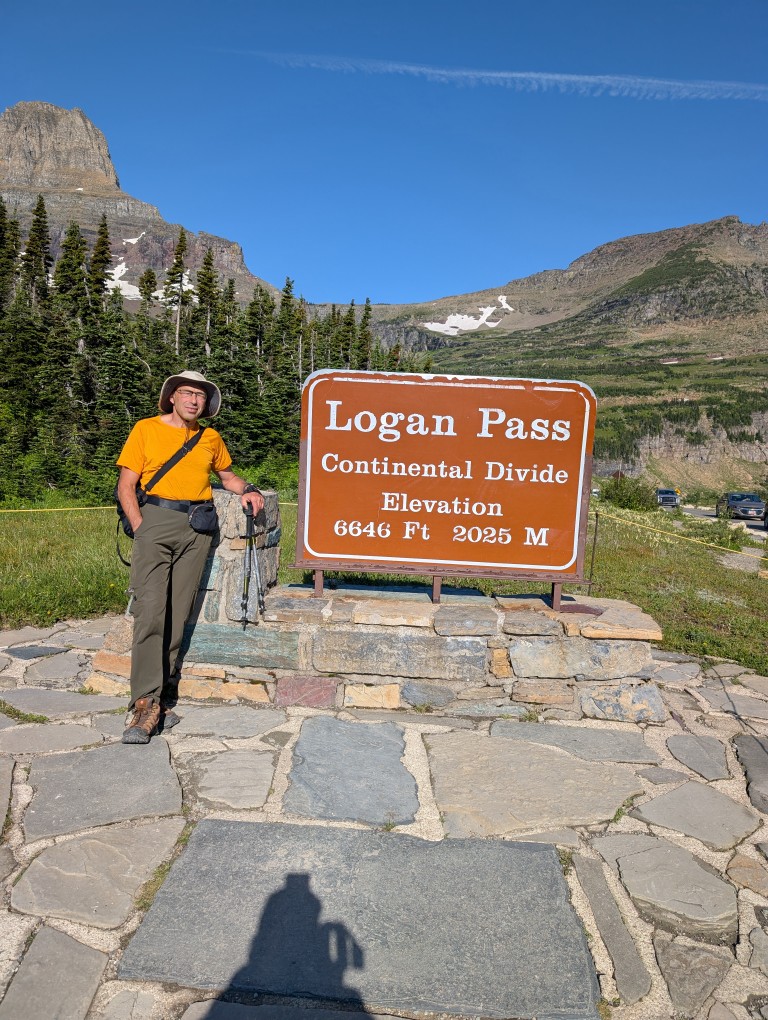
When I was planning my trip to Glacier NP, I almost accidentally came across a piece of news that made me a little nervous: the park, for the second year in a row, is allowing access to the road with the poetic name “Road to the Sun”"Only with special passes. Passes must be purchased, and although the price is purely symbolic ($1 per day), their supply is limited. This is how the park addresses the problem of overtourism. The problem with this road is that it's the only way to get around the park: trails to almost all the lakes, waterfalls, and other trails start from here.
There was still a month and a half left before the trip, but, as expected, all the passes had long since been purchased. I signed up for the pass availability notification mailing list (sometimes people cancel their purchased passes, and they become available again) and even received several notifications about vacancies. But every time I tried to buy one, it turned out someone else had already gotten it faster…
But later, I read the road information more carefully and calmed down: the road was closed after 7 a.m., and before that, entry was free. Considering I rented a place 10 minutes' drive from the park, and we planned to stay on Michigan time (two hours ahead of the park's time zone), there shouldn't have been any problems. And so it turned out.
The plan was to get up early and leave the hotel around 5:30 a.m., and we followed it. We quickly crossed the empty road to the park entrance and then drove more slowly along that very same Going to the Sun Road—the speed limit was 40 miles per hour.
Deep down, I hoped we'd keep going until the very end, because who in their right mind would wake up at 5:30 a.m.? However, the park sees over 3 million visitors a year, with around 800,000 of those in July. That's nearly 27,000 people a day—the population of a small town. And among that many, there are enough crazy people to cause a traffic jam on the park's only road, even at 6 a.m.
So soon we found ourselves at the tail end of a stream that was slowly rolling along the road. Slowly because the climb had just begun with a steep switchback, which even on an empty road wouldn't let you go very fast. It didn't bother us, though, because after the most picturesque serpentine in the world, The road we drove on last year in Greece doesn't scare us like that (though I'm a little apprehensive about the Peru trip—there will be plenty of switchbacks there). But we still have to keep the speed down…
At one point, we pull over to the side of the road and take a few photos—the view is so beautiful in the rays of the rising sun. Perhaps those five minutes would come back to haunt us later…
A few minutes later, we arrived at the visitor center parking lot, and I couldn't believe my eyes—the rather large parking lot was full. And mind you, it was 6:50 a.m.—normal people are still asleep at that hour. We had to keep driving. Several small parking lots on the side of the road were full, but finally, about a kilometer from where we were going, I saw a single empty spot where we could park. Perhaps if we hadn't stopped for those five minutes to take photos, we would have managed to park a little closer to the center. But the photos were worth it.
The view from our parking lot, however, was wonderful. Shivering slightly from the cold (the temperature this morning was just above freezing, with snow in places), we cooked breakfast on the stove, drank a traditional cup of cappuccino, and briskly headed back along the road to the trailhead.
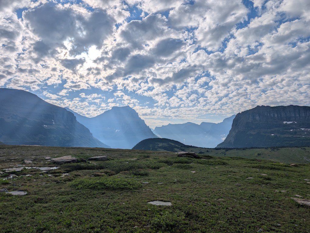
We made our way back to the visitor center, the first route for today is trail to Hidden Lake. When I walk along trails like these, the first thing that comes to mind is "May Day demonstration." The trail is beautiful, short, and easy, so all those crowds that occupied our parking space are heading that way. And so are we, because what else could we do? 🙂 We didn't make it all the way to the lake—about halfway there, the trail was closed due to increased bear activity in the area. Considering I'd forgotten my bear spray in the car again, we decided not to risk crawling under the fence like some others… So we admired the scenery and turned back to the parking lot.
The main trail for today awaited us - Highline Trail (the high trail). It's long—40 miles—and people hike it for days, with tents. But we weren't tourists today, we were just out for a stroll, so we decided to walk it for a few hours (to a small pass near the summit).“Haystack”), and turn back.
I must say, the trail turned out to be the most spectacular of these three very busy days. It's not difficult because it runs parallel to the slope, without significant changes in elevation, but it's very picturesque.
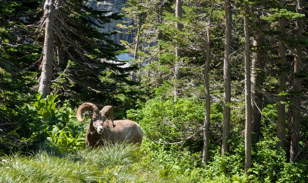
Moreover, since this is the only convenient trail running along the slope, local animals have taken a liking to it. So we encountered a deer (very close, we could reach it with our hand), a marmot (marmot "—it's not a swear word, but the Latin and English word for marmot," and "mountain sheep" (a bit off the trail, but that's for the best). We didn't encounter a bear, though—maybe next time.
Well, the landscapes there themselves are wonderful - I probably took at least a hundred photographs, so it was a real shame to clean them.
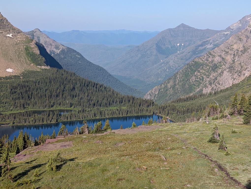
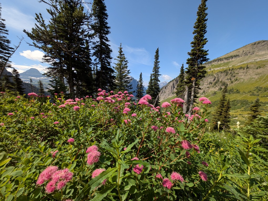
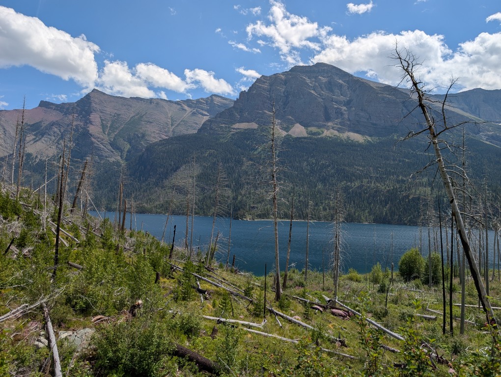
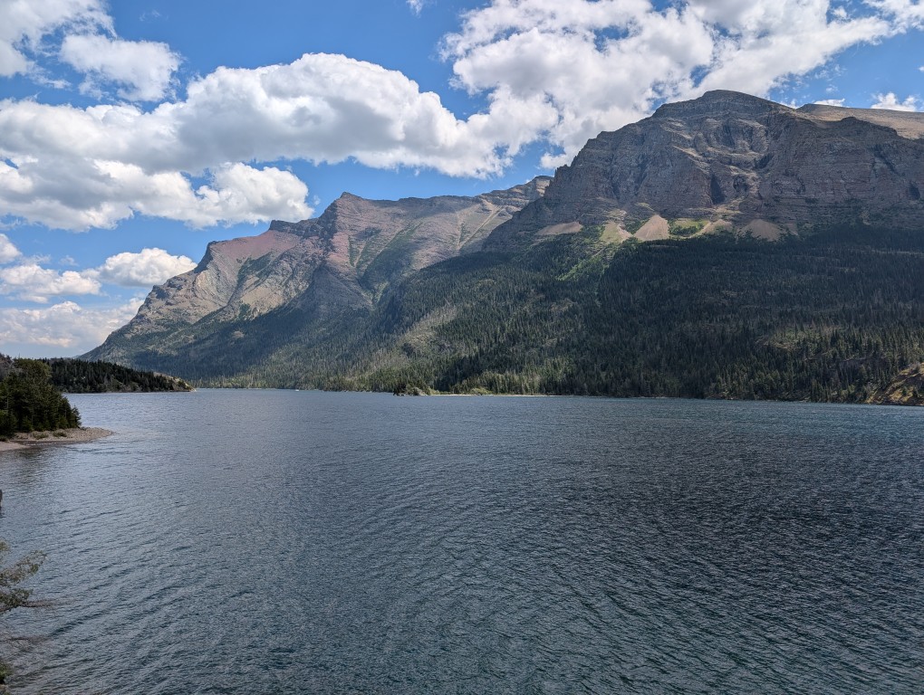
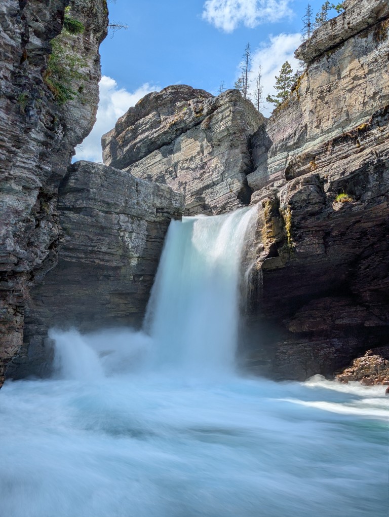
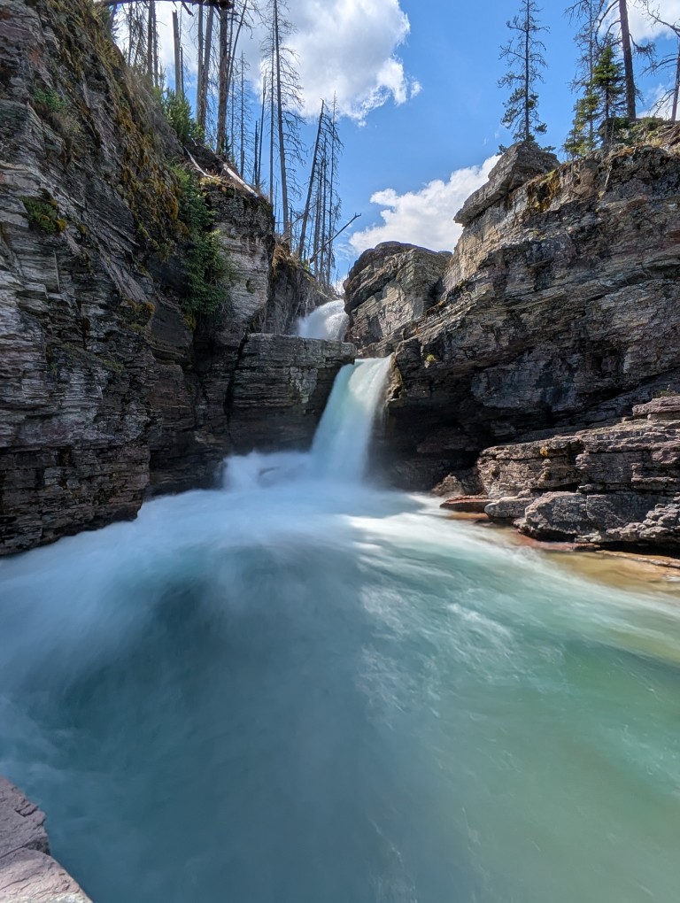
Returning back to the car, we had lunch and, since the sun was still high, we drove on to Lake St. Mary (Saint Mary Lake). This is a typical mountain lake, long and narrow, located in a small valley. Many streams flow into the lake, along which there are beautiful waterfalls - they were our target.
The trail to the waterfalls is very scenic, but, like many places in this park, it's a bit gloomy due to the large number of dead trees—apparently, a major fire raged here about 15 years ago. New growth is now growing, and the charred remains of the former trees stand as a reminder of the past cataclysm.
However, the overall impression is very bright and positive. The trail is easy and well-trodden.
The waterfalls themselves are beautiful (there is a cascade of three waterfalls).
More:
Some desperate girls jumped off the bridge into the water. We didn't.
After returning along the same trail, we took a long, leisurely ride back. Nearing the park's exit, we spotted a deer with classic antlers, just like a postcard, on the side of the road.


 Another thing is that the climb takes much longer on foot. Most people travel lightly, with small backpacks for day trips. There were runners, like Kevin and Kasha. And then there were those heading to the high-altitude campsite with heavy backpacks and special canisters for storing food from bears. Denis even regretted not planning a hike into the wilderness. But it was still good, especially once we got higher.
  The high-mountain meadows are ablaze with flowers. Every bend in the trail opens up to a stunning panorama. Everything is in full view. And somewhere higher up, there are more lakes, and that's where we're heading. First, a small lake called Surprise appeared, then another, larger one. It's surrounded by mountains on all sides, like an amphitheater. That's what they called it.
 We're sitting on the rocks, taking in all this beauty. There are about seven other people here. We weren't even that tired, and when a turnoff to another trail appeared, we decided to go and see what was there, just a short distance away, about 600 meters up. We weren't even stopped by the warning sign saying, "Are you ready for what comes next?" We thought, what could possibly be there? Well, a ravine. No big deal. It turned out to be not just a ravine, but also loose scree, which requires a fairly steep climb, and then the trail, which is even steeper. Moreover, there were no visible markings or signs to indicate the direction, which was confusing. And, surprisingly, there were quite a few people on such a difficult section. Mostly young people. There was even a reckless mother with a baby in a backpack, who was jumping defiantly over the boulders.
 Some people wash off the road dust in a civilized shower, while others "take" a dip in the lake. A spicy Japanese soup helps us replenish our strength. This is enough for me to sit with a book and write travel notes, and for Denis to take a Spanish lesson and answer client emails. It's still light, but I'm already very sleepy. Tomorrow we'll continue on to Yellowstone.
 It's a good thing we photographed it from afar. But the trail is also beautiful—it smells of sun-warmed pine resin and wet pine needles. About twenty minutes later, we unexpectedly found ourselves near the tourist center. Elderly Japanese people fluttered effortlessly from a tour bus in the parking lot and, chattering excitedly, set off along the trail to photograph Devil's Tower. They're the kind of people who take pictures and marvel at everything, like children. But we were heading in the other direction. In one place, a storm had knocked down several trees. Perhaps the devil, the tower's owner, was angry and uprooted everything in his path. Then we encountered some Martian landscapes with red soil. The trail beneath our feet also turned red.
  From the other side of the cliff, a beautiful view of the distant distances suddenly opened up: green hills and blue forests, the blue ribbon of the river and the yellow ribbon of the road. They encountered climbers, young men with backpacks, ropes, and carabiners.